Monique needed a rest day, and so Paul and I decided to climb the Jahnweg on the Third Sella Tower, which we
had contemplated as a family climb the day before, but abandonded due to cold and windy weather in favor of
the sunny Little Micheluzzi. It turned out this was just as well, as the Third Sella Tower would not have
been a good family climb.
We started in cold and windy weather from the Sella Pass, and the sun soon disappeared behind the towers.
At the base of the third tower we found a snow field, and wet and awfully cold rock. We alternatingly stared at the rock
and at the topo for a while, unsure about where the route started. We finally decided that it had to start to the
right of the huge gully. Paul was not overly eager to lead the first pitch, so I gingerly started up, making sure my
freezing finger would not slip on the wet and dirty rock. Even accounting for the adverse conditions, I found the climbing
quite hard for the rating of III the guidebook gave it. After a while the climbing got better, but I could not find the
two fixed pins the topo showed, making me more unsure about whether we were on route. After a little over a hundred feet
I found a belay station, so we knew we were at least on some route. The book said
the next pitches should be easy, so Paul started out quite confidently, only to run into surprisingly difficult terrain
just a few feet above the belay. Soon enough the two pins showed up, the second of which turned out to be hard to clip.
Even as a second I found the moves hard, and the pin strenuous to unclip. (Later we contemplated that Jahn placed this
pin, or hopefully its precursor, on lead, wearing hobnailed boots and belayed on a hemp rope. These guys were good!!)
Clearly, the topo was all screwed up, and the
two pins and the hard section (IV, which the `dictionaries' translate into 5.4 or 5.5; yeah, right!) were above the first
belay, not below! Anyway, Paul found another belay station, so we were on route. The next pitch moved into the huge gully,
and we simuled most of the distance to the huge ledge aptly called the Spiral Band, as it spirals around the tower.
Of our two guide books we had taken only one, since the other one does not describe the lower half of the route.
Unfortunately, the one we had had proven not quite reliable by now, which gave me a bad feeling for what was to come.
These misgivings were quite justified, as it turned out. We followed the Spiral Band up the ramp where the photo in
the book showed the upper part of the Jahnweg to start. Sure enough, there was a fixed pin, clearly meant as a belay
anchor. This made us confident that we were in the right spot, wrongly so, as it turned out. I led the first pitch off
the ledge. The start was steep with no pro, then the terrain got lower angled and red paint dots started showing up.
This reminded me of the description of the descent route in the book we had left behind. The climbing after the intial
section was easy, low
fifth class, but the rock was loose, and I was not quite sure where we were at, which made me slightly nervous. Paul
was much more confident, mostly on account of the red paint marks. Since we were not quite sure about anything, we
kept belaying despite the relatively easy terrain, although we could place essentially no pro. A few pitches up I ran
into a steep 10-foot wall, at the base of which I found one of the many plaques common in the Alps that said somebody
had died there. This really lifted my spirits, especially since I was unable to build a decent (by my wimpy American
standards) anchor. I brought Paul up, and he did not deny the fact that the next pitch was his to lead. After a few
aborted attempts at what we called `The Boulder Problem' he got up with much grunting, continued up a ramp that offered
some good pro for a change, and announced that he was essentially on the summit. While following, I realized that the
`Boulder Problem', if done correctly, is not harder than VB or maybe 5.7/5.8, but given that the leader has to
onsight it with no chance to protect the (lousy) belay, it is quite unnerving for both the leader and the belayer,
as both would go down if the leader fell and the lousy belay failed. (Maybe that's how that plaque came to be?)
Anyway, neither this section nor anything
else we had climbed resembled the topo in the &^#%$(@ book in any way, although it faithfully reproduced the route
drawn into the photo. We scrambled to the summit and enjoyed being there, but this enjoyment was somewhat mitigated
by the fact that we knew that getting down was going to be nontrivial.
After a while I started looking for the rap anchor. I followed the instructions in the &^#%$(@ book, namely, to go West
from the summit, but could not find anything that resembled an anchor. Instead I found a party coming up. I quizzed the
leader about which route they were on, and he was adamant that they were on the Jahn. Once they were up, we compared topos,
and his (Italian) guidebook seemed to say that they had indeed climbed the Jahn, while we had climbed God knows what.
That party, who turned out to be French, did not know how to get down either, so we spent quite some time peeking over
the loose edges of the tower. Finally, Paul and I decided to go with our memory of the description in our other book,
which said to go towards Piz Ciavazes, the opposite direction of what the &^#%$(@ book said. As soon as we took that
memory seriouly, I saw a distinct trail that ended at the edge, and sure enough, five feet below the edge Paul found a
very decent rap anchor. We immediately realized that this rappel would take us past our Boulder Problem, and that the
rest of the descent would be downclimbing the route we had come up. So we started out, and things went quite alright
until we came to the last, slightly overhanging, step above the Spiral Band, on which we would really have appreciated
a rappel. There was no way to set one up, though, even if one were willing to leave gear, and so we had no choice but
to downclimb. It was not all that hard,
but sure unnerving. Then we scrambled back along the Spiral Band, downclimbed the gully, and finally rappelled the
lowest two pitches.
It was good to have been on the Third Sella Tower, but overall it was a somewhat hairraising experience. Some of that
was undoubtedly due to poor information; the upper part of the Jahnweg is supposed to be good climbing on good rock.
Still, the descent makes me kind of doubt whether I will want to find out for sure whether that's true by going up a
second time. But then, maybe we just had a bad day.
Photo Gallery:
Click the pictures to see a higher resolution image.
|
|

|

|
|
|
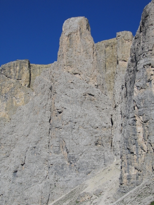
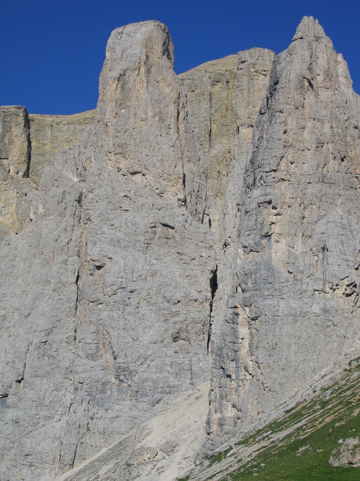
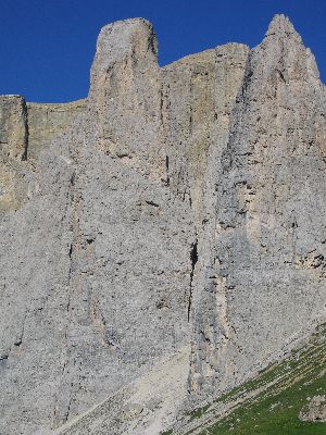
| The Third Sella Tower (left) from the trail. Notice the Spiral
Band about halfway up. |
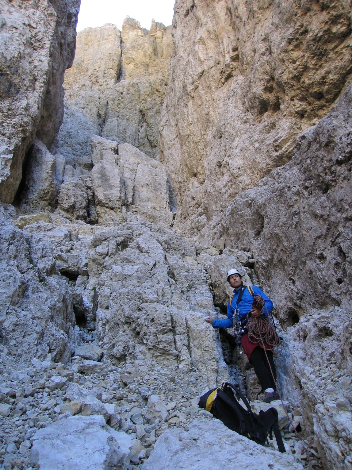
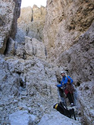
Paul in the gully |
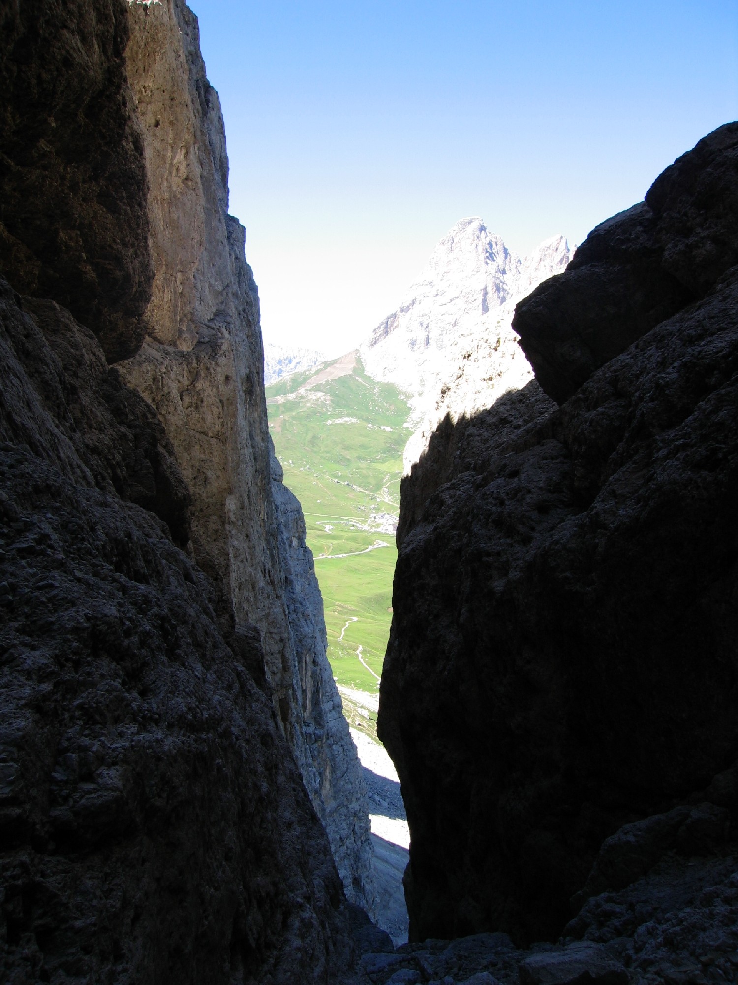
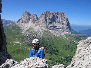
View out of the gully towards the Langkofel |
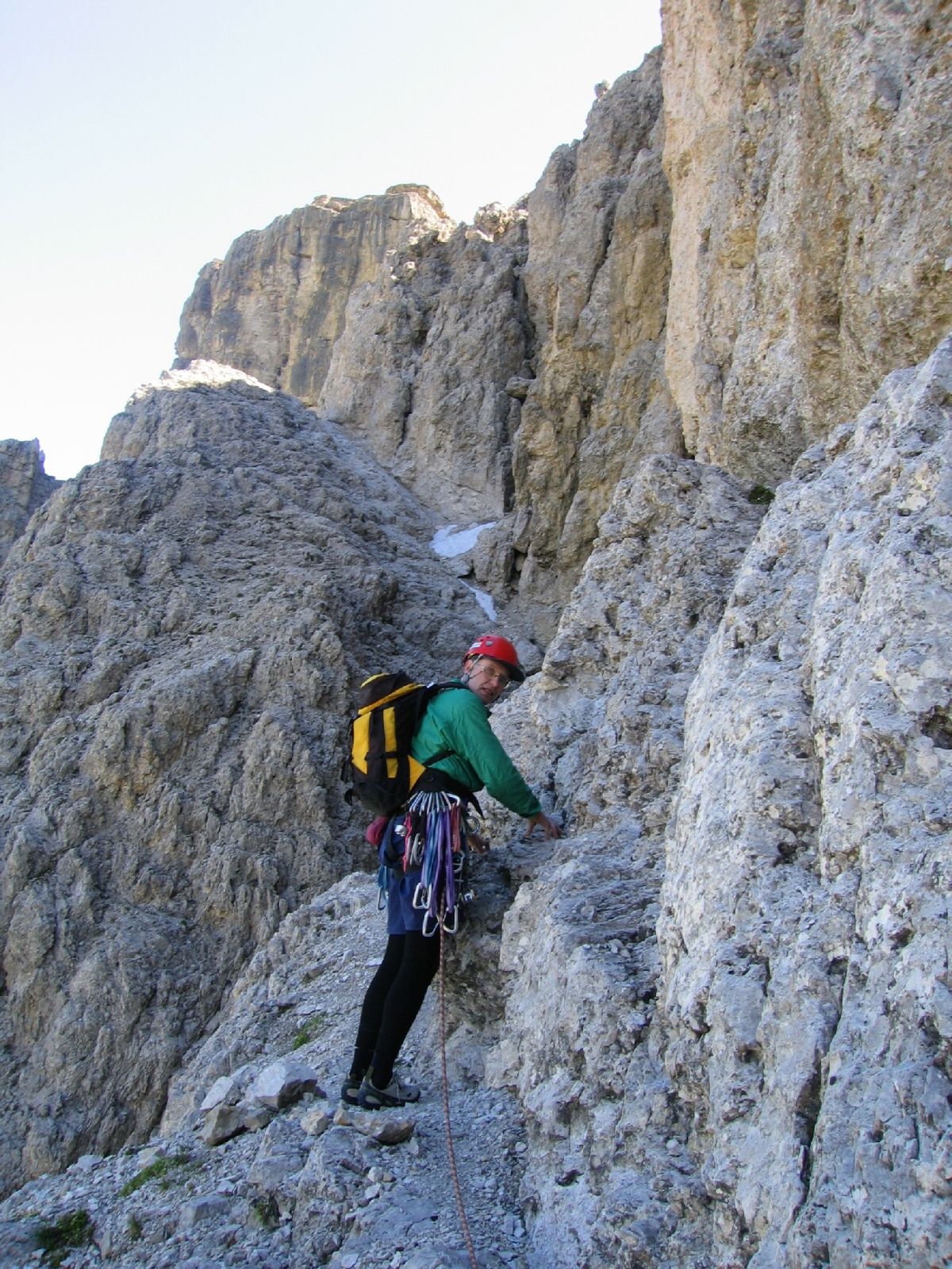
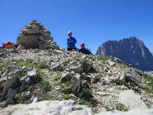
Dietrich on the Spiral Band |
Paul high on the route |
On the summit |
|
|
|
|
|
|
|

|
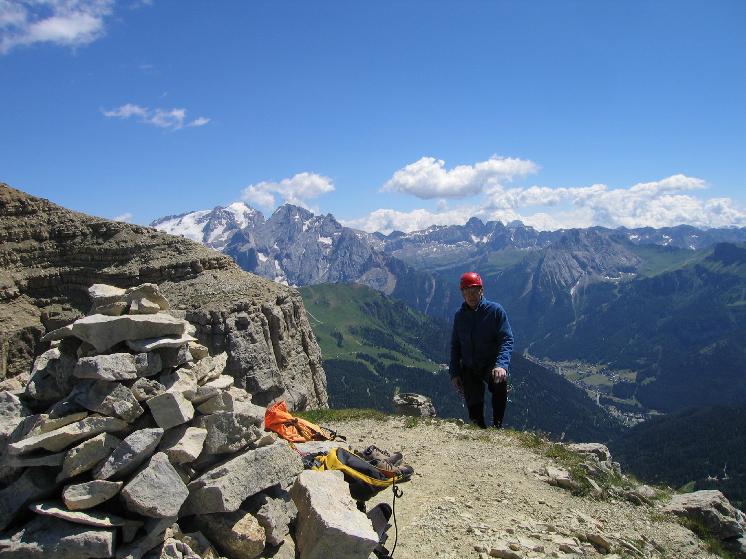
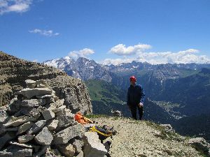
| On the summit, Marmolada in background |
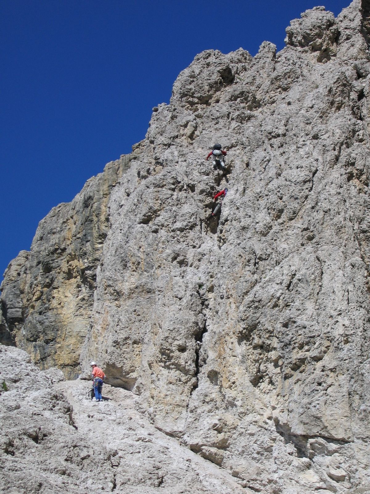
A party downclimbing to the Spiral Band |