Forbidden Peak had been on my tick list ever since I saw the mountain from the summit of Sahale many years ago,
but something had always come in between, most recently bad weather in early July. Now we were determined to do
it, late season or no late season. So I started out from Eugene on Friday at 6am, picked up Paul in Seattle, and
we proceeded to Marblemount to pick up our permit.
By 3pm we were at the trailhead ready to go. It was HOT. Our little REI thermometer showed 105, but it had probably
been exposed to the sun, a realistic estimate was around 95. The trail turned out to be very overgrown, and in the
green tunnels it was even hotter than at the trailhead. At the first creek we dumped our packs, got the filter out,
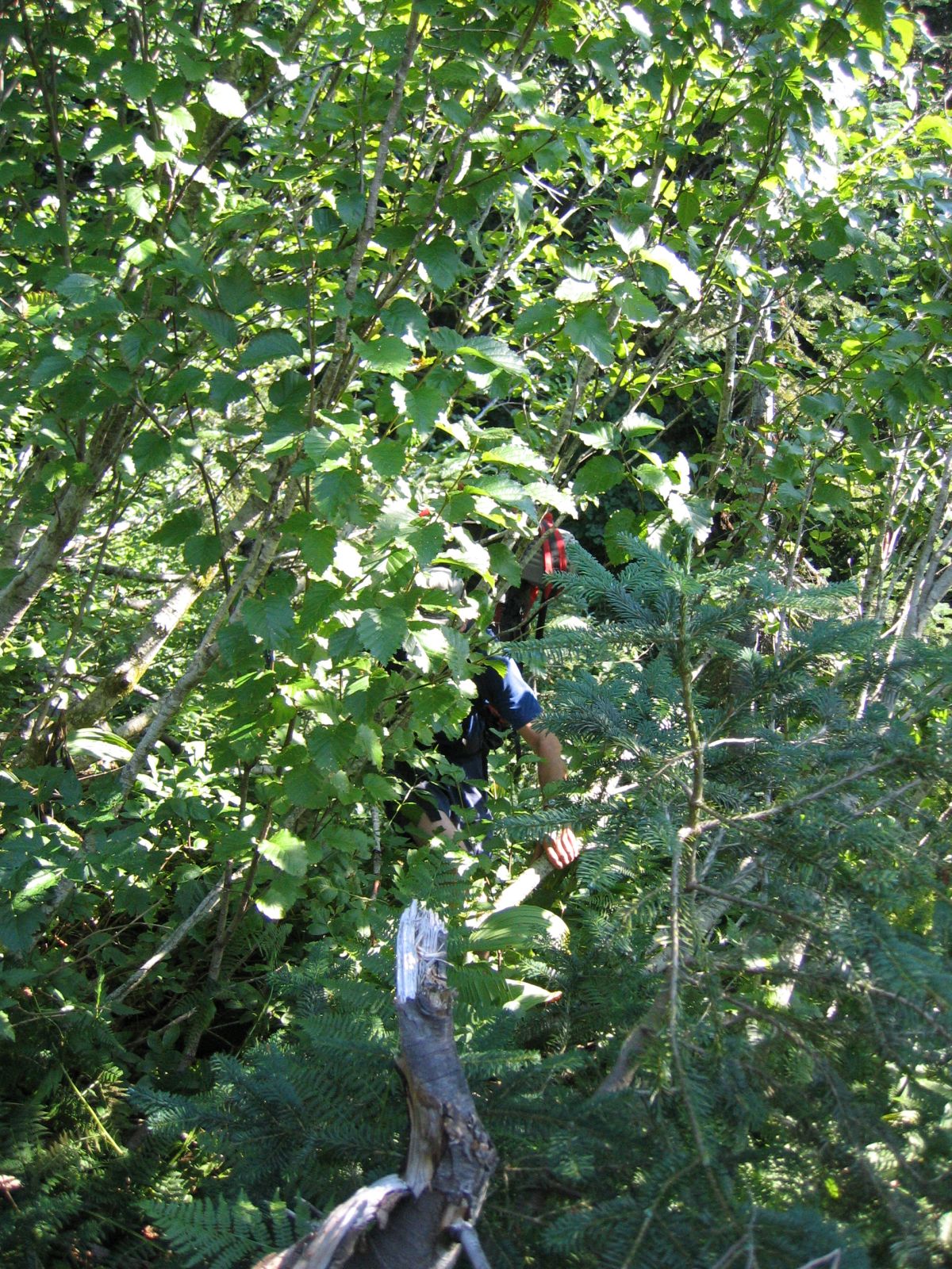
drank an amazing amount and generally cooled off. After a while we got to an avalanche swath, where we promptly
got lured off route by a deer trail. Pretty soon we were doing the worst bushwacking I have ever done. This
continued for something like an hour and a half, until we finally managed to break out of the alder and salmonberry
thicket, tired, and our shins all scratched up. After some more reasonable travel through steep forst we reunited
with the trail and continued up into Boston Basin. Almost four hours after leaving the trailhead we finally reached
the campsites. It was still amazingly hot, and we were pretty shot at that point. We filtered and drank unbelievable
amounts of water, and then retired under Paul's Megalite, setting the alarm to 4am.
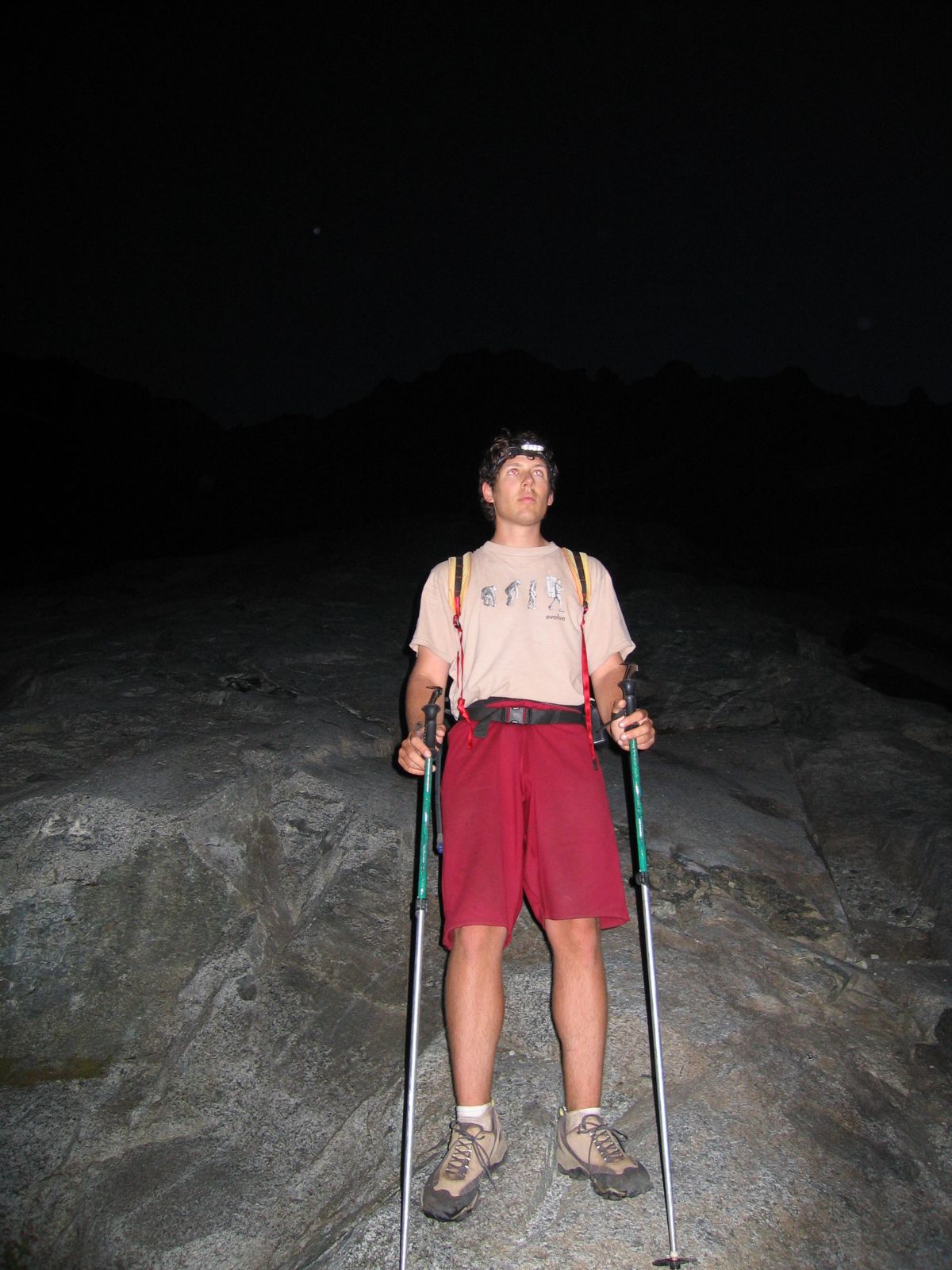
It did not really cool off during the night either, and when the alarm went off the thermometer showed 68 degrees.
At 4:45 we set out towards Forbidden in the light of our headlamps. The approach initially travels over a huge area
of glacier-polished gneiss slabs, with some third class sections that were interesting in the dark and provided some
gneiss warmup (it's hard to resist this pun). By the time we reached the glacier remnant it was light. We donned
crampons and continued up. The gully
was clearly out of condition, so we headed towards the face to its left, following Beckey's advice. The moat turned out
to be easier to cross than I had feared; one long step (don't look down), the sound of crampons scratching on gneiss,
and we were on the face.
We put on rock shoes, cached our boots, crampons, and ice axes/ski poles, and started simul-soloing. After a while
we decided to rope up, however, as the climbing was not entirely trivial, somewhere in the low 5th class range.
After the first pitch it got easier, actually, but the rock deteriorated, and we continued climbing roped. A few rope
lengths got us to the notch, which we reached a bit over three hours after leaving camp. We started to suspect that
the crux of this climb is the trail into Boston Basin! We rehydrated, ate something, admired the views, and prepared
to tackle the ridge, which looks magnificent from that point.
Most of the ridge is technically very easy, 4th or very easy 5th class, but the exposure is unforgiving. We simuled
some, belayed some, and made good progress. Both the rock and the protection are good, and the climbing is exhilarating.
After a while Paul came to the crux gendarm, which he attacked on its northern side. This provided 15 or 20 feet of
maybe 5.6, but on the way down we found that the southern side is quite a bit easier. Two more pitches and we were on
the West Summit, which we skirted on the north side to gain the true summit. It had taken us 6.5 hours from camp, just
a bit longer than the time Beckey quotes.
After a long lunch break, admiring the unbelievable views, we started down. We soloed some, simuled some, and rappelled
some, and all in all it took us exactly as long to get down to the notch as it had taken to climb up. Just before the
notch I had a scary encounter with a 10-by-8-by-1-foot slab of gneiss that started to tilt when I put my weight on it.
I mantled back up, which made it rock back to the position it had been in, and I made sure I found a way down
to the ledge that avoided this giant mouse trap.
We scrambled down the uppermost pitch of the approach, and figured that five rappels would get us down to the glacier
in no time. Not so. The existing rap stations were idiotically spaced, which led to some soloing, either farther down,
or back up to a more reasonable point to rappel from. When pulling the rope on the third rappel it jammed
(between the rock and the sling, it later turned out, in a completely bizarre way), and Paul led back up a full 100 feet
to free it. Eventually we got down to the moat, though, and descended the glacier and the slabs back to our camp.
The weather had deteriorated a bit, with t-storms all around, and we decided to pack back down and drive to Seattle that
night. This time we managed to not lose the trail and got back to the parking lot in two hours. By the time we got to
Sedro Woolley, Paul's favorite Mexican restaurant was just closing, so we had a dinner sandwich near I-5 and got to
Seattle close to midnight, which made it a 20-hour day.
Overall this was a great trip, and the ridge proper was one of the very best routes I've ever done. The climbing is
easy and aesthetic, and you can't beat the position. Sometimes I read trip reports that sound disappointed, and I
have no clue why. Maybe the route has been hyped so much that people expect some kind of überclassic that does
not really exist? Be that as it may, we thought it well deserves its classic designation, even without the snow
couloir that would undoubtedly add to the experience.
Photo Gallery:
Click the thumbnails to see a higher resolution image.
|
|

|

|
|

|
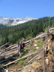
| View of Forbidden Pk shortly before we lost the trail ... |
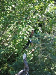
... and were in for some serious bushwhacking |
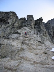
Paul on the gneiss slabs early in the morning |
Johannesburg Mt from the approach pitches |
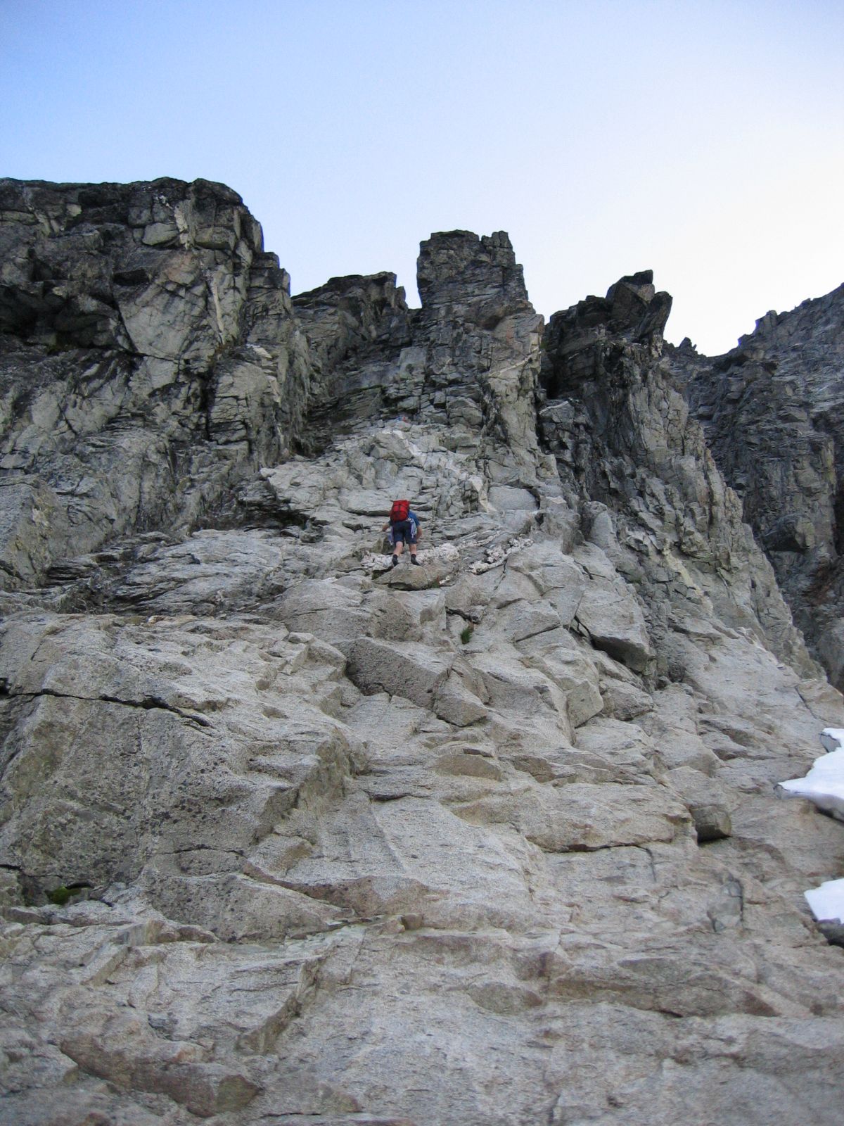
That's me soloing the first approach pitch ... |
... and following low on the ridge |
|
|
|
|
|
|
|

|

|

|

|
|
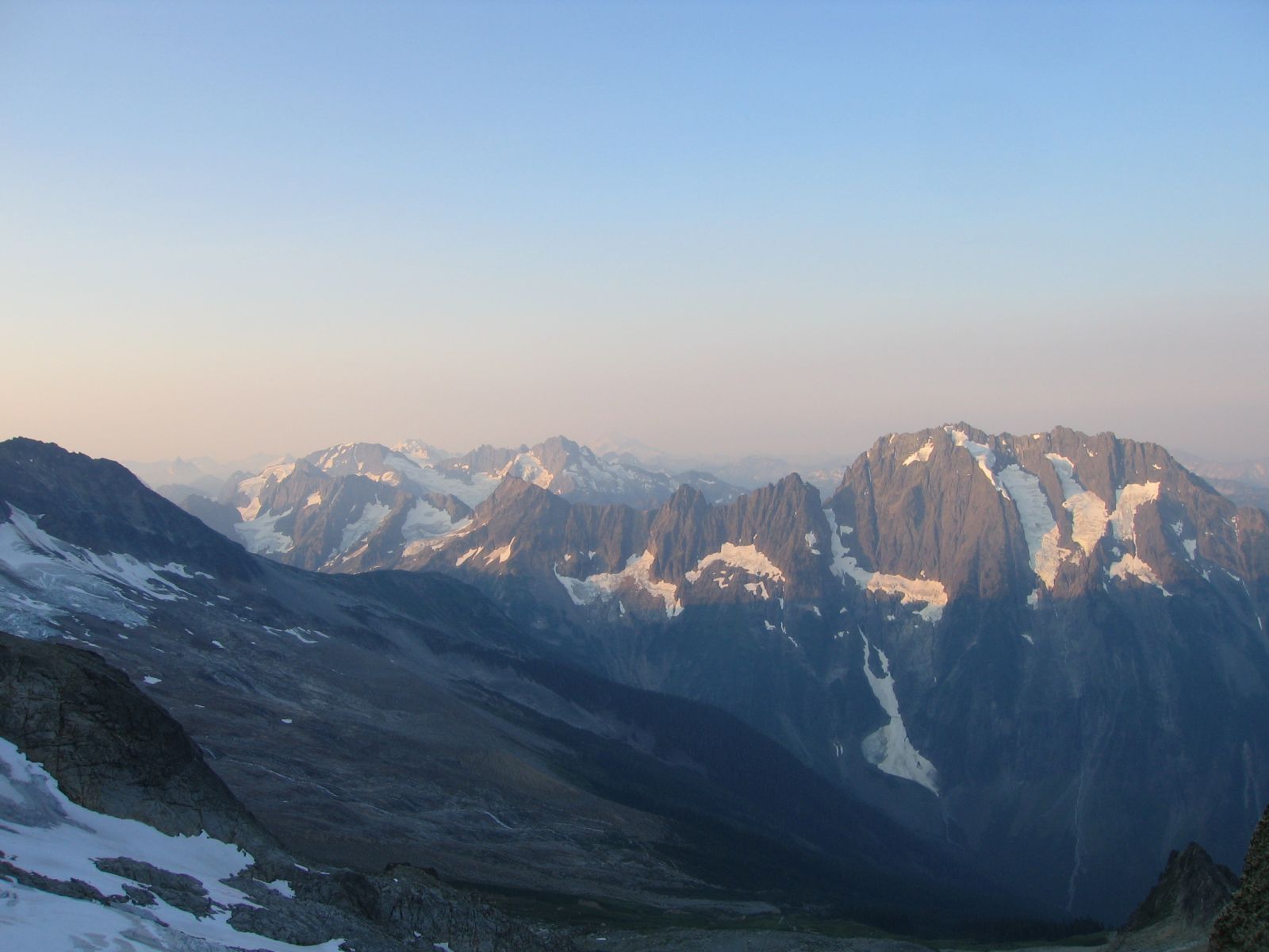
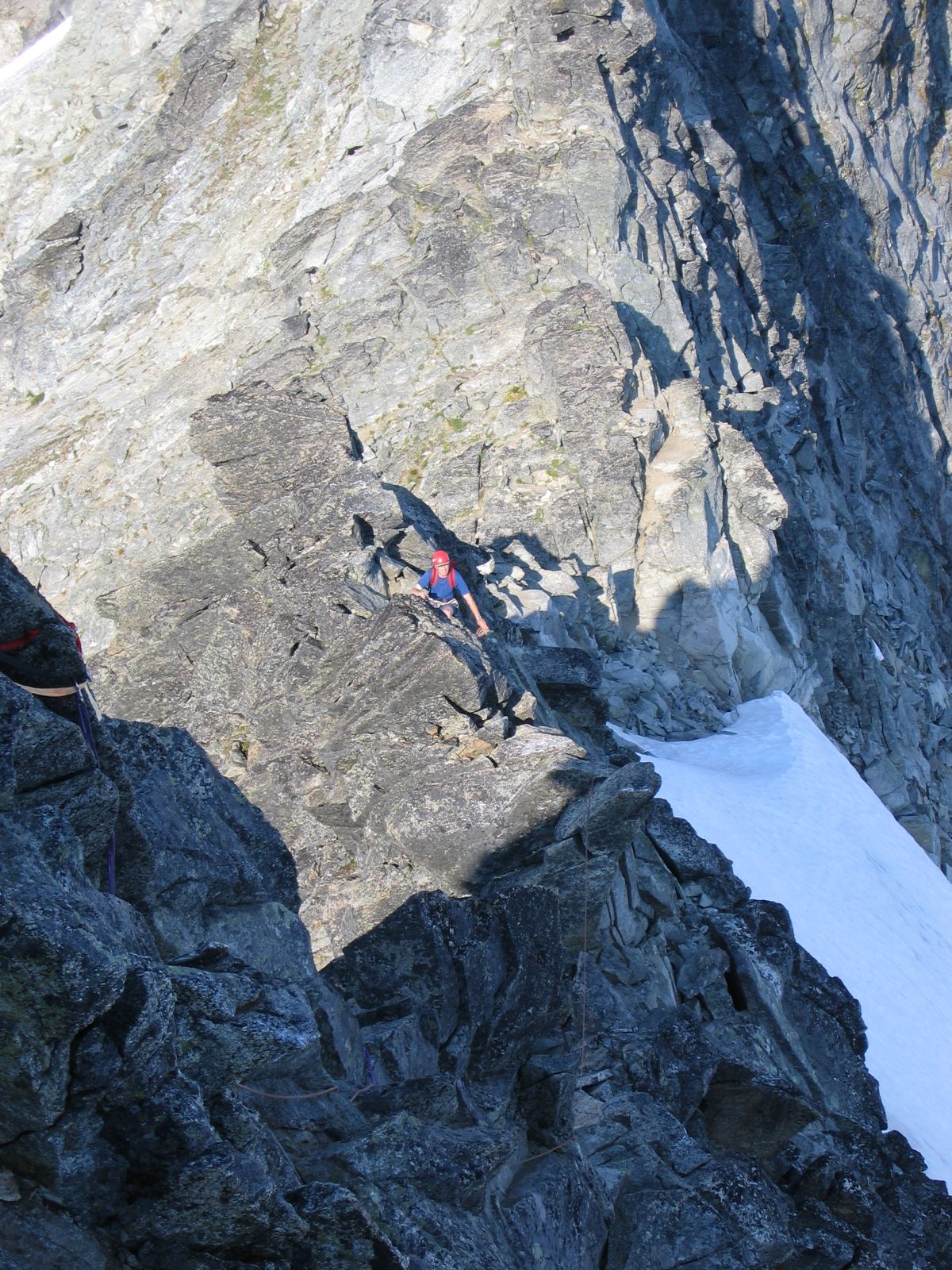
| Paul simulclimbing, Eldo in the background |
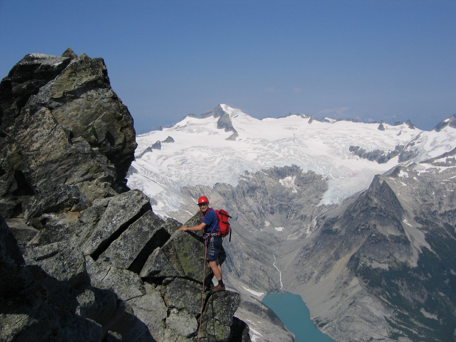
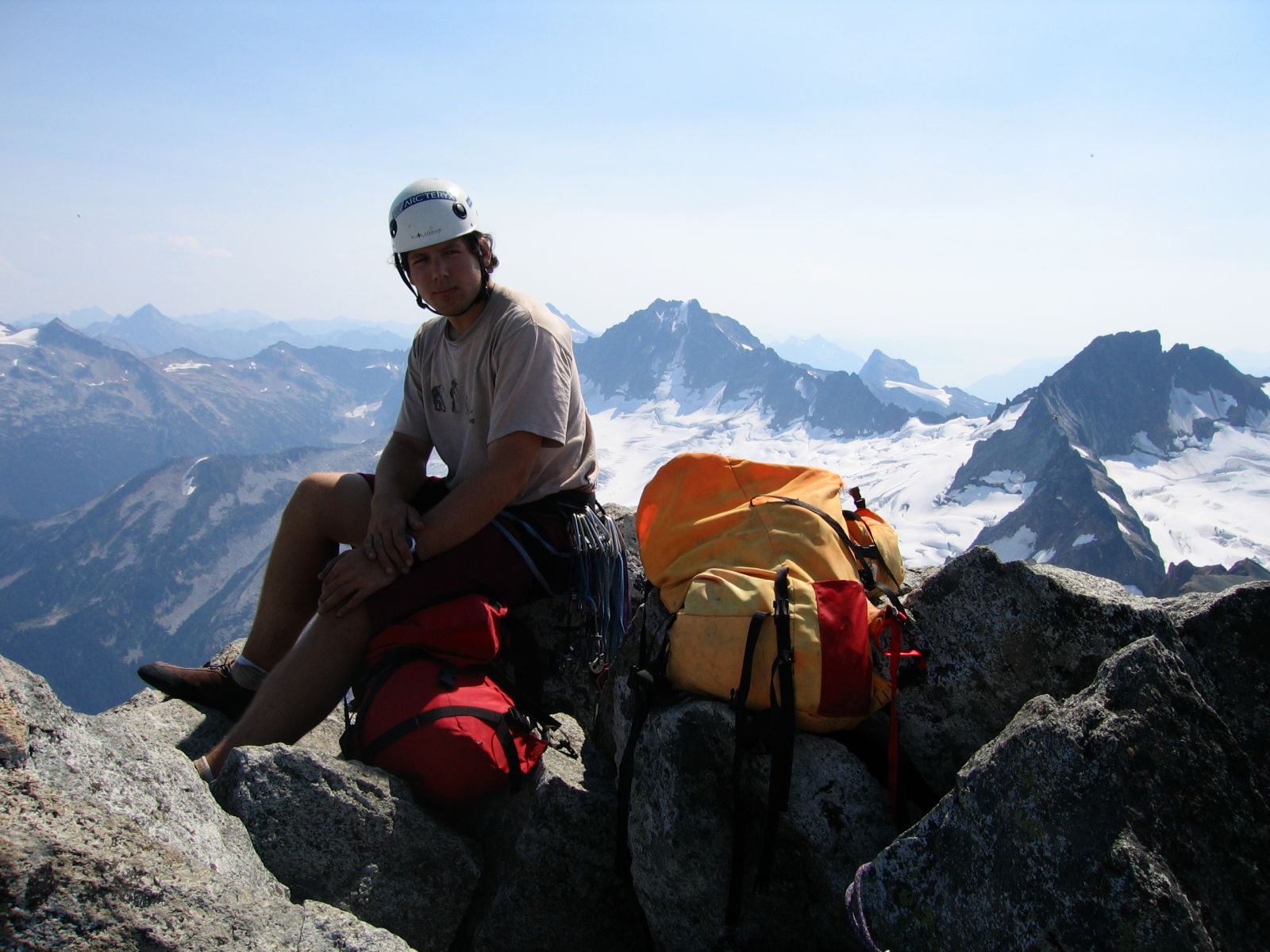
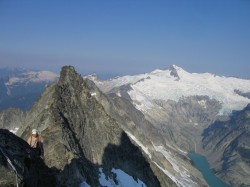
Here I am just below the summit, Eldo and the Inspiration glacier in background |
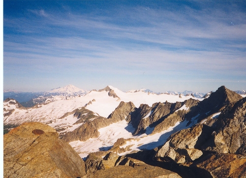
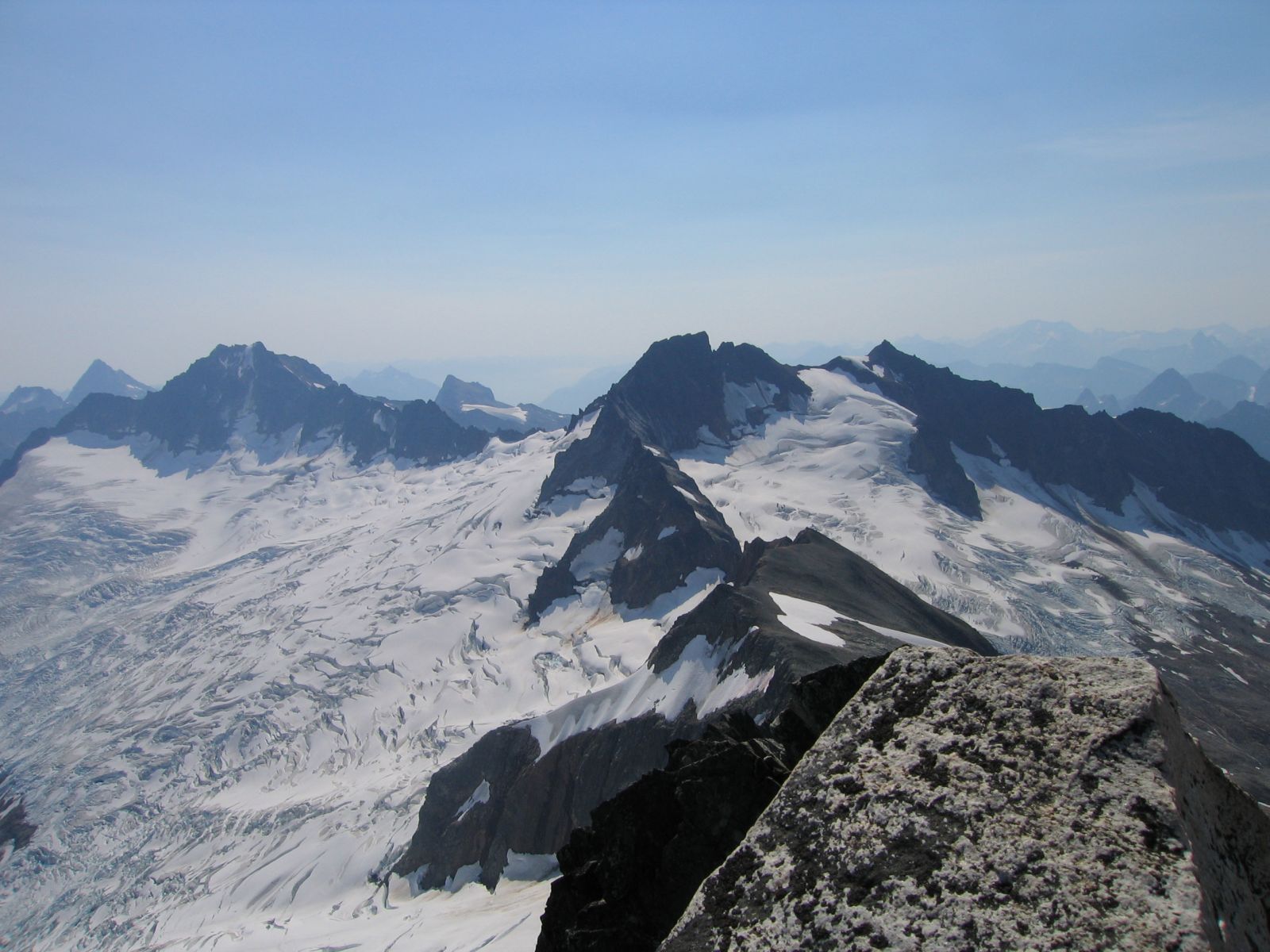
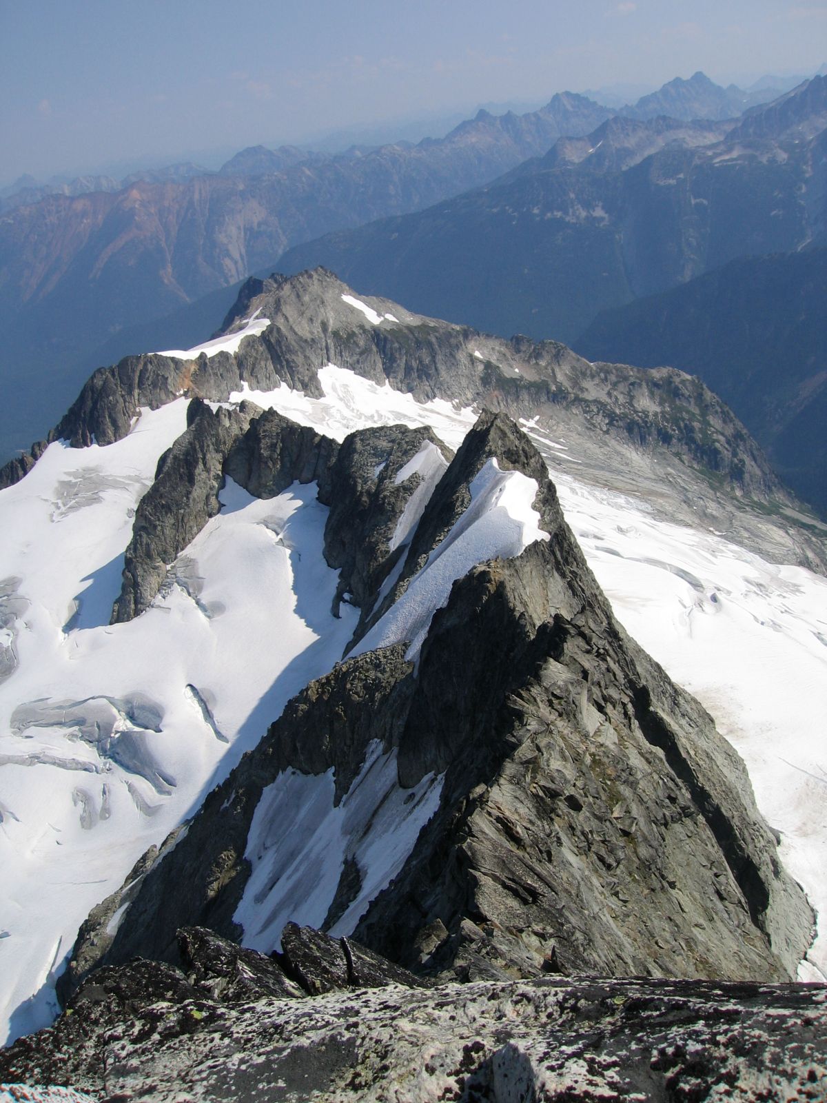
Sahale, Boston, and Buckner, with the Quien Sabe and Boston glaciers
(right to left) from the summit |
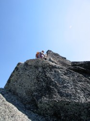
Paul on the summit |
View down the North Ridge from the summit |
Paul downsoloing |