Routes: Trail from Pamelia Lake
|
|
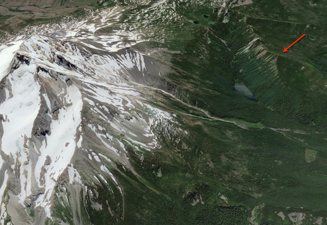
Grizzly Peak towers 2,000' above Pamelia Lake, with Mt. Jefferson, some 4,600' higher,
just across the lake. This makes for a phenomenal view, especially when Jefferson is
snow covered. Grizzly Peak is surprisingly steep, and the trail from Pamelia Lake is
exposed in places, so some caution is called for when there is snow and ice on the
trail. It is very densely forested, so leave your skis at home and take snow shoes.
Routes: Trail from Pamelia Lake
|
|
|
Party: DB solo
Route: Trail
Equipment: none
Time: Trailhead - Summit: 2 hrs 55 mins
![]() Summit - Trailhead: 2 hr 5 mins
Summit - Trailhead: 2 hr 5 mins
![]() Roundtrip from Trailhead: 5 hrs 45 mins
Roundtrip from Trailhead: 5 hrs 45 mins
Comments: Water ice on the trail with little snow cover made for treacherous conditions.
Trip report:
It had been cold and sunny for several days, and I figured the Pamelia trailhead would still be accessible, which turned out to be correct. The snow line was at 2,700', but it was only a dusting. More suprisingly, there still was not much more snow at almost 6,000'; maybe six inches in places, and much less than that in others. There was water ice on the trail in many spots, so care was required, but I did not use the snow shoes I carried. The view from the summit was spectacular.