Routes:
S-N Traverse (II-III, 5.7)
|
|
Matthes Crest is an amazing formation that is very well hidden from view.
The approach is substantial by Tuolomne standards, and the full splendor
of the surprisingly narrow ridge can be appreciated only from the crest
itself. The most popular route is a traverse from south to north that
starts in a notch near the south end and ends on the highest point, the
North Summit. There are gendarmes south of the notch, though, and the
route in principle continues past the North Summit. Much of the climbing
is third or fourth class, but some of the fifth class sections are stiff
for the grade. Two 50m ropes are necessary for getting down.
Routes:
S-N Traverse (II-III, 5.7)
|
|
|
| References: Chris McNamara, supertopo.com | ||
Date: August 16, 2010
Party: Paul and Dietrich Belitz
Route: South-North Traverse
Equipment: 1.5 sets of stoppers, Camalots 0.5 - 3, 3 small tri-cams, 15 slings
Time: Highway - Base of Climb 3 1/2 hrs
![]() Base of Climb - North Summit 5 1/2 hrs
Base of Climb - North Summit 5 1/2 hrs
![]() End of Rappel - Highway 3 hrs
End of Rappel - Highway 3 hrs
![]() Roundtrip from Highway 14 hrs
Roundtrip from Highway 14 hrs
Trip report:
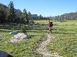
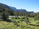
Matthes Crest had been on my tick list for a long time. We were in Tuolomne in order to acclimatize for Whitney, and figured that spending much of a day between 10,000' and 11,000' was as good a way to acclimatize as any, so this time we would do it. We started from the Cathedral Lakes trailhead at 6:20am and made good time to Cathedral Lakes. There we left the trail and made our way through some swampy areas and some forest to the Echo Lake Basin. Getting up to the notch was more work, but shortly before 10am we arrived there.
There was one party ahead of us, and so it took a while until we started climbing. We swung leads on the first three pitches, and then simuled for quite a while with Dietrich in the lead, with the exception of a short exposed downclimb that we belayed. We belayed the undercling pitch, and after that simuled again, this time with Paul in the lead. All along the way the climbing is easy, but the exposure is breathtaking. Skirting the South Summit proved somewhat intimidating, if technically easy, and then we arrived at the base of the North Summit. There was some confusion, as Paul was convinced that the North Summit was really the South Summit, but we finally got that straightened out and matched up what we saw with the sketches in the supertopo. The route looked quite improbable from there. I checked out the dihedral, decided it was at least 5.8 wide hands/offwidth, which the topo confirmed, and decided against that. So I went up the first 5.7 step, which turned out to be quite easy, if unprotected, and set up a belay at a diagonally ascending finger crack that led to the chimney the topo was showing. Paul shed his pack for leading the crack, which is also rated 5.7 but deceptively hard and strenuous due to poor feet, then hauled his pack and disappeared through the chimney. I followed and found the 5.7 finger crack one of the hardest 5.7 pitches I've ever done. Soon we were on the summit and enjoyed the terrific views. Unfortunately, there is not quite enough room in order to take good pictures. It had taken us 5 1/2 hours from the notch to this point.
We did not linger too long as it was getting late. Finding the rap slings did not take long (go straight toward the South Summit and you'll see them down and right), but we screwed up setting up the double-rope rappel and had to start over again. Finally I rappelled to the trees, Paul followed, and we managed to pull the ropes with no problems. I was convinced that a single-rope rappel would suffice for the rest, but changed my mind when I found myself still on solidly fifth-class terrain at the end of the rappel. So Paul changed the setup from single rope to double ropes, and that deposited us on second-class talus. This rappel definitely took us longer than it should have.
We figured it would probably get dark before we made it back to the car, and hence decided to go back the way we had come rather than checking out the more rugged, if shorter, route through the Echo Peaks. With some molestation by mosquitos we made it back to the car by 8:20pm, just barely avoiding the need for headlamps.
Very impressive trip in a great position, with good climbing on perfect rock.
Paul at Cathedral Pass. |
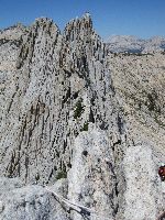
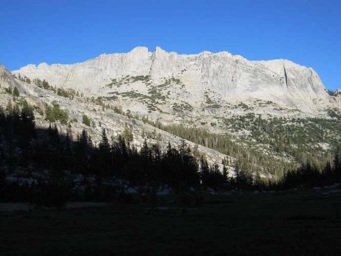
Matthes Crest comes into view. |
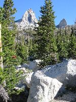
On the way up to the notch. |
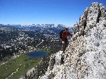
View from the notch. |
Paul following the first pitch. |
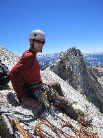
Simulclimbing on the crest. |
||||||
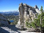
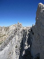
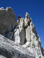
View of the North Summit from the crest. |
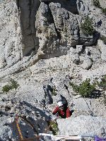
Paul after the undercling pitch. |
One of the many short downclimbs. |
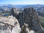
View of the North Summit from just below the South Summit. |
View south from the North Summit. |
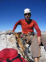
Paul on the summit. |
||||||
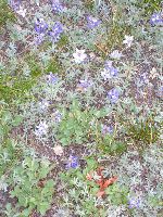
Wildflowers near Echo Creek. |