Mt. Olympus had intrigued me ever since I saw the sign "Glacier Meadows 17.5 miles"
at the Hoh Ranger Station twenty years ago, but I really got interested after seeing
the trip report by Ben Manfredi and Jason Hummel, who did an 18-hour speed ascent in
2003. Being twice these guys' age I figured I should allow for a bit more than 18 hours,
but I wanted to climb this peak that looks like it had been picked up in Greenland
and dropped in Washington State.
I don't know many people whom I could convince to go on a 45-mile hike, but Paul was
fair game. The logistics were complicated. Monique and I started at 6am in Oregon,
we picked up Paul at 11am in Seattle, then we headed towards the Edmonton-Kingston
ferry. We waited forever for the ferry, and by the time we finally got going from
Hoh it was 4:40pm. We figured we had better get at least to Elk Lake in order to make
the next day reasonable, and so we went as fast as our packs allowed. Still, there was
a creek to ford, the rangers at Mile 9 informed us that we needed a permit after all,
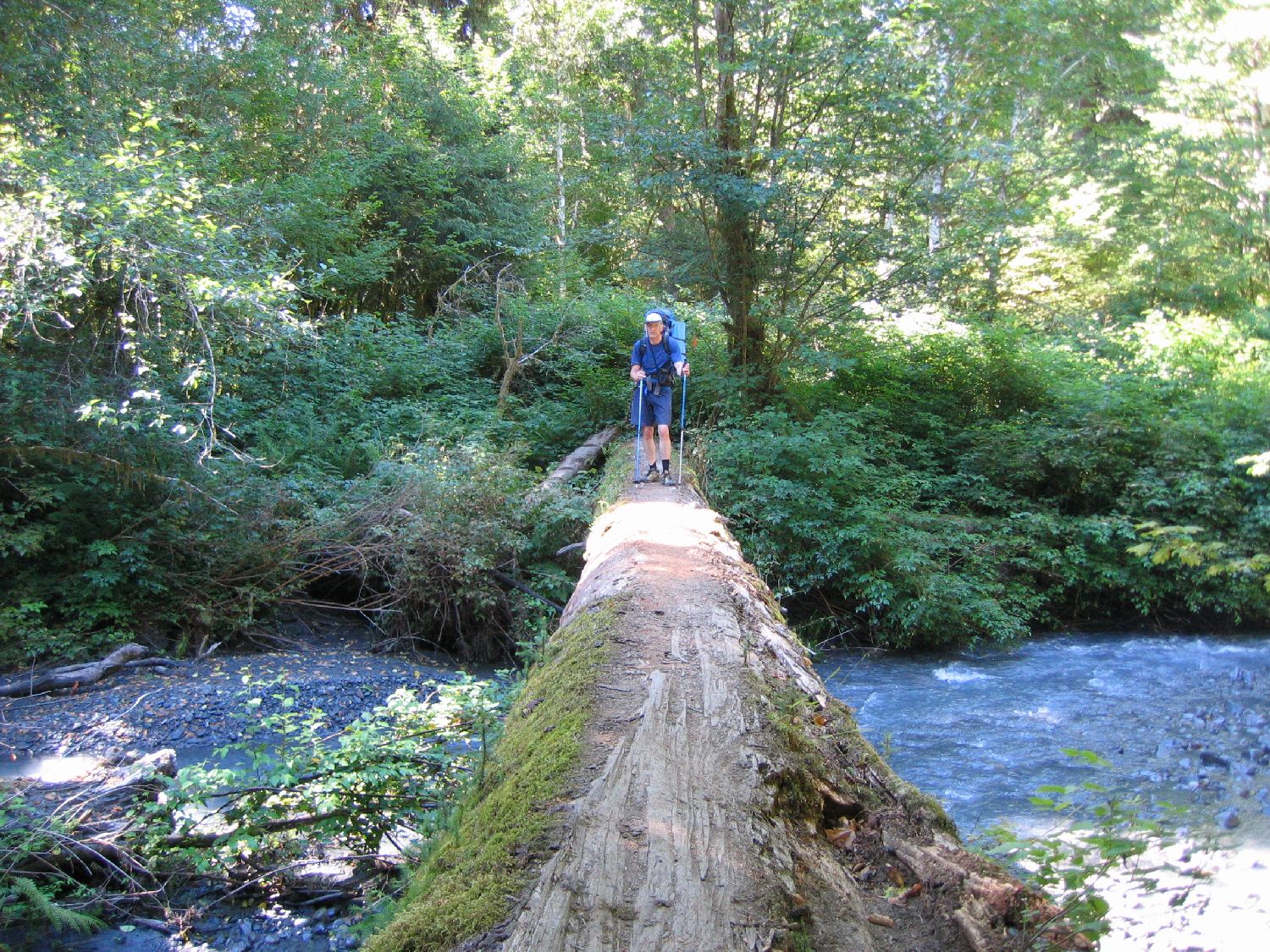
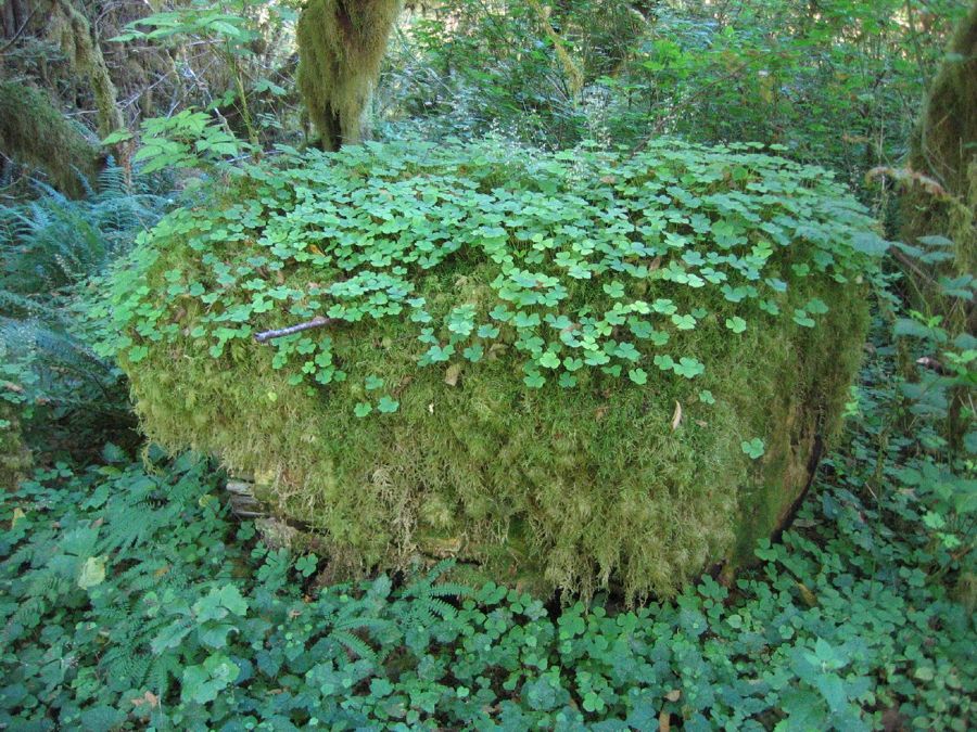
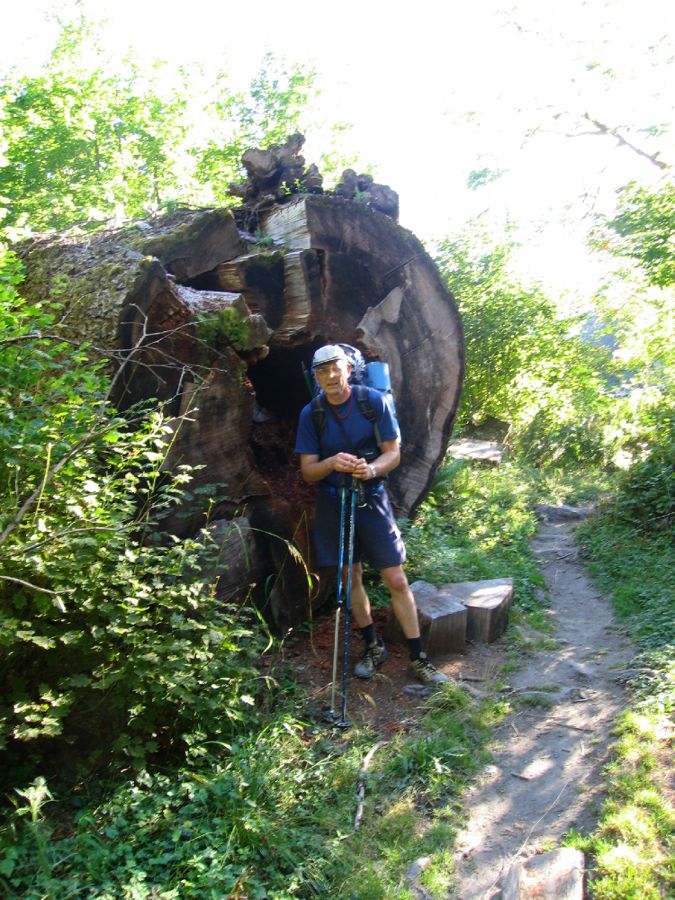
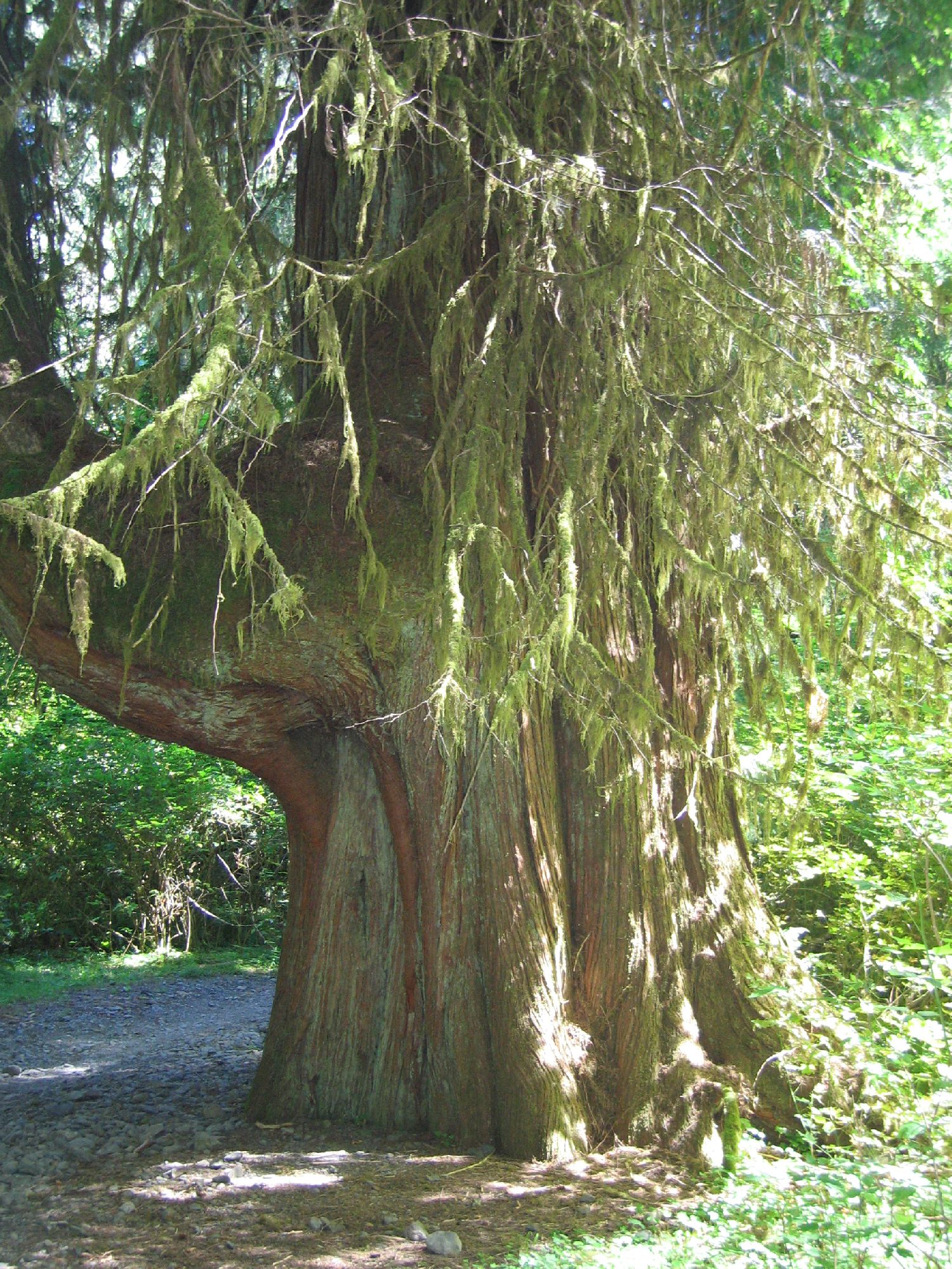
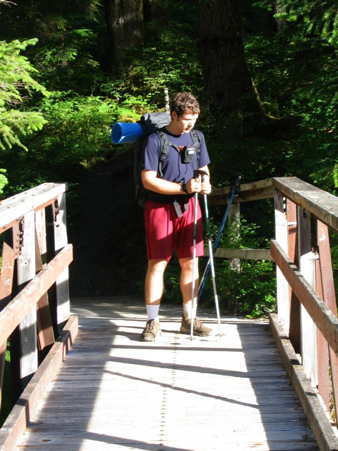
and so on. The forest is extremely nice, though, and the trail is very good. By the
time we started to gain elevation after the footbridge at 13.1 miles it was getting
dark, and on the slopes to the hanging valley that's home to Elk Lake we got out our
headlamps. At 10pm we stumbled into a nice camp site at Martin Creek, just 5 minutes
from Elk Lake, and called it a day. Filtering water and cooking dinner took some more
time, but by 11pm we finally were in our sleeping bags.
We had agreed to take it easy the next morning, and we did not carry an alarm anyway,
so we slept until the morning light woke us at 6am. We stacked out sleeping bags below
a log and I switched from sneakers to boots (Paul opted for sneakers all the way). By
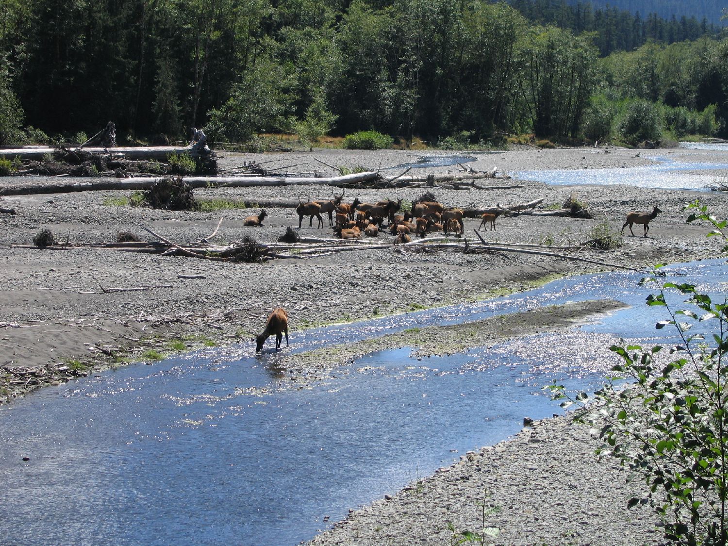
6:50am we were on our way, surprised a herd of elk, and shortly after 9am we arrived
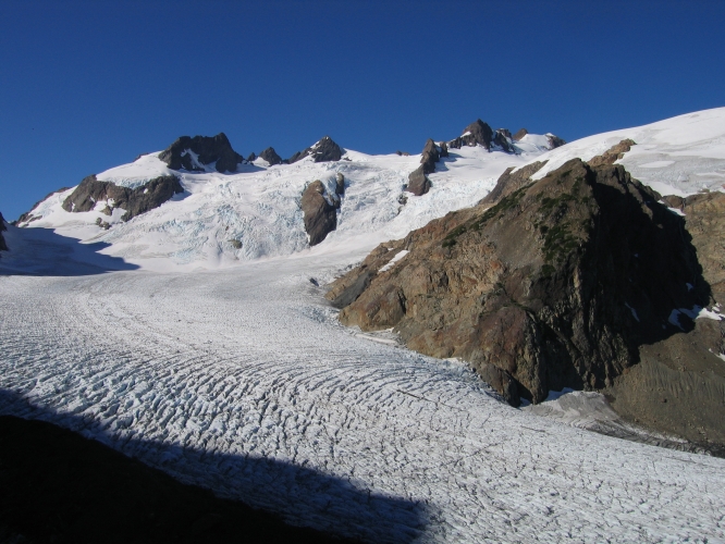
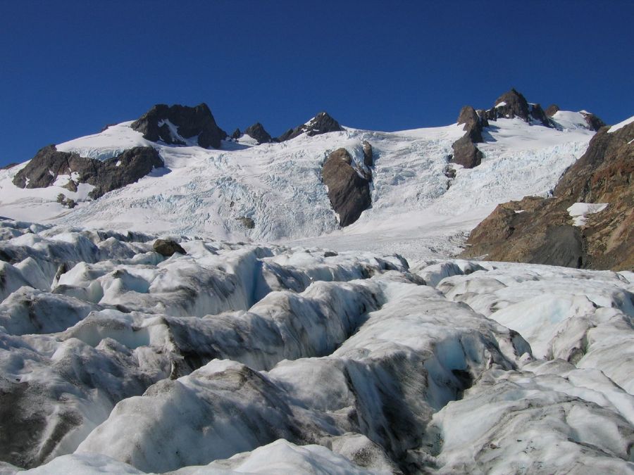
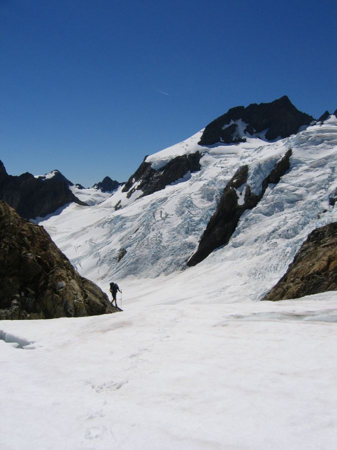
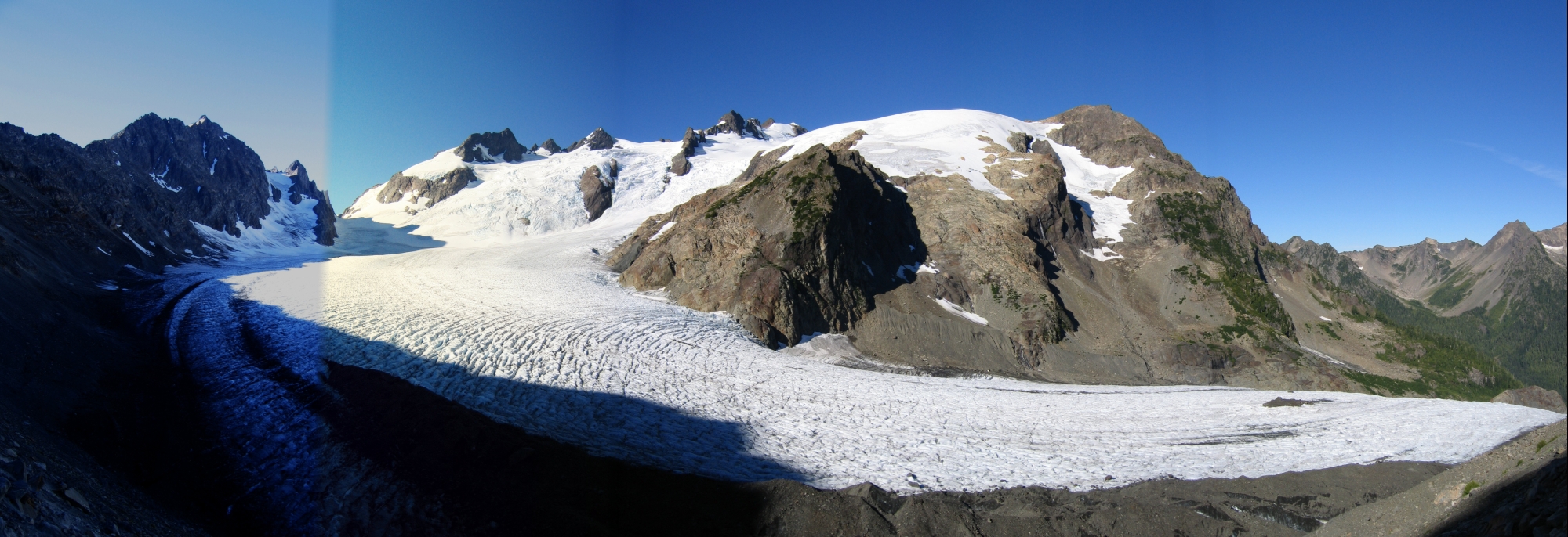
on the lateral moraine of the Blue Glacier. Here we were, just 19 miles and 4,500
vertical feet from the trailhead, and we already got to see our mountain! And wow,
what a view!
We slid down the moraine noting that it would be a pain to get back up on the way back,
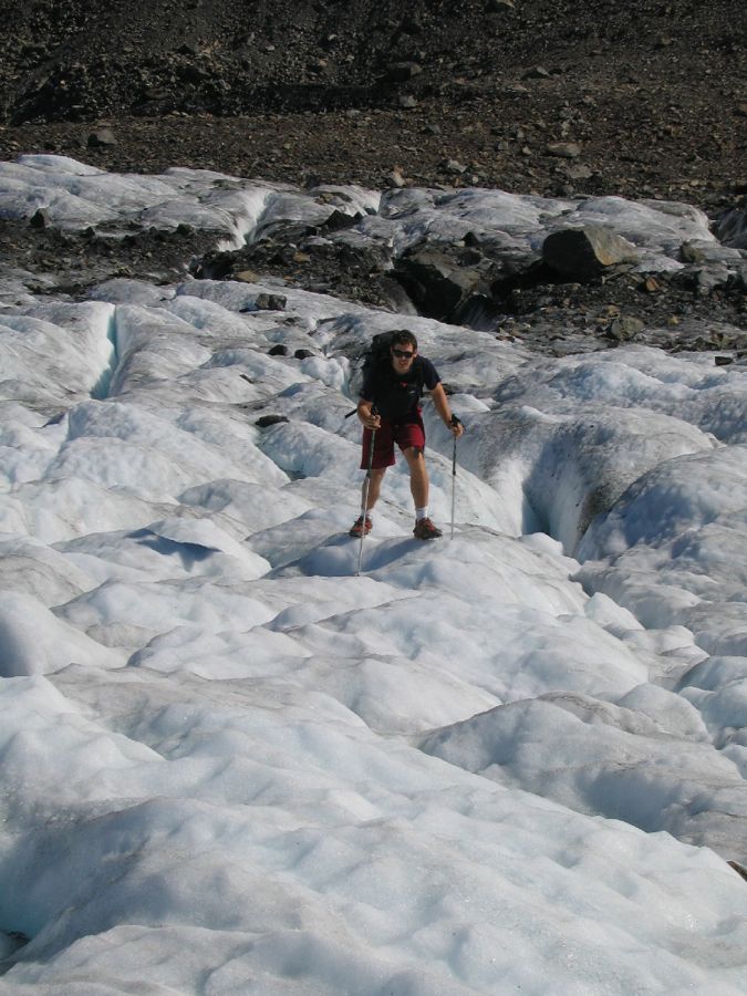
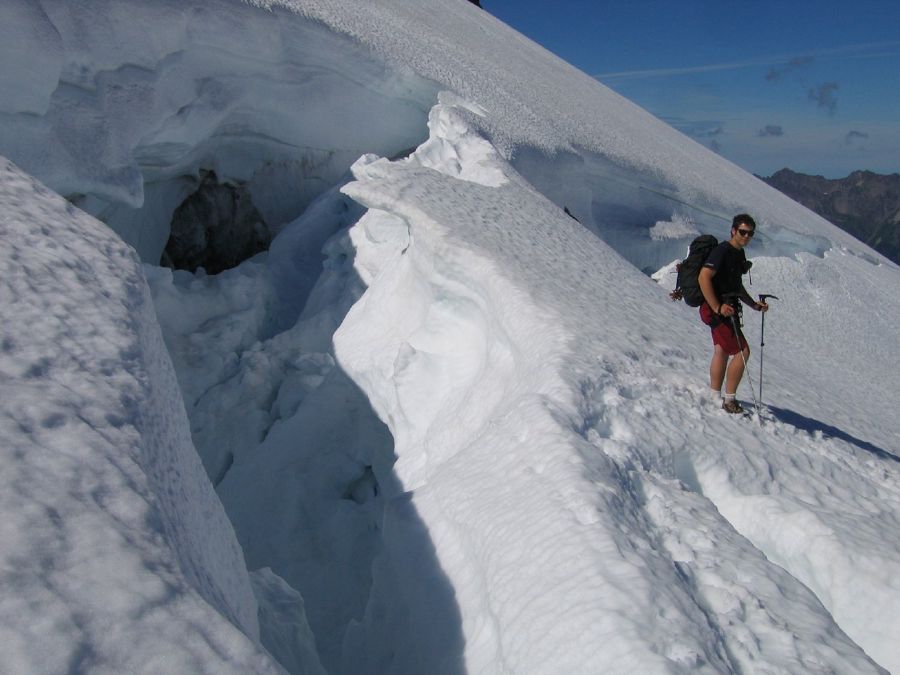
donned crampons, and started to traverse the very rough lower part of the glacier. There
was water running everywhere, and very deep holes filled with meltwater. The ice was
solid, though, and we did not bother to rope up. The lower part of the Snow Dome was
bare rock, and the next 1,000' were rather miserable on bad scree, although not as
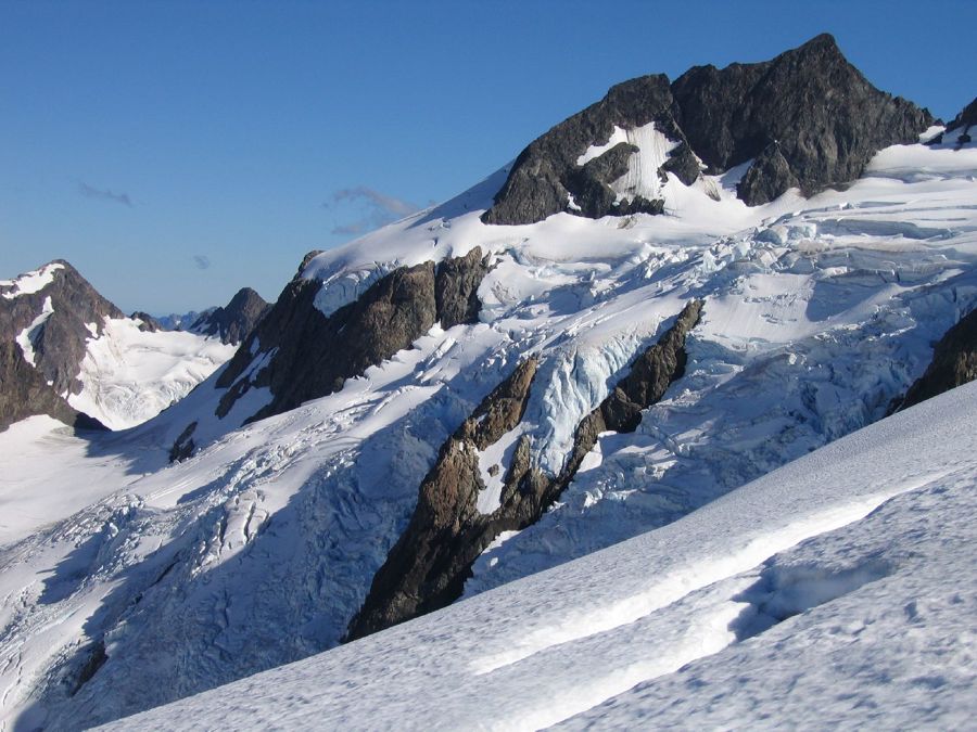
miserable as going back down. We watched a huge serac collapse on the easternmost of
the three ice falls; it would have been a bad day to climb one of the falls. Eventually
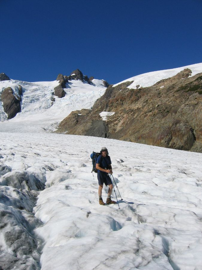
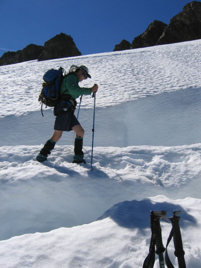
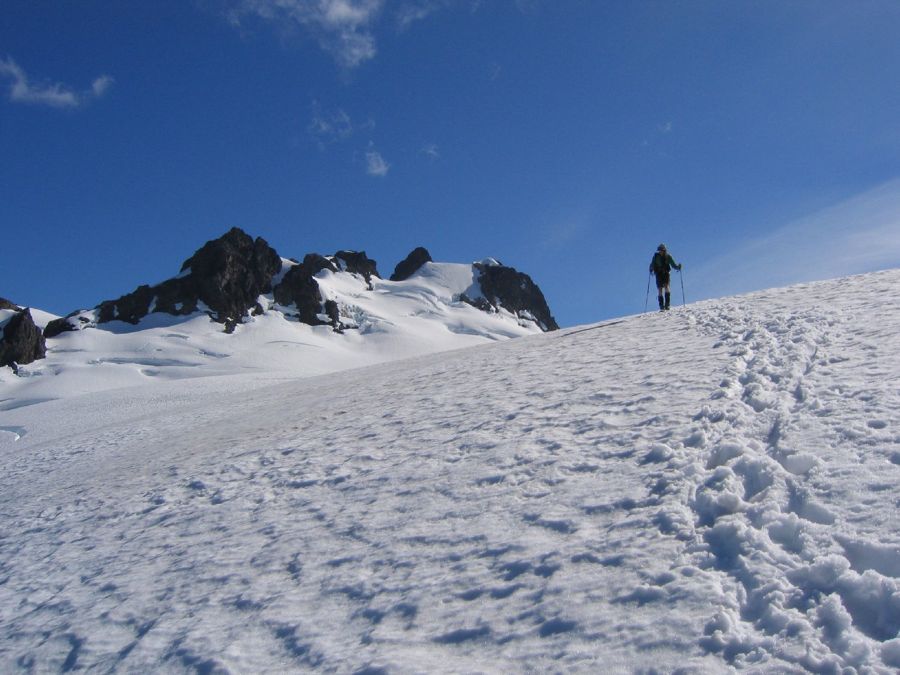
we reached the snow at 6,000', and kept going north (i.e., away from the summit) in
order to avoid blue ice. Finally we turned around, crossed a scary snow bridge, and
reached the ice cap at about 6,600', where we roped up.
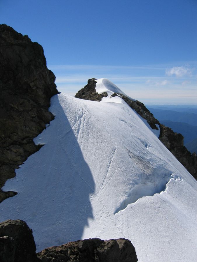
The view from the ice cap toward the mountain is amazing, but at this point we got
confused about two things. First, which of the myriad summits is the true summit?
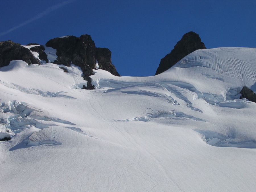
And second, what's the best way to get there? There were pretty fresh tracks going
far left on easy snow, eventually crossing over to the south side, and much fainter
tracks going up directly towards a very nasty looking bergschrund. While we were
approaching the point where the tracks split a party of two came down the left option.
They reported that they had indeed crossed over to the south side because the schrund
had not looked inviting, had climbed a few peaks, but always discovered that something
else was still higher. Eventually they got frustrated and turned around. From their
description we figured the true summit was what we had thought it was before we got
confused (the photo in Kearney's book has it right, by the way), and decided to go
straight for the schrund. It was clear that crossing it was not an option, but skirting
it to the left and then traversing above it, crossing a rock band, looked feasible.
Apparently that was what the party had done that had left the by now very faint tracks.
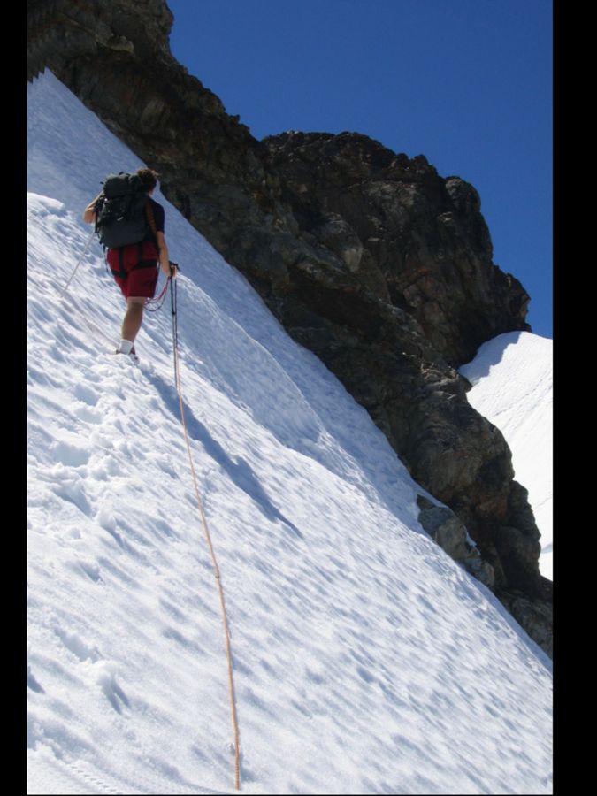
The snow above the schrund was good, but the exposure was fearsome, and I regretted
having opted against snow protection for weight reasons. The rock band was easy, but
did not take any pro, and the crux of that section was getting back onto the snow,
sans protection. We finally reached the steep but unexposed snow slopes below the summit
block, at which Paul's feet got seriously cold, the price he paid for not having had to
carry boots on the trail.
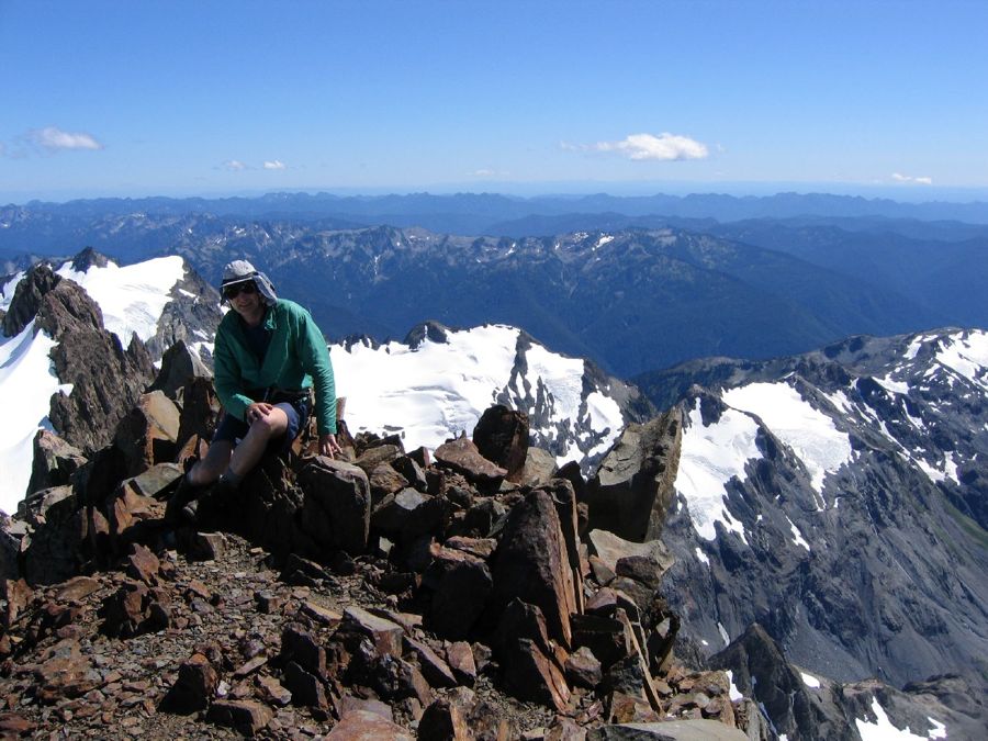
We ditched the rope, Paul warmed his feet, and then we started up the rock. Kearney
says to climb the NE side, but there was no obvious line, so we started on a more
inviting ramp up the NW side. After a while Paul got stuck and declared that he did
not care for soloing this in wet sneakers. I brought up the rope, had a look, and
could not really blame him. Indeed, even with boots I was glad I had brought some
rock protection. A surprisingly difficult (about 5.4) pitch on my doubled half rope,
on which I placed a #13 stopper and the two cams I had brought,
got me to a block festooned with slings. I brought Paul up, and from there it was a
few more feet of scrambling to the summit. Eight hours to here from Elk Lake.
We enjoyed the terrific views, then rappelled back down the route we had climbed and
started the descent. We had no real desire to backtrack the traverse above the
schrund, so we scrambled up to the summit next door and descended to the south.
There we found the tracks left by the party we had met on the ice cap and followed
them down to the Snow Dome. This was easy snow hiking and we did not even rope up
again. We opted to descend the Snow Dome farther north than where we had come up in
order to stay away from the awful scree a bit longer, had a scary encounter with a
moat, and finally cursed our way down the scree to the lower Blue Glacier.
Crossing back over to the moraine was uneventful, slogging back up it was not quite
as bad as we had feared, and soon we enjoyed the last view of the mountain. While
hiking back to our camp my feet started hurting, but in slightly different places
than the night before. I figured (correctly as it turned out) that the next day
they would probably hurt irrespective of whether I wore boots or sneakers. 14 hours
after we had left we were back at Martin Creek and soon fell asleep.
On Sunday morning we took it even easier than the day before and did not get going
until 7:30am. I wore boots for the downhill part and then switched to sneakers, but
I'm not sure it made much of a difference. Over the following 13 miles we put in
hydration stops with increasing frequency, and our feet hurt more and more. We also
were noticably slower than on the hike in. The forest was still magnificent, but
truth be told, about five miles of magnificent forest would have sufficed to drive
the point home as far as I was concerned. Eventually we could tell that the trail
head was getting closer from the increasing number of tourists we met, and finally
we did arrive at Hoh. I was pretty tired at that point and my feet hurt seriously,
and I'm afraid I rather rudely walked away from a carload full or curious tourists
who took an interest in us exotic animals emerging from the forest. While Paul put
on his tourist-deterring face (nobody wants to mess with a wild animal that looks
tired, hungry, and pissed off at the same time) and stayed with the packs I set out
to look for camp site 73 on C Loop, where I hoped to find Monique. I did indeed find
her there, but it took me a full 20 minutes to get there!
Paul kept bitching about how long the route had taken us, but I'd say our time of 5 1/2
hours plus 14 hours plus 6 1/2 hours was quite reasonable. As for our light-and-fast
approach, we got that about right on this trip. My main luxury was to carry my boots on the
trail, and that turned out to be a good thing as neither one of us might have wanted to
lead the summit block in wet sneakers. The weather was stable, so going without a tent
and without bivy sacks was a no-brainer; our Subkilo down bags were plenty. We used
and needed virtually all of the equipment we brought except for a few pounds worth of
clothes, but if you go that far from the trailhead you want to make sure you can get
back in case the weather turns crappy after all, which it all too often does in
Washington. We also made sure we took the time to stay well hydrated, which certainly
contributed to the fact that we still felt strong at the end of the trip, discounting
our feet.
We took a brief cold dip in the river, admired another herd of elk, and then started
back to Seattle, this time via Olympia. Ten hours and many traffic jams later Monique
and I finally arrived at home, envying Paul who had already enjoyed a few hours of sleep
at that time.
Olympus is certainly a magnificent mountain, and I enjoyed the variety of climbing.
While the monster approach is a pain, the hike is through pleasant terrain and it
adds to the feeling of accomplishment and to the appreciation of the scenery high up.
Overall a great trip, although my feet took a few days to get back to normal.