|
Mt. Shasta is a dormant volcano that sticks out of the plains south of the Siskiyous and
north of the San Joaquin Valley. It is not really part of any range, but just a solitary
representative of the Pacific Ring of Fire. The huge elevation gain from the plains make
it very impressive, both from below and from the summit, but it also means that AMS is
likely to strike unless you are pre-acclimatized. The routes vary from endless boring
slogs to good glacier routes to crumbly ridges. The difficulty and seriousness of all
routes depends hugely on conditions. Also be aware that Shasta has a tendency to create
its own local weather pattern, and that high winds near the summit are common even in
clear weather.
Topo Map
Routes: | Hotlum-Bolam Ridge
(easy glacier travel and/or Class 4) |

|
References: | S.F. Porcella and C.M. Burns,
Climbing California's Fourteeners ,
The Mountaineers (Seattle, WA 1998)
|
| | J. Smoot, Summit Guide to the Cascade Volcanoes , Chockstone Press (Evergreen, CO 1992) |
|
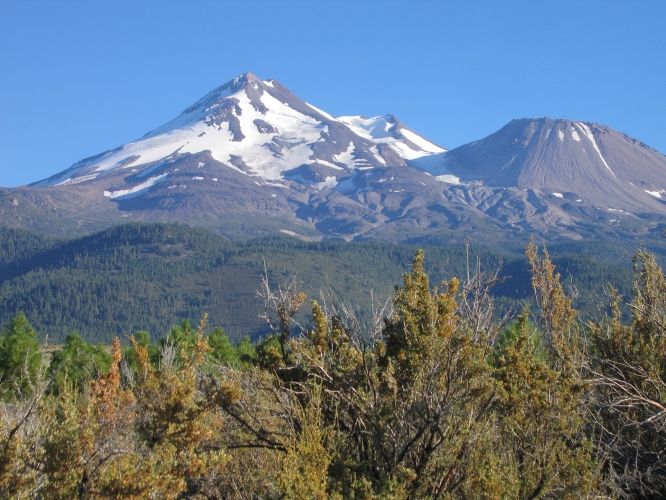
Mt. Shasta from the NW in late August
|