Routes: West Ridge (I, 4th class, moderate ski descent)
|
|
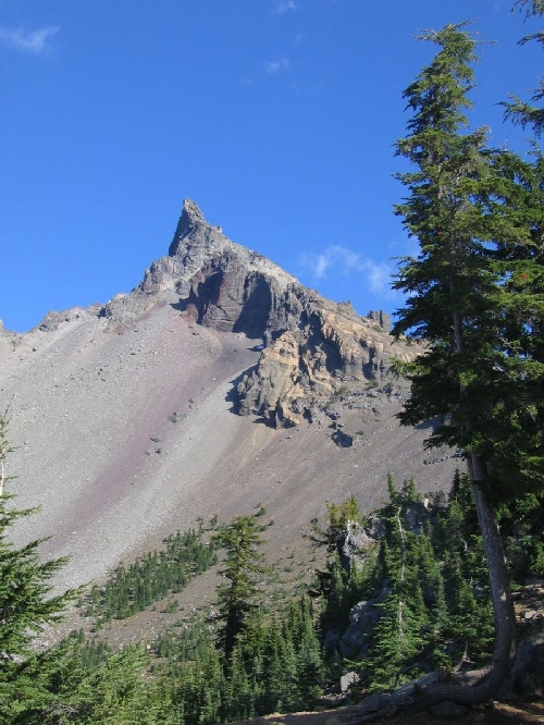
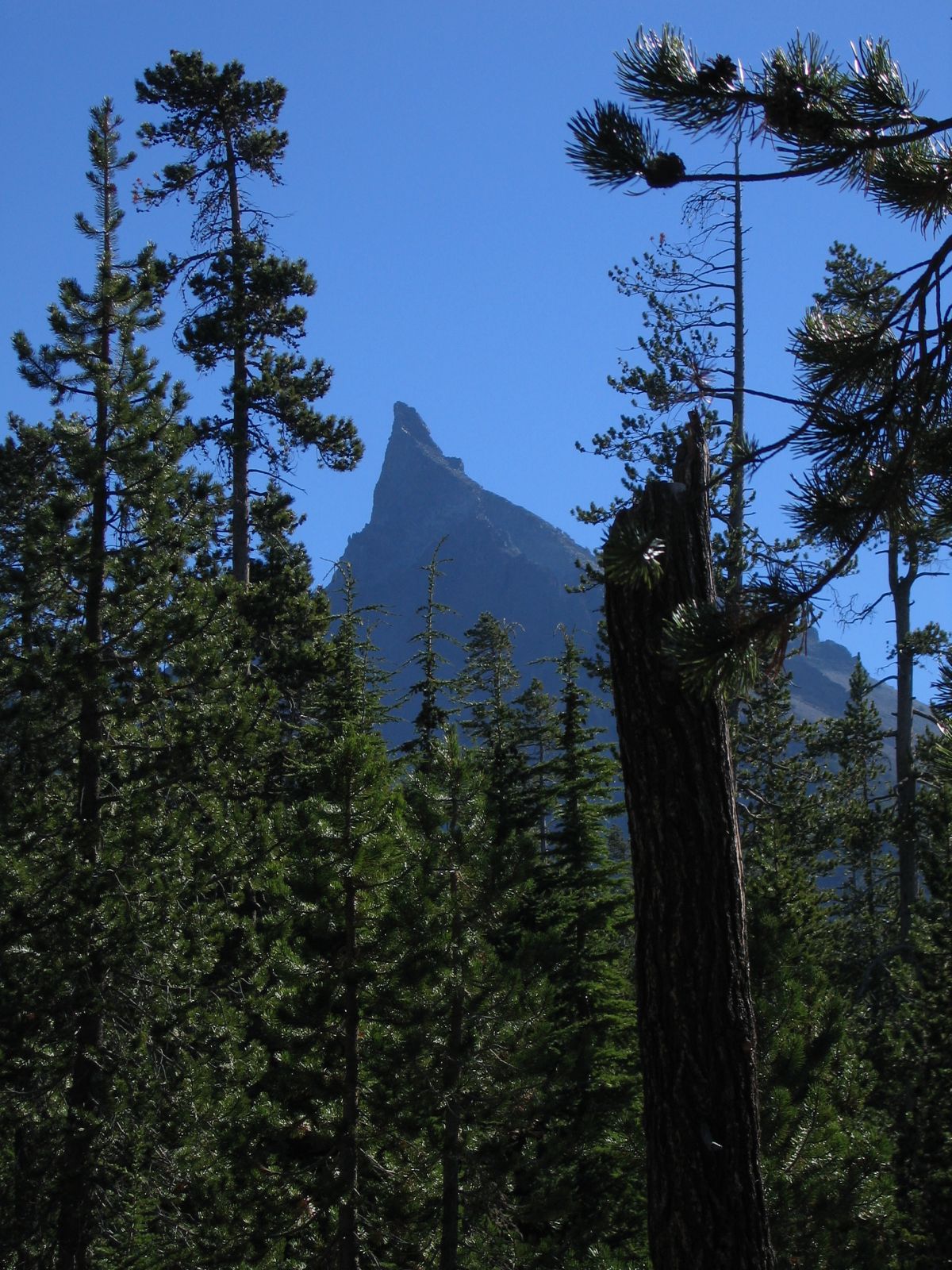
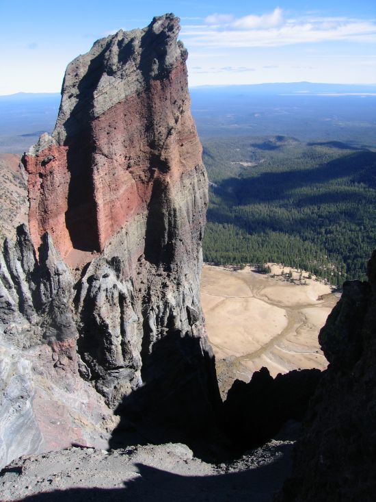
Mount Thielsen looks extremely impressive from any direction, yet the summit
pinnacle is only a very short fourth class scramble. On the summit one finds a
lot of fulgurite, or fused rock due to lightning strikes. The mountain was named
after a railroad engineer, Hans Thielsen. The summit pinnacle is not skiable, but
the slopes starting 200 vertical feet lower provide a good ski descent, although
they melt out fast in the spring.
Routes: West Ridge (I, 4th class, moderate ski descent) |
|
|
| References: Jeff Thomas,
Oregon High
Keep Climbing Press (Portland, OR 1991)
|
||
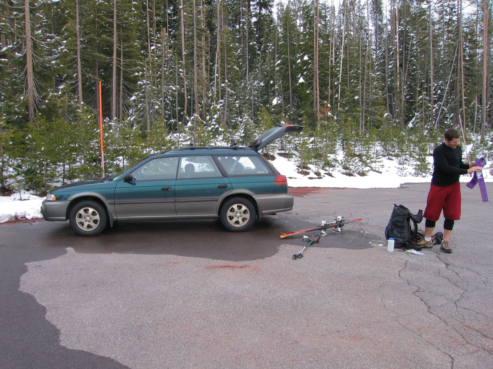
Party: DB solo
Route: SW Ridge to saddle below summit pinnacle
Equipment: AT Skis, skins
Time: Trailhead - Saddle: 5 hrs 15 mins
![]() Saddle - Trailhead: 1 hr 30 mins
Saddle - Trailhead: 1 hr 30 mins
![]() Roundtrip from Trailhead: 7 hrs 30 mins
Roundtrip from Trailhead: 7 hrs 30 mins
Comments: Great snow pack. Good snow in bowl.
Trip report:
The winter of 2016/17 produced the best snow pack Oregon had seen in years, and I
figured I might finally be able to ski all the way from the saddle (I was). The snow
line was right at the parking lot, and after about 15 minutes of hiking I switched to
skinning. Once I entered the steeper part of the bowl I switched back to boot packing,
and reached the saddle in my usual time of a bit over 5 hours. If I had brought
crampons (which I did not) I could easily have gone up to Chicken Point, and if I had
brough rock shoes (which I didn't bring either) I could probably have gone to the
summit, but since I didn't bring either I called it good at the saddle. The cornice
must have been even more impressive than usual, so I made sure to keep a respectful
distance from the edge. The skiing down to the PCT was great. The first 1,000' or so
were actual corn; farther down it got a bit softer but was still fine. Somewhere in
the trees I lost the tracks and wound up intersecting the highway about half a mile
south of the parking lot. I probably went down the Porcupine Creek watershed rather than
Camp Creek. Fortunately I realized that I had gone too far to skier's right,
not left, so it was no big deal. Great trip.
Party: DB solo
Route: SW Ridge to saddle below summit pinnacle
Equipment: AT Skis, skins, crampons
Time: Trailhead - Saddle: 5 hrs 10 mins
Comments: Low snow pack. Icy ridge, good snow in bowl.
Trip report:
Due to a crazy 2013 I had not been skiing in almost two years, and I had not been to
Mt. Thielsen in almost eight years, so I set out to check out the lowest snowpack I've
seen in 27 years in Oregon. I was able to skin from the trailhead, but just barely. The
weather was perfect, but the ridge was very icy, so I switched from skins to crampons
shortly after crossing the PCT. My hight point was the saddle by the large tuff gendarme.
I got a view to the east, but was careful to not get too good of a view, as I guessed the
cornice was overhanging by at least 20 feet. I down climbed the first 100 vertical feet
or so due to ice, but then I found surprisingly good snow in the bowl all the way down
to the PCT. The forest provided the usual survival skiing with a few nice stretches in
between, and by 6pm I was back at the trailhead. My new skiing outfit (BD Aspects with
Dynafit Speed Radicals and Ascencsion skins, and Scarpa Maestrale RS boots) worked very
well, and it is much lighter than my old setup.
Party: DB and John Toner
Route: W Ridge
Equipment: 50 m half rope
Time: Trailhead - Chicken Point: 2 hrs 25 mins
Comments: Time down includes 90 minutes looking for a missing camera
Trip report:
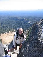
John was looking for a belay on the summit pinnacle, and I did not mind another trip in
perfect fall weather, so we agreed to meet on Sunday around noon near the summit of Thielsen.
I left the trailhead at 9:30 and met John shortly before noon at Chicken Point. I set up
a toprope, and soon we both were having lunch on the summit. The weather was very nice,
with a few puffy clouds forming, and some more substantial cloudiness towards the north.
We descended the scree and continued on to John's camp just below the PCT. Just as I was
about to leave (John wanted to spend a second night) I missed my camera. Remembering that
I had left it at Tenaya Lake in August after swimming, I was convinced I had done the same
thing and left it at the first big tree on the scree slopes, where I had emptied my sneakers
and drunk some water. So I went back up. I got to the tree, no camera. I continued up the
scree slopes until I could no longer be sure where exactly we had come down, no camera.
Frustrated, I went back down, and emptied my pack, without any real hope. Sure enough,
there it was, in the main compartment, where I NEVER put it! I still have no good idea
how it got there. But anyway, I was relieved, took leave from John and ran down to the
trailhead.
Nice trip, although I turned the 3,800-foot climb into a 5,000-foot climb. Next time I'll
empty my pack first, before going halfway back up the mountain.
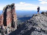
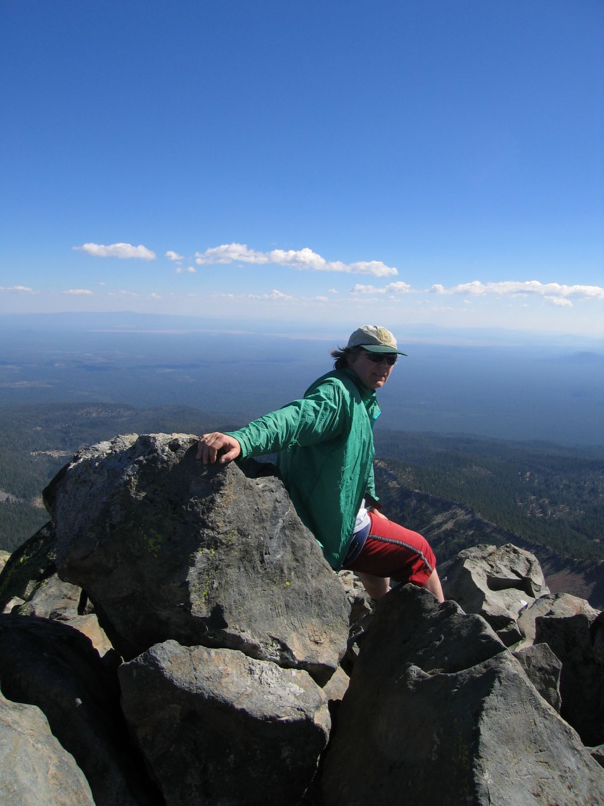
John just below the summit.
John on the summit.
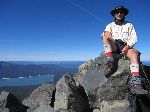
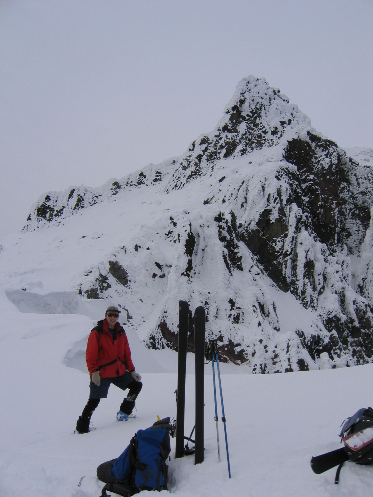
Dietrich on the summit
Dietrich in the saddle.
John descending the scree slopes.
View of Mt. Bailey from treeline.
Party: Paul and Dietrich Belitz
Route: W Ridge
Equipment: AT Skis
Time: Trailhead - Saddle at ~9,000' : 6 hrs
Comments: Time up includes lengthy lunch break watching the weather
Trip report:
2005 had by far the worst spring break weather we had ever experienced. This was all the more
frustrating as the entire winter had been anomalously warm, dry, and sunny. The snow pack was
accordingly abysmal, and originally our idea had been to go south to Mt. Shasta in order to
get some skiing in. When the weather was horrible day after day, we abandoned this idea and
focused on a day trip on Friday, when a break in between two storms was supposed to produce
weather that would suck less.
Two years ago we had attempted Mt. Thielsen on skis, only to get whited out high on the
west slopes. Thielsen's pumice slopes are rather smooth in places, which is good if the snow
pack is low, and so we decided to try again. We figured that the summit pinnacle would be
all plastered with rime ice (which turned out to be correct), and that summiting was not an
option in the context of a day trip, so we took skis only and set our sights on the saddle
at almost 9,000' where the scramble up to Chicken Point starts. The driving was slow, and we
started out from the trail head only at 9:30, despite having left home at 6:30. Diamond Lake
greeted us with the usual view: A low cloud ceiling, and no mountains whatsoever in sight.
There was barely enough snow for skinning off of the snow park, but the snow was nice,
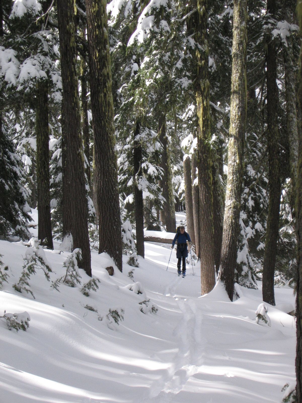
fresh powder. We skinned up to the PCT in a bit over two hours, following the summer trail
for about half of the way, and took a break. As we continued up the west ridge we occasionally
caught a glimpse of the summit pinnacle, but then the weather deteriorated and we figured that
soon we would get whited out, just like two years ago. Sure enough, once we reached the bottom
of the cliff that splits the west slopes the clouds caught up with us. We stopped for a lunch
break, brewed up, and contemplated the weather. While we were eating, visibility improved, and
we could see the saddle that was our objective not so high above us. It was 2pm by then, but
we figured we could reach the saddle within an hour, and after some more deliberation we
kept going. We actually managed to skin all the way into the saddle, although the last 200 or
so vertical feet were a bit marginal, with lots of rime ice and lots of rocks sticking out.
Strangely, here at almost 9,000' there was much less of a base than around 7,000'; it was
essentially the new powder on bare rocks. We reached the saddle at 3:30pm, our turnaround time.
I am still suprised that it took us six hours to climb 3,700', but skinning is slow, and Paul
was breaking trail almost all of the way since my BCA skins were balling up and gave me lots of
trouble. I'll have to find myself some better skins.
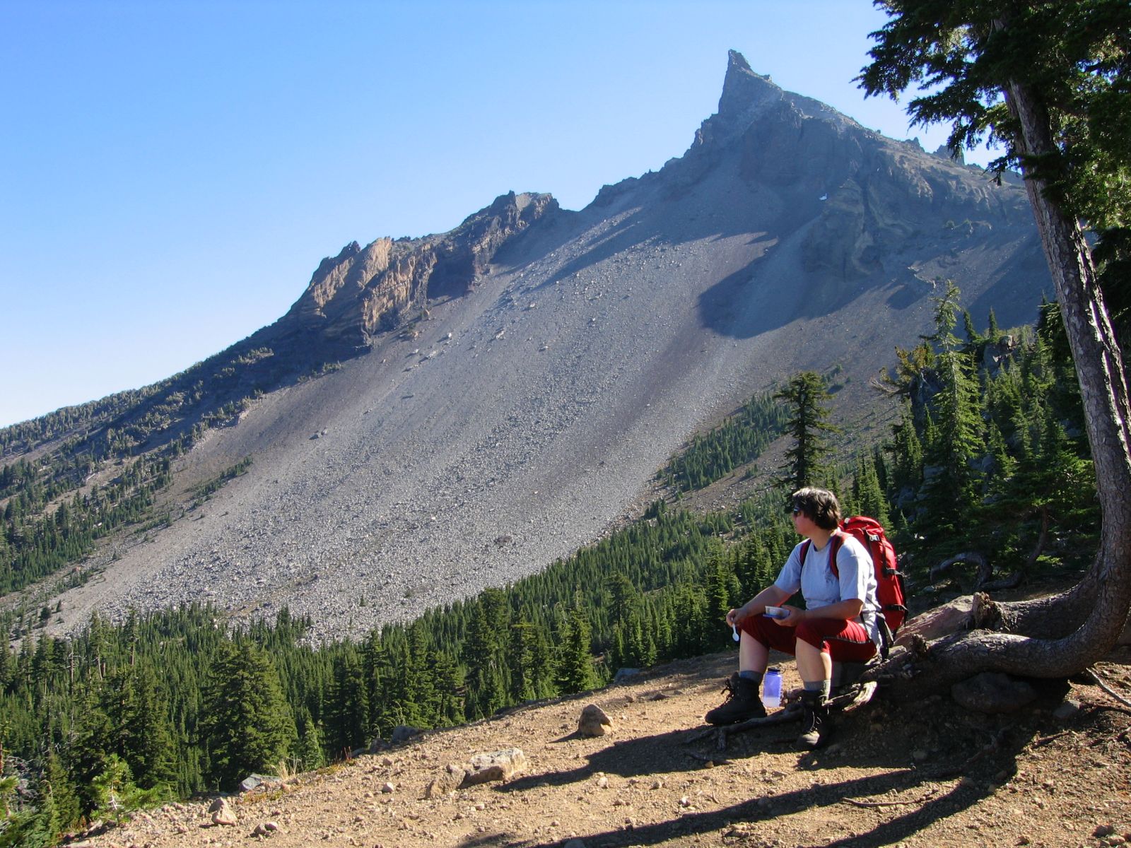
We admired the views and the rime ice-covered summit for a few minutes, then we figured it was
time to get down. The top section did not have enough snow cover for skiing, so we downclimbed
until we were past the rocky section. Then we put our skis on and experienced some of the best
powder we've ever found in Oregon. The skiing was unbelievably cool! With the snow pack as poor
as it was, we made sure to reunite with our skin tracks at the PCT for the trip through the
woods. To our surprise, the tree skiing was also very good, and we managed to ski all the way
to the sno park without even scratching out skis, although we were on about an inch of snow at
the end. Even though we stopped often to take photos, the skiing was so fast that we got to our
car with 90 minutes of daylight to spare.
It was a very nice trip by any standards, but by the standards of this horrible spring break
it was superlative.
Party: Dietrich and Monique Belitz
Route: W Ridge
Equipment: 9mm half rope, some slings
Time: Trailhead - Base of Pinnacle : 3 hrs 45 mins
Trip report:
Having been frustrated in Spring twice, we decided to do Thielsen in the Fall, as Monique
had never summited it. We got a leisurely start at 9:30 from the trailhead, and hiked up
to the PCT in a bit under two hours. On the way up the West Ridge we caught up with a
large party, and in the notch below the summit pinnacle commonly known as Chicken Point
it was quite busy. We should have gotten an earlier start after all! Monique was not
comfortable soloing the pinnacle, so I got the rope out and gave her a belay from above.
There was more rubble on the ledges than I remembered, and the rope promptly dislodged
a rather large piece, despite Monique's efforts to flip the rope over it. Fortunately,
it did not hit anybody. The summit was somewhat crowded, and so was the descent, with
a fixed rope, our rope, and a few soloists all intermingling. After lunch at Chicken
Point we plunge-stepped down the scree slopes to the PCT, and then followed the trail
back to our car. Except for the many parties on the summit it was a very nice trip in
perfect fall weather.
Party: Dietrich and Monique Belitz
Route: W Ridge to ~8,000'
Equipment: AT Skis (DB)
Time: 6 hrs roundtrip Trailhead - High Point
Comments: Time includes laps on the N slopes of the ridge
Trip report:
Some day I'm going to summit Thielsen in Spring and ski from the base of the summit pinnacle, but
today again was not that day. I had been sick on Memorial Day weekend and was eager to get out,
and I wanted to do some skiing before the season is over, so we decided against Smith Rock and
in favor of the mountains, despite a lousy weather forecast. We figured we'd go over Willamette
Pass and then decide whether to go north to South Sister or south to Thielsen.
It was raining all the way up Willamette Pass, and Diamond Peak was solidely socked in. On the
east side it looked better, though, and Odell Butte was clear, so we figured the thing to do was
go as far east as possible. Thielsen is not any farther east than Diamond Pk, so we turned north
on Cascade Lakes Highway, thinking we could always do Bachelor if things did not look good enough
for South Sister. Thirty miles up Cascade Lakes Highway it started to rain again. It was still
raining at Devils Lake, and the obsidian cliffs were just barely visible. We continued to Bachelor,
where it was raining even harder, and the wind was blowing like crazy, with gusts that rocked the
car. After sitting there for a while we decided to bite the bullet and go back south after all.
On the highway we picked up two dudes who had attempted South Sister, called it quits at 8,000'
and taken the wrong gully back down. They looked extremely wet and appreciated the ride back to
their car. Two and a half hours after we had left Highway 58 we were on it again, this time heading south.
On 138 it started to rain again, but at Diamond Lake it was dry. No sign of any mountains anywhere,
though. By now it was past 11am. We looked at the watch, at where Thielsen should have been, at
each other, and quietly left all technical equipment in the trunk, as summiting was not realistic
under the circumstances.
After half an hour on the trail we hit snow, and after two hours we reached the West Ridge above
the PCT. The cloud ceiling had risen a bit, and occasionally we even got a glimpse of the summit
pinnacle. Pretty soon the ceiling settled at around 8,000' though, and remained stable there for
the rest of the day. We went up the ridge for a while, then Monique took a break while I did some
laps down the north slopes of the ridge. The skiing was good, with a somewhat wet layer on top of
well consolidated stuff. After having done around 1,200' worth of extra credit this way we kept
going up until we hit the cloud ceiling. The views were breathtaking. Amazing colors on Diamond
Lake, the slopes of thielsen and Crater Lake Rim drifting in and out of the clouds, and extremely
dark clouds engulfing us at times. For some stupid reason I did not take a camera, which was too
bad.
Going down consisted of nice skiing down into the trees, followed by 1,000 vertical feet of
survival skiing, followed by tree hopping until we intersected the trail. On the drive back we
still could see the ceiling on Thielsen, in exactly the same location as when we had been up
there.
Despite the awkward start it was a very nice trip. Some day I'm going to summit Thielsen in
Spring, though!
Party: Dietrich and Paul Belitz
Route: W Ridge to ~8,800'
Equipment: AT Skis
Time: Trailhead - High Point 4.5 hrs, High Point - Trailhead 3 hrs, roundtrip 7.5 hrs
Comments: Deep, wet snow
Trip report:
We were desperate to try out our new Mira skis, and settled on Thielsen to do so. We
started out in very nice weather, hiked up to the PCT intersection, and then skinned
up the West Ridge. Once on the ridge the weather started to move in, and at around
8,600' we got whited out. The terrain was quite steep by now, and we boot packed again,
postholing in deep, unconsolidated snow. The weather was clearly deteriorating, and
at around 8,800' we called it quits. Being unfamiliar with the skis, and unable to
see anything, we did kickturns for a while, but from around 8,300' on we were able to
link turns in the heavy snow. The cloud ceiling had dropped all the way to tree line
by then, but by the time we got back to the car the weak front had moved through, and
the summits were visible again. We had perfectly timed the three or four hours of bad
weather! Oh well, so I'll have to come back and summit under spring conditions (I've
done it many times in summer or fall).
Date: March 22, 2014
![]() Saddle - Trailhead: 2 hr 10 mins
Saddle - Trailhead: 2 hr 10 mins
![]() Roundtrip from Trailhead: 8 hrs 10 mins
Roundtrip from Trailhead: 8 hrs 10 mins
Date: October 8, 2006
![]() Trailhead - Summit: 2 hr 50 mins
Trailhead - Summit: 2 hr 50 mins
![]() Summit - Trailhead: 4 hrs
Summit - Trailhead: 4 hrs
![]() Roundtrip from Trailhead: 8 hrs 30 mins
Roundtrip from Trailhead: 8 hrs 30 mins
Photo Gallery:
Click the pictures to see a higher
resolution image.
Date: March 25, 2005
![]() Saddle - Trailhead : 1 hr 25 mins
Saddle - Trailhead : 1 hr 25 mins
![]() Roundtrip from Trailhead : 7 hrs 35 mins
Roundtrip from Trailhead : 7 hrs 35 mins
Photo Gallery:
Click the pictures to see a higher
resolution image, or watch the slide show
(caution: 10.7 MB).
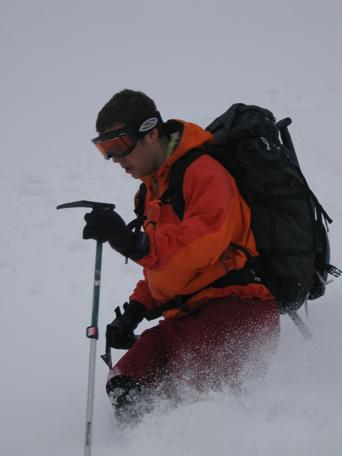
There wasn't much snow near Diamond Lake.
As we climbed up to the ridge the weather first improved,
and then deteriorated,
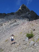
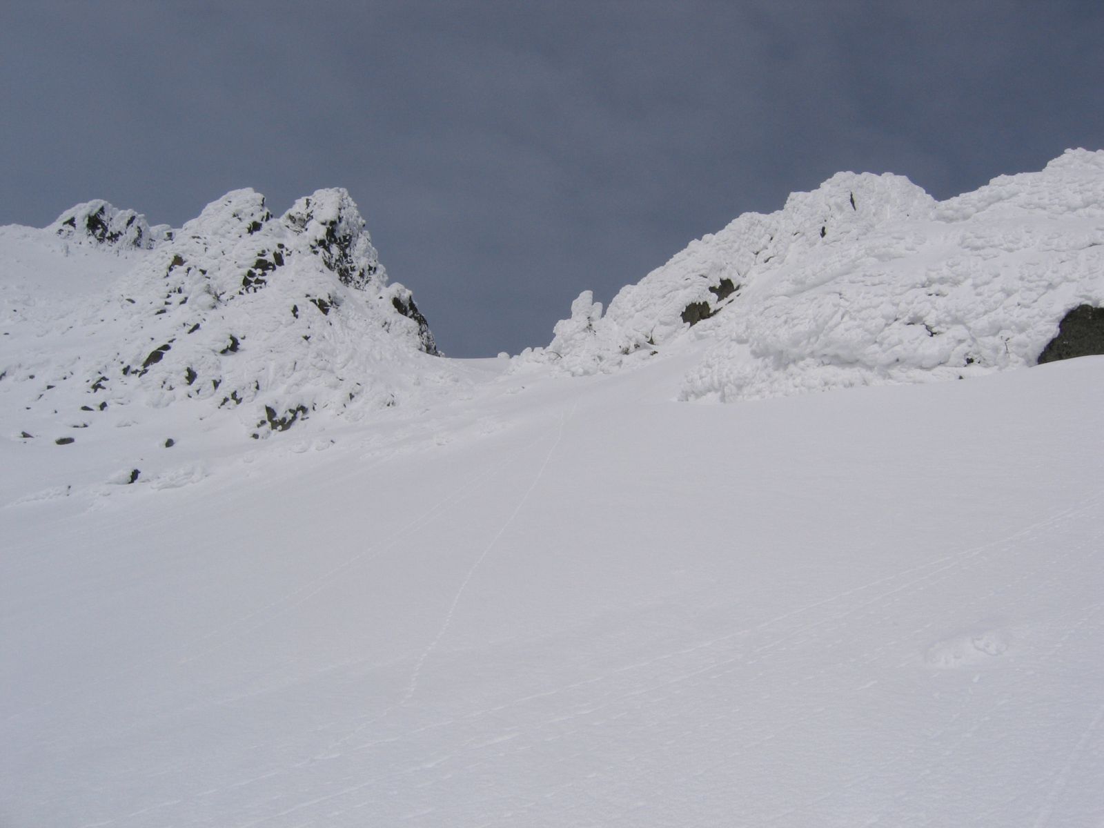
but occasionally we could see the summit pinnacle.
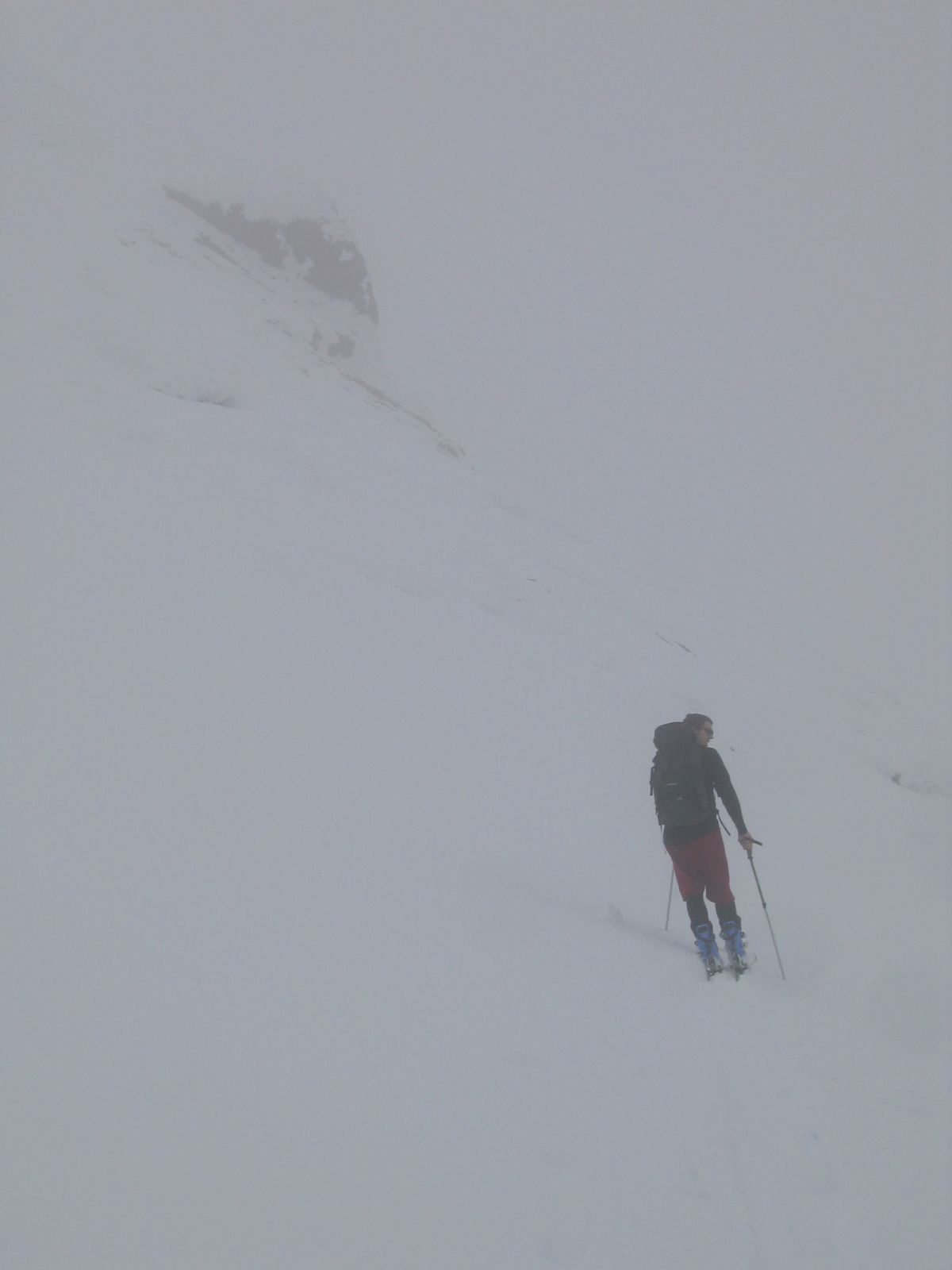
Around 8,200' we got whited out,
so we had lunch and waited for the clouds to pass.
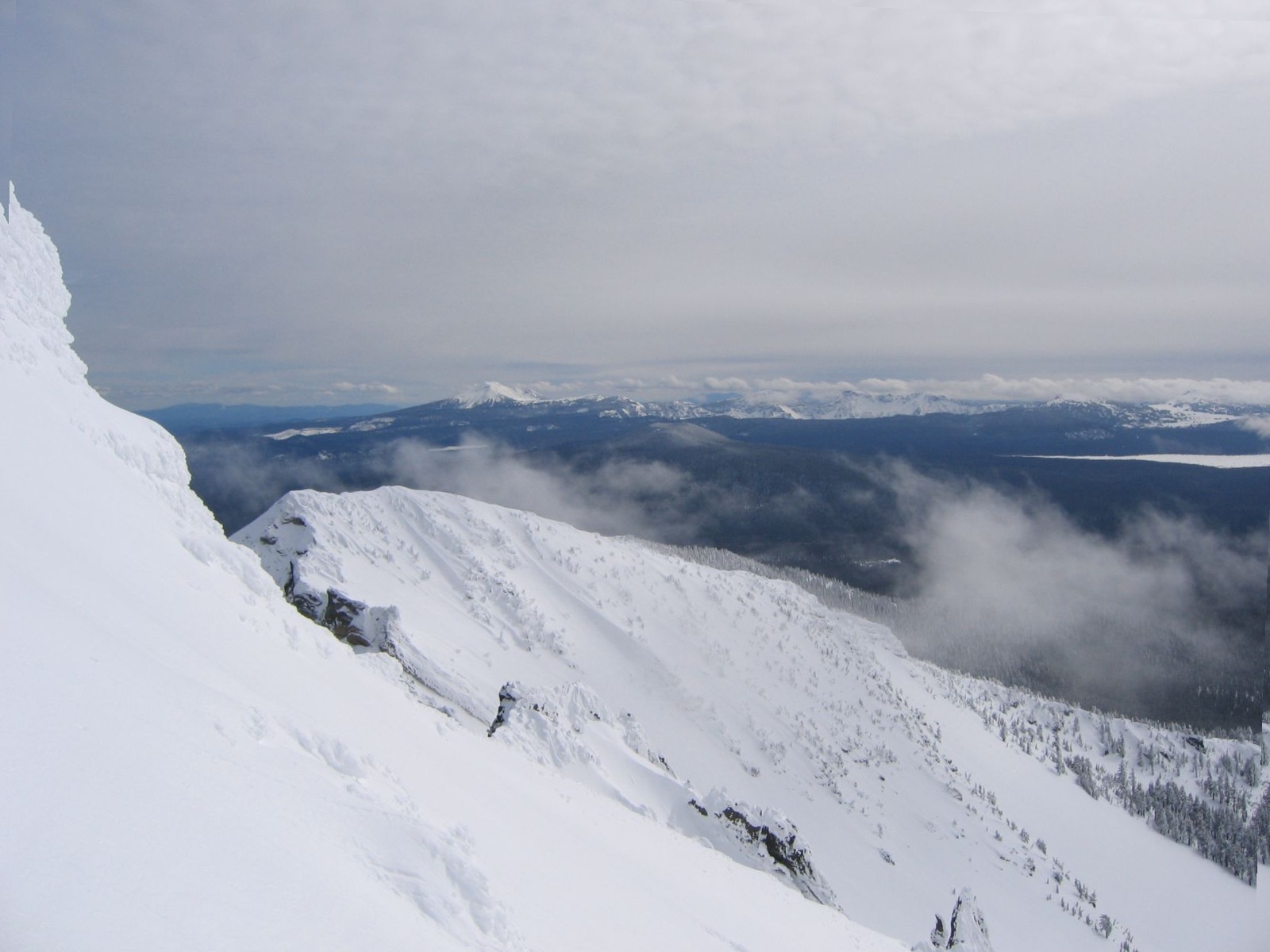
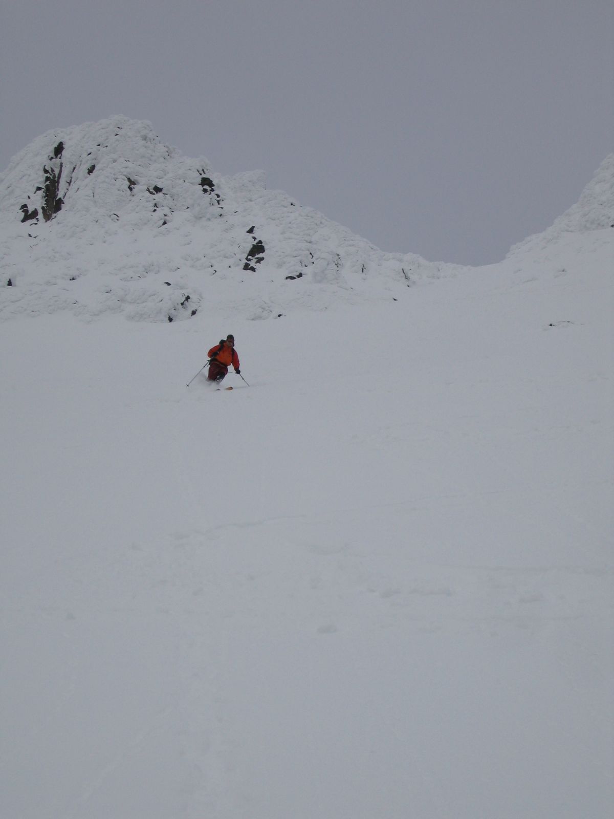
We resumed climbing and could soon see Crater Lake
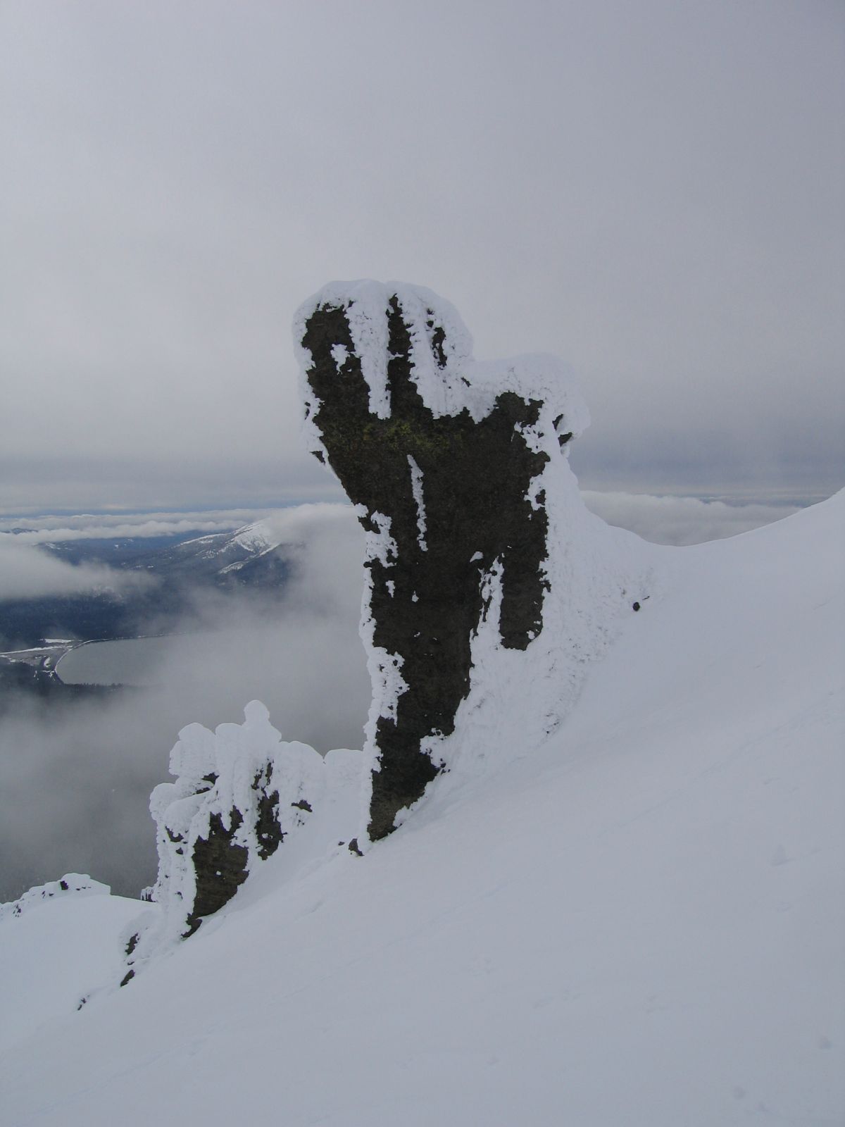
as we approached the rime ice-covered rim
and tuff formations.
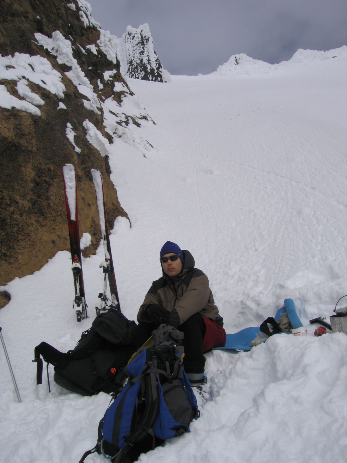
The saddle was plainly visible now.
Getting there was a pain,
but we made it just by our turnaround time.
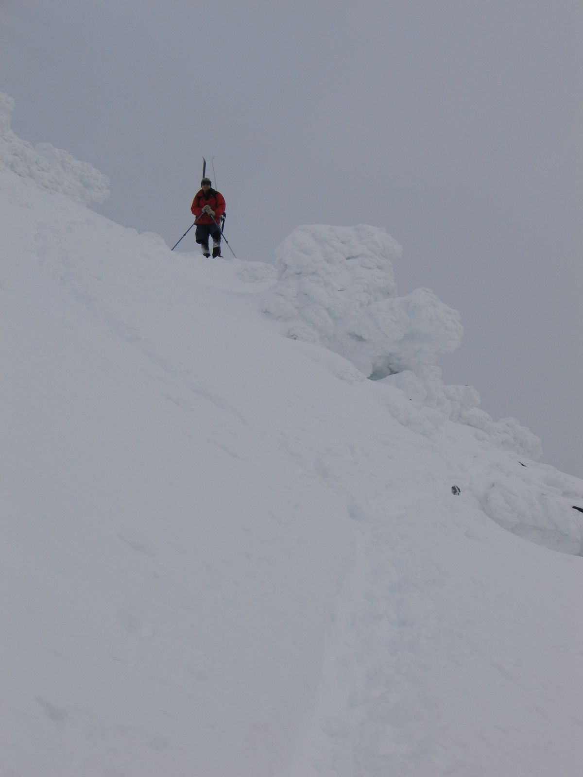
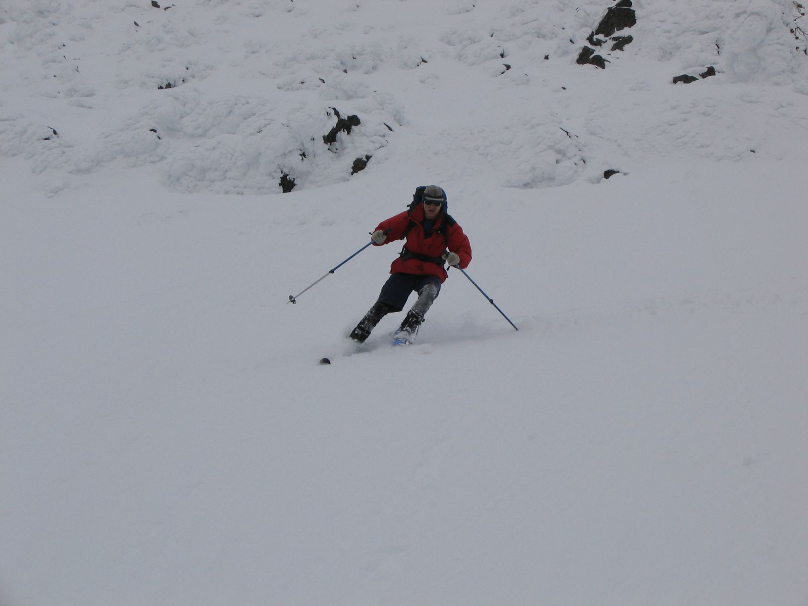
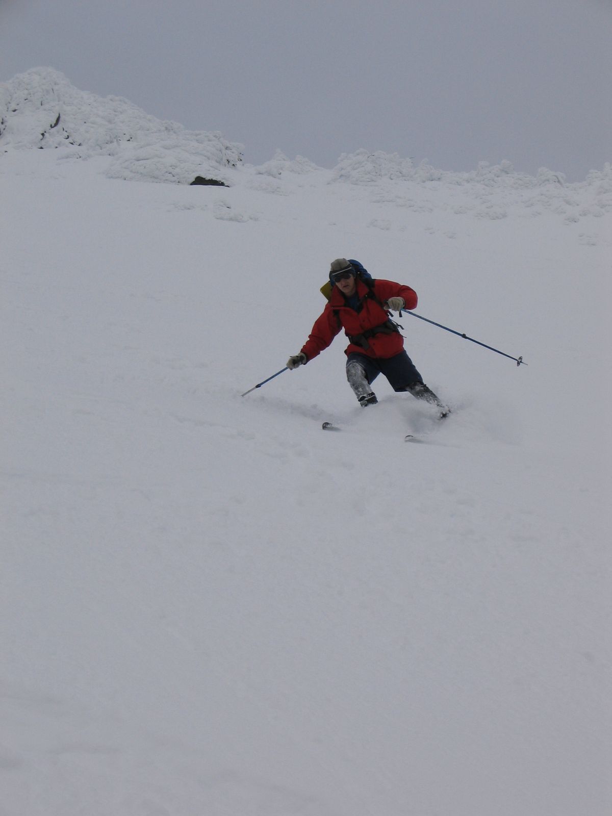
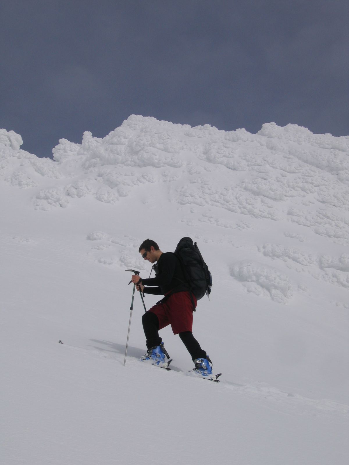
We had to downclimb the first 200' due to poor snow cover,
but below the rock bands we started skiing
in perfect powder
with the summit pinnacle as a backdrop.
Going down was very fast
and we got back to our car with plenty of daylight to spare.
Date: October 2, 2004
![]() Trailhead - Summit : 4 hrs 10 mins
Trailhead - Summit : 4 hrs 10 mins
![]() Base of Pinnacle - Trailhead : 2 hrs 15 mins
Base of Pinnacle - Trailhead : 2 hrs 15 mins
![]() Roundtrip from Trailhead : 7 hrs 30 mins
Roundtrip from Trailhead : 7 hrs 30 mins
Photo Gallery:
Click the pictures to see a higher
resolution image.
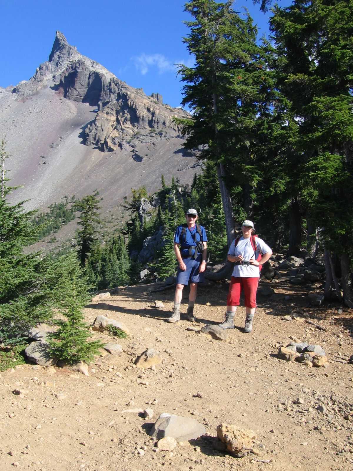
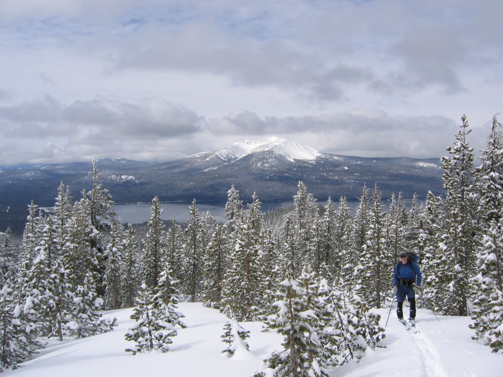
Mt. Thielsen from low on the trail.
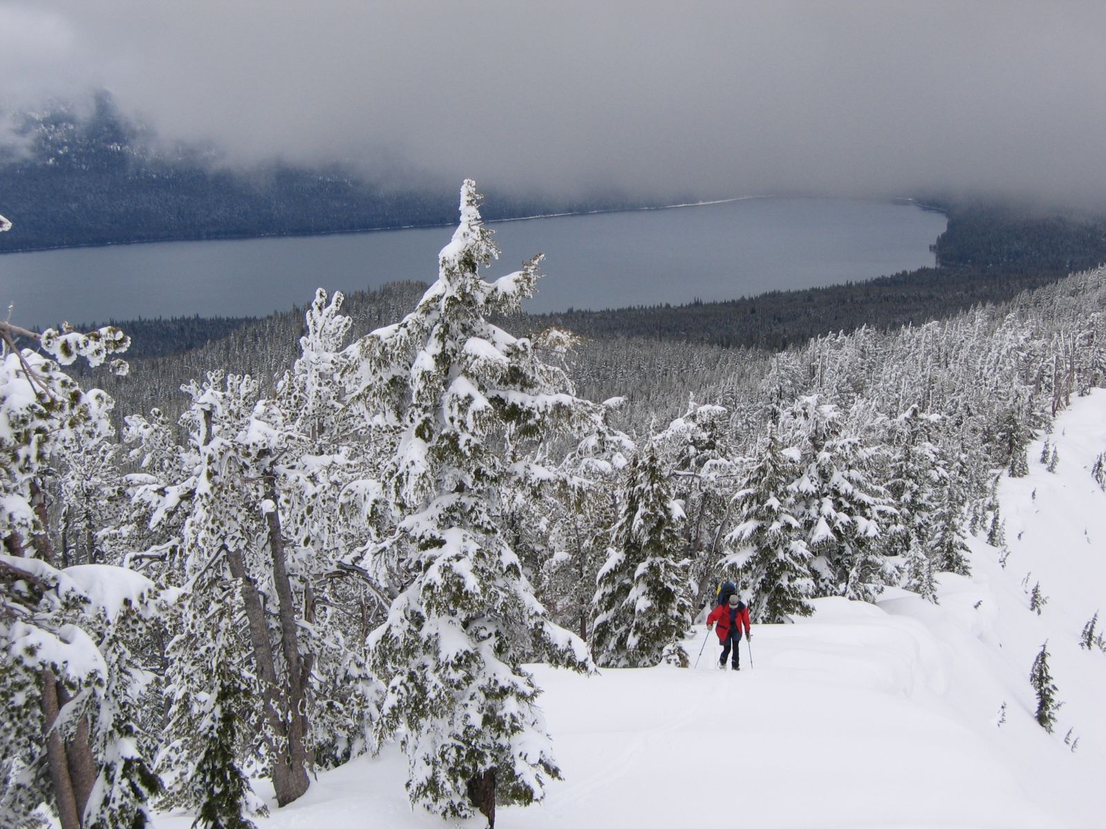
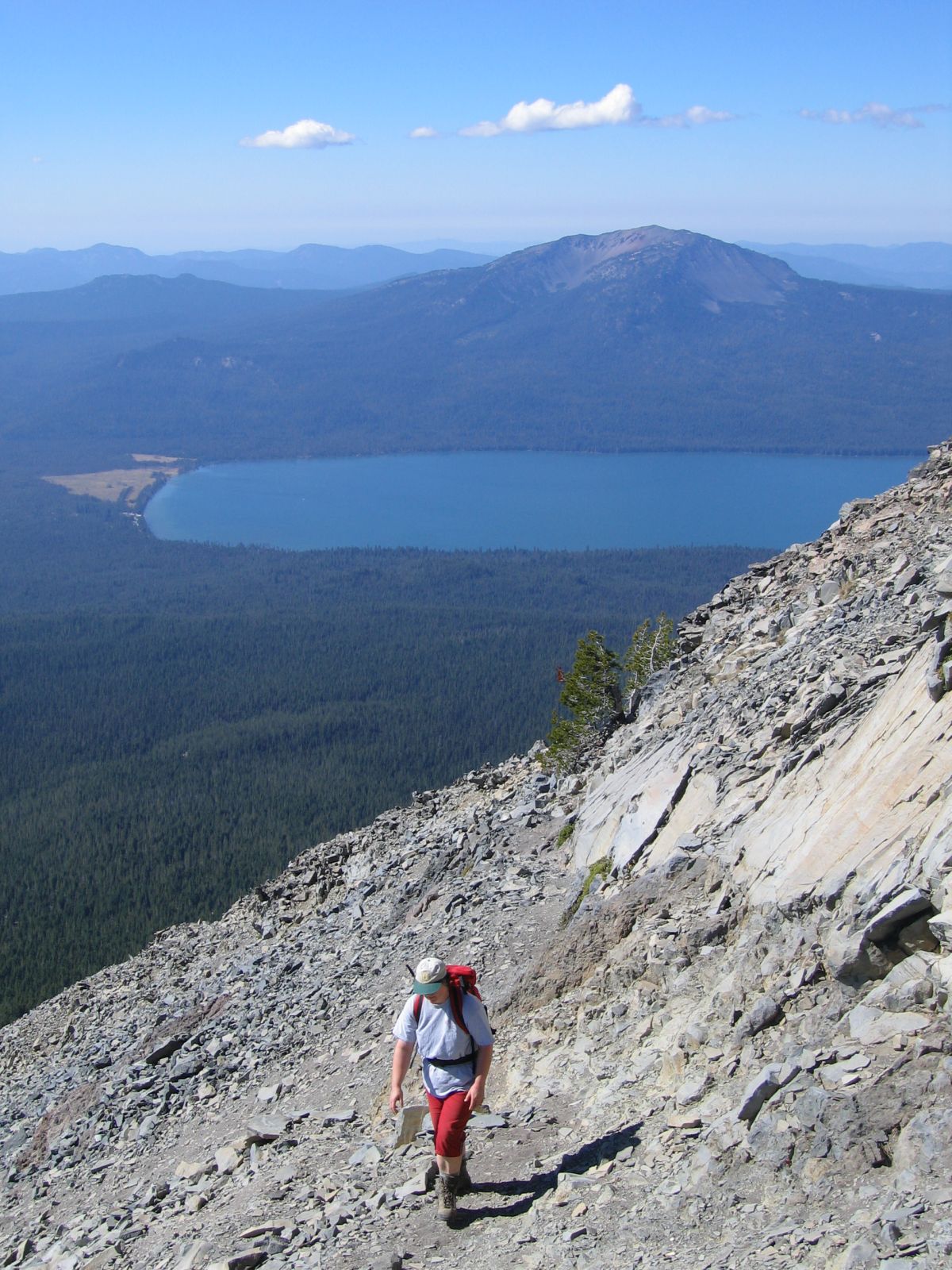
Monique at the PCT intersection.
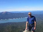
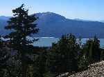
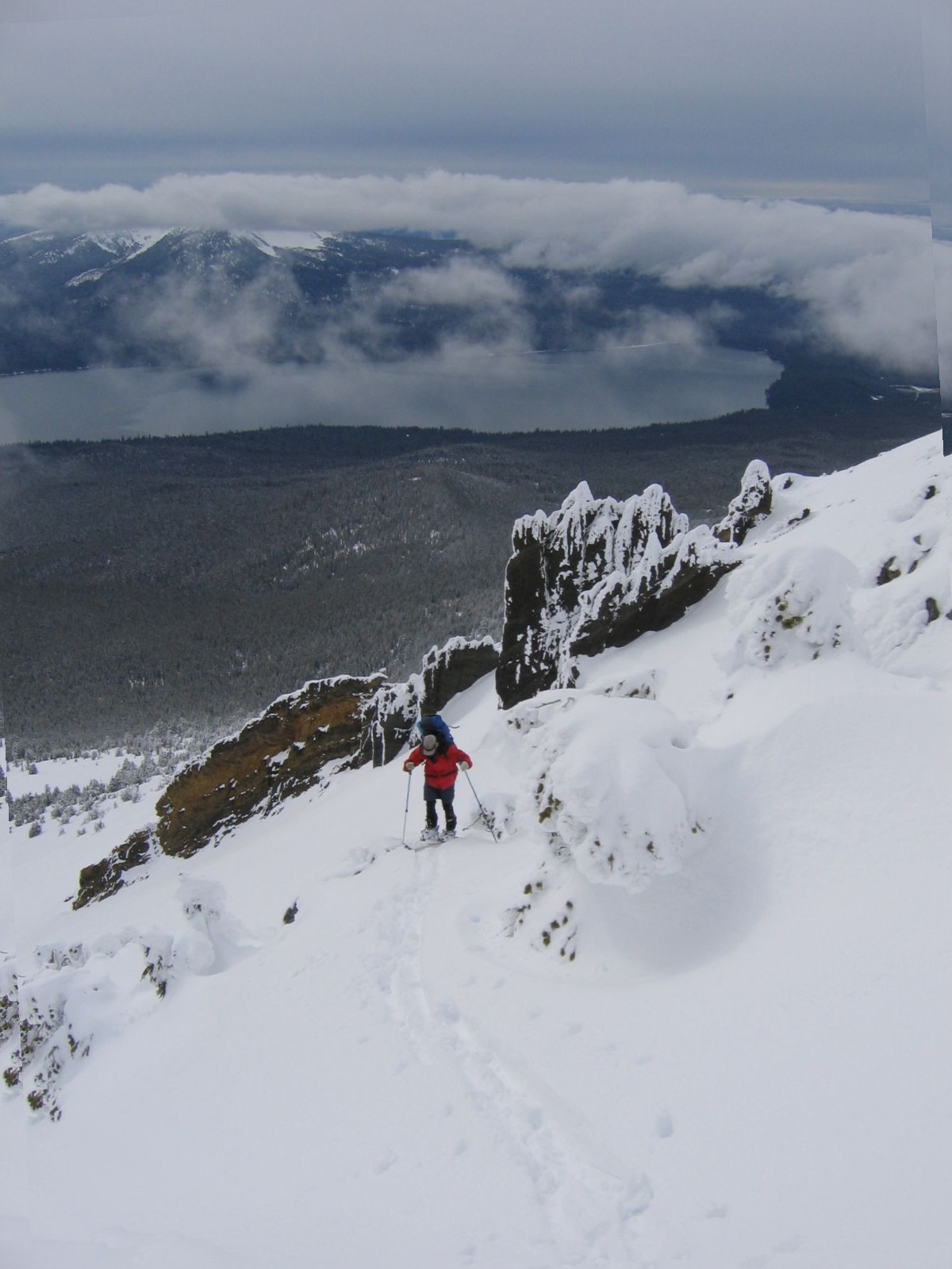
Monique approaching the summit pinnacle. Diamond Lake and
Mt. Bailey in the background.
Monique on the summit, looking east.
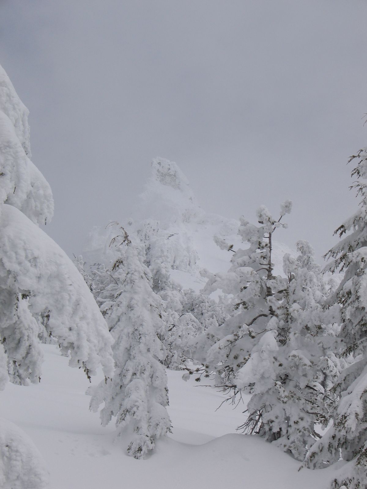
Tuff formations just below the summit.
DB and MB at the PCT intersection.
Date: June 6, 2004
Date: May 25, 2003