"Aristagoras...came then to Sparta during the reign of Cleomenes, and when he had an audience with the King (so the Spartans report) he brought with him a bronze tablet on which the map [chalkeon pinaka] of all the earth was engraved, and all the sea and all the rivers." .." Summary: we Ionians need help to remain free, if would be a disgrace if you, the strongest of the Greeks abandon us. Moreover, the Persians lack courage, and even wear pants. Most importantly, they are very rich. " take that city and then you need not to fear to challenge Zeus himself for riches " Cleomenes postponed his decision for three days. On the third day he asked Aristagoras how many days journey it was from the Aegean to Susa. . " Thereupon Aristagoras, who had managed the rest so cleverly, and succeeded in deceiving the king, tripped in his speech and blundered; for instead of concealing the truth, as he ought to have done if he wanted to induce the Spartans to cross into Asia, he said plainly that it was a journey of three months. Cleomenes caught at the words, and, preventing Aristagoras from finishing what he had begun to say concerning the road, addressed him thus:- "Milesian guest, quit Sparta before sunset. This is no good proposal that you make to the Lacedaemonians, to conduct them a distance of three months' journey from the sea."
- Consider this map of
ship wrecks; note that causes are not clear at all. Storm? war? pirates?
navigational errors?
- They also ought
to represent change. Consider this map of Germany in 1919.
Is this map a success? Do we understand any better why the Germans hated the Versailles treaty? What do we need to know to make sense of map? How can it be improved?
- Perhaps it might
be better to render "before" and "after" maps. Consider these two maps
of the Mediterranean in 60 and 44 BC.
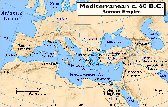
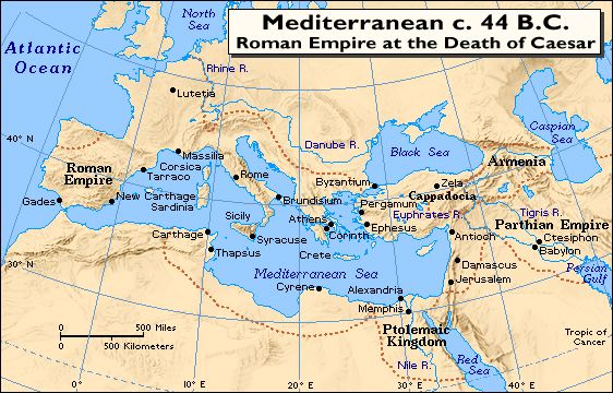
What would it take to improve these maps? - Now consider this
map of Europe during the barbarian invasions.
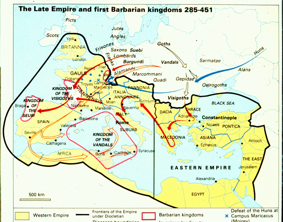
What can the typical undergraduate say about the fall of the Roman Empire on the basis of this map? Does he or she have any sense of the fundamental causes of political change in this period? or why urbanization was in decline? - In fact, historians want to measure the phases of transformation and also understand the slow and often irregular changes that occurred. .
- A static map may
be enough to represents relatively simple events, here the battle of
Mantinea.
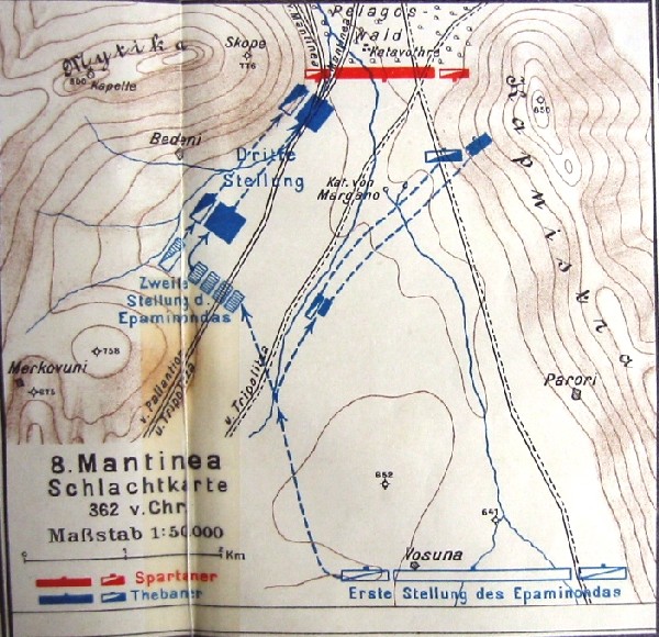
Nevertheless, Krommeyer-Veith often needed to employ a series of maps to represent a relatively straightforward battle. Here Leuctra. .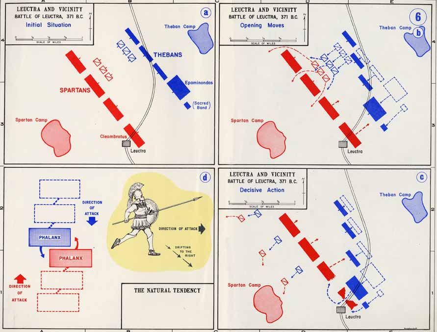
- Here is an important
example of a map that relies on a variety of sources and scholarship.
.
- The more factors
one introduces into a map the more complex and incomprehensible it
may become. Consider this famous 19th C. map.
- Though our maps are a marginal improvement on those seen by Herodotus, the fact remains that however desirable it may be to represent the dynamics of historical change it is in fact very difficult to do so.
- The Problem: "States'
Rights" and "slavery" belong to the most important factors leading
to the American civil war. But why was slavery so important to the
South? Slavery
and Cotton.
- The Problem: Romanization. [alternate] In the biography of his father-in-law, Tacitus describes what Agricola had done to encourage peace and romanization. The elite should be challenged to devote their resources to the construction of civic amenities, and in the Histories (4.74) he notes in the famous speech attributed to Entellus Cerialis the following: "Gaul always had its kingdoms and wars until you [Gauls] submitted to our authority...from you we have never asked for more that what was needed to support the peace (taxes collected in order to support armies). Everything else we hold in common with you. You often command our legions and govern this and other provinces. There are no privileges and no distinctions and no exclusions [nihil separatum clausumve]. Tacitus had then a very clear concept: Romanization meant urbanization, peace, integration. But was he right? :
- Western Pacific 1850 to 1950
- Cold War
- The new interface.
- We are not offering a technological breakthrough.
- The main advantage here is to arrangement of static material so that the whole is greater than the sum of the parts.
- The observer has the opportunity the consider and evaluate a variety of factors (not limited to those here).
- We believe that this system allow a considerable body of scholarly research to be presented in such a way that it gives both beginners and advanced student new insights into historical problems.
- If nothing else, we hope that those present leave with a more critical understanding of what constitutes a good historical map, and what needs to be done to make them better.