|
The
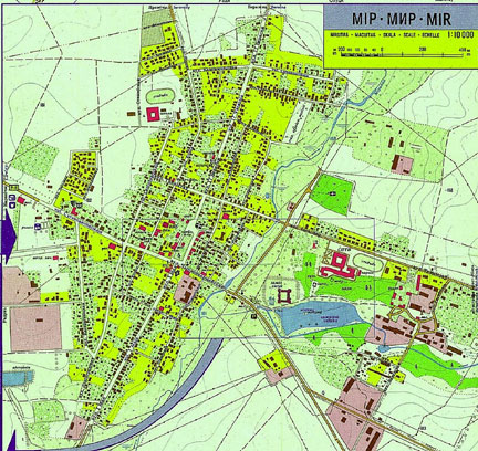
town had not grown since the war. The population in the late 1990s was around 3000 compare to more then 5000 before the war.
Only a few small blocks of flats have been built on the outskirts
of the town. A large secondary school for the arts was
built outside the town, very close to the site of the
Memorial.
Jews
lived all over town before the occupation, however the
majority of them lived around the town center. The center
is left of the square with churches on each end.
There are many vacant lots where houses once stood.
The wooden structures were destroyed by fires caused
by the cross fire during the war.
The building that is used now as the town hall (bottom
of square across from the church) was a house of
a rich Jewish family.
Google Satellite Map of Mir 2007 - click to view Mir from above.
Once you get to the map, you might need to switch to Satellite or Hybrid view. Then click on the + (plus sign) to zoom in. Mir castle is on the lower right.
There are other maps of Belarus and Mir included on the History of Mir page. |