The WUN MAP Project
Enhancing Citizen Participation With Mobile GIS Technology

A Collaborative Project Between The West University Neighbors and The University of Oregon


Home Overview
& Data
Key
Concepts
Maps Project
History

Media

Original
Proposal

Contacts Links


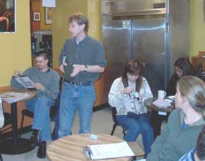
Students of this project are enrolled in "PPPM436/536: Applied Geographic Information Systems and Social Planning".  This course focuses on applying GIS to social planning, bottom-up community development, and public participation. Professor Schlossberg conducting the data gathering training at a local coffee shop.
The class is divided into a lecture and a lab component. The lecture time is really a seminar forum to discuss issues of relevance to the use of GIS, such as empowerment, citizen participation, equity, and organizational opportunities/constraints of adopting GIS technology. 

This course is for the intermediate GIS users seeking to expand their range of GIS skills.  The main foci of the course are to: increase comfort of accessing and using census data at a community scale, learning the Spatial Analyst and Network Analyst extensions of ArcView and ArcMAP GIS, and being introduced to the 3D Analyst tools for the GIS software. Lab exercises focus on community-based issues and data, such as mapping the walkability of a neighborhood and conducting a census-based socio-economic analysis.

Beginning in the Fall, 2004 term, this class also learns how to use ArcPad - mobile GIS technology that is used with a personal digital assistant (PDA).  Exercises and the WUN MAP project focus on how to develop a customized data entry capacity linked to base maps that can be used for community-based data collection and analysis.  It is exciting to train new cohorts of students who are functional in a mobile GIS technology that can more easily integrate spatial analysis and community organizing and development.
 

Instructor Marc Schlossberg, PhD
E-Mail schlossb@uoregon.edu
Phone 541-346-2046
Office 128 Hendricks Hall
Selected Course Readings:

(note: these readings are provided in the spirit of shared community knowledge and are for personal use only)

  • Craig, W. and Sarah Elwood (1998).  How and Why Community Groups Use Maps and Geographic Information.  Cartography and Geographic Information Systems 25(2), 105
  • Kretzmann, J. and John McKnight (1993). Building Communities from the Inside Out: A Path Toward Finding and Mobilizing a Community’s Assets” (Introduction Only).  Evanston, IL: Institute for Policy Research.

  • Aberley, D. (1993). Boundaries of home: mapping for local empowerment, New Society Publishers. P. 1-16

  • Talen, E. (2000). "Bottom-Up GIS: A New Tool for Individual and Group Expression in Participatory Planning". Journal of the American Planning Association. 66(3). p. 279-294.
  • Schlossberg, M. (1998). Asset Mapping and community development planning with GIS: A look at the heart of West Michigan United Way's Innovative Approach . Paper presented at the 27th Annual Meeting of the Association for Research on Nonprofit Organizations and Voluntary Action, Seattle, WA.
ArcPad Lab Exercises and data
  • Coming soon...

  Main Community-Based GIS with ArcPad Page  
       
Neighborhood GIS Walkability GIS Housing Condition GIS Teaching GIS


   For more information:
   Marc Schlossberg
   541-346-2046
   schlossb@uoregon.edu
   http://www.uoregon.edu/~schlossb/PPPM/