|
|
|
|
Thursday, July 15, 200 |
|
|
Cleaning up the neighborhood
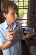
Students in the Department of Planning, Public Policy and Management will map 'problem areas' in the West University neighborhood this fall July 15, 2004 Broken beer bottles. Loud parties. Drug-addicted bums. The occasional riot. The West University neighborhood, home to thousands of students, has always had its share of problems, which some say has led to a rocky relationship with the University. "It really is almost a love-hate relationship between the neighborhood and the University," said Deborah Healy, board secretary of the West University Neighborhood Association. The West University Neighborhood Association and the University have been searching for a way to establish a healthy relationship that can benefit everyone involved. This fall term the Department of Planning, Public Policy and Management is offering a course that aims to do just that. Students in Assistant Professor Marc Schlossberg's Applied Geographic Information Systems and Social Planning class will work with West University neighborhood residents to create a computerized map of the area using hand-held mapping devices. Using these maps, planners can figure out where the problem areas are in the neighborhood and help beautify the area by adding more lighting or garbage and recycling facilities, Healy said.The mapping devices can record information about an area, such as tree location and garbage can placement, and make it available in graphic layers. People viewing the map can choose which layer of information they want to see at what time. The map will serve both as a way for students to apply the technical skills developed in prerequisite courses to a real-life situation and a way for the University to help the West Neighborhood and its leaders build a better community, Schlossberg said. "We're really trying to get our joint needs fulfilled," Schlossberg said, adding that this course is one of the few in the country to actually work with a neighborhood to produce something it can use. Universities typically have a strained relationship with surrounding neighborhoods, Schlossberg said. "Normally when universities do projects in the community, they do projects on communities. They abstract data from the community, come back to their office and do their thing and leave nothing behind," he said. "Communities are tired of being research subjects and getting nothing in return." Schlossberg said he had been exploring ways to use mapping as a tool to help community leaders improve the quality of living in their neighborhood when he received a small grant from the Northwest Academic Computing Consortium, which works to make advanced information technologies like the mapping devices available to students. Meanwhile, Drix Rixmann, chairman of the West University Neighborhood Association, contacted the University, seeking help to improving the neighborhood. "It so happened that Drix's timing of wanting help for the community in visualizing a neighborhood coincided with me thinking about the GIS class and how to help the communities do just that," Schlossberg said. Rixmann, a 1975 graduate of the University and a nine-year neighborhood resident, said he hopes the mapping project will help the neighborhood become the vibrant community he knows it can be. "This neighborhood is full of interesting people, but there's just no sense of community that brings everyone together," he said. Rixmann and Healy discussed the project with board members and neighborhood residents at the neighborhood meeting July 1 and addressed an array of concerns from many people, Rixmann said. At the meeting, neighbors expressed concerns about having details of their properties mapped. "It's not going to do any more than the people let it do," Healy said. "Even with tecHnology, it's not magic; it takes money." Concerns over University involvement in neighborhood issues are not surprising, Schlossberg said, given the tradition of universities treating neighborhoods as merely data samples. "Communities having these types of healthy skepticism is legitimate and not something I intend to ignore," he said. Because the project is intended to benefit the West University neighborhood, the decision of what to include on the map will not be made until neighborhood meeting in October, so that all students are available to participate, Rixmann said, noting that neighborhood leaders and residents will continue to discuss the project until then. Named as possibilities for a spot on the map include historical sites, sidewalk hazards, the various fruit trees scattered throughout the neighborhood, as well as the areas with poor lighting or other potential hazards, Healy said. "I think what we're looking at is to make the neighborhood a place where we feel safe and can enjoy the diversity," Healy said. "It's is a first step toward understanding the neighborhood and being able to do something about it." Meghann M. Cuniff is a freelance reporter for the Emerald.
|
|
| Original Source:
http://www.dailyemerald.com/vnews/display.v/ART/2004/07/15/40f67f2252e78 Captured: July 15, 2004 |