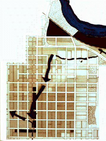
BORROWING WATER FROM THE WILLAMETTE: In the left diagram, water flows downhill from the Millrace through the eleven block Emerald Canal and into the Amazon at 17th and Pearl St.
This is the normal pattern. Approximately 100 cfs flows regularly through the system except during those rare times when withdrawing water from the Wilamette would threaten its biological health.
As described in the Emerald Waterway System map, the additional water flows through Amazon Creek into Fern Ridge Lake, over Fern Ridge Dam and into the Long Tom River, and then is returned to the Willamette again north of Monroe
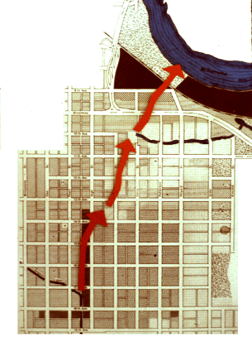
(Right Diagram)
A REVERSIBLE CANAL: The diagram on the right shows the ability of the canal to reverse its normal flow during a major flood event in the basin.
When water backs up in the Amazon and threatens to flood the central area of the city (flood map), the Emerald Canal provides a direct path for moving inland flood waters to the Willamette. A restored Lower Millrace, if properly constructed, could also serve as the needed floodwater passage to the river.