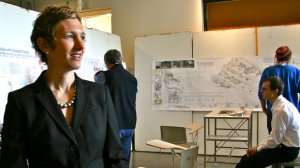
 EUGENE, Ore. -- (June 30, 2009) -- In the middle of New York City's Chinatown is a quaint park. Yet Elisabeth "Liska" Chan, a professor of landscape architecture at the University of Oregon, sees something else.
Her eyes peel back the visage of a pleasant recreational area to unveil a 19th-century melting pot of African Americans, Jewish immigrants and Italian refugees. She sees the birthplace of the Italian-American mafia and other gangs. She sees the neighborhood where tap-dancing originated. She sees the center of two horrific cholera outbreaks. She sees layers of "invisible history."
In May 2009, Chan received a $10,000 faculty award -- one of three Oregon Community Credit Union Research Fellowships. She will apply the funds toward her research of the region in lower Manhattan. "Chinatown Invisible: A visual history of a New York City landscape" is phase one of a larger three-year project.
After receiving a master's degree in 2000 from Cornell University, Chan joined the University of Oregon in fall of 2001 as a specialist in landscape architecture media. She came to Eugene after hearing about how UO students "had control over their education," she said. "The styles of education -- the ways we teach -- are really based on the individual."
For the past seven years, Chan has taught introductory studios for undergraduate and graduate students. She has instructed students on landscape representation and reclamation, while encouraging them to see complex, or even invisible, landscapes. Her concept of invisible landscapes encompasses systems, either ecological or historical, that influence the land but are not immediately apparent in studying an area.
For example, in 2008, Chan surveyed Eugene's Amazon Creek waterway. When she asked a storeowner about the wetlands that once thrived in the area, the owner, apparently unaware of that history, responded: "That would explain why our building is sinking towards Willamette Street," the east-west dividing line of the city.
"Graphic representation in landscape architecture remains largely limited to traditional drawings used for centuries, which evolved partly from rural landscape painting," Chan said. "When investigating the complex, cultural and environmental legacies of two centuries of urban landscape changes, these traditional graphic methods prove inadequate."
To convey such transformations, Chan photographs landscapes and draws them in ink and pencil. Once she gathers all of the components she compiles them to create hybrid maps -- layered Mylar containing maps, sketches, photos and sometimes other elements. "The maps are almost archaeological in nature because you can see the history of landscape over time," she said.
Chan will use the same process in New York City. Some people, she said, know a few truths about the area's origins as the rough Five Points neighborhood, but most derive their knowledge from the inaccurate but thrilling blockbuster film "Gangs of New York" released in 2002. Through a traveling exhibition at the end of her first phase of research and an eventual book of drawings, photographs, and maps, Chan says she hopes to show what really happened. The last stage of her project could be an interactive Web site.
"Contemporary life does not recognize the history of the place at all," Chan said of Chinatown's relationship with Columbus Park. In her research, beginning in fall 2009, she hopes her main source of information will be from interviewing people. She will talk to historical societies, cultural centers, archaeologists and schools. In addition, she will gather her usual visuals.
"Once people are aware of the history, it will influence how they design the place and its potential to grow," Chan said. "This landscape -- like all landscapes -- continues to persist and have a future. It will change, and those changes are influenced by the site's history and legacies."