Week
4: Europe and the World
Textbook reading: Birn, Chapter 5. This
week we look at Europe's relations with the wider world from two perspectives:
first, the growing impact of European commercial and (increasingly)
political and military penetration of the societies in Asia and Africa;
and second, the reverse effects of seventeenth- and eighteenth-century
"globalization" on European economies and cultures.
The First
Globalization
I. Expanding Horizons: The Advance
of European Explorations
Image right: Willem van de Velde (1633-1707), The
Cannon Shot (Detail) (1670). Oil on canvas, 78,5 x 67
cm. Rijksmuseum, Amsterdam. Image Source: Web
Gallery of Art.
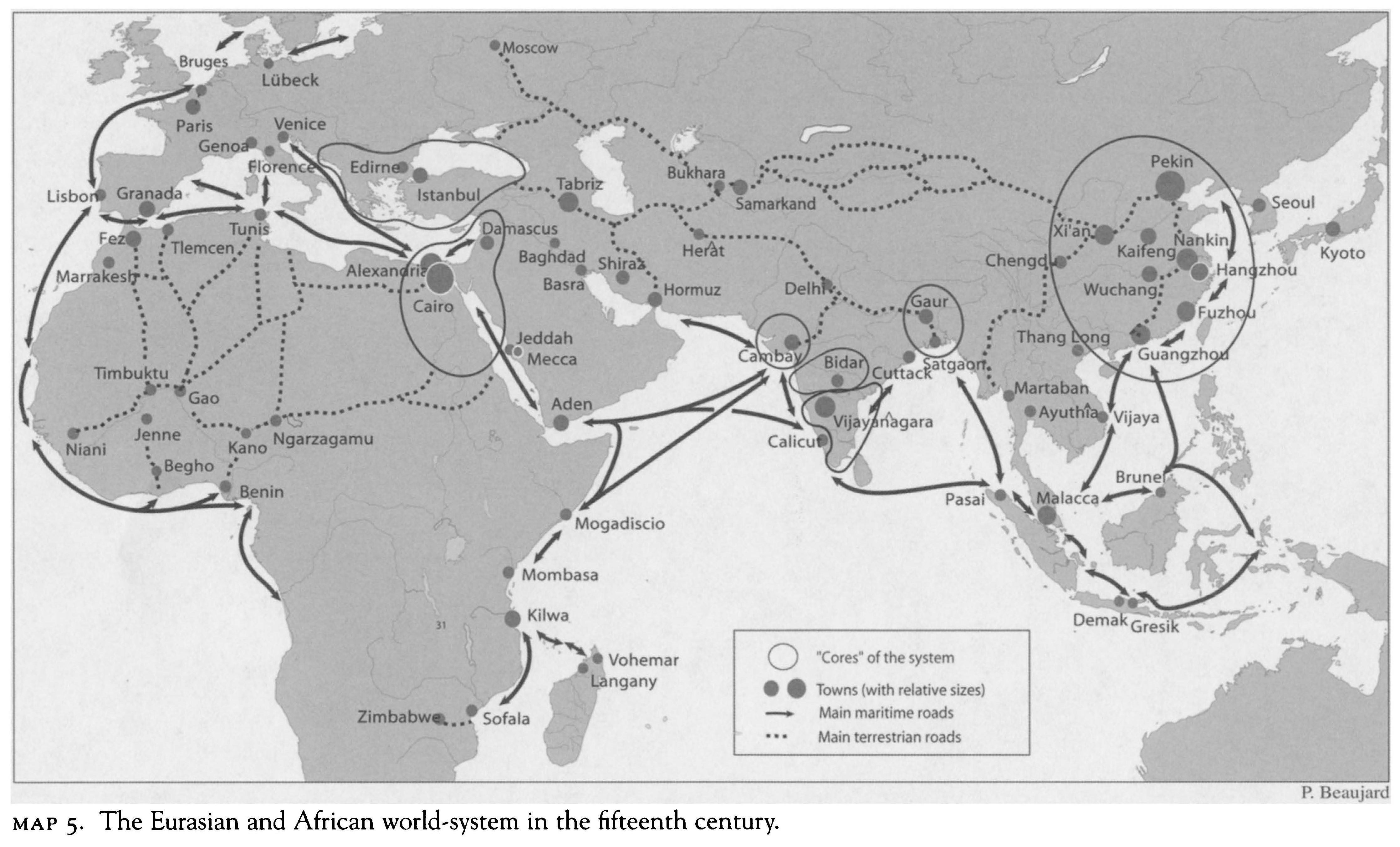
Map: European Explorations (1492-1600)
Map: The Fifteenth-Century Eurasian World System
Map: European Explorations in North America, 1565-1690
Map: Explorations of Terra Australis
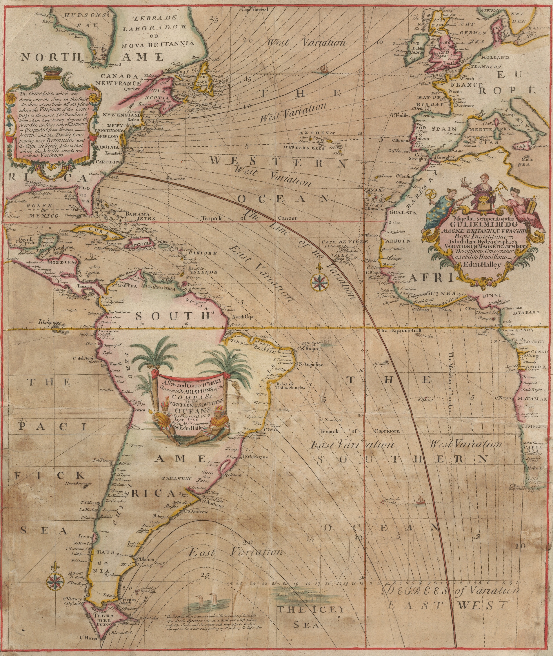
Map: Edmond Haley's
“Magnetic Declination Map” (1701)
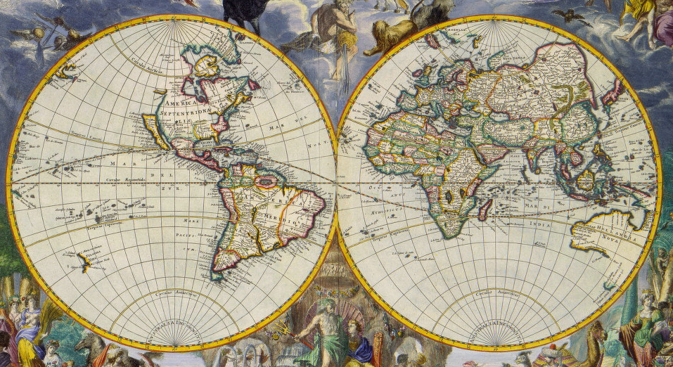
II. Knowledge of the World:
The New Cartography
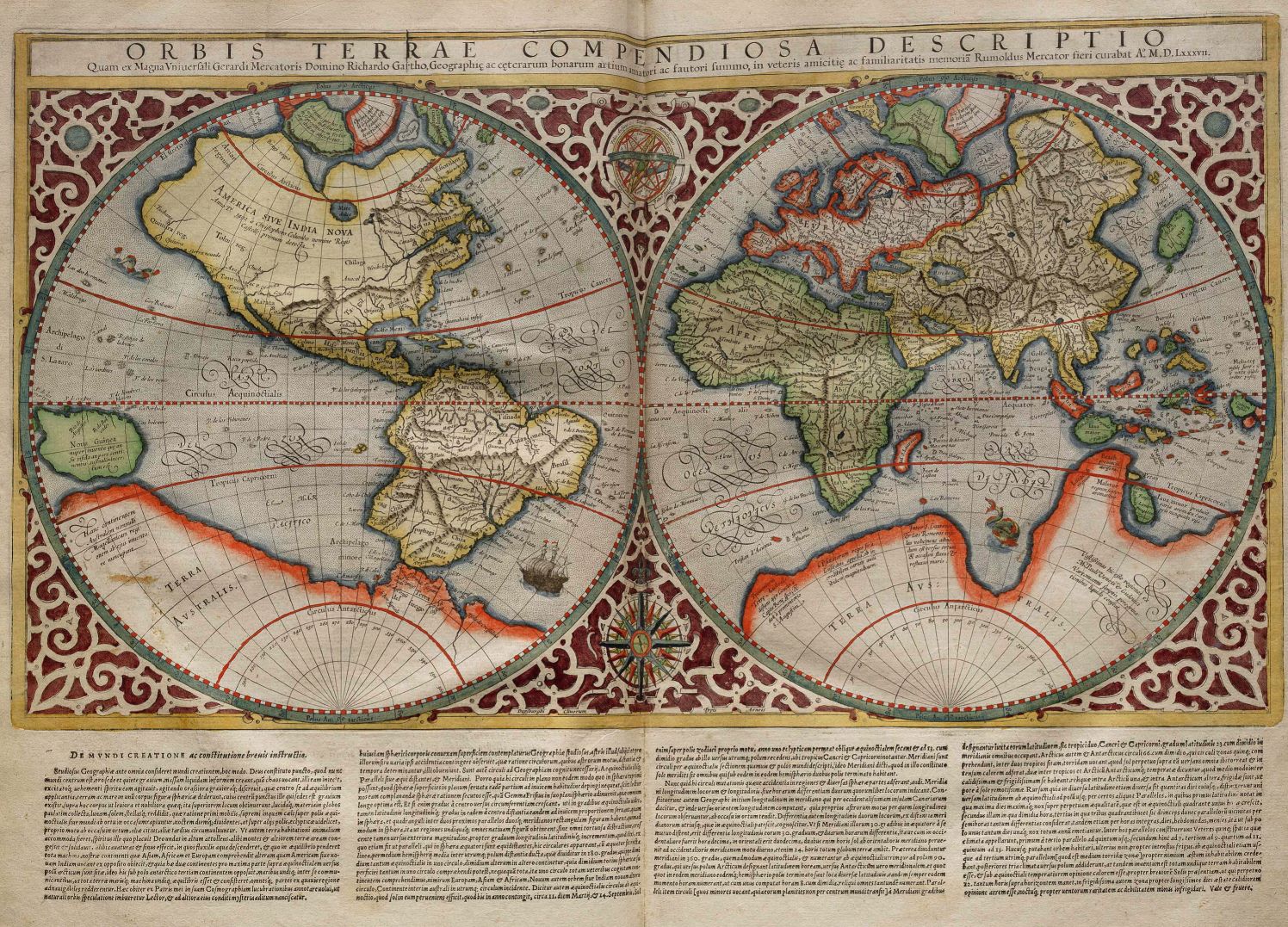
Image: Gerhardus Mercator, Orbis
Terrae Compendiosa Descriptio (1595)
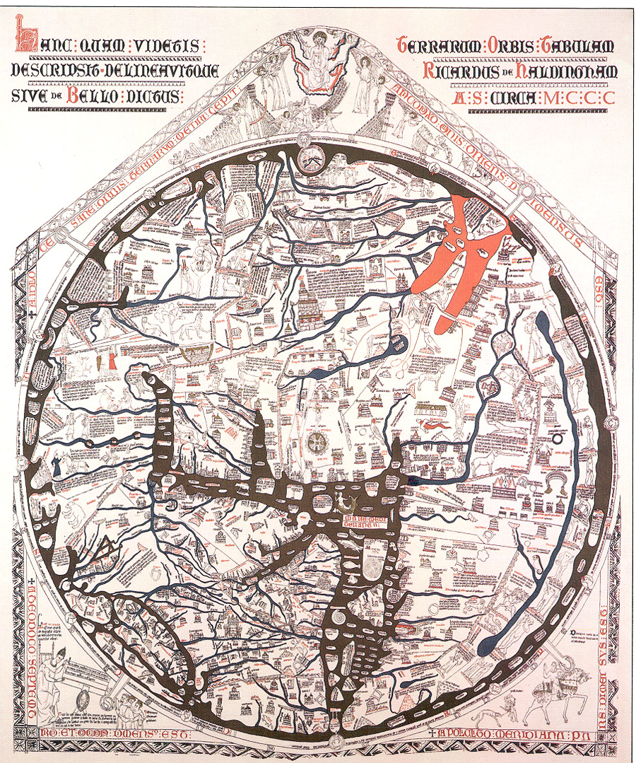
Image: The Hereford Map (13th century)
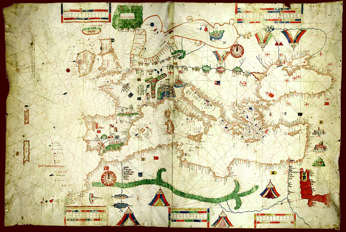
Image: A Portolan Chart of the Mediterranean,
1489
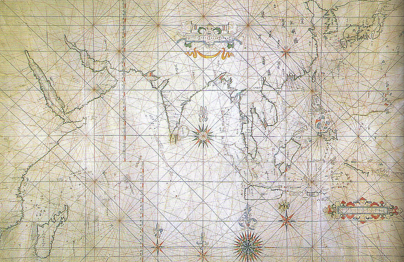
Image: A Japanese Portolan Map, 17th C.
Image: Mercator's Projection,
1569
III. Europeans Abroad
A. Warfare with Non-Europeans
B. European Competition, Local Cooperation, and the Projection of
Power
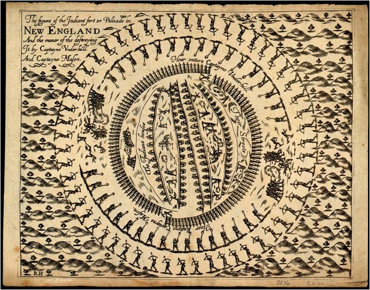
Map: The Mystic Massacre, May 26, 1637
IV. Colonization, Slavery, and
Consumption
A. From Tribute Extraction to Capitalism
B. A Case in Point: Slave Economies and the Middle Passage
C. Slavery and Sugar: Creating a Consumer Society
Animation: The Atlantic Slave Trade
Map: The Atlantic Slave Trade
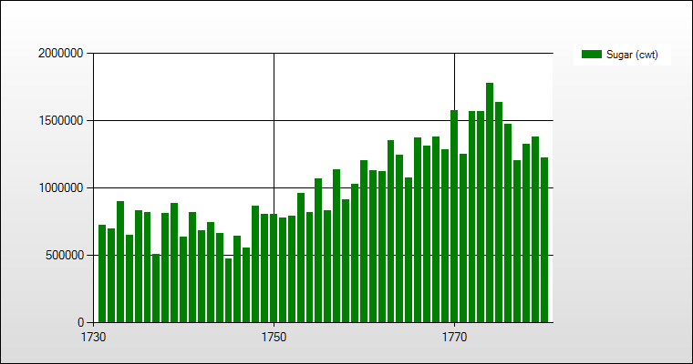
Chart: Annual Sugar Consumption in England, 1731-1780
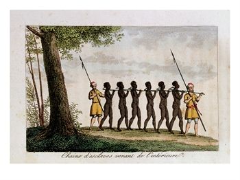
Image: Chaine d'esclaves venant de l'interieur,
from René Claude Geoffroy de Villeneuve, L'Afrique, ou histoire,
moeurs, usages et coutumes des africains: le Sénégal (Paris,
1814), vol. 4, facing p. 43. The author lived in the Senegal region
for about two years in the mid-to-late 1780s and made this drawing from
his own observations. He provides a detailed description of the capture
and the movement of slaves from the interior to the coast: “Every
year the Mandingo traders, called slatées or Sarakole [Sarakule,
Sarracolet, etc.] Negroes, after having sold slaves in exchange for
European goods, leave with necessary goods for the interior, toward
Bambara country. The Mandingo slatées often carry with them iron
bolts of 15 to 18 inches long...They cut pieces of a heavy wood, around
5 or 6 feet long, forked at one end so that the forked end can fit around
the slave's neck. The two ends of the forked branch are drilled/pierced
so as to permit the iron bolt, held at one end by a head, and fixed
to the other end by a flexible iron blade [which passes] through a hole
in the bolt...When all the slaves are run through in this fashion and
the traders want to start the march to the coast, they arrange the captives
in a single file. One of the traders puts himself at the head of the
line, loading on his shoulder the handle of the forked branch of the
first black; each slave carries on his shoulder the handle of the forked
branch of the person behind him...During the entire route, the fork
is never removed from the slaves' necks, and at the arrival point, as
at the departure, the traders take great care to check if the iron bolts
are in good working condition. It is thus that five or six armed traders,
without fear, can succeed in conveying coffles of 50 slaves, and even
more, from the interior to the European coastal factory.” Commentary: The
Atlantic Slave and Slave Life in the Americas, University of Virginia.
Image source: Allposters.com.
|
.jpg)
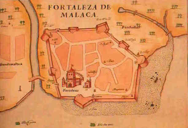
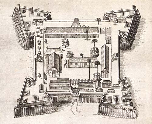
Image: Fortress of Melaka (1630)
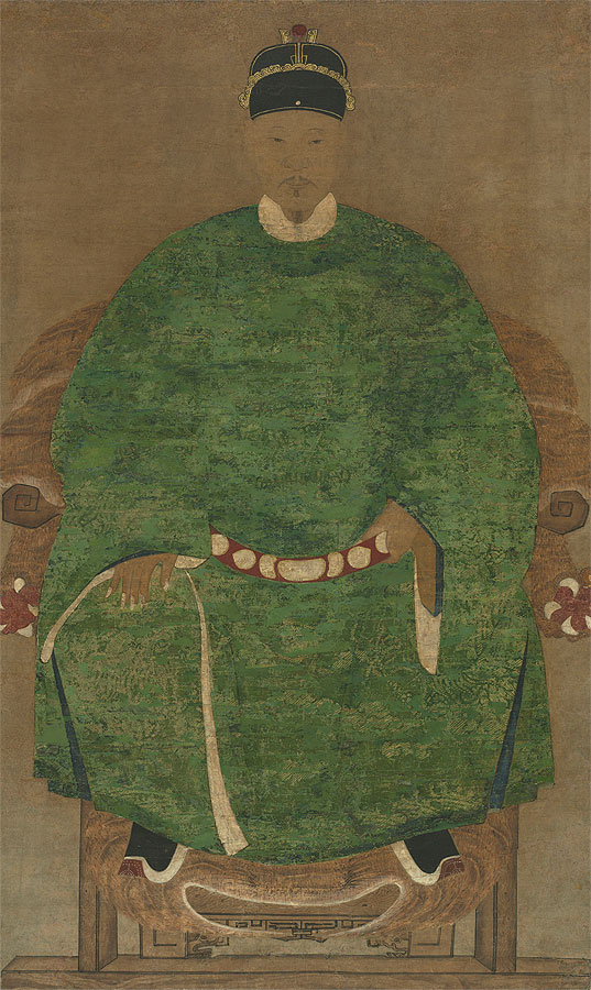
Image: Zheng Chenggong
(1624-1662)
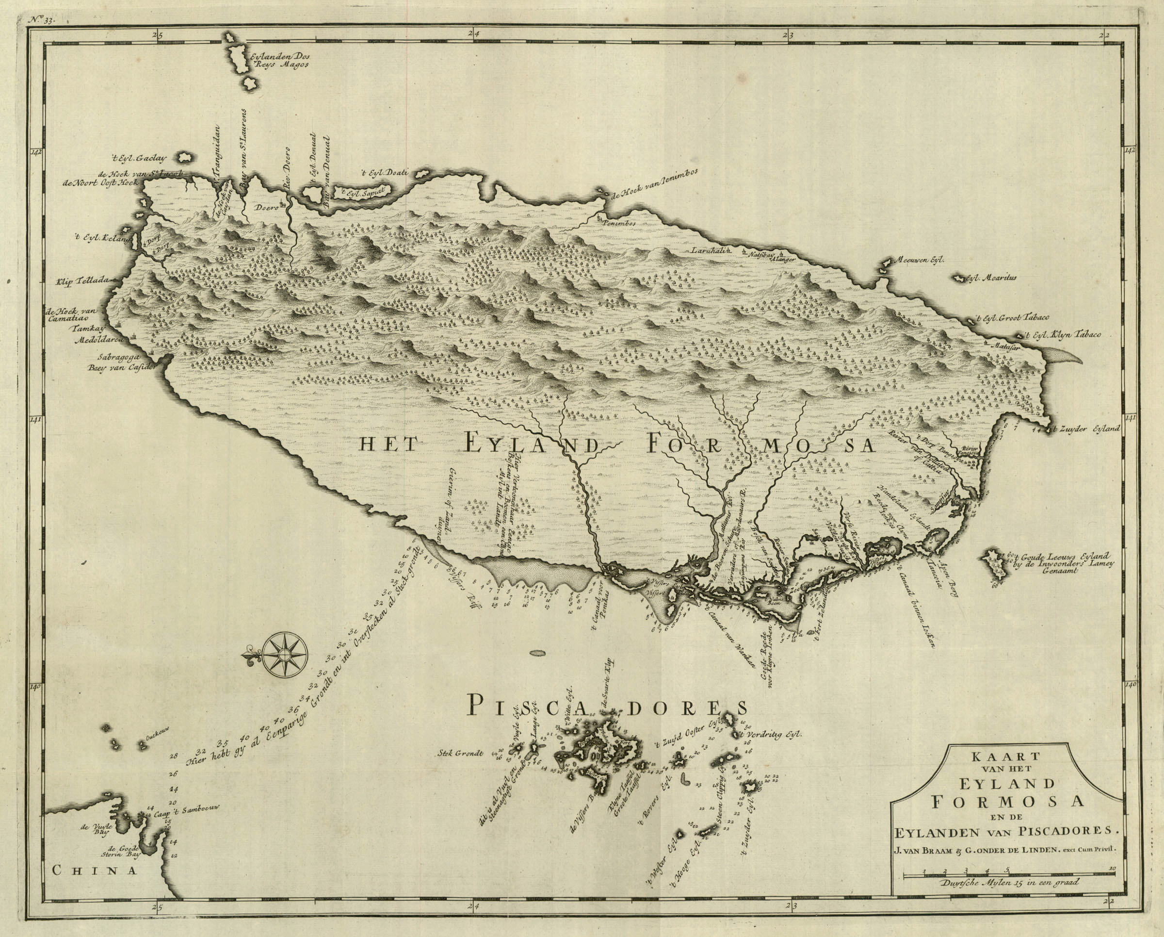
Map: "The Island of Formosa" (1726)
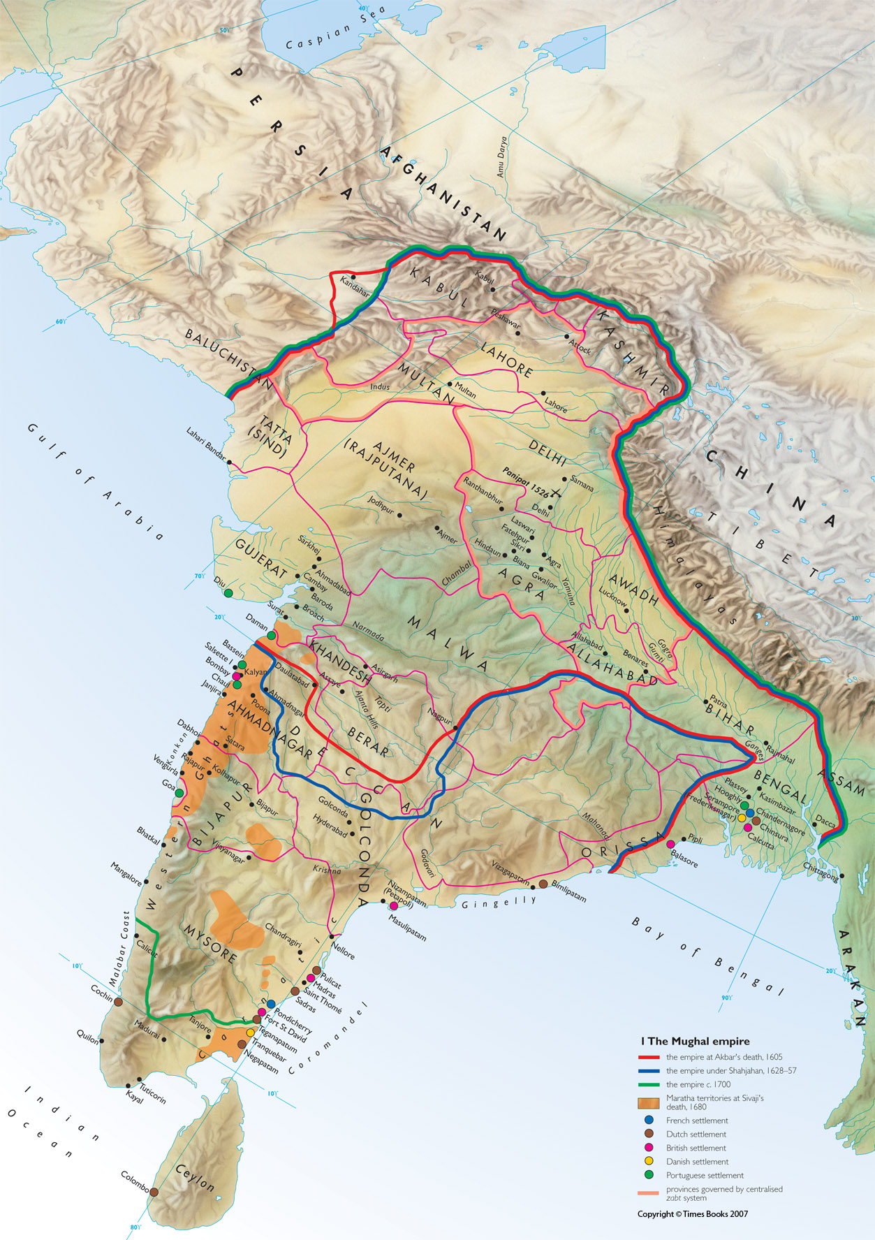
Map: The Mughal Empire
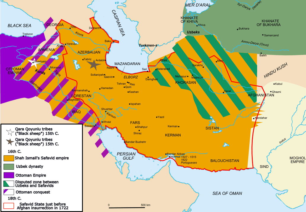
Map: The Safavid Empire
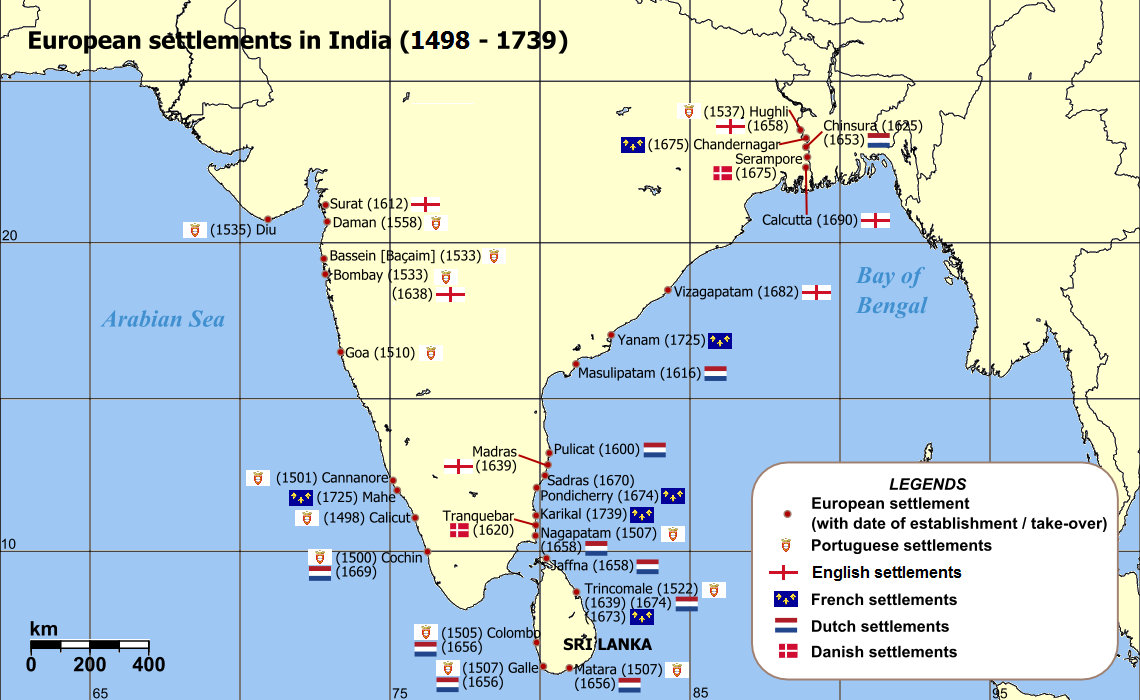
Map: European Settlements in India (1498-1739)
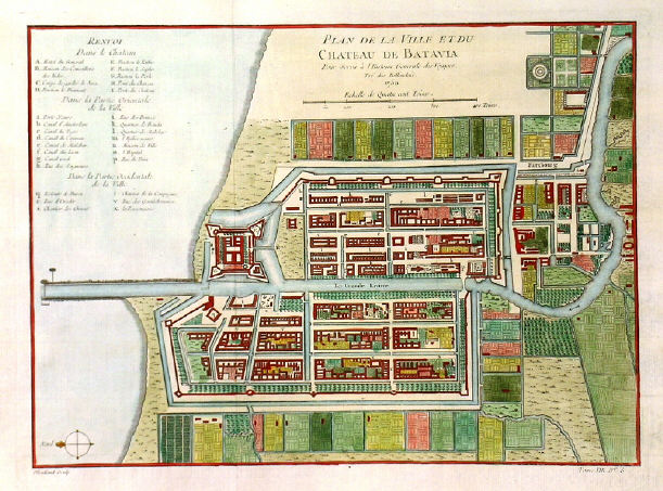
Image: Batavia (1681)
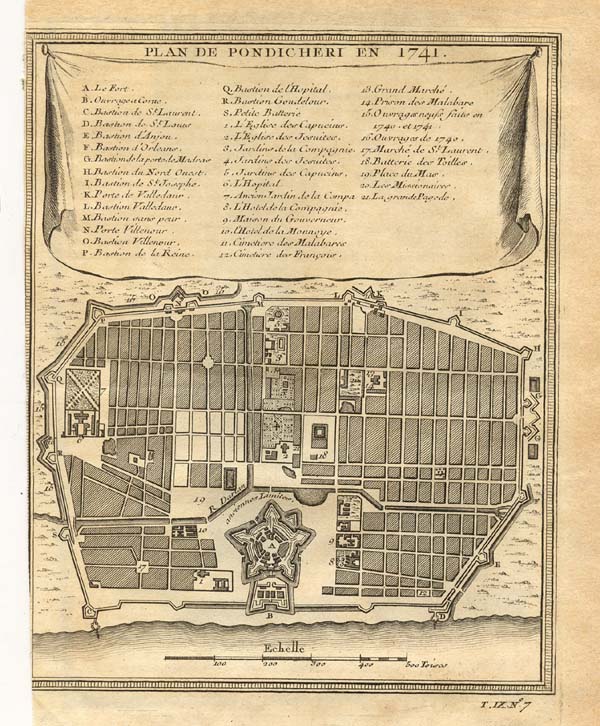
Image: Plan de Pondicherry (1741)
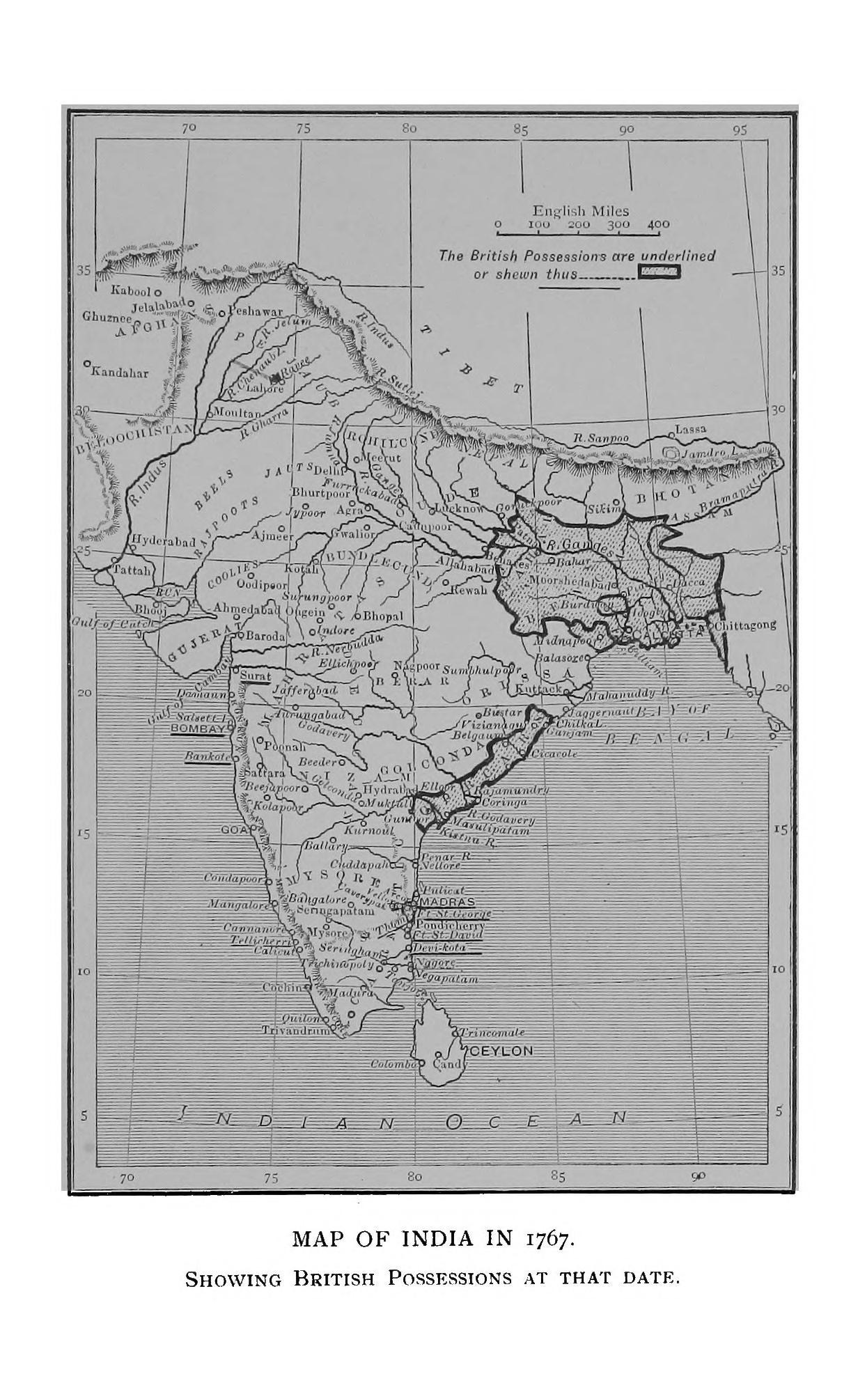
Map: Map of India in 1767
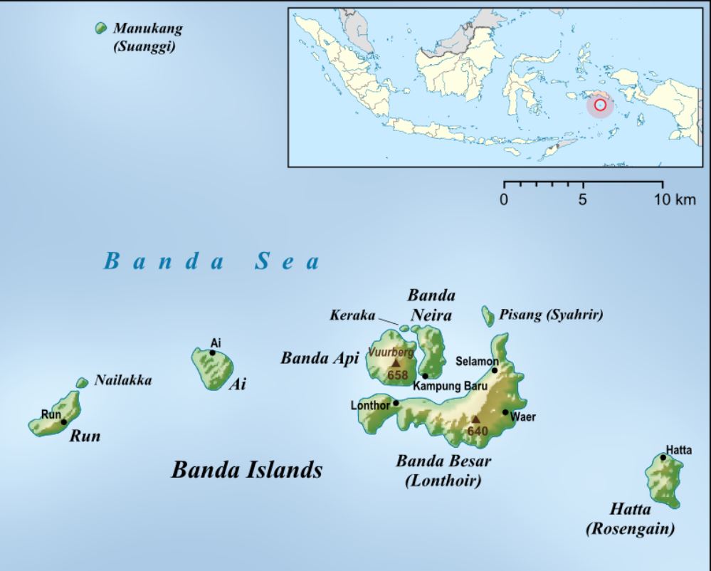
Map: The Banda Islands (Indonesia)
Image: Fort Nassau (1646) |

.jpg)