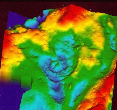
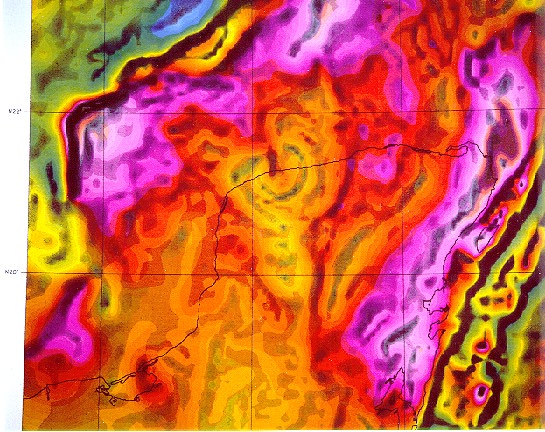
If you look on a bathymetric map of the Yucatan region, you will see that there is no morphologic evidence for a crater, that is there is no obvious circular depression. So how can geophysicists "image" such a crater? There are several ways, including the effects it has on the local magnetic and gravimetric fields and by conducting seismological experiments to detect subsurface structures. Following are several examples of such studies. The impact and its rings are easily seen in these data.
Gravity and Magnetic Field Anomalies are shown below
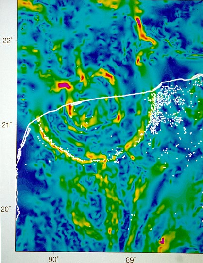
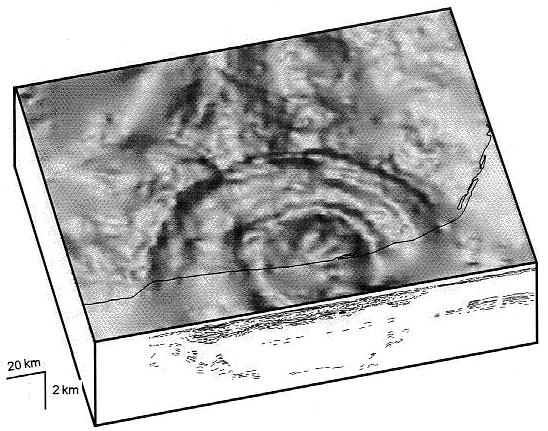
This last image combines the gravity data (the grey shaded surface image) with the results of a seismic reflection experiment (shown on vertical section). The reflection data reveal the deformation of structures beneath the surface. The coast line is shown in black.