|
Seismicity of the Archipelago: Preliminary Results Map of Seismic Array 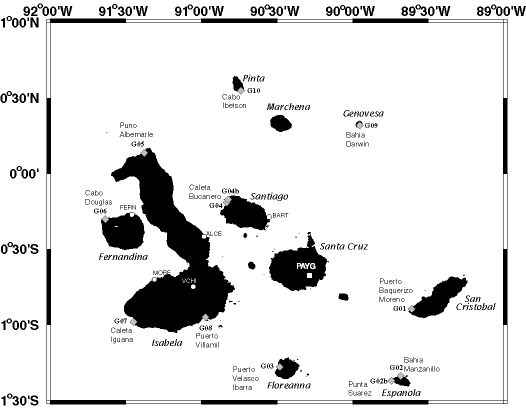 | | Map of Project IGUANA Seismic Array |
Map of the Galapagos Archipelago with locations of seismic stations. Broadband sites are shown as diamonds; high-frequency sites as circles. The apeture of the array is 200 km by 300 km, north-south and east-west, respectively.
|