
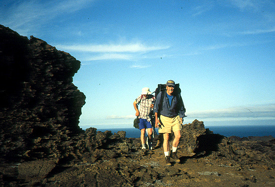
Fernandina, September 1999. |
| IGUANA Field Work | ||
|
|
||
| Installing Broadband Seismometers on the Islands |
| Lugging equipment on Fernandina |
|
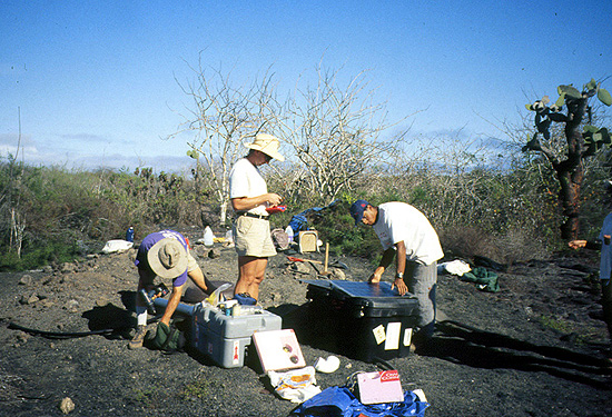
We installed 10 broadband seismometers on 8 of the larger islands. With the help of personnel from the CDRS, sites with likely sediment, necessary for burial of the sensor, were suggested. This is not a site with sediment! But it is on the way to a tiny pocket of sediment that collected in a small depression. Here we are receiving help from the crew and cook of our support boat, the Espanola. |
| Preparing a site on San Cristobal |
|
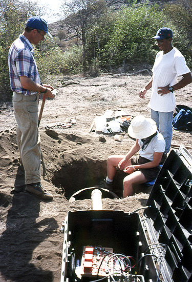
Our second site was installed on the island of Espanola. We found plenty of soil at this site, with the help of the captain of the Espanola. He has been sailing these waters for his entire life. He knows the islands. From left to right, Pat Ryan unpacks equipment, Doug Toomey checks tools, and Darwin Villagomez prepares to attach a solar panel to our caja negra. The solar panel charges the batteries, which power a site. Since this is our second installation, we are not yet a well-oiled machine. But after a couple of more days, watch out. After several weeks, this site was found by vandals and damaged. On our next servicing round it was moved to a safer location. Most likely, the vandalism occurred as a result of ongoing tensions between fishermen and the Galapagos National Park. |
| Aligning the seismometer |
|
Pat Ryan gives Emilie Hooft Toomey a compass bearing, so as to line up the horizontal channels of the seismometer in the North-South, East-West directionds. Darwin Villagomez looks on. Darwin joined our team for the deployment, at the time he was a student at the Instituto Geofisico, Escuela Politecnica, in Quito. Presently, Darwin is a graduate student at the University of Oregon and is analyzing the local seismicity data. Several of our sites did have abundant, volcanic ash. This made for very quick digging and relatively deep installations. |
| Placing the seismometer in a vault |
|
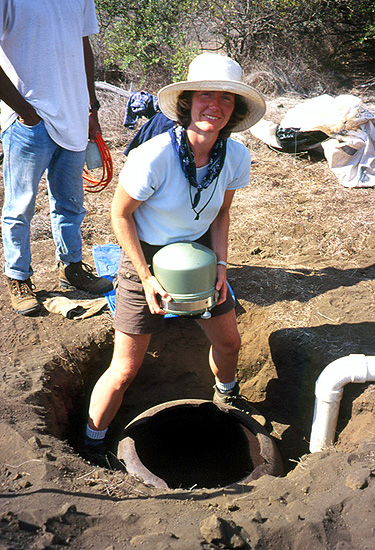
Emilie Hooft Toomey prepares to lower a Streckheisen, STS-2 into a vault. The STS-2 is a broadband, three component seismometer that records ground motion over a wide range of frequences (<0.01 to 50 Hz). These seismometers provide high quality recordings of both local and teleseismic earthquakes. They were installed in September of 1999 and will be recovered in the fall of 2002. |
| Finished site |
|
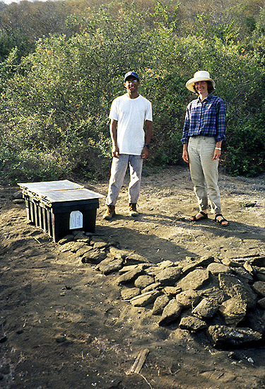
Darwin Villagomez and Emilie Hooft Toomey admiring a completed installation. The seismometer is buried in the vault at the foreground; it is covered with rocks to provide additional insulation. The black box in the background houses the recording equipment. |
| Installing High Frequency Seismometers on the Islands |
| Hiking in on Bartoleme |
|
Pete Hall (foreground) and Vinicio Caceres (background), of the Instituto Geofisico, Escuela Politecnica, hiking in with equipment to a high-frequency seismometer site. |
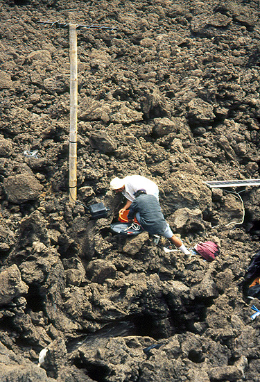
| Working on equipment |
|
There are a total of five high-frequency, vertical component seismometers installed permanently in the western archipelago. These record vertical ground motion at about 1 to 50 Hz and the data is telemetered back to the Charles Darwin Research Station where it is archived. Students from the Instituto Geofisico analyze the data, which is particularly useful for monitoring the volcanoes on Isabela and Fernandina. The array also detects many local earthquakes that are not directly associated with the volancoes. Since the high-frequency instruments are not sensitive to temperature variations, they do not need to be buried. Consequently, they are deployed in rugged terrain, where few would chose to roam. The pole supports the radio antenna, which telemeters data back to the lab. Andreas Sanchez and Vinicio Caceres are laboring over equipment. |
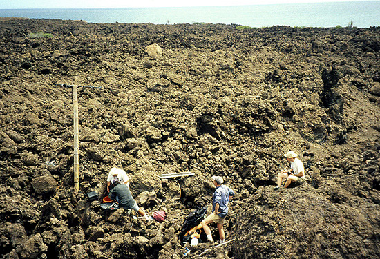
| A view of a rough site and smooth waters |
|
Some work, while others try to find a comfortable place to sit in the lava. |
| People and Geology |
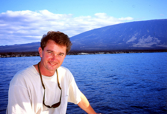
| Doug Toomey and Fernandina |
|
Doug Toomey smiles after completing the installation of the sixth site. Only four more to go! In the background, the steep slopes of Fernandina, one of the most active volcanoes in the Archipelago. |
| Darwin Villagomez on Pinta |
|
Darwin Villagomez on Pinta, his favorite Island, and home of the tenth and last seismic station. |
| Pahoehoe of Fernandina |
|
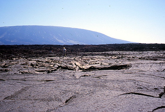
Easy walking on a large field of pahoehoe lava from Fernandina volcano. Conditions of work in the Galapagos are not always this easy. They often include carrying equipment on rough aa lava, temperatures of more than 100F, and no shade. |
| Anniversary Celebration |
|
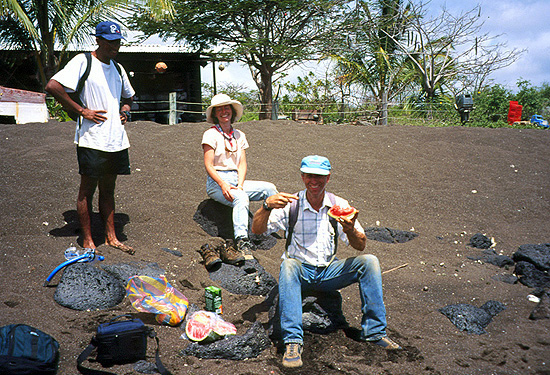
Pat Ryan enjoying one of the delicacies of Floreana Island on its black sand beach. This was also the celebration of Emilie and Doug's first wedding anniversary. Sometime after digging a hole and sweating profusely to install the seismometer, they both realized it was their wedding anniversary! |
| Spatter Cones of Bartolome |
|
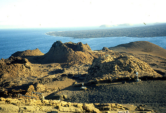
Late afternoon on Bartolome Island, where one of the short period seismometer is installed. View of some eroded spatter cones from the top of the island. |
| Exotic Sights near the Sites |
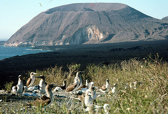
| Cinder Cone on Isabela |
|
The backdrop of a large cinder cone provides a dramatic setting for a colony of blue-footed boobies. |
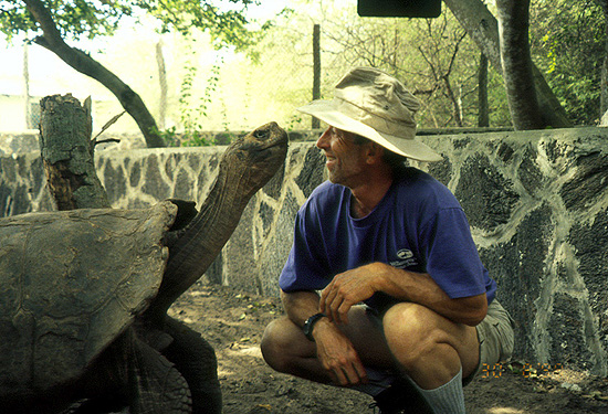
| Foreplay at the Tortiose Breeding Center |
|
Pat Ryan gets up close and personal with one of the giant tortoises now at the breeding center in Villimil |
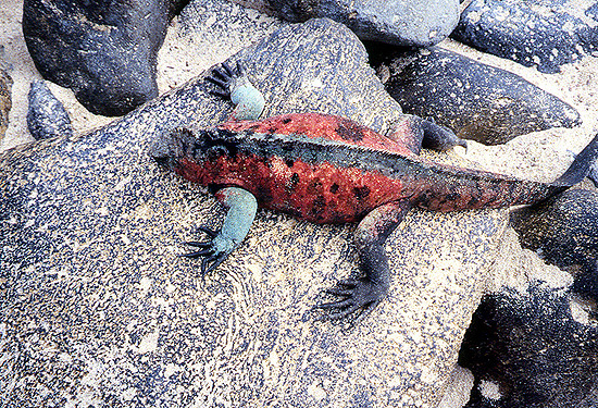
| Marine Iguana |

|
The namesake of the IGUANA Project (Imaging Galapagos Upwelling and Neotectonics of the Archipelago). The marine iguana is Godzilla like in looks, but much less alarming in behavior. |
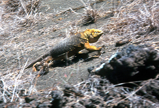
| Land Iguana |
|
The land iguana is more reclusive than the marine iguana. This large specimen measured about 4 feet in length. There scat is impressive in size, and usually the first sign that one has entered their territory. |
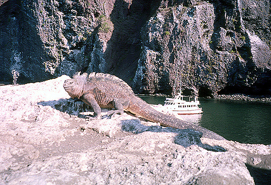
| Marine Iguana and Espanola |
|
Each trip we have the pleasure of overnighting in the natural cove of Punta Vicente Roca. A truly impressive region formed presumably by the collapse of part of Volcun Ecuador. Here one can see a full spectrum of Galapagos wildlife. |
| Marine Iguana of Espanola |
|
On Isla Espanola the marine iguanas take on a different hue. |
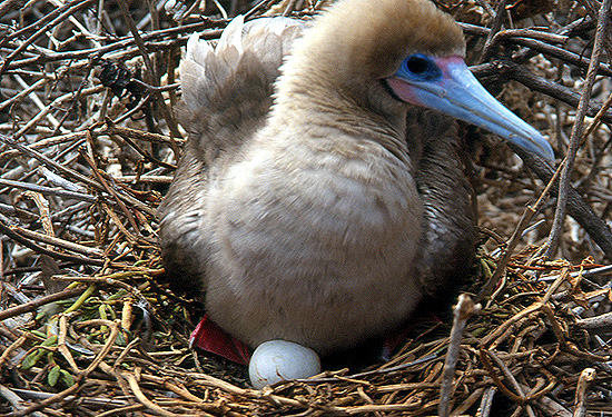
| Juvenile Booby on Nest |
|
On Isla Genovesa the bird population is several million. Most are quite unphased by our presence, provided that we step carefully. |
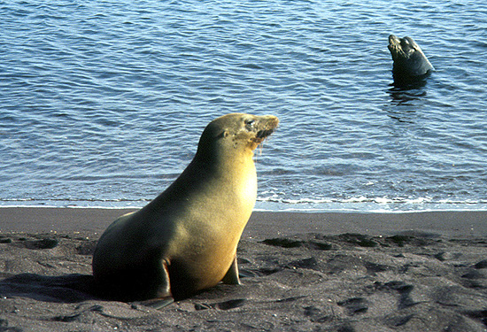
| California Sea Lions |
|
Our constant companions at the beach. The female is curious and friendly, a good swimming partner. The male is more terrotorial and standoffish. |
| Seismicity of the Archipelago: Preliminary Results |
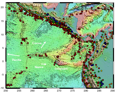
| Regional Seismicity |
|
Regional setting of the Galapagos including seismicity (mb>4.2) for the period of September 1999 to June 2001. The Galapagos area is well located with respect to local and regional activity. Epicenters are color coded by depth (red, <30 km; yellow, 30 to 70 km; green, 70 to 150 km; blue, 150 to 300 km; purple, 300 to 500 km; orange, >500 km). |
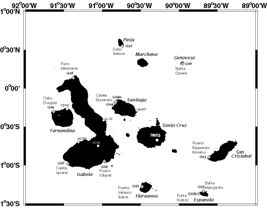
| Map of Seismic Array |
|
Map of the Galapagos Archipelago with locations of seismic stations. Broadband sites are shown as diamonds; high-frequency sites as circles. The apeture of the array is 200 km by 300 km, north-south and east-west, respectively. |
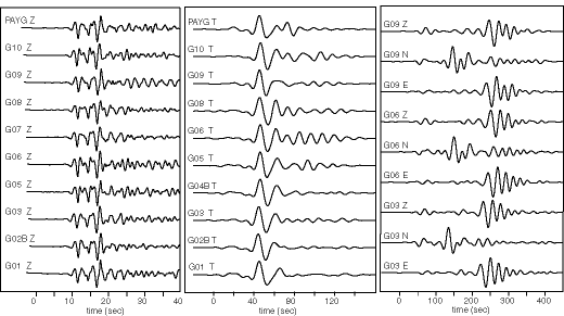
| Broadband Seismograms |
|
Examples of P and S body waves and Love and Rayleigh surface waves. Left panel shows P waveforms for a mb 6.5 event at 82 degrees; bandpass filter 0.33 to 2 Hz. Middle panel shows S waveforms for a mb 6.5 event at 37 degrees; bandpass filtered at 0.033 to 0.1 Hz. Right panel shows surface waves for mb 5.8 event at 29 degrees; bandpass filtered at 0.0125 to 0.05 Hz. |
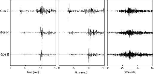
| High Frequency Seismograms |
|
Examples of local events registered on the three components of station G06, and filtered highpass 1Hz. Left panel shows the mb 5.0 event, middle panel shows a shallow volcano-tectonic event beneath Alcedo Volcano, and the right panel shows a high frequency signal (3-7Hz), that may correspond to volcanic tremor. The appearance of the latter event on four of our seismometers indicates a location on nothern Isabela (Volcano Alcedo?). |
| Distribution of Seismicity |
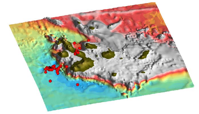 |
Bathymetry of the Galapagos with location of earthquake epicenters between September 1999 and August 2000. The Galapagos Archipelago is a seismically active area and the seismicity appears to be associated with both tectonic faulting and the active volcanoes. The PDE catalog annually reports at least 1-2 events with magnitudes larger or equal to 4.3. Our continuous record of seismic signal, the high quality of the data, and the low levels of high frequency noise, allow the detection and location of local events with magnitudes larger than 2.0. Using data from the first year of operation of our network, we have located 56 seismic events within the archipelago. In the same period of time, the NOAA's Pacific Autonomous Hydrophone Array, that acoustically monitors the area, located 13 events (roughly those with ml>3.0), and only 2 events (Mw 5.7 and mb 4.3) were reported in the PDE catalog. The kinds of events detected by out network include tectonic events, volcano-tectonic events and high frequency signals that could correspond to volcanic tremor or perhaps landslides. A complete spectral analysis of the data set will determine the nature of these signals, and whether or not other volcanic signals like long period events or tremor are present. The epicentral resolution of our preliminary locations, with average horizontal errors of 6 km (compared to 17 km for the NOAA locations), permits us to correlate local seismicity with specific tectonic features or particular volcanoes. This is the case of the series of events located west of Fernandina, on the flexural moat, or the events located beneath active Alcedo volcano. For common events, our locations differ to those of NOAA's by an average of 40km, and 60km compared with the events in the PDE catalog. |