IS THE MARTIAN SCENARIO SUPPORTED: CURRENT AND PAST CONDITIONS
ON MARS
 |
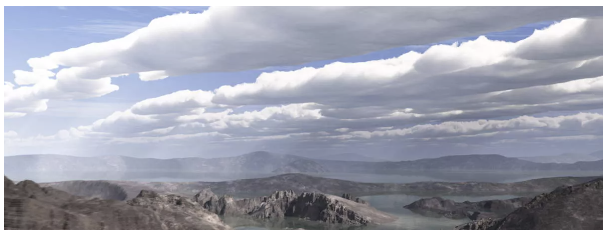
Astronomers suggest that in the past Mars had a much
thicker atmosphere than today (upper left: artist's conception)
and was much more earth-like
(there are models which suggst that the
young Mars had an atmospheric pressure of 2 bars, 1.01 bar is
1 atmosphere). This
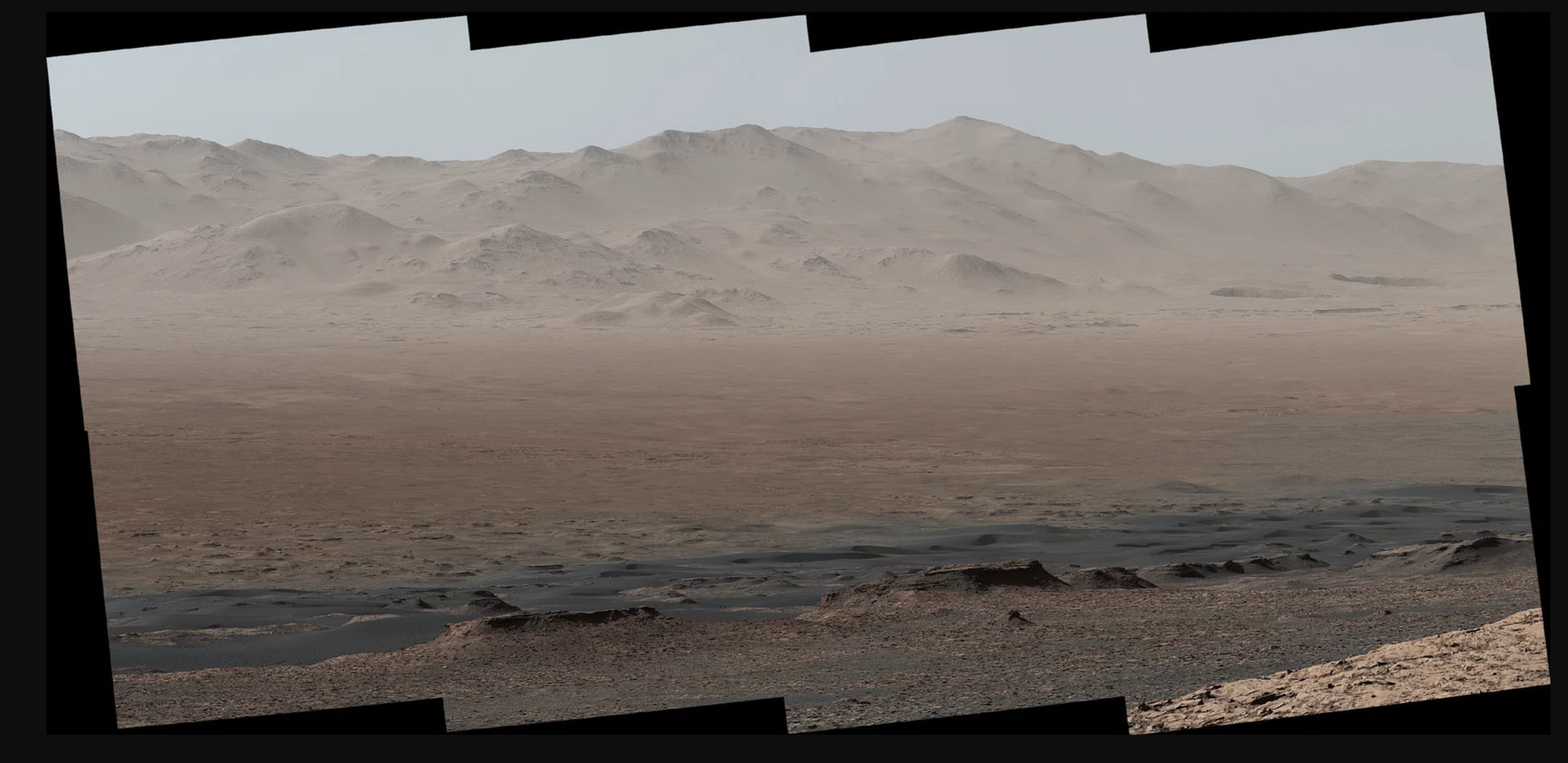
is interesting because, today,
the atmospheric conditions on Mars are such that liquid water cannot
exist on the surface of Mars (lower left: Curiosity panoramic picture of
Gale crater).
Is there evidence that in the past, Mars may
have had an atmosphere that was much more conducive to
Life As We Know It (LAWKI)?
Here, we do three things:
- We look at the evidence for water on Mars today
- We look at the evidence that Mars once had a thicker atmosphere and
supported quiescent liquid water, such as in rivers and lakes in the past
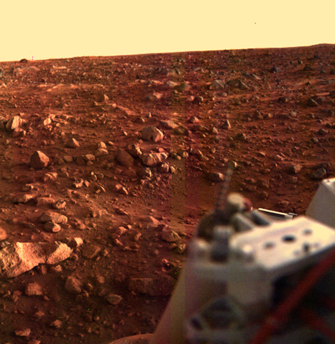
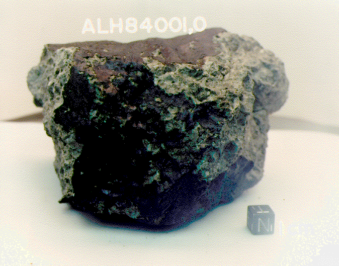
- We look at two past attempts to find current or past life on Mars: Viking
Biology experiments, Allan Hills meteorite
|
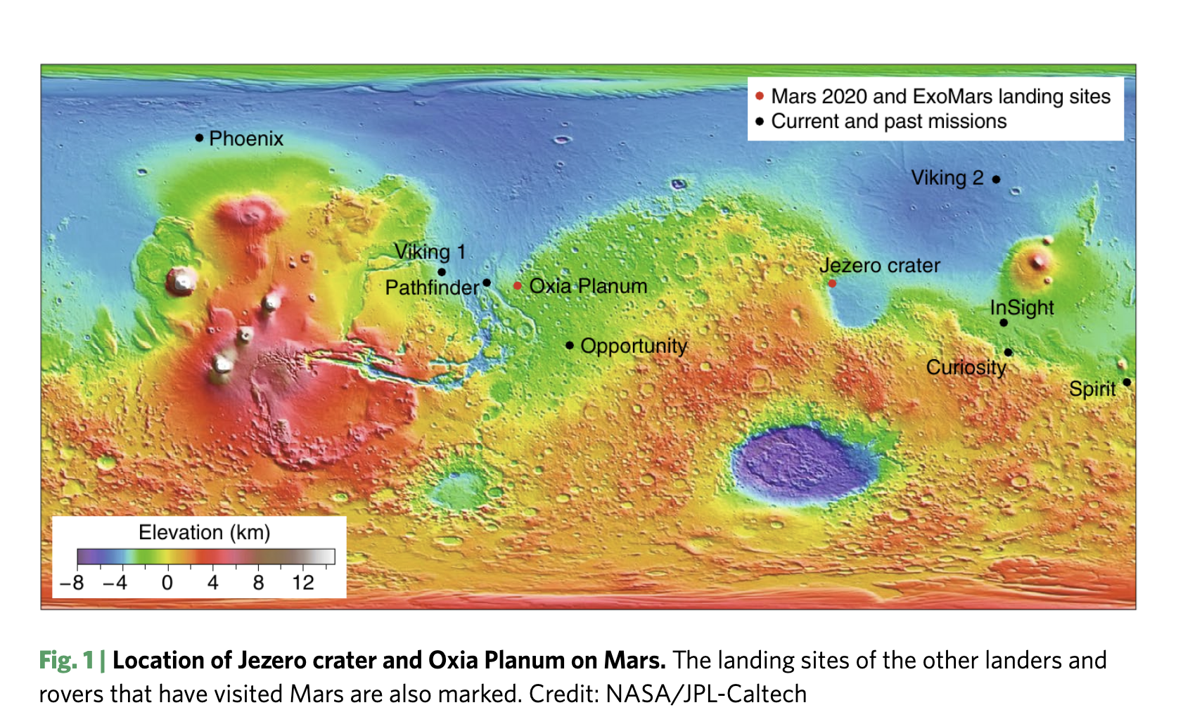
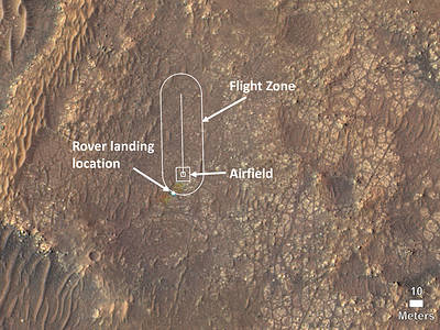
LANDERS AND THEIR LANDING SITES
|
This highlights a large problem we
have with exploring Mars using
landers. We place the landers in selected spots. We can explore a little in
the vicinity of the spots using rovers and helicopters, but not a lot.
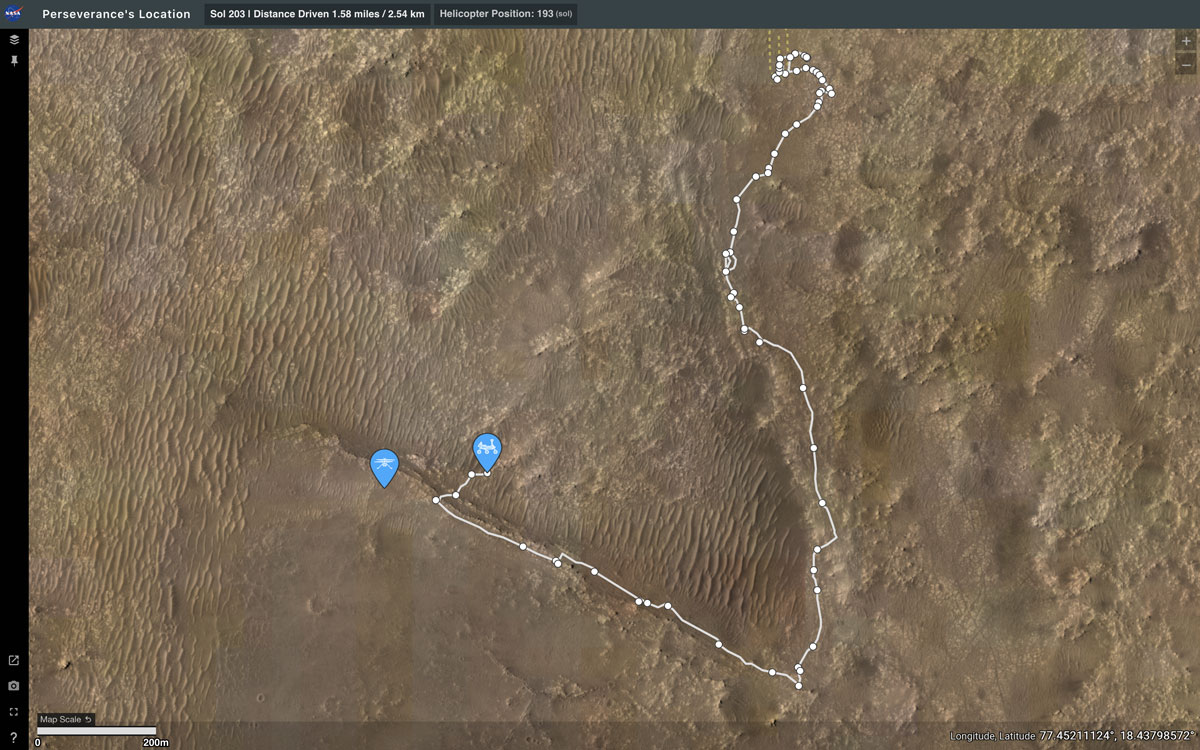
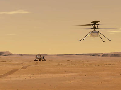
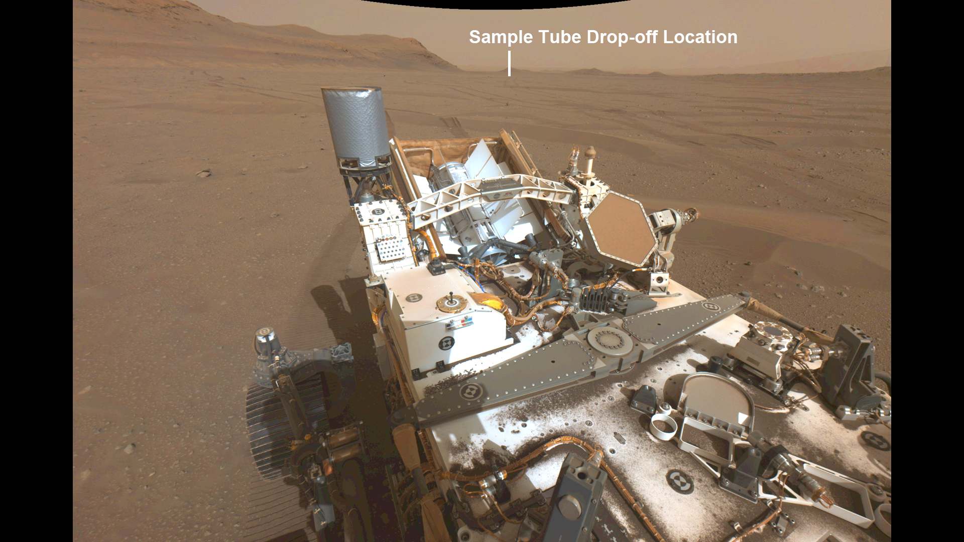
The latest rover in Jezero crater, Perseverance,
is fast, but moves only at 0.1 miles per hour (4.2 cm/sec).
The lunar rover was designed for a top speed of 8 miles per hour
but was driven by Eugene Cernan at 11.2 miles per hour.
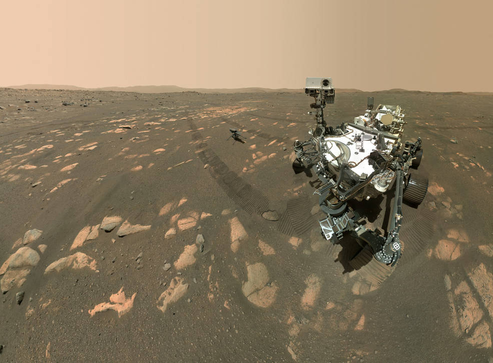
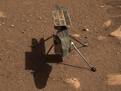
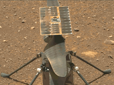
There is a helicopter that accompanies Perseverance,
Ingenuity, which flies at speeds of up to
12.3 miles per hour with a range of 0.44 miles at
altitudes up to 12 meters.
|
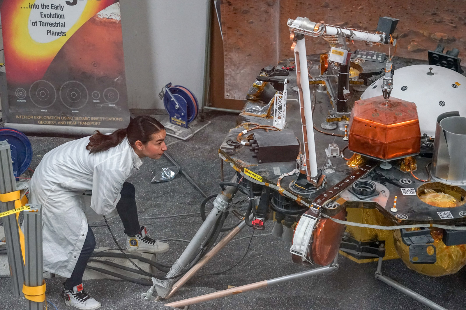
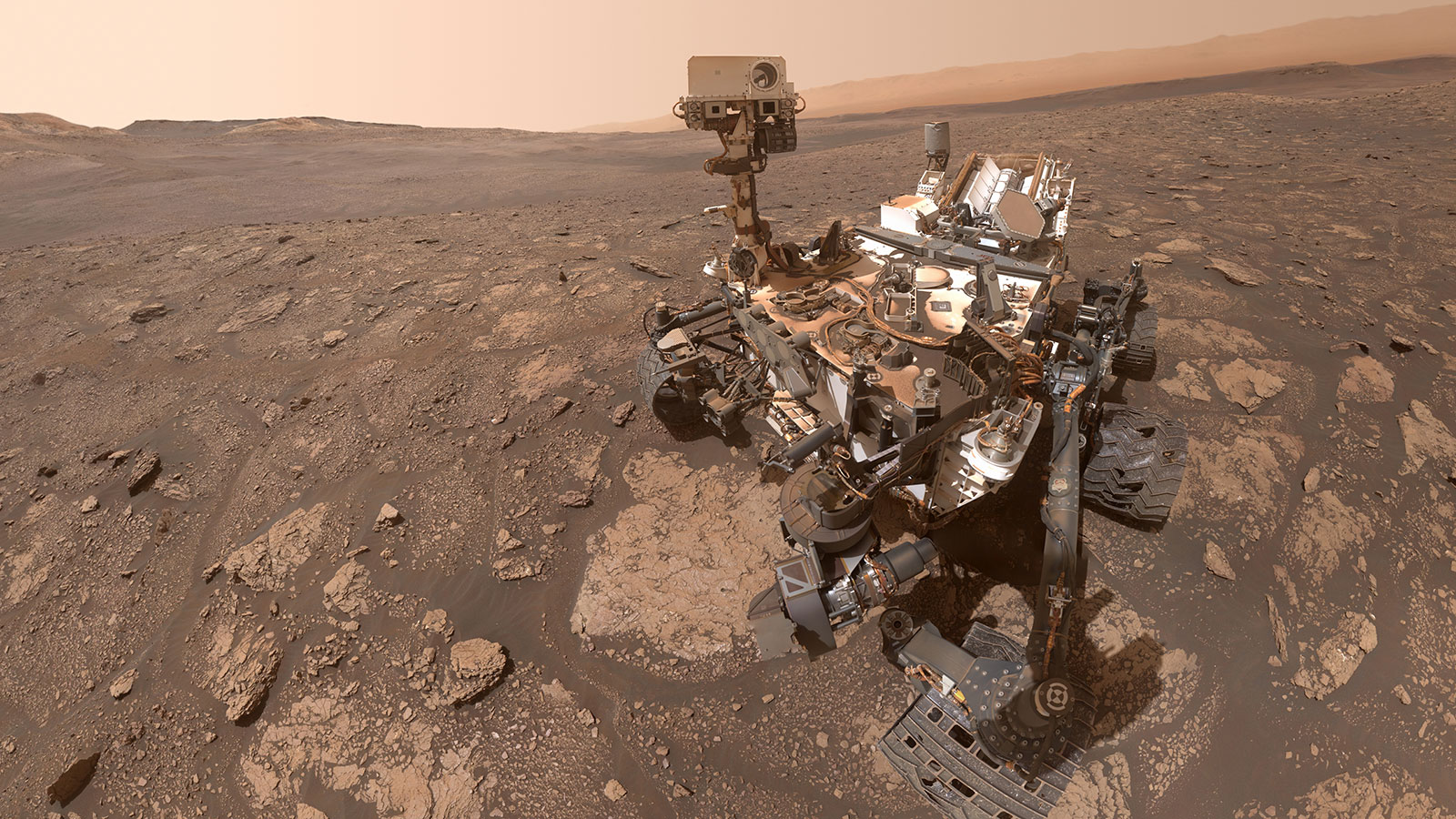
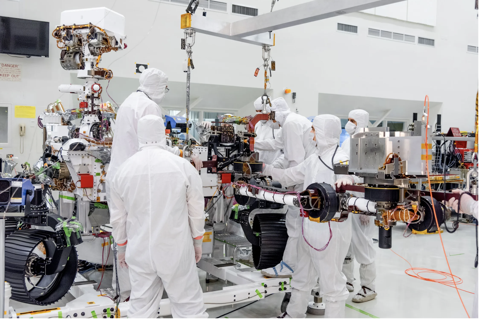 Perseverance being prepared in lab at JPL
 |
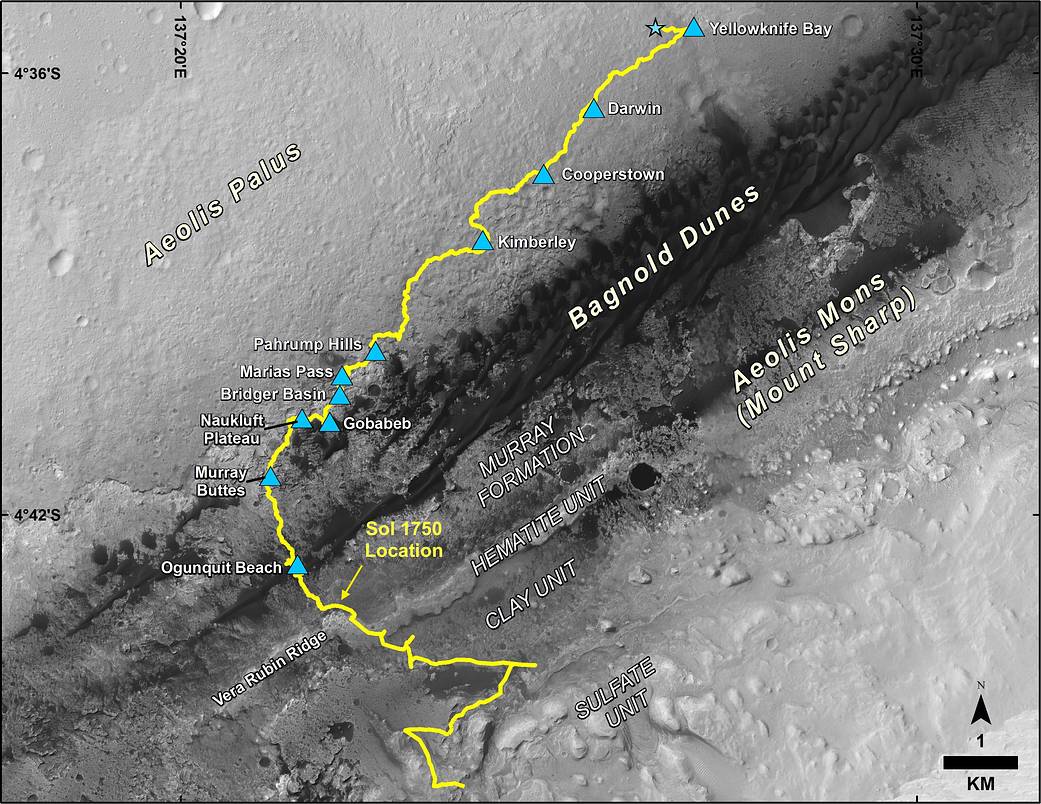
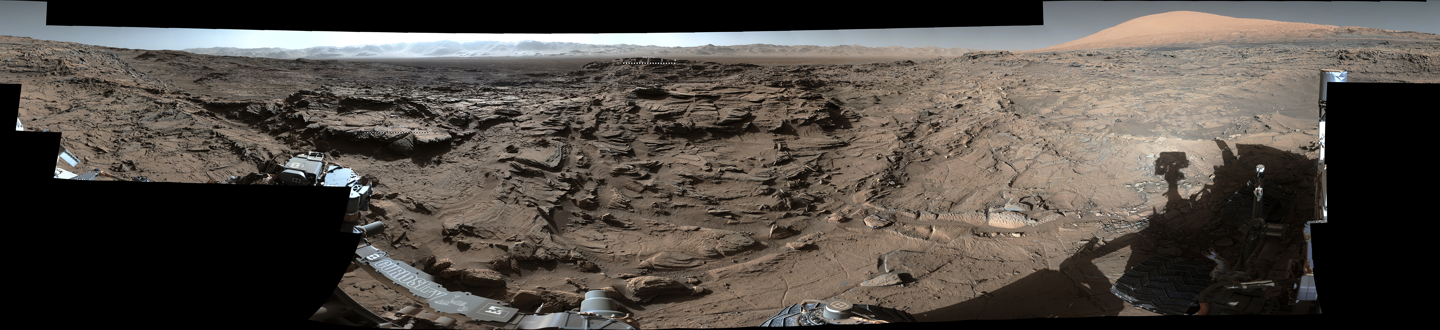
I. CURRENT MARS
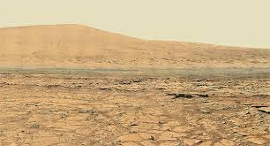
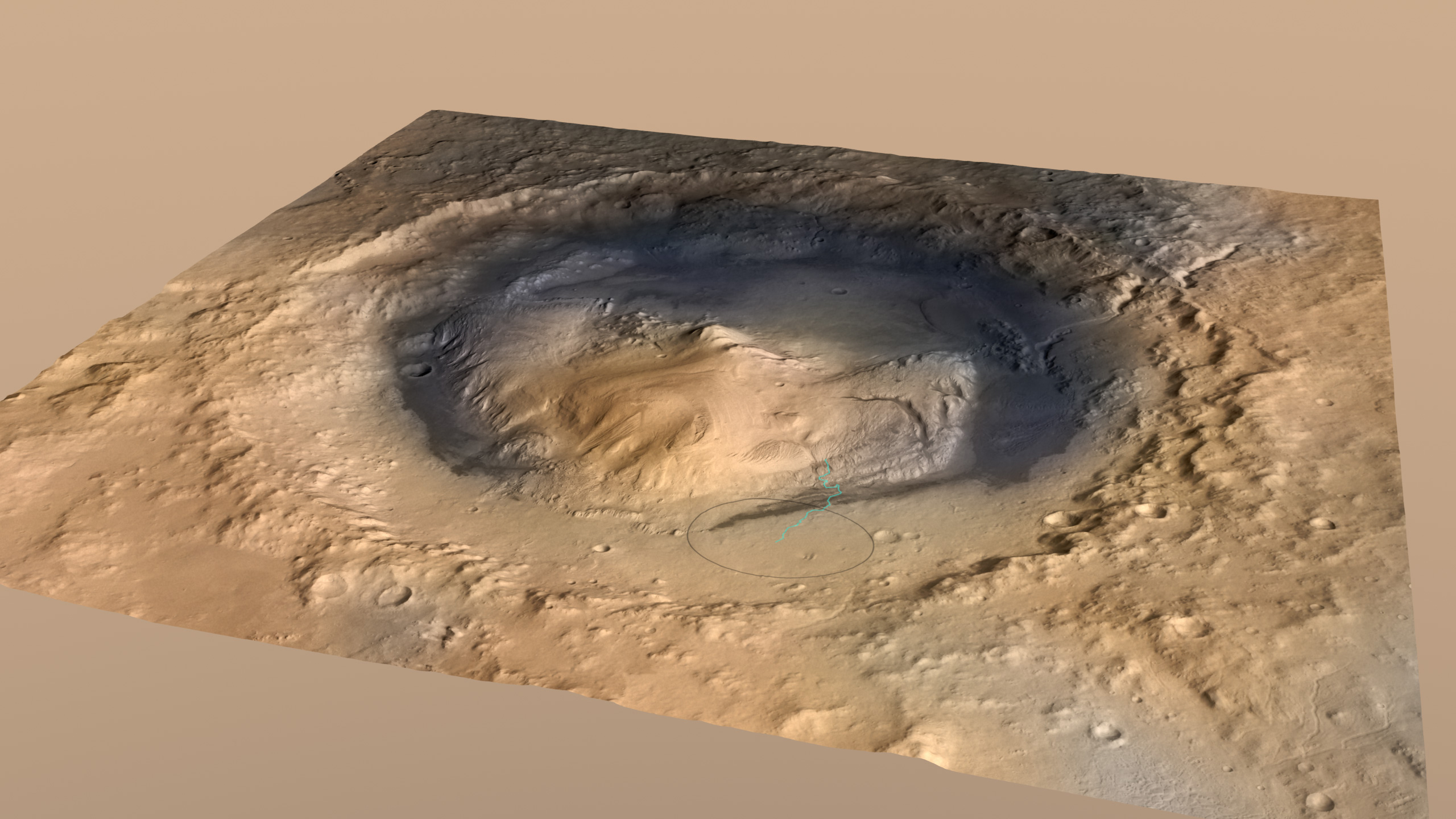
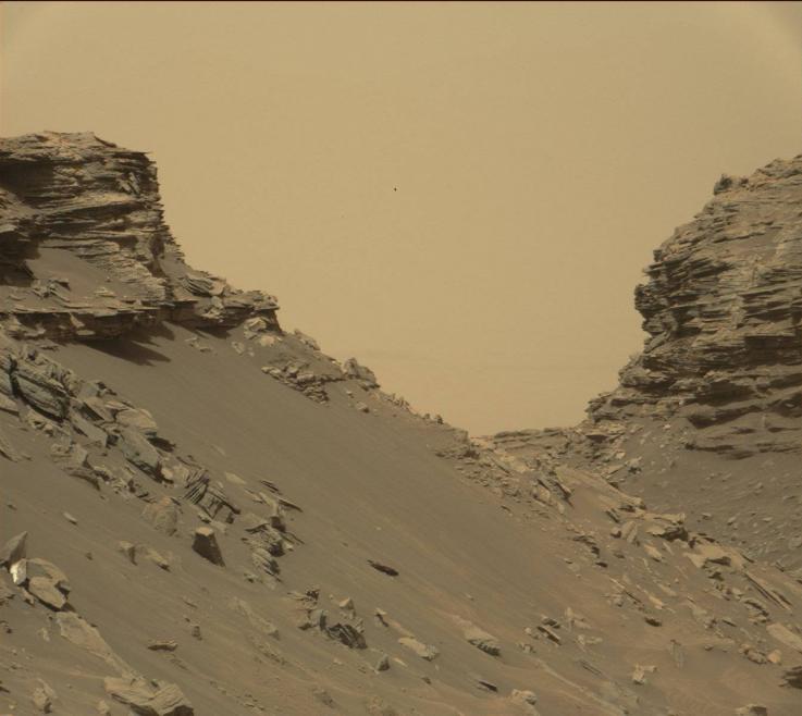
The view of Mount Sharp in Gale crater from Curiosity (left
panel). On the right panel, you can see where Curiosity landed and the
route it followed in Gale crater. Gale crater is an old basin,
3.6 to 3.8 billion year old. Gale crater is about 150 kilometers in
diameter. It is the lowest spot on Mars for over
1,000 kilometers. Mount Sharp rises
5.5 kilometers above the crater floor.
Sediments in Gale
crater which stopped accumulating 3.1 to 3.8 billion years ago, show that
there was abundant flowing water and a lake that existed for tens of thousands
of years (if not millions of years) in Gale crater.
|
Current Conditions at Gale Crater
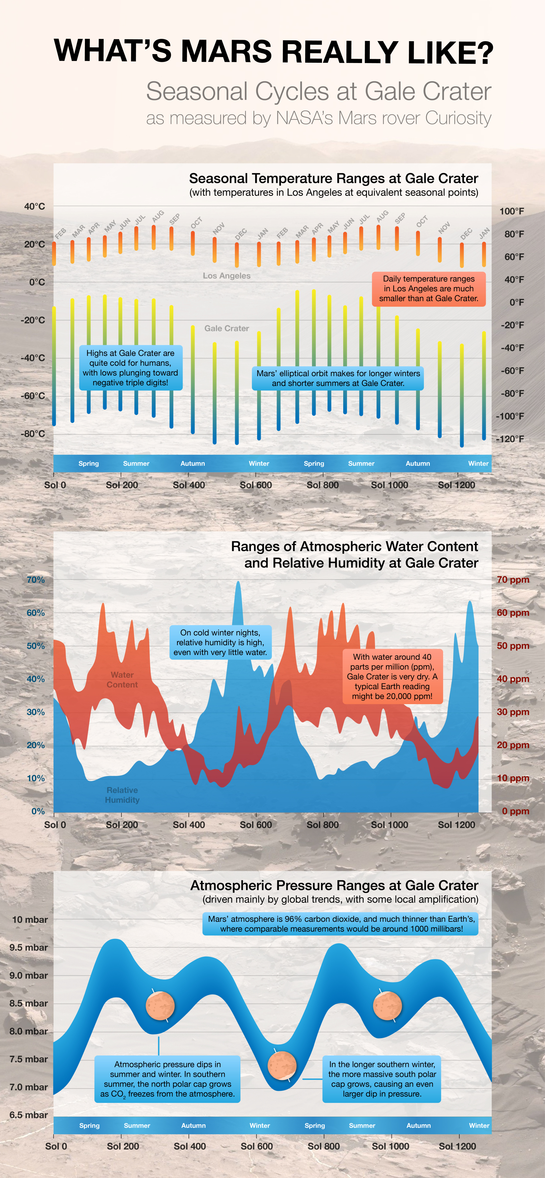 |
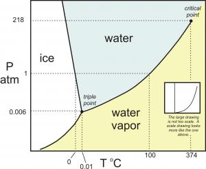
Phase Diagram for Water
Mars currently has a low temperature, from below the freezing point of
water on Earth, ~0oC (32 F), to nealy -60OC
(-120 F), and very low atmospheric pressure, less than 1 % than that for
the Earth. Can see on the phase diagram for water that Mars
currently cannot support
liquid water on its surface except under extreme conditions.
|
II. MARS AND WATER
We see plenty of evidence that there is water on Mars. There is
just no evidence that liquid water currently
exists in large amounts on Mars. For example,
there is
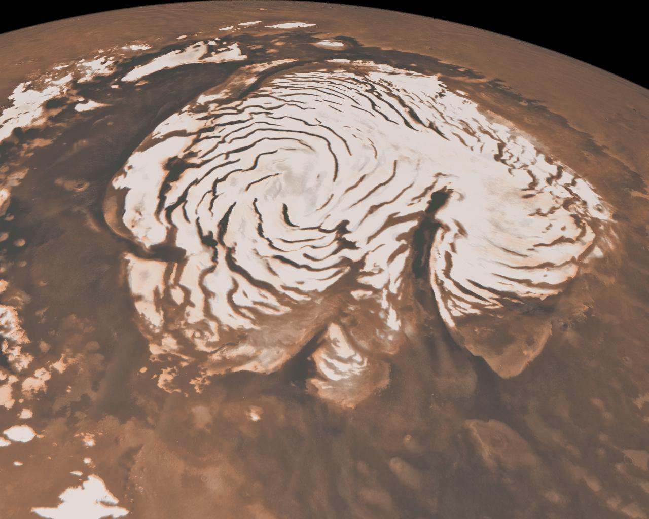
water in the residual polar ice caps on Mars:
The polar caps on Mars have two parts; regions that show
seasonal variations and
residual caps. The seasonal caps are thought to be composed of frozen
carbon dioxide. The residual caps are smaller and brighter than the
seasonal caps and are mainly water ice in the north and
water ice with a veneer of carbon dioxide ice in
the south. The
residual caps contain roughly the same amounts of water ice.
The northern residual cap (right hand pictures) is around 1,000 kilometers
in diameter and has thickness of about 2 kilometers, if uniformly
spread. This is about 60 % as much ice as contained in the Greenland
ice sheets. The southern residual polar cap is roughly 1/3 in extent
compared to the northern polar cap but is thicker and contains about
as much water ice as does the northern residual polar cap.
|
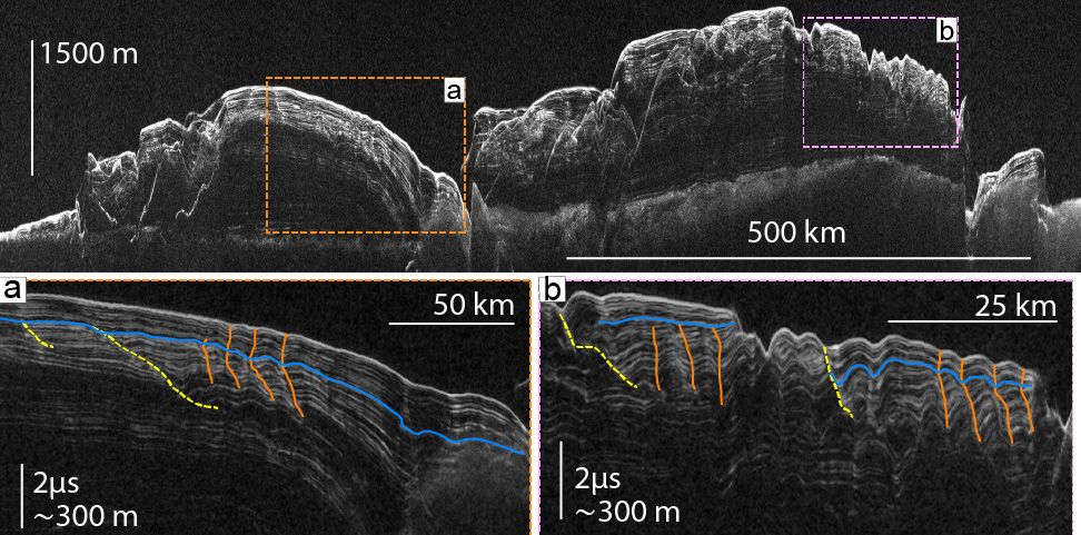
The above is a cross-section of Mars's northern
polar ice cap (taken with Shallow Radar on NASA's Mars Reconnaissance
Orbiter MRO). The top 100-m to 300-m layers of ice show evidence of
changes between ice age and inter-glacial periods.
(Image credit: Southwest Research Institute) |
In addition to the water in the northern residual polar caps, there is
also evidence for water in the low-lying clouds above canyons, and in
large glaciers lying scattered rocky debris:
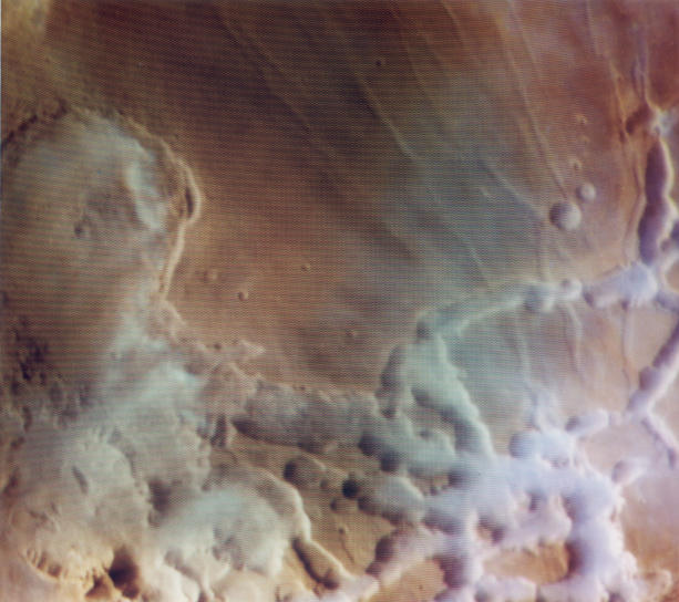 Clouds Above Canyons
|
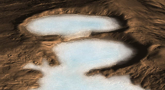
Glaciers on Mars
Huge glaciers up to half a mile thick which lie close to the equator of Mars
are thought to be the remnants of an ice age on Mars.
It is thought that the glaciers formed up to 100 million
years ago and represent evidence of climate change on Mars.
Hundreds of glaciers have been identified by researchers using
ground-penetrating radar which allows them to see through the
rocky layers of debris covering the ice. The largest glacier
is 13 miles long and more than 60 miles wide. It could be a
source of water for astronauts on Mars. When the glaciers
formed, Mars' climate was much colder because the angle Mars' spin axis
makes with its orbital axis was much greater than it is now (see
Milankovitch cycles). This allowed
ice sheets to extend far beyond the polar regions and towards,
possibly even reaching, the Equator.
|
There is also a permafrost layer on Mars today as
implied by
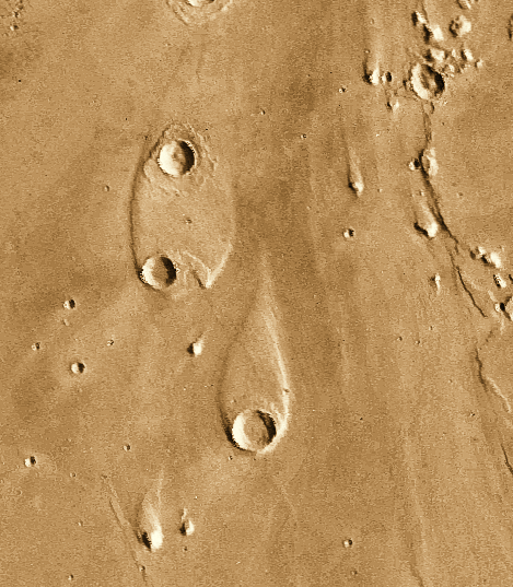
Outflow
Channels (large channels which can be up to 100 kilometers and
thousands of kilometers long--likely formed by catastrophic flooding),
"Islands", and
Splosh Craters (oozing mud formed by impacts which melted
the permafrost layer).
The outflow channels and islands were produced by massive floods on
Mars. Presumably what happened was that some event (possibly the impact
of a large object) caused a
rapid, large-scale melting of the permafrost layer which caused floods.
There is ample evidence that water exists on Mars much of it
below the surface which can be
melted and lead to transient flows.
The question of how much water is left on Mars?
is still open, however. Has most of it been stripped,
as is thought for the CO2,
or is most of it tied up in ice and/or the crust?
The question can be answered by the
deuterium-to-hydrogen ratio (D/H), as was done for Venus.
On Mars, the (D/H) ratio is around 5 times larger than
that found on Earth; on Venus
the (D/H) ratio is 120 times larger than that found on Earth. The large
(D/H) ratio on Venus suggests Venus has lost more than 99.9 % of its water.
On Mars, the (D/H) ratio is smaller and suggests that Mars has
lost less water, but still, Mars has lost
more than three-quarters of its water. A lot
has been lost, but there still is likely to be a lot of water
left to tap on Mars.
III. IS THERE EVIDENCE FOR A MORE HOSPITABLE CLIMATE IN THE PAST?
There was indeed evidence that in the past
water existed in liquid form
on the surface of Mars under quiescent conditions, even before the current
generation of Martian landers, rovers, and helicopters. There were thus
strong hints that grossly different atmospheric
conditions on existed on Mars in the past than currently exist
width=700 and thus hope that life had existed on Mars in the past.
This picture has been sharpened many-fold in the last twenty years
with our current landers and rovers.
|
|
|
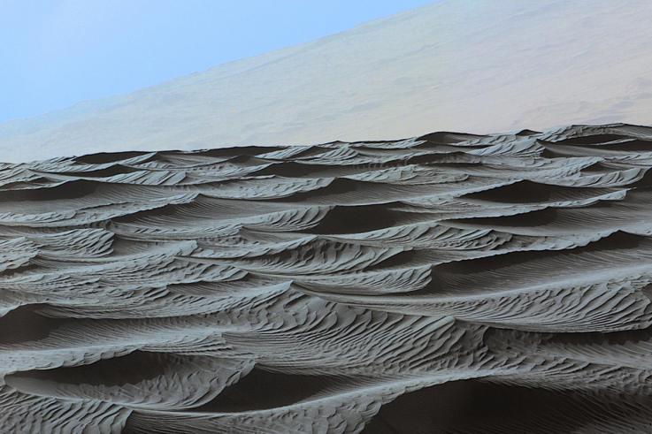
Sand Dunes
These no-drag ripples
change in size depending on the density of the medium moving the grains.
That medium is Mars's atmosphere.
By studying wind-drag ripples preserved in Martian sandstone,
scientists have found evidence that the planet lost most of its
atmosphere early in its history.
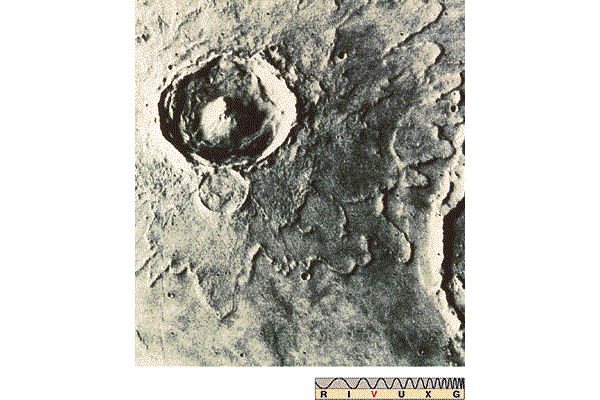
"Mesas, Buttes"
Formed over millions of years due to weathering and erosion, buttes tend
to be tall, flat-topped, and steep-sided, and appear to form from larger
mesas or plateaus.
Found on Earth as well, the only real difference between a mesa and a
butte is the size, a butte is taller than it is wide, while a mesa is
a much larger, slightly less elevated feature.
The buttes and mesas rising above the surface in the Murray Buttes region
are thought to be the eroded remains of ancient Martian sandstone.
|
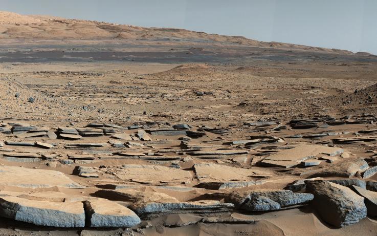
Dried Lake Beds
A view from the "Kimberley" formation on Mars. The strata in the foreground
dip towards the base of Mount Sharp, a mountain that formed in the
middle of Gale crater. This is the ancient depression that
existed before the larger bulk of the mountain formed.
A series of long-lived streams and lakes existed at some point between about
3.8 to 3.3 billion years ago, delivering sediment that slowly built up the
lower layers of Mount Sharp.
|
|
|
|
|
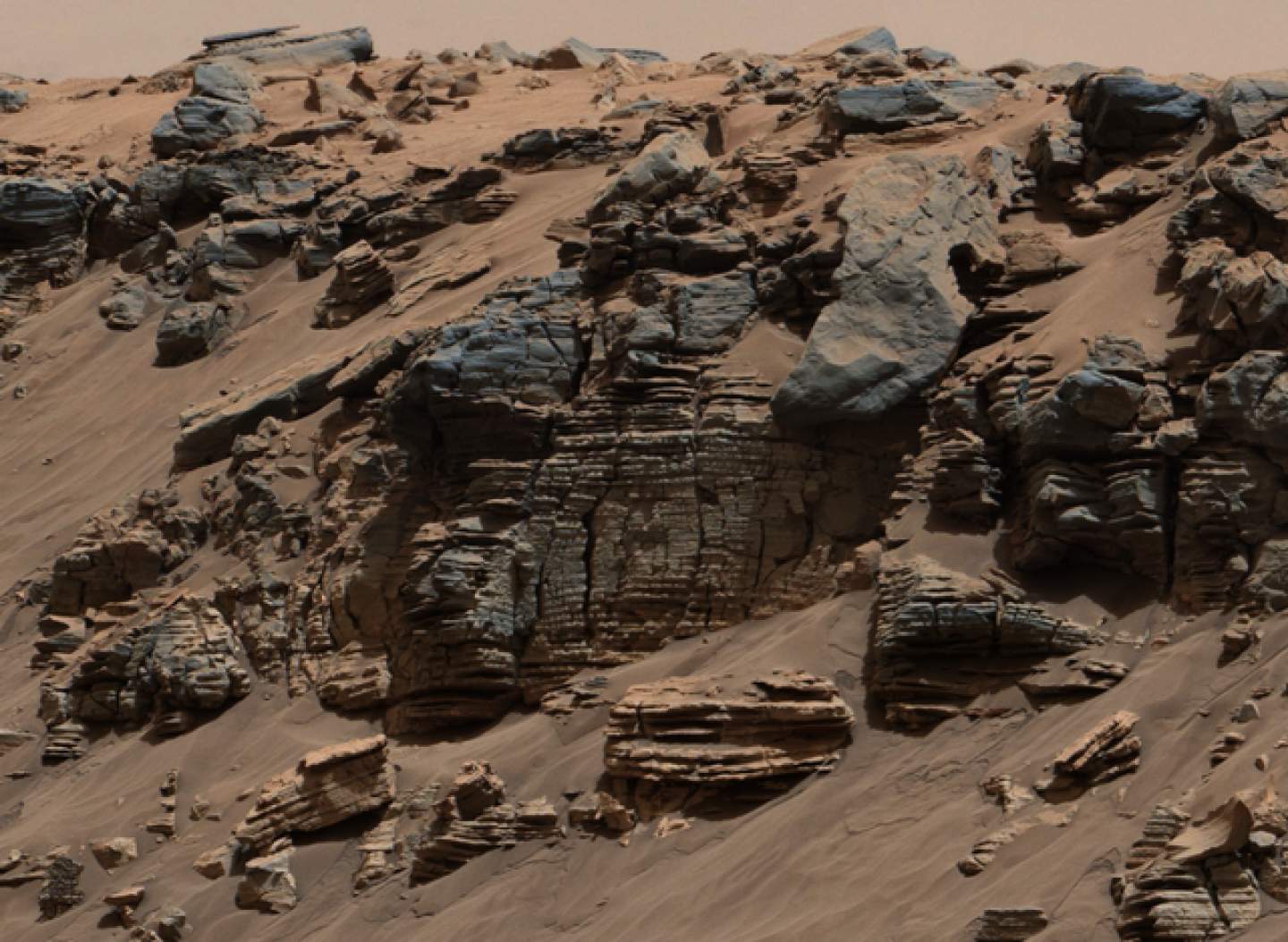
Sedimentary Rock
A sedimenary layer one meter in thickness suggests a lake that lasted for
hundreds or thousands of years. The pictured sedimentary
rock are up to 75 meters in thickness. These thicker sediment deposits
indicate for much longer times, tens of thousands of years (if not
millions of years).
The lowest layer of sedimentary rock (the oldest layer) are sandstone with
embedded pebbles up to nerly 1 inch across. The pebbles have varying degrees
of smoothness. The pebbles are consistent with an origin in the walls of the
crater dozens of kilometers away, a distance too far to have been carried by
wind. They indicate a streamflow. On top of the bottom is a thicker layer of
sandstone. The layer is not sloped, as is the lowest layer that
followed the streambed. The layer is flat as would happen if it was
deposited on the bottom of a lake.
|
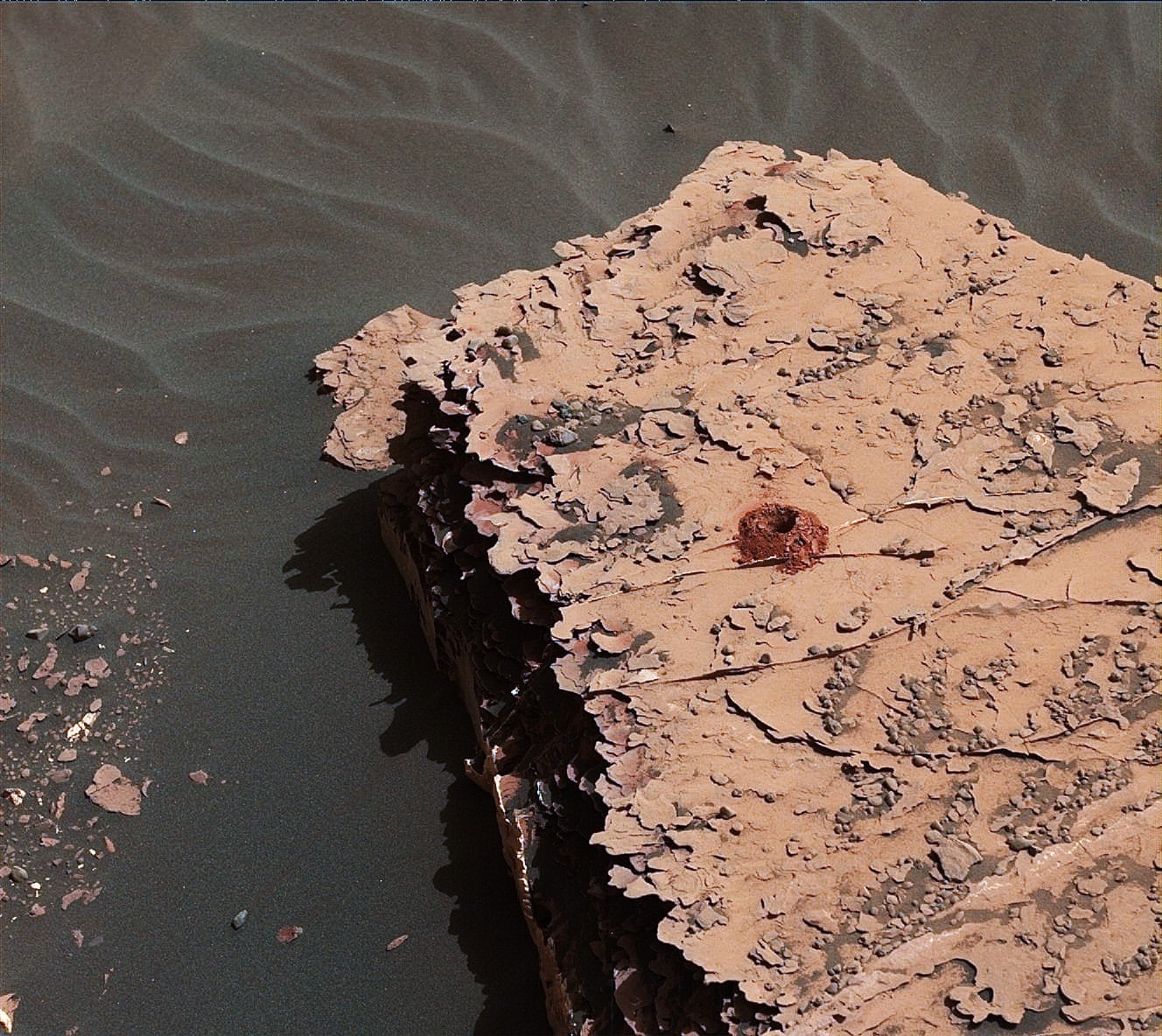
sample hole
A small hole on Mars represented a big achievement for Curiosity.
The hole is about 1.6 centimetres across.
|
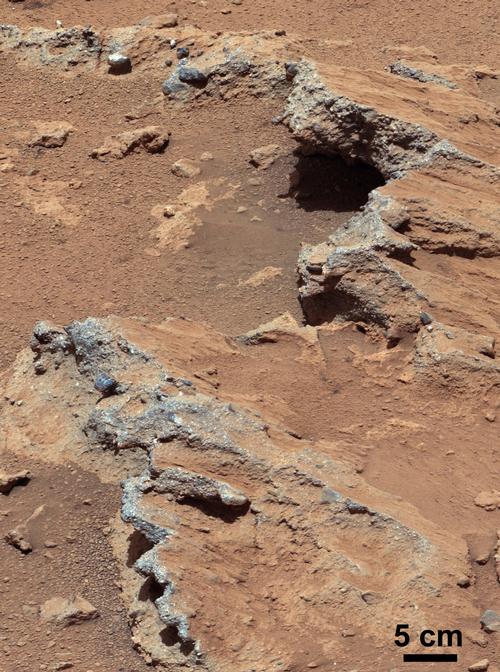
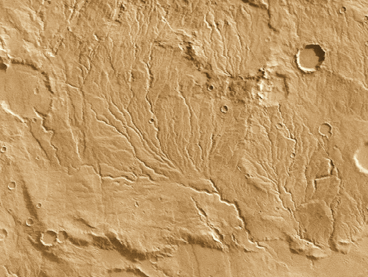
Streambed
Analysis reveals pebble-containing slabs in an ancient streambed.
The rocks are the first ever found on Mars that contain streambed
gravels. The sizes and shapes of the gravels embedded in these
conglomerate rocks -- from the size of sand particles to the
size of golf balls -- enabled researchers to calculate the depth
and speed of the water that once flowed at this location,
the stream was flowing at a speed equivalent to a walking
pace -- a meter per second -- and it was ankle-deep to hip-deep.
|
IV. InSight
 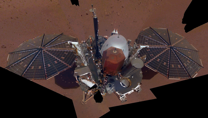

|
InSight:
Listening to a Meteoroid
Major Results from InSight
InSight detected more than 1,300 seismic events; 50 were strong enough for
study. The best data came from Cerberus Fosse, a region of recent geologic
activity (within 2 million years ago). The signals lasted 6 hours with
reverberations traveling through Mars several times. InSight found
- the major layers of Mars, the core, mantle, and crust--the crust was
thinner under InSight 25 to 40 kilometers, Mars's core was less dense,
molten and
larger than expected,
about 1,800 kilometers in radius roughly half the size of the Earth's
core. The lower density meant that Mars had
lighter elements than iron mixed in with its core which is why it could be
molten at lower temperatures.
- the lithosphere was thick, about 500 kilometers. On Earth,
the average thickness of the lithosphere is about 100 kilometers--note
that the oceanic crust is thinner than the continental crust.
- InSight found evidence that Mars had a magnetic field when younger.
Currently, Mars has no magnetic field, but there is evidence in the rocks
that Mars had a magnetic field just after its birth but that it disappeared
after a few hundred million years.
|
IV. NEXT STEPS
V. PAST SEARCHES FOR MARTIAN LIFE


