MARS

When considering the surfaces of planets, one is naturally
led to consider analogues of the oceanic and continental regions of the
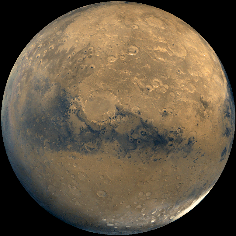
Earth. In this spirit, the surface of Mars can be divided up into
two types of
terrain:
- Rough, cratered terrain (which superficially resemble the
lunar highlands) which covers most of the southern hemisphere
and on average, is greater than 3 km above sea level. The
cratered regions are thought to be on the order of 3.9 billion years
old.
- Plains (sites of extensive lava flows) dominate the northern
hemisphere and which typically lie below sea level. On the plains
the densities of large craters are 10 - 100 times lower than in the southern
hemisphere.The plains are thought to be on the order of 3 billion years old.
The transition between the northern and southern hemispheres can be
abrupt with elevation changes of 4 km occuring over the span of a few hundred
kilometers.
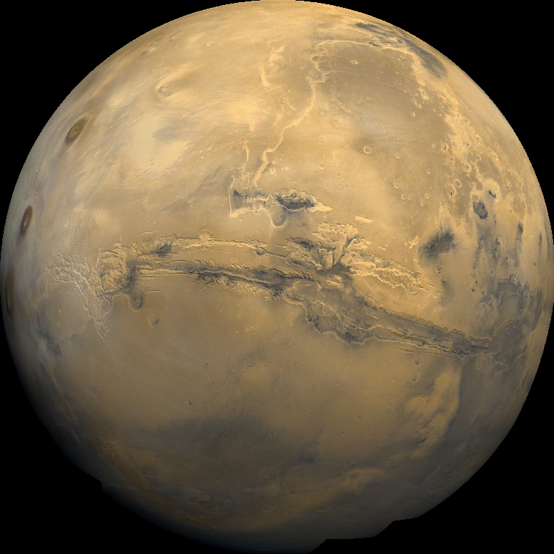
An interesting region which straddles the two zones is the
Tharsis Bulge. The Tharsis Bulge was volcanically active, is roughly
the size of North America, and rises to a height of about 10 km above sea
level.
The Tharsis Bulge is the least cratered and so is the youngest
part of the planet's surface. Tharsis probably started to form
~3.9 billion years ago, but has been active until fairly recently.
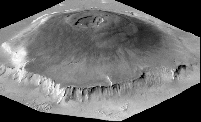
Near the top of the Tharsis Bulge, there
are three great shield volcanoes, each rising 18 km to summits at
elevations of 27 km with bases on size 400 kilometers.
An even larger volcano,
Olympus Mons
rises 25
km above the northwestern slope of Tharsis to reach the same
height as
the Tharsis volcanoes of 27 km above sea level.
Olympus Mons
is nearly 700 km across its base, roughly the size of France and may have
been active as recently as 100 - 300 million years ago. Note
that:
- the
tallest Hawaiian island is only 100 km across its base and is around 9 km
high.
If all of the Tharsis volcanoes are shield volcanoes, then
this suggests that at the time the volcanoes formed there
was not large scale plate tectonic activity going on.
- the slopes of the volcanoes are not heavily cratered indicating
that the volcanoes were active within the last few hundred million years
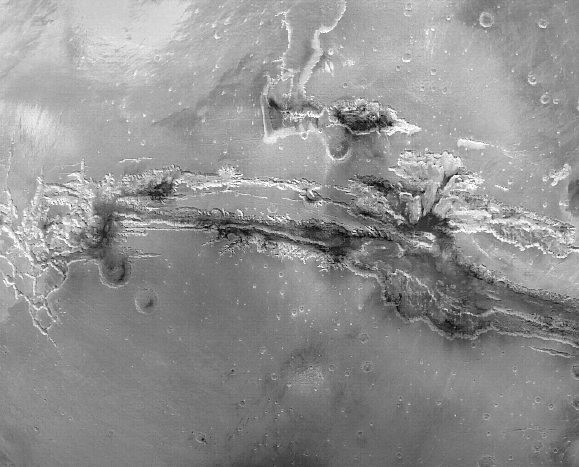
Near the Tharsis Bulge is
Valles Marineris,
part of an interconnected system of east-west running canyons
approximately 4,000 km long. The individual canyons are 3 km deep, but
in the center of the canyon, the depression is nearly 7 km and more than 500
km wide.
The Grand Canyon would fit easily into one of the tributaries of
the Valles Marineris.
These features likely started to formed around 3.5 - 3.9
billion
years ago!
The Tharsis Bulge was thought to have
formed through an uplift (vertical rise) of the crust of Mars. The
Valles Marineris was also probably due to some sort of crust
cracking driven by crustal motion. It
was not cut by flowing water (as was the Grand
Canyon).
There is ample evidence of geological activity on Mars, however,
there is no clear evidence of plate tectonics as found on the Earth.