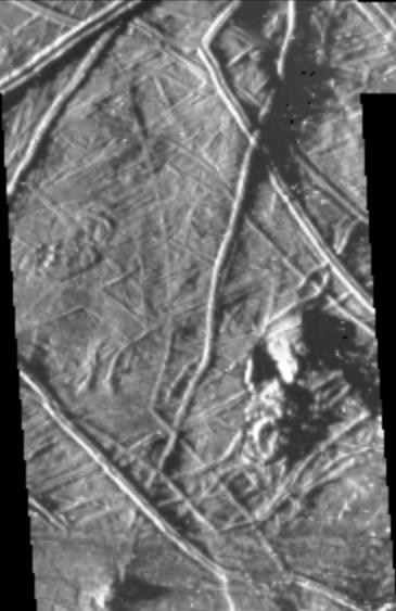
This image of Europa was taken by the Galileo spacecraft under "low-sun" illumination--the equivalent of taking a picture from a high altitude at sunrise or sunset. Note that in this image the topography of the terrain is emphasized. Planetary geologists use information from images acquired under a variety of lighting conditions to identify different types of structures and interpret how they formed. For example, the length of the shadow cast by a feature (e.g. a ridge or knob) is indicative of that feature's height. In this recent image, ridges and irregularly shaped knobs ranging in size from 5 kilometers across down to the limit of resolution (0.44 kilometers/pixel) can be seen. Measurements from shadow lengths indicate that features in this image range from tens of meters up to approximately one hundred meters in height.