Module Number: EU17
Module Name: Spain
Date:
Introduction
text box While Spain today is a unified, single political entity, history did not always indicate that this would come to be. From pre-Roman times to the Christian Reconquista, the Iberian peninsula has consisted of numerous distinctive regions throughout the centuries. Even today, Spain consists of 18 distinct regions, each with its own Parliament and often its own distinct language. Today's region-specific dialects, flags, and vocabularies emphasize the distinctiveness of each area. They are clear evidence that what today is simply known as "Spain" has for many more years been a group of distinct cultural and political entities that only formed a single nation after centuries of fragmentation.
|
|---|
Instructions to artist (including "legend / key") Label major rivers: the Tagus, Guadalquivir, Ebro, Duero.
Label translucent characters the Sierra Nevada, Sierra Morena, Pyrenees, Balearic Islands, Gibraltar.
Section 1
Title: Natural Resources of the Iberian Peninsula
Frame 1:
Caption: Natural Resources of the Iberian Peninsula
Use map inventory numbers: Natural resources of Spain, Portugal
Include: gold (Au), silver (Ag), copper (Cu), cement (Cem), iron and steel (Fe), lead (Pb), marble (Marb), tin (Sn), and zinc (Zn). Let the names of the tribes become translucent. Shade in Carthaginians in green, Greeks in blue, Romans in red. Refer to colonization map for those areas.
Also, please use the relevant material from the Natural Resources Map at http://mappinghistory.uoregon.edu/english/EU/EU05-02.html. In addition, if it would be possible, please create an icon for honey and fish sauce. Honey was located in Baetica, in the south of Spain. Fish sauce was created in modern-day Malaga, also in southern Spain.
The natural resources of Spain were considerable and indeed in some periods fell into the realm of being fabulous. Unlike other Mediterranean countries, Spain was a particularly rich source of minerals, including gold, silver, lead, and copper. These resources formed the basis of prosperity for natives and were eagerly sought by outsiders.
|
|---|
Section 2
Title: Ancient Iberia
Frame 1:
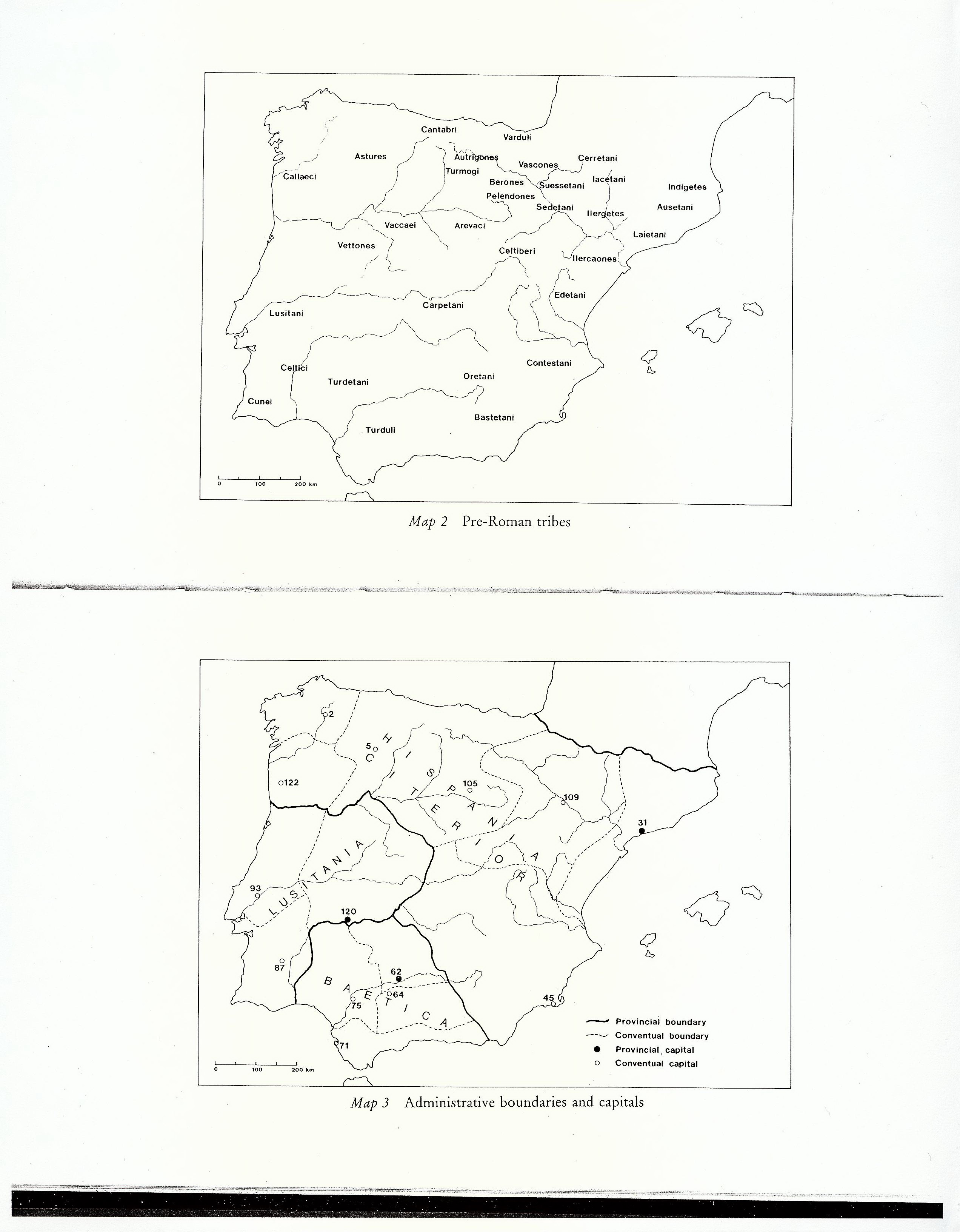
Caption: "Ancient Iberia" applies to both
Use map inventory numbers: Pre-Roman tribes
Notes to artist: If the names of the indigenous tribes create too much clutter in northern Spain, let us know and we will edit the list down. For background use standard beige and do not mark any borders.
When the Romans arrived on the northeast coast of the Iberian Peninsula in the mid-third century BC, they found considerable linguistic and cultural diversity. Keltic and Iberian groups were scattered throughout; the Phoenicians favored the coastal areas in the south. We cannot speak of any common language or culture in this period.
|
|---|
Frame 2:
Caption:
Use map inventory numbers: Roman provinces
After defeating Carthage in the Second Punic War in 202 BC, the Romans began to extend their control into the interior of the Iberian Peninsula. In 27 BCE the Roman Emperor Augustus divided the peninsula into three provinces: Hispania Baetica, Hispania Taraconensis, and Lusitania. The Romans brought Latin, the foundation of the Spanish language. The three provinces provided the Roman Empire with valuable exports, including olive oil, metal, and wine. By 80 AD a significant number of communities enjoyed the benefits of Roman citizenship.
|
|---|
Section 3:
Title: Germanic Invasions
Frame 1:
Caption: Barbarian Invasions
Use map inventory numbers: Invasions
On this map, block out western Europe and the western parts of North Africa up through the southern part of England to the north, and the Rhine to the East. Include Italy to the South. Create layers that correspond to the times of the invasions marked on the map. A word of caution: the colors on this invasion map need to be different from the Roman/Carthaginian/Greek colors used before. Exclude the Huns but allow one frame each for the other groups. Recall we marked the Visigoths in variants of blue to distinguish the two periods of movement. That should still work here. This is a button map, and identify one button each for "Alans and Vandals", "Suebi", and "Visigoths".
After more than five centuries of Roman rule, the early fifth century CE saw great migrations of Germanic peoples, including the Alans (an Iranian group), Suebi, Vandals, and Visigoths to Iberia. These invasions marked the end of Roman rule in the Iberian Peninsula and the establishment of barbarian kingdoms. There followed a major decline in the quality of urban life.
|
|---|
Section 4: Visigothic Spain. This section consists of three frames, illustrating the changing control that the Visigoths exercised over significant portions of the Iberian Peninsula. Use a timeline, not buttons.
Title: Visigothic control
Frame 1:
Caption: "The Iberian Peninsula under the Visigoths" applies to all frames
Use map inventory numbers: Visigoth control
Please include both the yellow and lined-yellow portions of this map, but as blue.
The Visigoths established control of the peninsula by AD 456. The Visigothic administration continued to use many aspects of Roman life, including aqueducts, bridges, and roads, but none of them were maintained at earlier levels. The Visigoths ruled for nearly three centuries.
|
|---|
Frame 2:
Caption:
Use map inventory numbers: Visigoths lose some land
Remove the areas that are represented by diagonal lines. Rome is red.
By AD 560, the Roman Emperor Justinian had reclaimed some areas in southern Iberia. The majority of the Peninsula remained under Visigothic control.
|
|---|
Frame 3:
Caption:
Use map inventory numbers: Visigoth control
Please include the area conquered by 600, also as blue.
By AD 600, Visigothic control expanded to include again most of the Iberian Peninsula except for marginal areas in the southern coast.
|
|---|
Section 5:
Title: Islamic Spain
Frame 1: Phase 1
Caption: "Islamic Spain" for all
Use map inventory numbers: Muslims arrive
Buttons for the dates 711, 714, 721, and 732 and label buttons as per map. Caution: note that Islamic control does not extend to all of Iberian Peninsula as the base map here correctly notes. Use a green for Muslims, but a different green from the ones used used for Carthaginians before. Are there enough shades of green for adequate contrast?
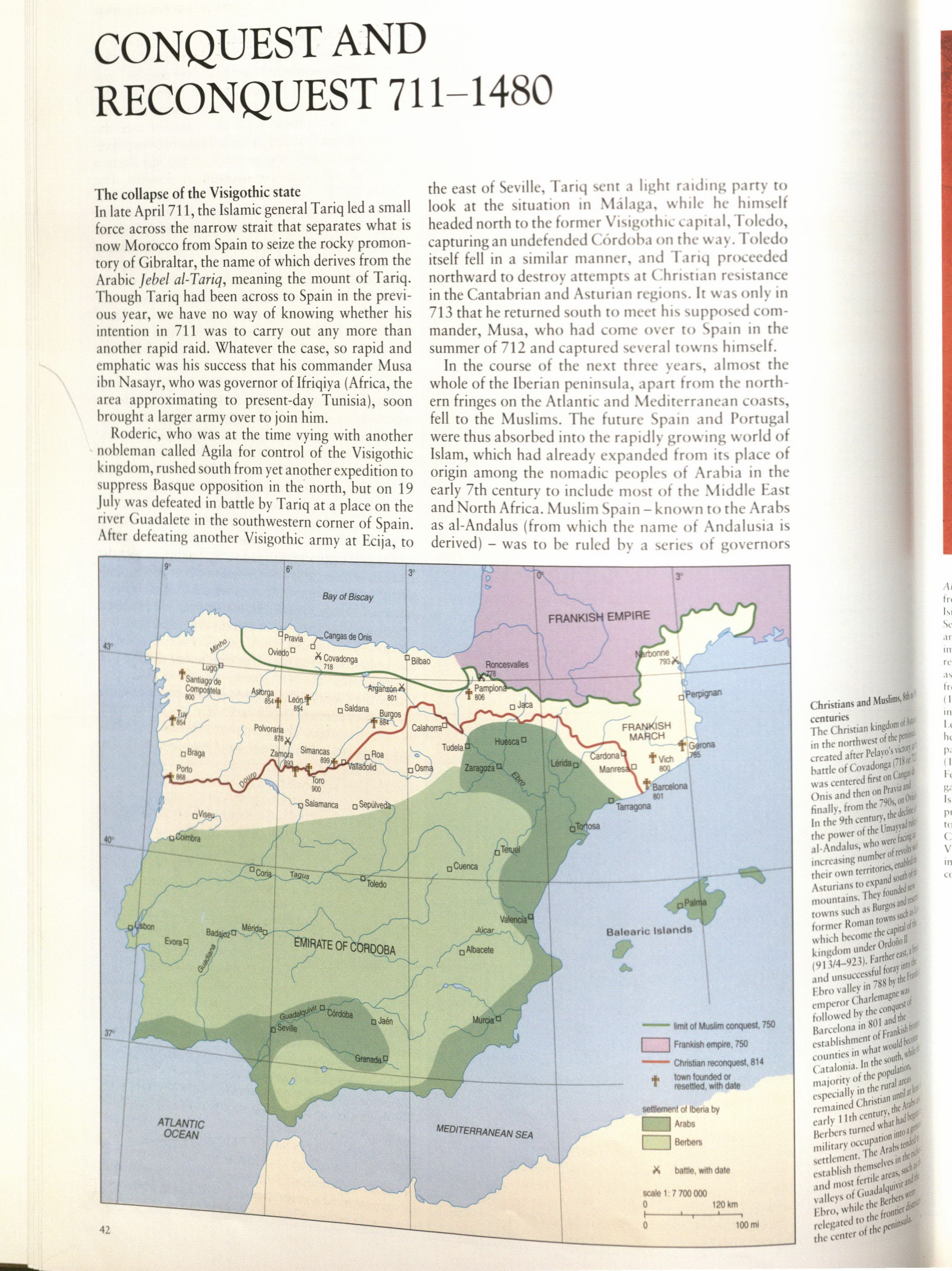
In AD 711, a mix of Arab and Berber forces crossed the Straits of Gibraltar from northern Africa and overthrew the Visigothic kingdom.
|
|---|
Frame 2:
Caption:
Use map inventory numbers: Muslim control
Please show Muslim control as a shade of green, but no need to distinguish two different shades of green as shown in this map.
By AD 721 the Muslim invaders dominated most of the peninsula. The Muslim-controlled area of Iberia was known as Al-Andalus, and for four centuries it covered most of the peninsula. Only small Christian kingdoms remained in the North. The Muslims brought great advancements in agriculture, architecture, science, and mathematics to the peninsula.
|
|---|
Frame 3:
Caption:
Use map inventory numbers: Taifas
The taifas can be represented, as in the model map, as various shades of green. For Christian Spain we will want a variant of red, but not the same as Roman red.
By AD 1010 Al-Andalus was divided by civil war, fragmenting into smaller political units, known as the "taifa" kingdoms. A separate leader ruled each taifa, and boundaries were flexible and changed often.
|
|---|
Section 6:
Title: Reconquista
Frame 1: Phase 1
Caption: "Reconquista" for all frames
Use map inventory numbers: Christian kingdoms
The taifas can be represented, as in the model map, as various shades of green. The shades of green are only to mark particular political divisions and otherwise have no significance. The Christian kingdoms can be various shades of red.
As Al-Andalus was fragmenting, the Christians in the North began efforts to re-conquer their land from the Muslims. This effort was known as the "Reconquista." Existing kingdoms grew larger and new kingdoms formed as well. Each Christian kingdom had separate laws, customs, and languages.
|
|---|
Frame 2:
Caption:
Use map inventory numbers: Portugal
Portugal can be okra.
In 1128 CE, the kingdom of Portugal was established. Portugal has remained a separate political identity from Spain ever since.
|
|---|
Frame 4:
Caption:
Use map inventory numbers: Aragon
Please use the map in the bottom-left for this map, with different colors representing the Christian kingdoms and a single green for the Mulim-controlled areas.
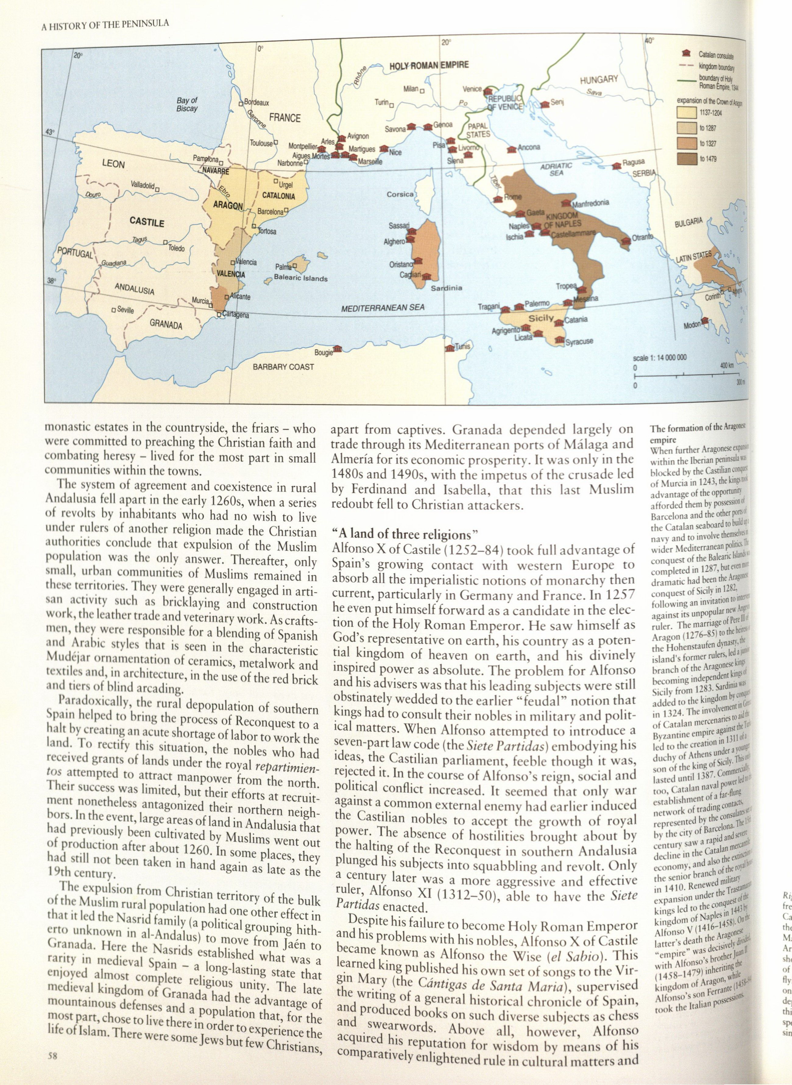
By AD 1150, Christian control of the Iberian Peninsula had expanded further south. The kingdoms of Aragon and Cataluyna (Catalonia) had united to form the larger kingdom of Aragon.
|
|---|
Frame 5:
Caption:
Use map inventory numbers: Castile-Leon
Please use the bottom-right map, but with Castile and Leon shown as the same shade of red. The others kingdoms can still be different shades of red.
In AD 1230, Castile and Leon united under Fernando III to form the largest and most powerful Iberian kingdom. Thereafter followed centuries of relatively unchanging borders.
|
|---|
Frame 6:
Caption:
Use map inventory numbers: Fernando and Isabella
Please show a single red color for the entire peninsula, with the exception of Granada, which should be green. Borders can remain, but the entire map can be red to represent Christian unity. Keep Portugal independent.
In AD 1469 the heir to the Argonese throne, Fernando, married the heiress to the Castilian throne, Isabella. This “union” left the majority of the peninsula united, with the exception of the only remaining Muslim holding, Granada.
|
|---|
Frame 7:
Caption:
Use map inventory numbers: United Spain
Spain will be red and Portugal will be okra.
In 1492 CE Castile-Leon captured Granada, bringing an end to the “Reconquista” and completing the re-conquest of the Iberian Peninsula.
|
|---|