Module Number: EU20
Module Name: France
Date:
Introduction
The Old Order in France collapsed in 1789. The French Revolution marked the end of the monarchy and resulted in the creation of the first French Republic. The effects of the Revolution led to turmoil throughout France, turmoil that was not brought under control until Napoleon seized power and began a systematic attempt to expand French control throughout western Europe. In 1814, Napoleon was defeated and the national borders of Europe and France received a new and more enduring definition at the Congress of Vienna.
|
|---|
Instructions to artist (including "legend / key")
These are the features I would like to be present on every map. The text should be well-defined and bolded for the first maps and then become translucent for the rest of the maps (the cities are a possibel exception).
1. Cities: Paris, Marseille, Lyon, Toulouse, Nice. Are there any cities that appear more than once that should be added?
2. Mountains: the Alps (Jura) are located along the Southeastern border, the western part of the great alpine chain, the Pyrenees are located along the southwestern border, and forms a natural border between France and Spain, the Vosges in eastern France.
3. Rivers: The Rhône (rises in Switzerland, runs West to Lyon and goes South to its delta at Marseille into the Mediterannean), the Garonne (rises in the Pyrenees, flows to the Atlantic through Toulouse and Bordeaux), the Loire (France's longest river, rises in the Massif Central, runs north and then west through Orléans, Tours and Nantes into the Atlantic), the Seine (runs northwest through Paris, into the English Channel), the Rhine (does not flow through France but forms part of the Franco-German border)
Colors: France (blue), England (red), Spain (yellow), Italy (green), Germany (DARK GRAY).
Section 1:
Title: Revolutionary France
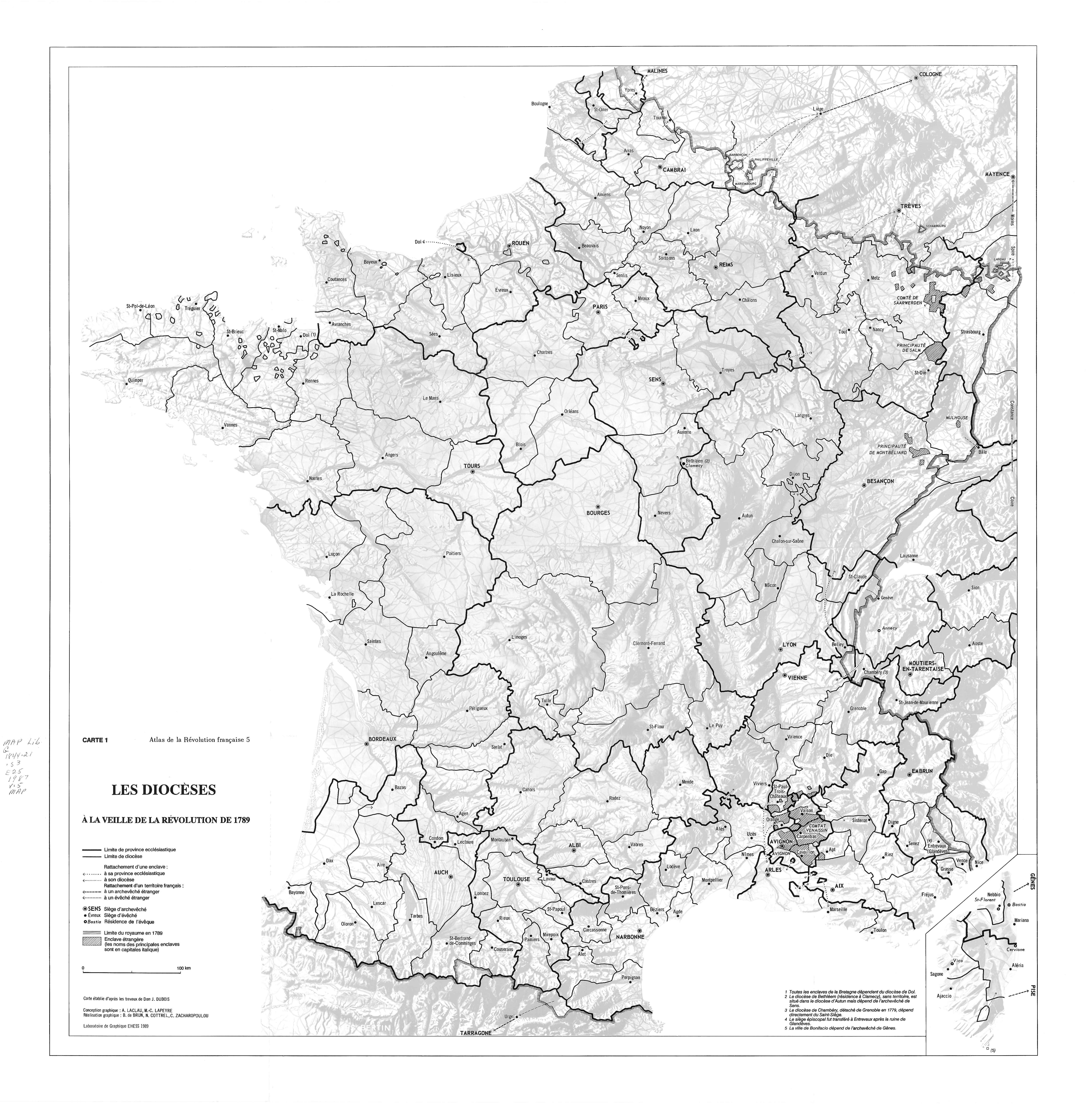
Frame 1: Religion
Caption: Nationalization of Church Lands
Use map inventory numbers: EU20_12, EU20_24
When France was on the cusp of a revolution, religion proved to still be a major source of conflict. In November 1789, the Civil Constitution of the Clergy introduced an ecclesiastical reorganization which nationalized church lands. It divided French priests and believers, (that sketched out) |
|---|
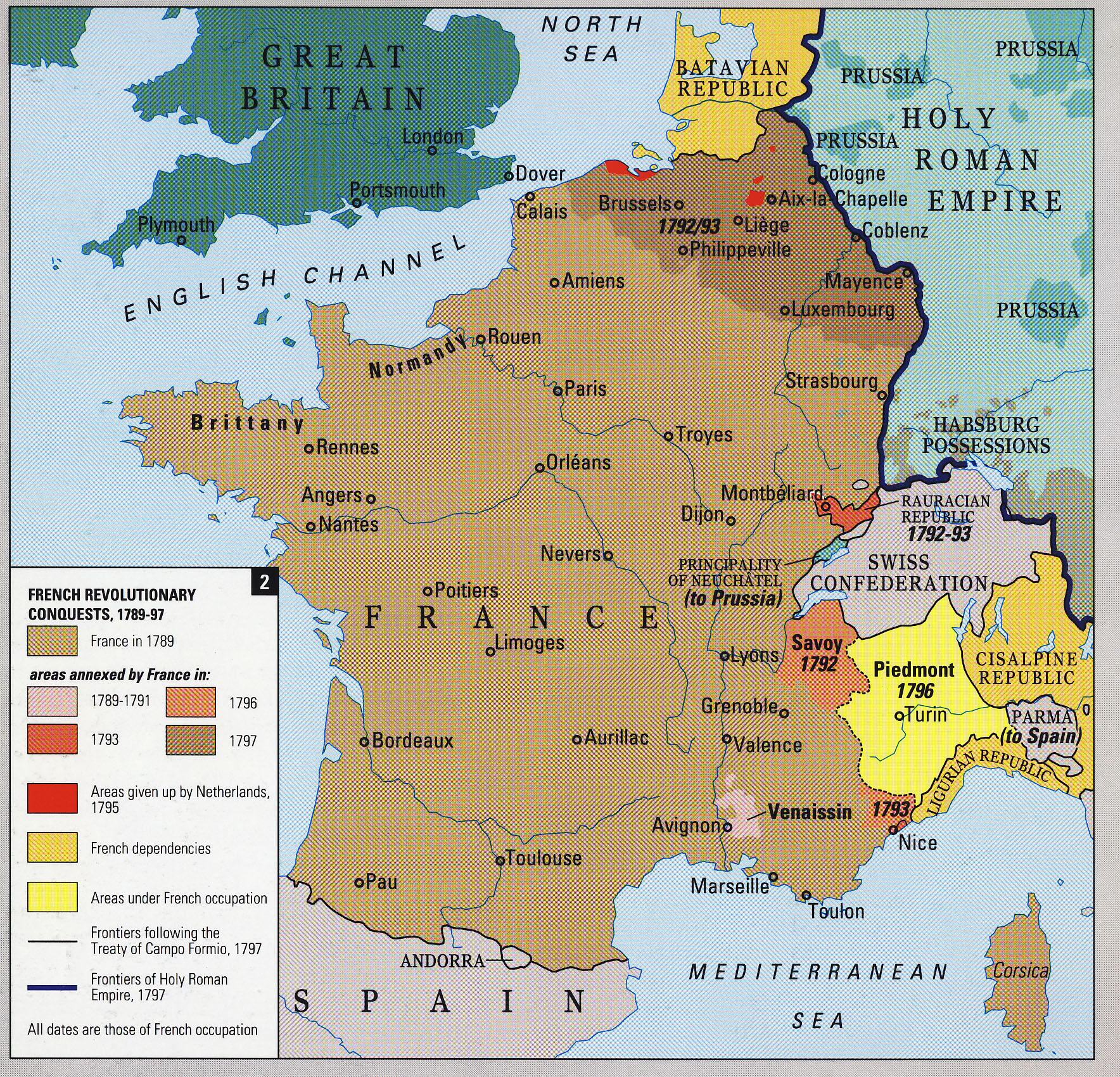
Frame 2: Expansion
Caption: Border Changes During the French Revolution
Use map inventory numbers: EU20_12, EU20_93
The Committee of Public Safety formed in April 1793 and cleared French soil of foreign armies by mid-1794 which allowed French power to spread. France annexed new territories in Southeastern France and occupied other regions in the same area. It also set up puppet regimes in neighboring states, and by the late 1790s France had become "La Grande Nation". |
|---|
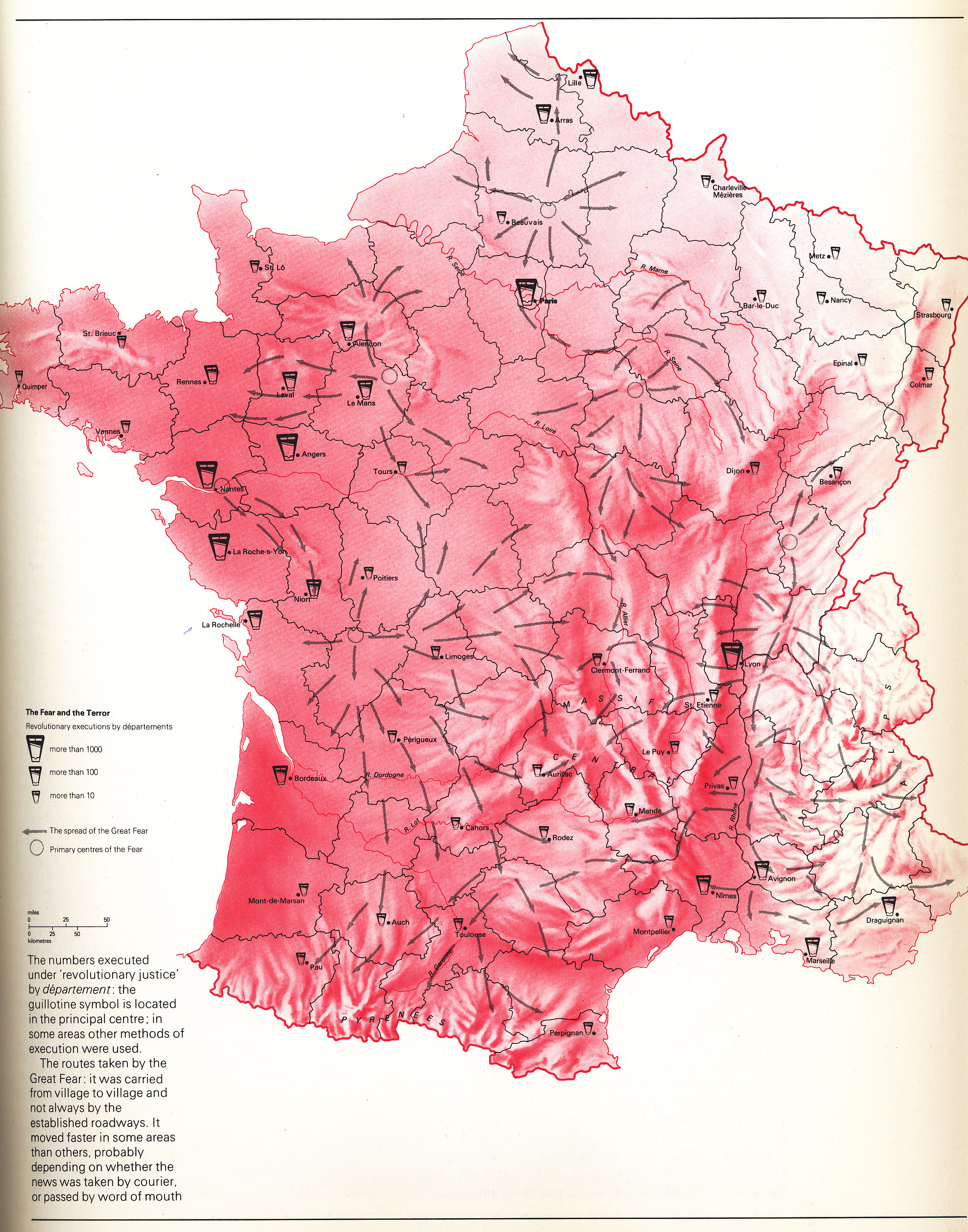
Frame 3: The Terror
Caption: Executions Throughout Revolutionary France
Use map inventory numbers: EU20_99
The guillotine was introduced as a more humane way of execution during the French Revolution. It was used throughout France as the most common way of executing those condemned during the Reign of Terror between 1792 and 1794. The city of Paris had the most executions, |
|---|
Section 2:
Title: Napoleonic Europe
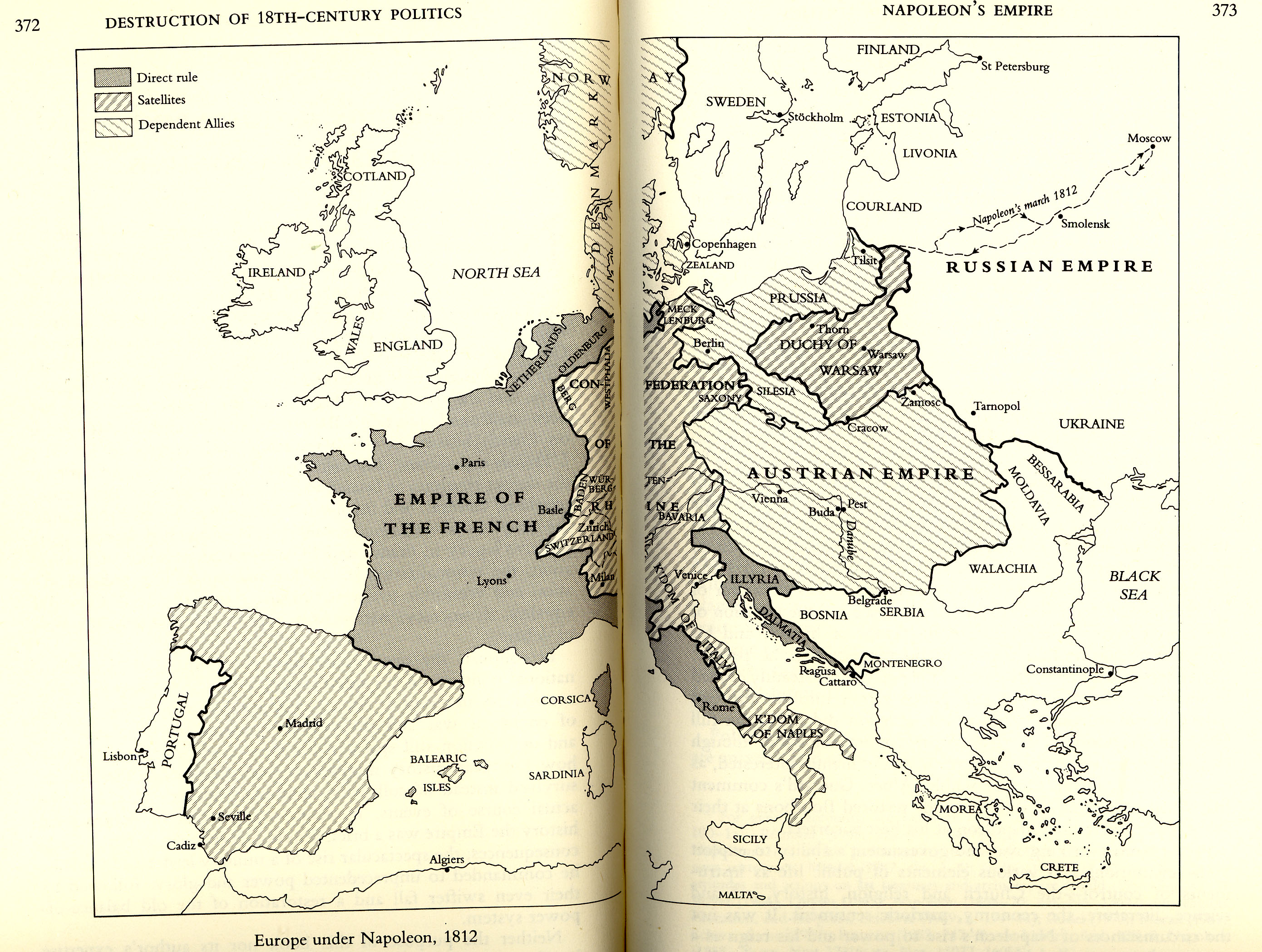
Frame 1: Napoleon's Beginnings
Caption: Napoleon as Emperor of France
Use map inventory numbers: EU20_15 EU20_23 EU20_97
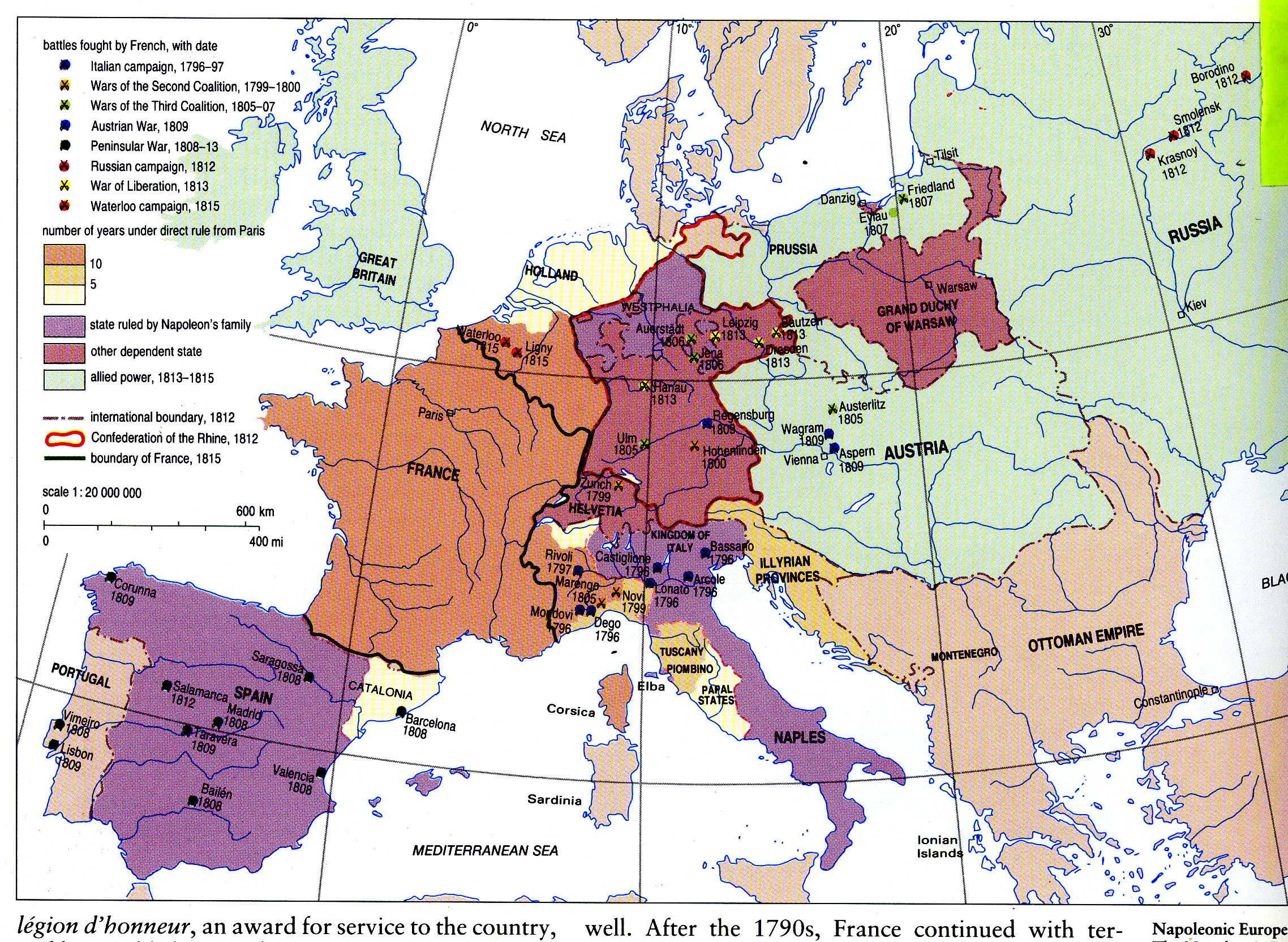
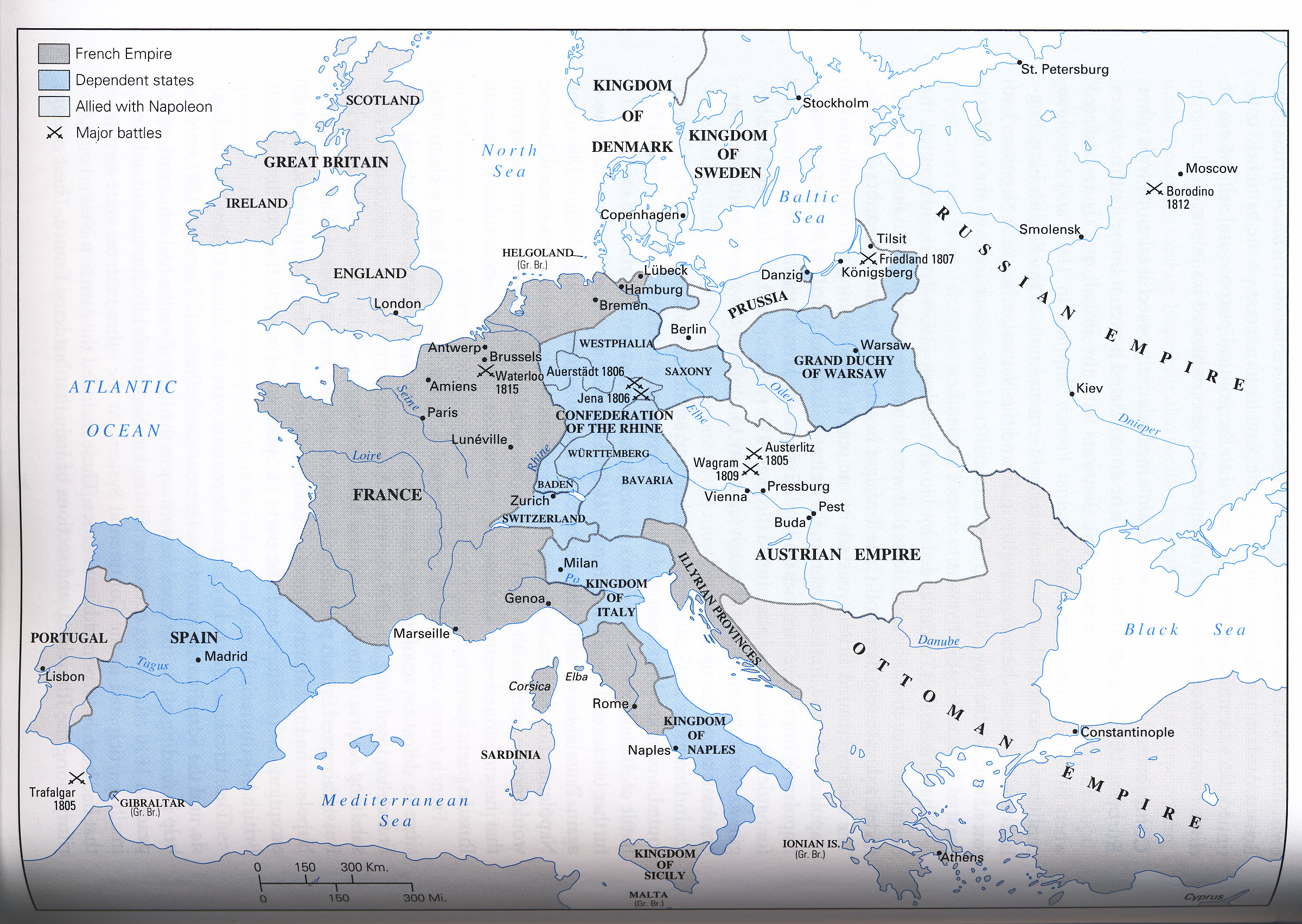
In 1804, Napoleon deemed (deemed or declared) himself Emperor of France. He rapidly began French expansion by conquering most of central Europe. Direct rule over his Empire extended along the Eastern coast of Italy |
|---|
Frame 2: The French Empire
Caption: Dependant States of the Empire
Use map inventory numbers: EU20_15 EU20_97
Napoleon's gains were divided into the French Empire (divided into the empire? Aren't they simply apart of the empire?). Dependant states, such as Northern Italy, were ruled by appointed members of the Bonaparte family. Not too soon after, he formed the Grande Duchy of Warsaw and placed it under the rule of one of his vassals, the German king of Saxony. His final designation to one of his foreign satellites was the appointment of his brother Joseph as king of Spain in 1808, who was later deposed in 1813. |
|---|
Frame 3: The Confederation of the Rhine
Caption: Napoleon's Unique Dependent Satellite
Use map inventory numbers: EU20_16 EU20_97
Western German States of the Holy Roman Empire allied with France against Austria. Napoleon organized them into the Confederation fo the Rhine, a loose association of roughly sixteen German states. He appointed himself as "Protector", unlike the rest of his dependent satellites which he appointed rulers to. |
|---|
Frame 4: Congress of Vienna
Caption: The Dissolution of Napoleonic Europe
Use map inventory numbers: EU20_14 EU20_92
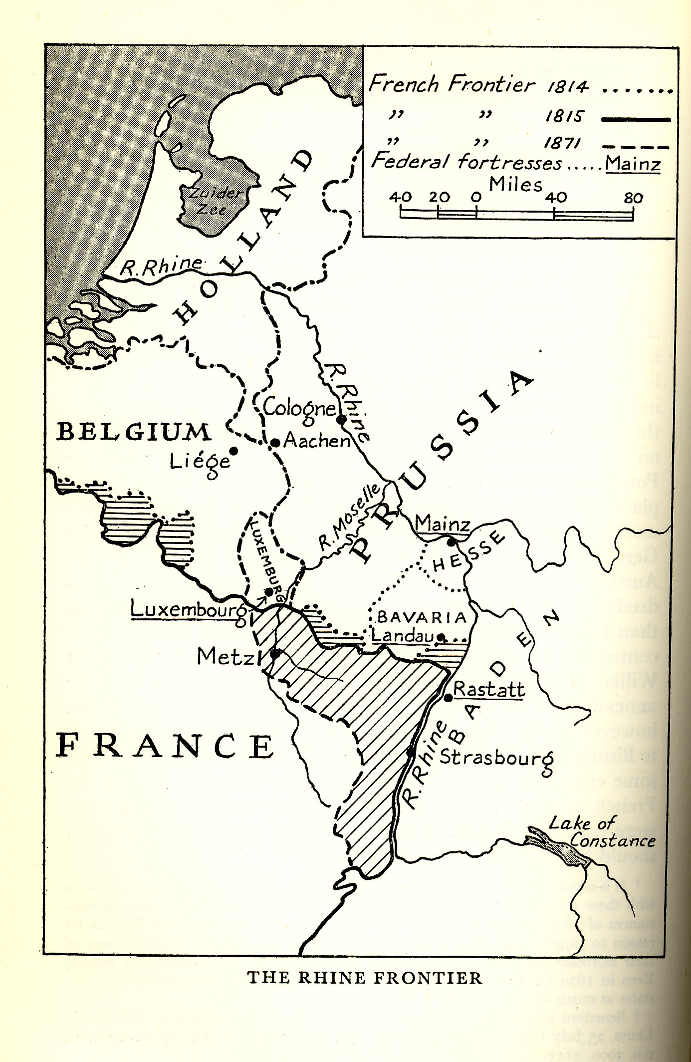
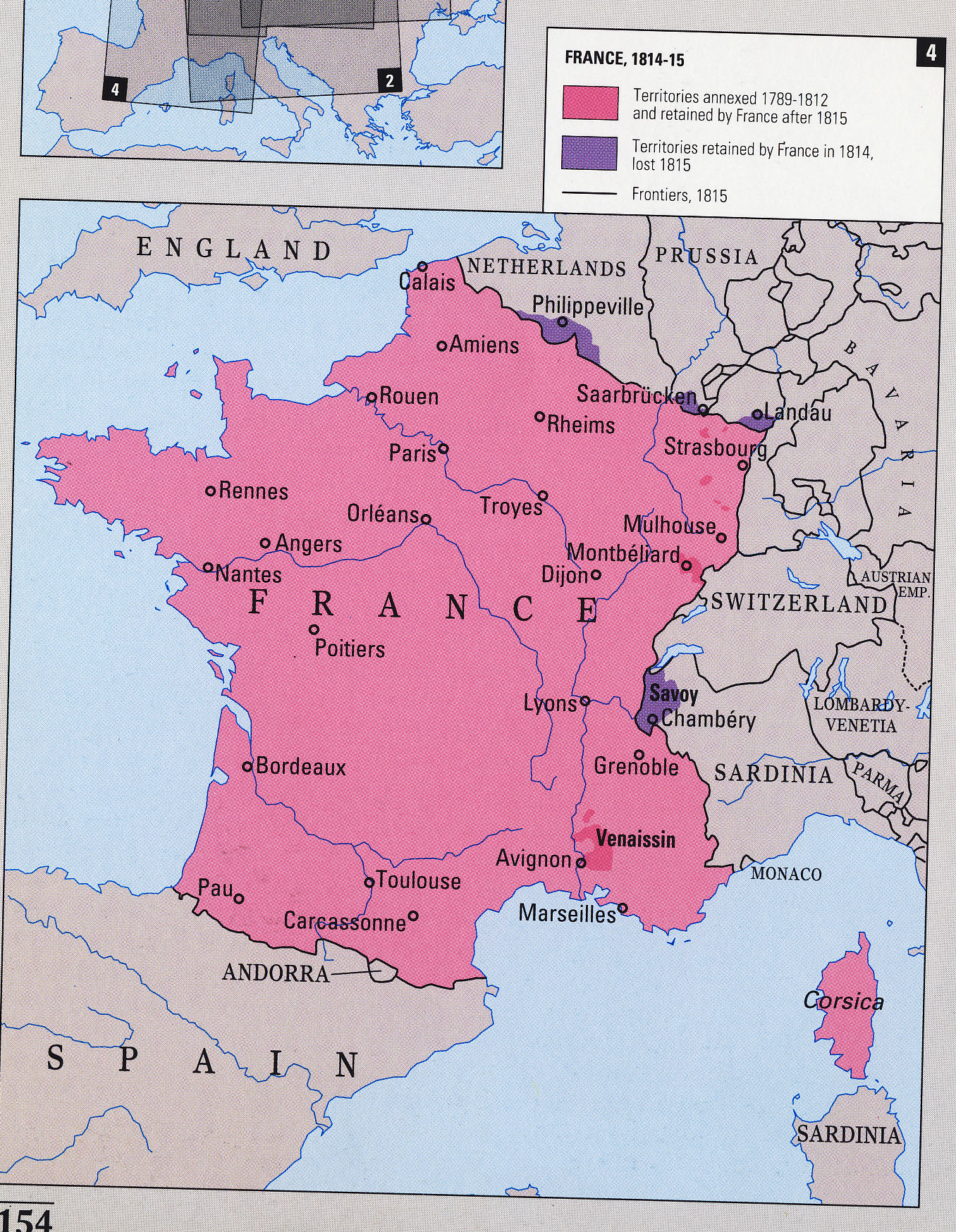
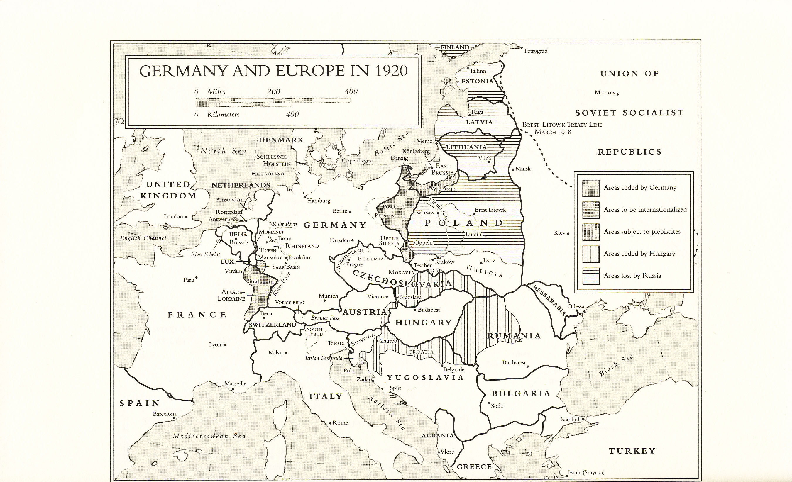
Though Napoleon wasn't completely defeated until the battle of Waterloo in June 1815, the Congress of Vienna met in 1814 and decided the fate of European borders. The conference of ambassadors from important European states settled the border issues that arose from the French Revolutionary and Napoleonic wars, as well as the dissolution of the Holy Roman Empire. France lost several territories along the Rhine, such as Savoy. What was the deciding factor for territory? Why did France lose territotory? *There is no transition between frame 3 and 4. |
|---|
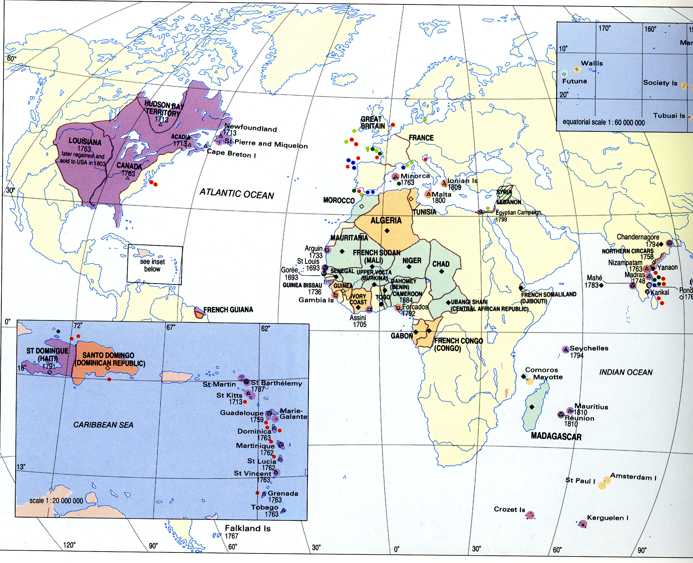
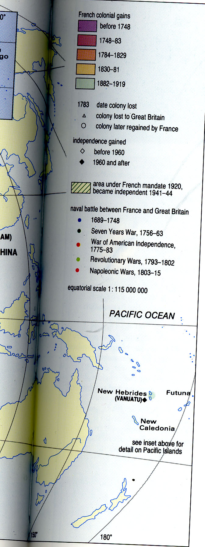
Frame 5: 19th Century France
Caption: Second Colonial Empire
Use map inventory numbers: EU20_20 EU20_21
During the 19th Century, a second colonial empire (how did this empire arise?) was attempted to expand beyond even that of Napoleon's. By the latter half of the century, France had gained territories in Northwestern Africa and control over the Dominican Republic. |
|---|
Section 3:
Title: 20th Century France
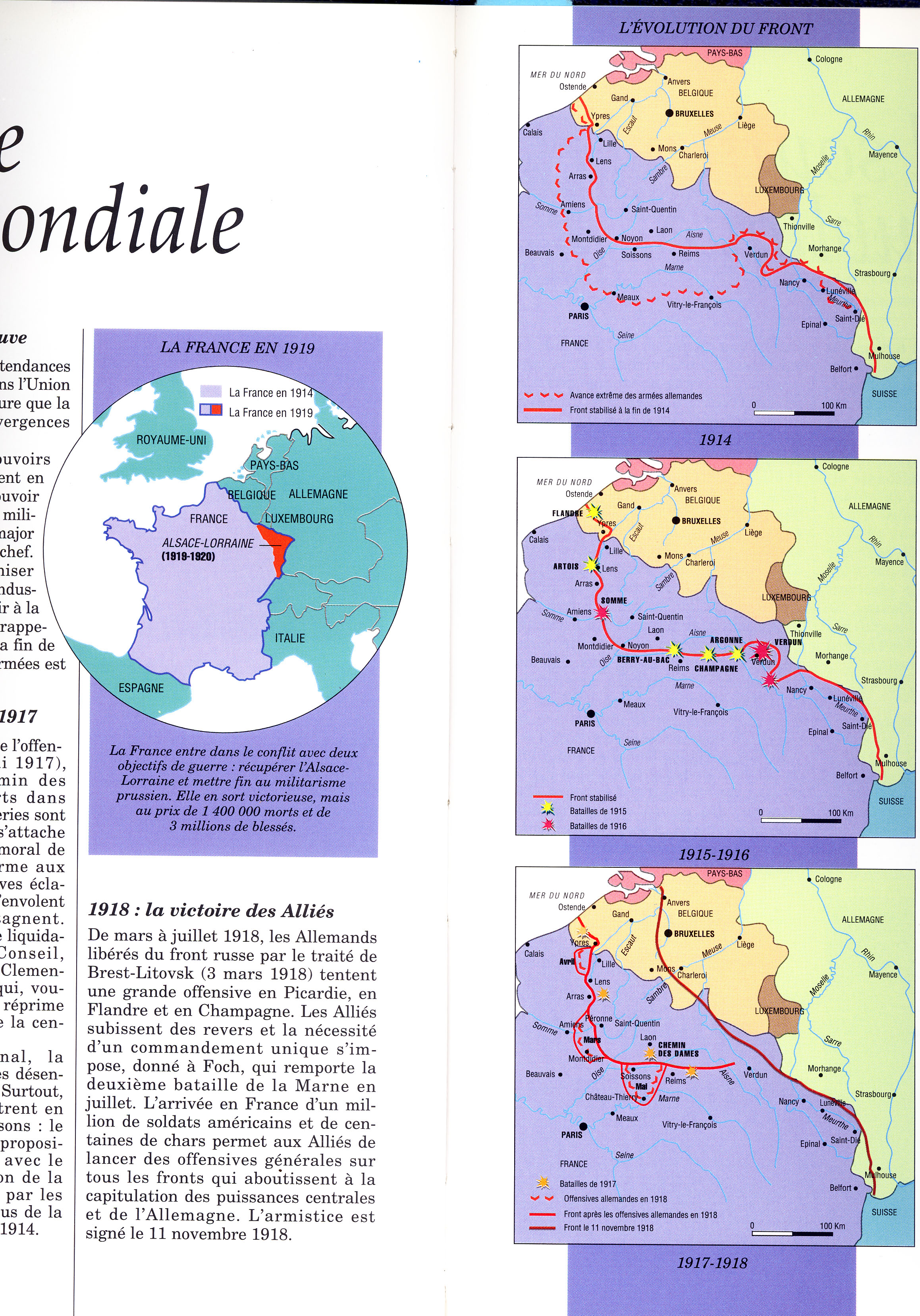
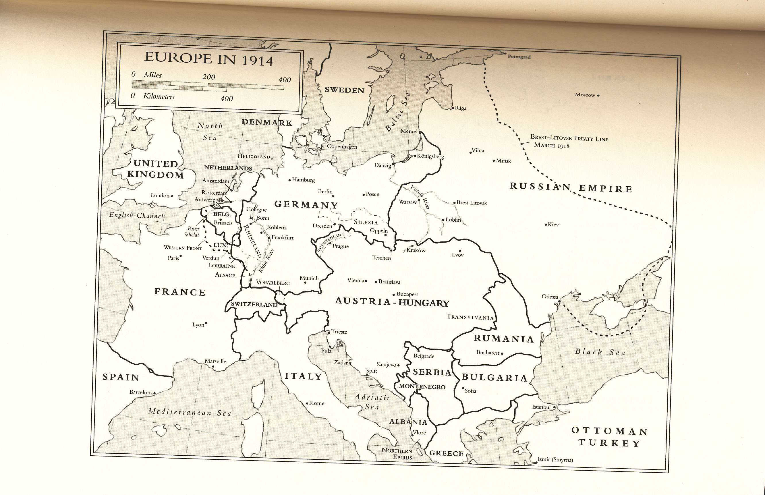
Frame 1: World War I
Caption: France During the Great War
Use map inventory numbers: EU20_27 EU20_28 EU20_77
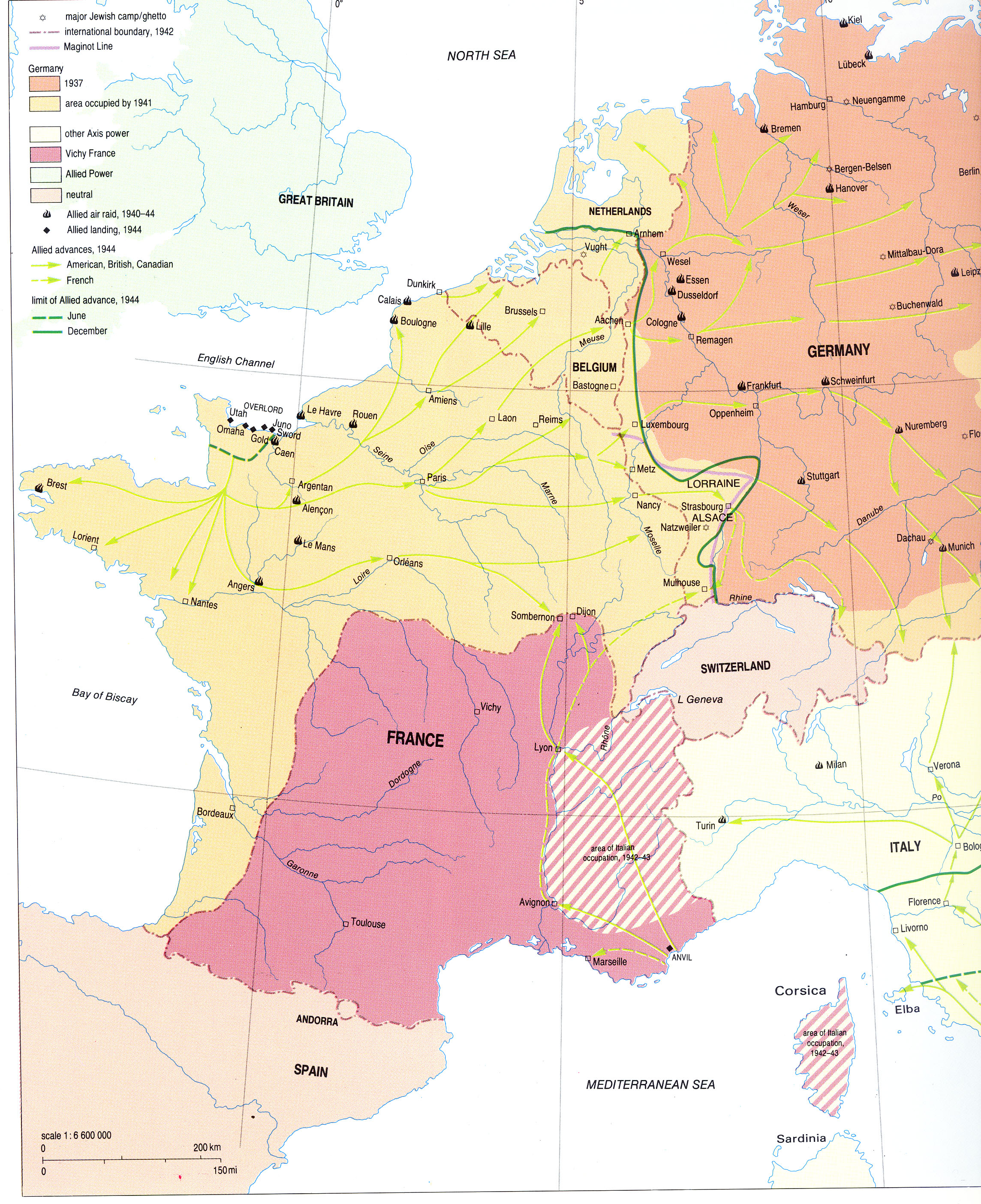
In August of 1914, Germany invaded France through Belgium, a neutral state, marking French involvment in the First World War. It's effects on France's population were devestating. Between 1914 and 1917, the Germans occupied and controlled the Western Front of France along the Rhine. |
|---|
Frame 2: Versailles Peace Conference
Caption: France After the War
Use map inventory numbers: EU20_27, EU20_78, EU20_96
It wasn't until the Versailles Peace Conference in 1919 that ensured German reparations and the demilitarization of the Rhineland. This created the Maginot line along the Western border and granted France control of Alsace-Lorraine once again. |
|---|
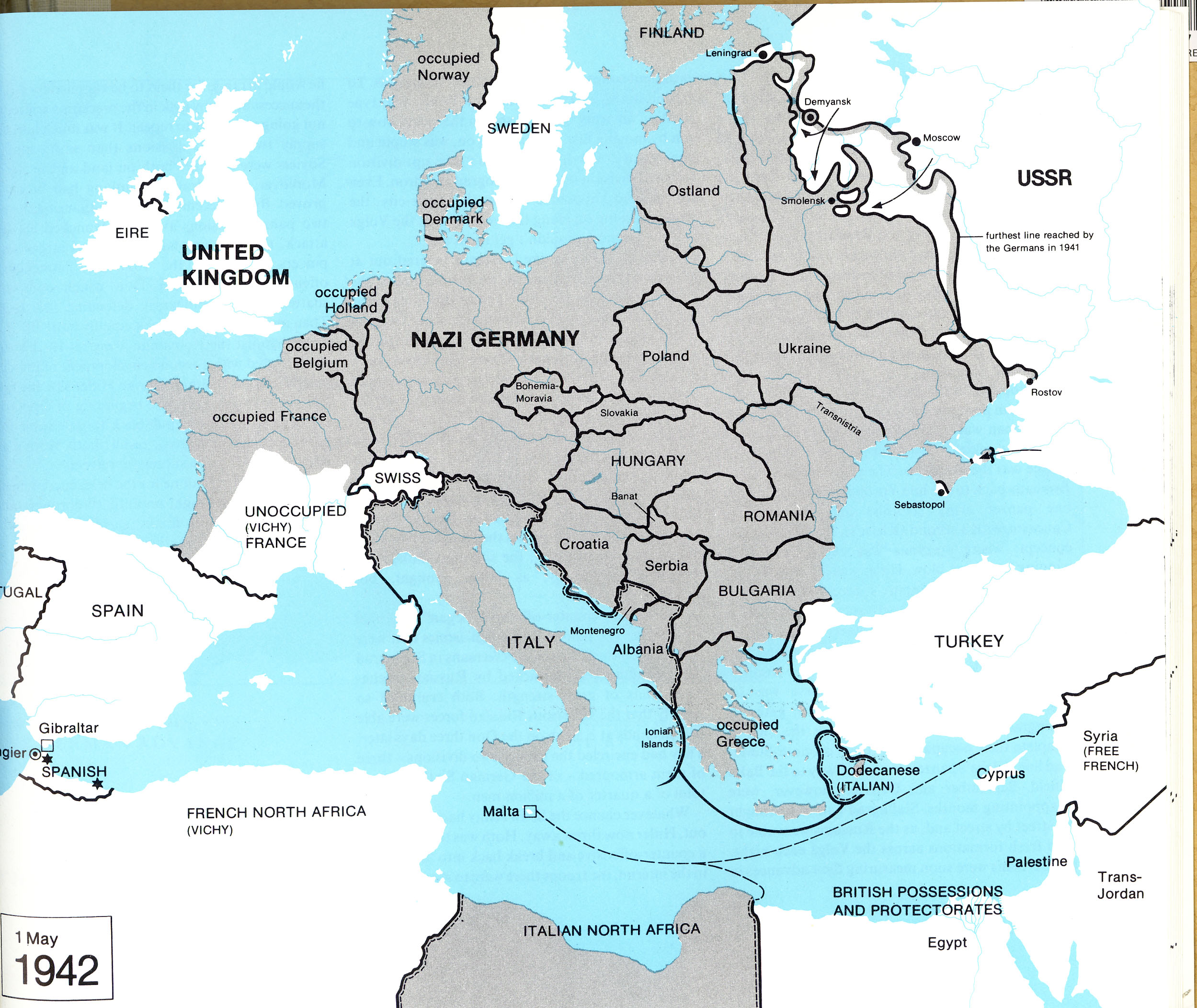
Frame 3: World War II
Caption: Germans Invade France
Use map inventory numbers: EU20_32 EU20_39
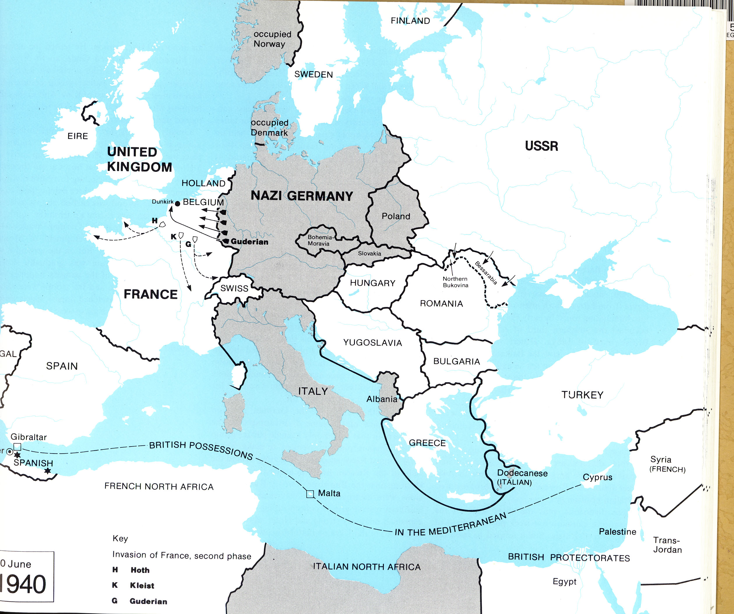
In 1940, the Nazi Germans charged through the Maginot line and took Paris in June. Alsace and Lorraine were restored the Reich (what is the Reich?). By 1941, Germany occupied all of Northern France as well as the Western coast all the way down to the Spanish border. |
|---|
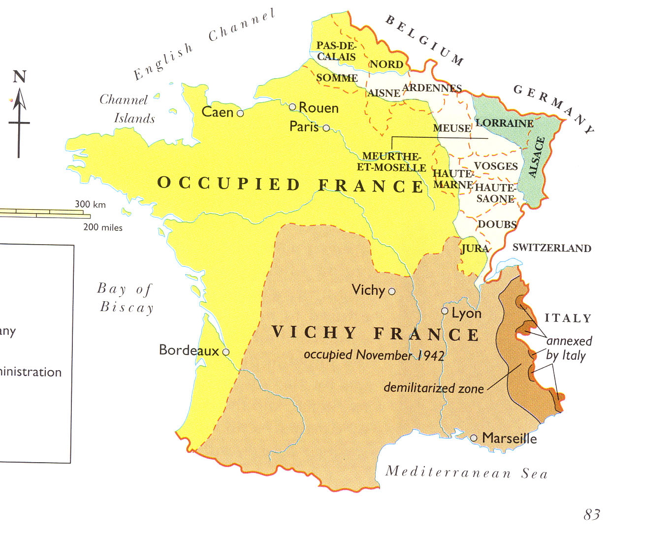
Frame : Vichy: The New France
Caption: France Under Nazi Occupation
Use map inventory numbers: EU20_37 EU20_41
After the invasion, Vichy became the new "capital" of France while Southern France remained in a state of chaos. In 1942, Germany invaded and occupied the Southern zone of France. Vichy was transformed into a Nazi Police state until 1944. Last sentence is vague. What is a 'Nazi Police state'? |
|---|
Frame 5: End of WWII
Caption: Restoration of France
Use map inventory numbers: EU20_32
In June 1944, American Allies stormed the beaches of Normandy. This marked the end of Nazi domination and the allies took back Paris, the rest of France, and the territories of Alsace-Lorraine from the Germans. |
|---|