

Built Environment Audits with Mobile GIS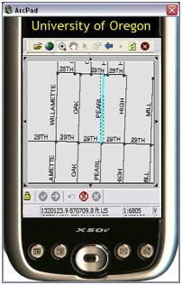
Over the last several years, I have been involved with a variety of projects to create built environment assessment tools with a special focus on the pedestrian and cycling environments. The tools have generally morphed into one comprehensive tool, now called the Complete Streets Assessment tool (CSAT), which is geared toward evaluating the pedestrian, bicycling, and transit facilities along street segments and intersections. The tool is available has been developed and tested in both English and Spanish.
These tools have been built within a GIS mapping environment, usually with a general citizen in mind as the collector of data. I believe that the process of collecting data can be as useful as the data itself. Engaging the community in assessing their environment can increase understanding of issues, connect individuals together in shared experiences and discussions, and can catalyze both individuals and groups into pressuring authorities to take action to improve the active transportation environment.
These audit tools have been developed using ArcPad GIS and include both objective and subjective questions. Their use has primarily been within a facilitated community process, whereby issue introduction, tool training, data gathering, data viewing via maps, and discussion of the process and the data all occur within a single day process. The conversations and observations tend to be very insightful and illuminating.
Additional tools on Safe Routes to School, ADA assessments, housing assessments, and other audit tools have been developed and used to varying degrees as well. All tools can be customized, altered, and used with different populations in varied contexts.
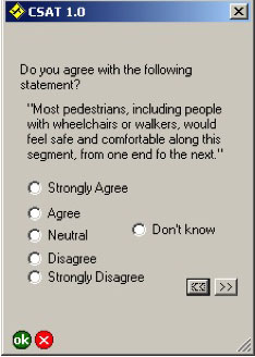
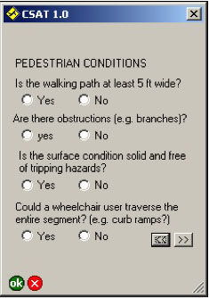
Here are some sample data entry pages:
| General Impression | Objective Observations | Final Assessment |
|---|---|---|
 |
 |
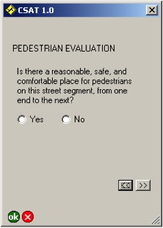 |
| For each mode of transportation, the assessor is asked to give an initial impression of the environment. This subjective question is often the most useful for community discussions around their values and how they perceive different environments. | The assessor then completes a series of objective data collection. | Finally, for each mode, the assessor is forced to declare whether the environment is reasonable or "good enough" for now. This does not mean that more cannot be done to improve the environment, but it is important to identify unacceptable areas and this forced Yes-No question thus becomes important for future community discussions |
Here is a sample map that can be produced from the data. This map overlays a subjective rating of streets and a subjective rating of intersections (green=good, red=bad) on tp of Google Earth. The data in this format allows community members to visualize their neighborhood, see how they and others rate different aspects of the active transportation environment, and provides a useful basis for identifying priority areas and next steps.
The data in this map was collected by parent volunteers in a school district as part of an intensive five year effort to improve the health of children in that school district. The project address health, nutrition, screen time, and physical activity, including the walk/bike to school and general neighborhood travel.

Next Step: An iPhone Version
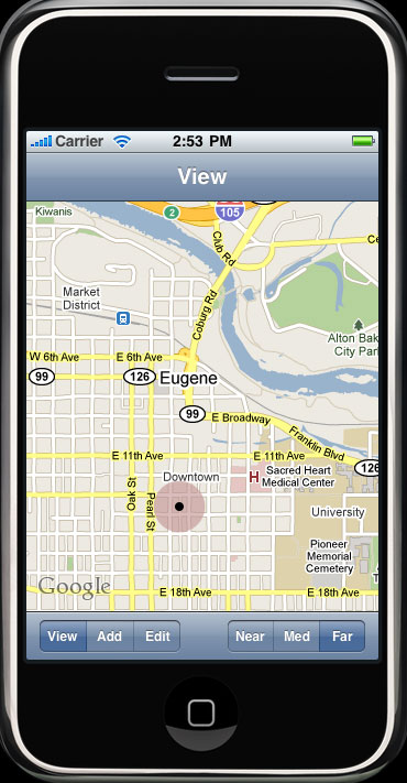
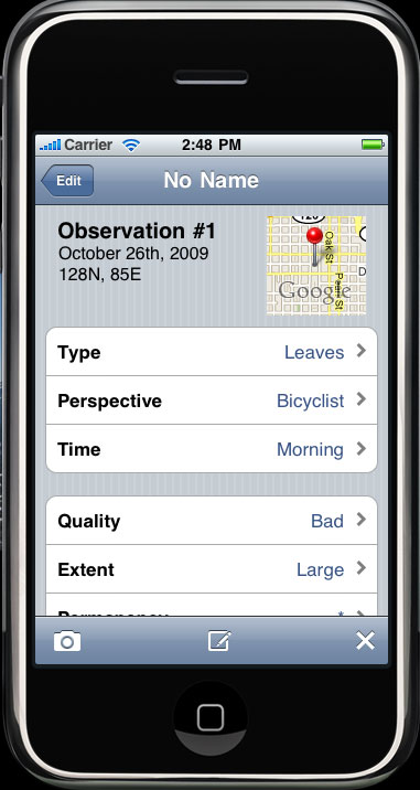
In the first half of 2010, we will be testing an iPhone version of these tools. The goals of the project are:
- To simplify the tehnological bais for built environment assessments out of the GIS environment and into common citizen technology
- To create a tool easily deployable nationally and internationally to help createa citizen based assessment of the entire pedestrian and cycling infrastructure; and
- To catalyze policy makers, city staff, and citizens into radically improving and prioritizing activites that support these more sustainable and healthy modes of transportation.
The user will be able to use their own iPhone to identify problems on their walking or cycling journey, quickly identify the spatial location, magnitude of the problem, and answer a few targeted questions. The data will be uploaded to a centrally accessible map for city staff, citizen groups, and individuals to use. Summaries of data activity can also be sent directly to city staff, the press, or policy makers as appropriate. The whole process should take less than 30 seconds. |
 |
 |
|---|