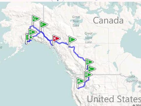
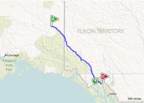
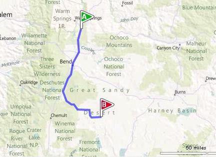
Christmas Valley to Alaska and Back:
Wednesday, May 25 – Wednesday, June 29, 2011
John and Shirien Chappell
Short version:
We saw lots of animals, spent many memorable hours together, enjoyed the scenery and friends we met along the way, and came home. Gas mileage averaged about 11 mpg.
Longer version:
Day -397, Sunday, April 4, 2010:
John: “I’m driving the AlCan next year. You coming with?”
Day -397 through Day -6:
We talked with friends, getting ideas of where to visit, what not to miss. We created spreadsheets of things to take, places to be sure to visit, things to see, number miles between cities. We gathered AAA TripTiks®, Good Sam campground books, copies of both the 2010 and later the 2011 Milepost® book, and were given several books on Alaska. We bought atlases, both spiral-bound and stapled. These we read and packed and unpacked and read some more.
Day -6, Thursday, May 19: Eugene to CV
We left after work and slept in CV.
Day -5, Friday, May 20:
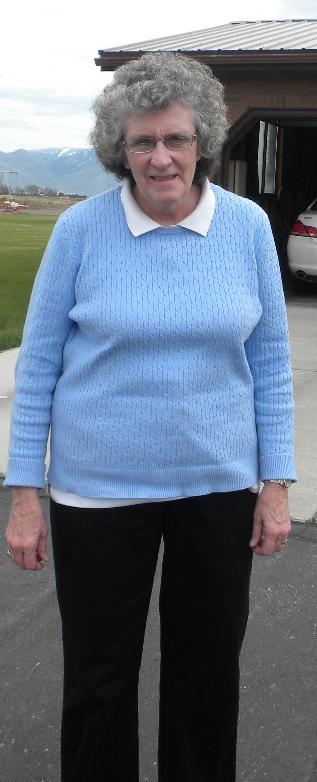
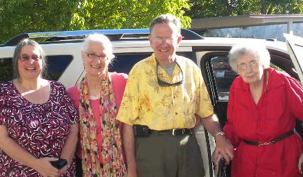
Shirien to Burley, ID, to nap until Steve and Susan Tuft returned from the Twin Falls temple. They arrived a little after noon and we took pictures of each other and of the lovely small table that belonged to Susan as a child which my John refurnished for her. That afternoon Susan and I, and Steve in his car, drove to Salt Lake. Susan and Steve were headed for the airport the next morning for a trip to Rochester, NY, to visit with Gwen and Tim and watch Gwen’s clarinet recital.
Day -4, Saturday, May 21:
In the early morning Clayton and I found a discount sporting good store where I bought some walking sticks and a backpack at his suggestion. What a great idea! The backpack replaced my purse and was much easier to tote around and I could put more stuff in it as needed. The walking sticks weren't used quite as much: I tended to use my cane instead, but had the terrain been more bumpy, we'd have used them lots. We'll use them on our next trip, more. Thanks for the great ideas, Clayton!! Later I visited with my dear friend Florence Iverson and then with Clayton and Jean. Flo and I went downtown in the beautiful Joseph Smith Memorial Building, and later all four of us ate the evening away in Marie Calendar’s in Bountiful. Also that evening I got a tour of Jean’s lovely home with the splendid international décor. She generously let Clayton take me for a spin up the gorgeous Wasatch canyons in her Miata, and then I drove up to Burley and stayed in Susan and Steve’s home.
Day -3, Sunday, May 22:
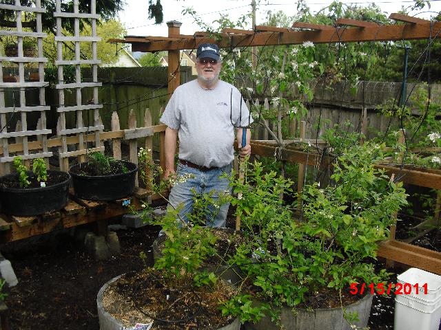
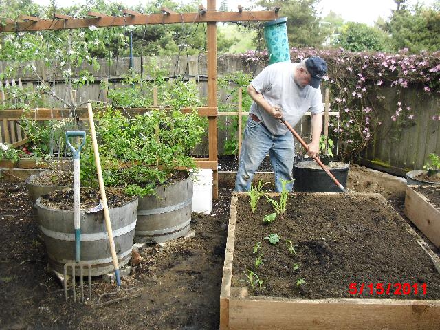
John worked hard in the Eugene garden, finishing off the raised beds and automatic sprinkling systems so all will be self-sustaining during our vacation. I drove from Burley to Eugene. We packed the truck with all the Eugene items we needed for the trip.
Days -2 and -1, Monday/Tuesday, May 23/24:
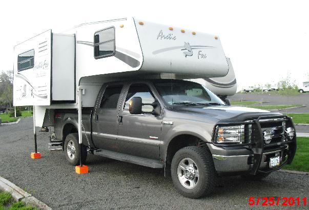
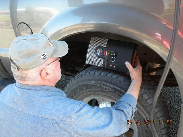
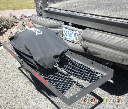
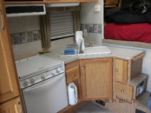
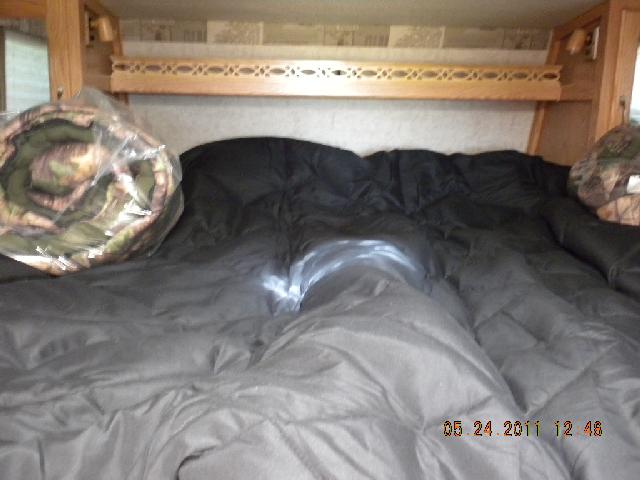
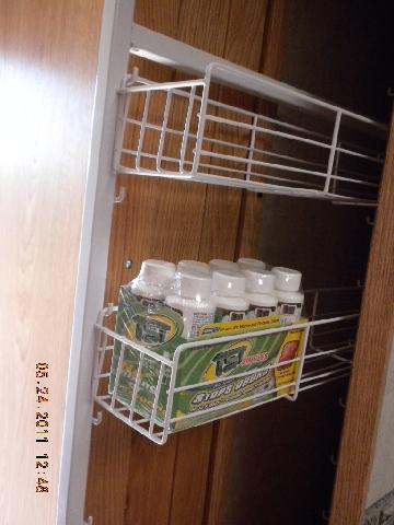
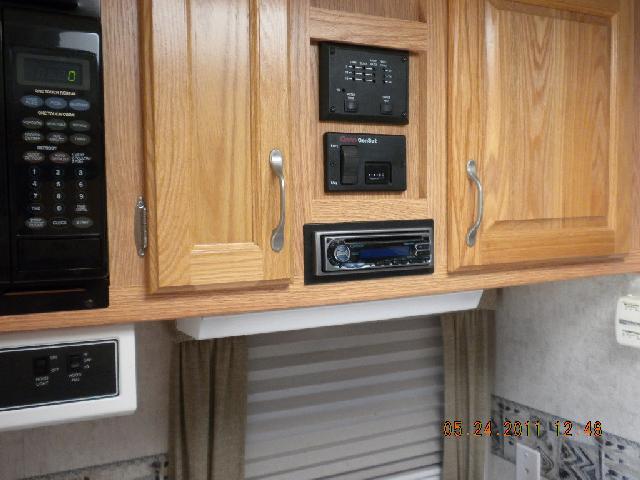
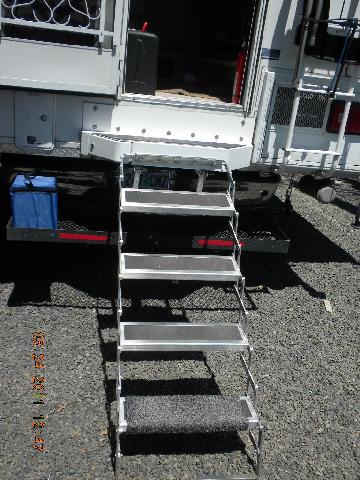
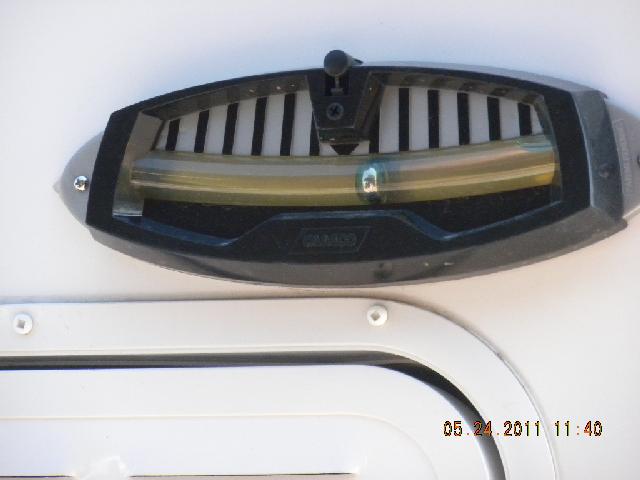
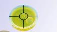
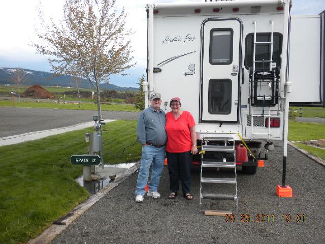
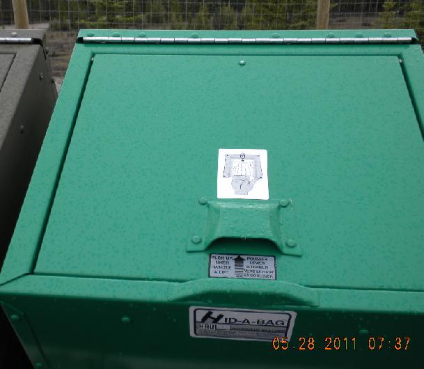
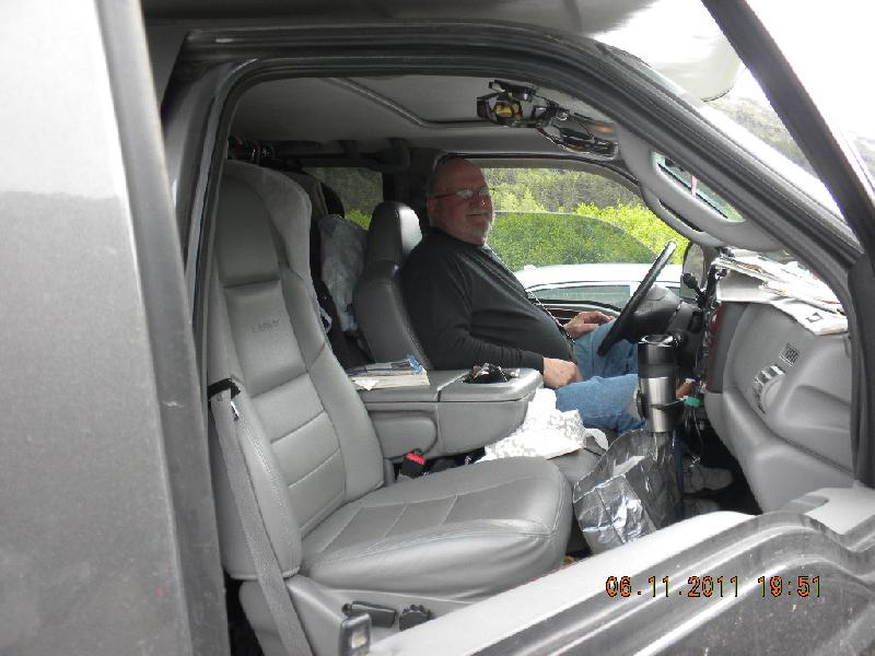
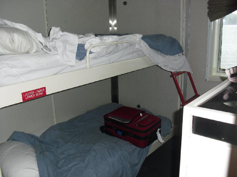
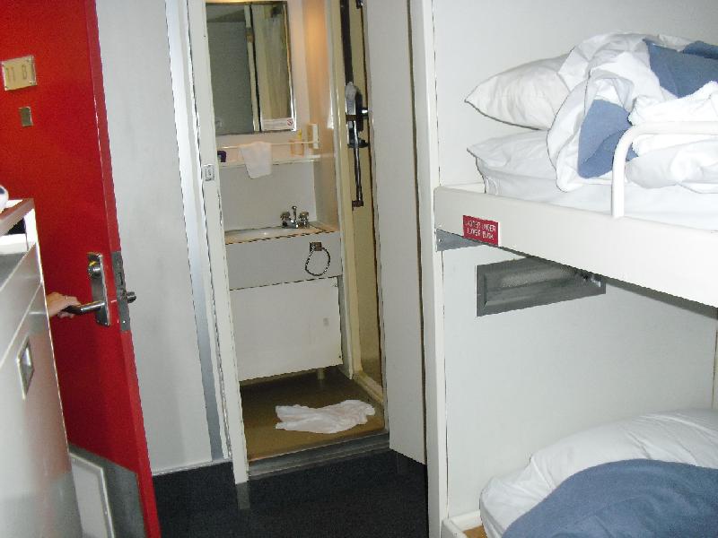
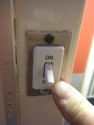
John and I drove to CV and began preparing our new-to-us 2005 Arctic Fox camper. It is heavy enough that it needed airbags! We also borrowed a cool little cargo carrier that fits into the hitch on the truck. We put two 10 gallon cans of diesel, a shovel, and a propane camp stove on it! Here are some photos of the inside: looks kind of big, doesn’t it? It is, too. It’s also comfy. Here’s a little cupboard for canned goods, there’s a tiny bathroom with a shower that nobody but Twiggy in her earlier days could use, and also a very welcome potty, and a microwave and music system and air conditioner and fridge and freezer… lots of room. See how many stairs it takes to get up into it? Here is a cool bubble leveling device: we bought two and put one on the side of the camper and on the back of it. When you drive into a camp spot you try to get it as level as possible using those two bubbles, and then you use the orange levelers under the jacks to get it all the way level. There’s a tiny bullseye level that we put inside the fridge and it was my duty each night to scamper in there and tell John which of the camper jacks need to go up or down to make the bullseye bubble fit the exact center. Oh: the beauty with these camper jacks is that they don’t require hand cranking, as you can see. You just push the right buttons and each goes up or down as needed. Very neat. Anyway, we finally got it all loaded and packed (here’s me and here’s John loading and packing and figuring logistics) and that night we didn’t sleep too well from all the excitement. This was, after all, a once in a lifetime trip for which we’d saved and looked forward to and it was going to be FUN!
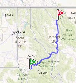
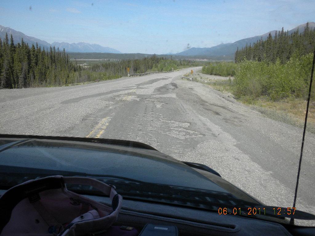
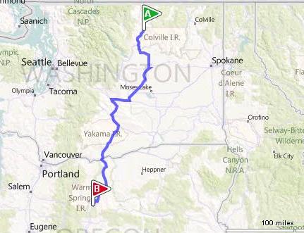
Day 1, Wed, May 25, 2011: Christmas Valley, Oregon to Grangeville, Idaho
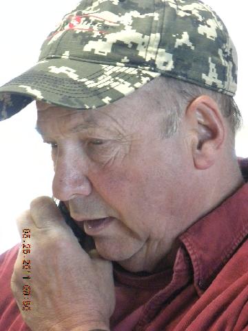
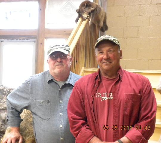
In Burns we stopped at the Great Basin Sporting Goods store to see a friend of John’s from his childhood, Ron Redding. Ron is the younger brother of Dale Redding, who was in John’s class. As youngsters the Redding boys and John used to roam from their home town of Salem over to Christmas Valley to hunt and raise some ruckus. It was a really great visit for the two of them.
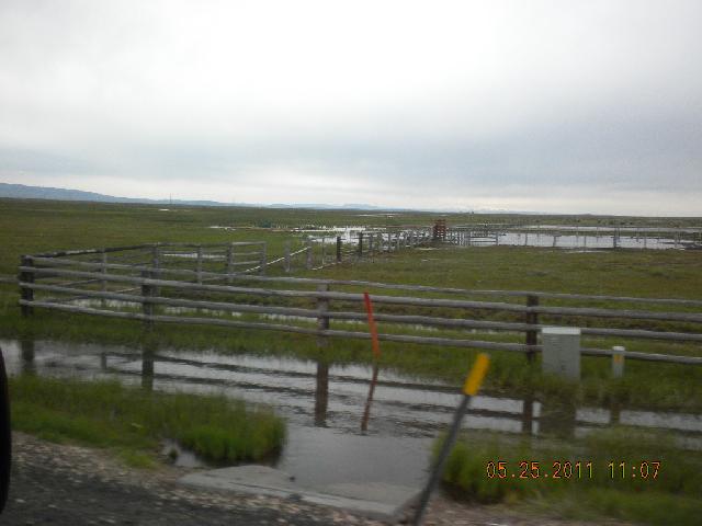
As we passed through the east outskirts of Burns we saw the flood waters that shut down Hwy. 21. We had a short detour around the closed highway and were amazed at how wet the area was.
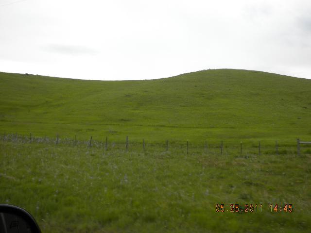
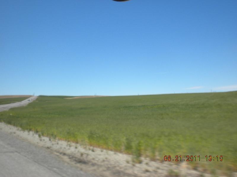
We continued to Ontario, Oregon, and then up through Idaho on Hwy. 95 through Weiser. How green Weiser was!
Digression: My dad and mom were traveling through southern Wyoming one time and Dad kept turning to Mom and saying, “Luana, I’ve never SEEN the desert so green!” and Mom would pat her chest and nod and smile her happy agreement. During this trip John frequently turned to me and tapped his burly chest and said, “Shirien, I’ve never SEEN (name of area) so green before!” One way you know you have a truly engaged spouse is when that person adopts your family’s patterns and funny word pronunciations and tells your family jokes as if they were his own. I have an absolute winner for a husband.
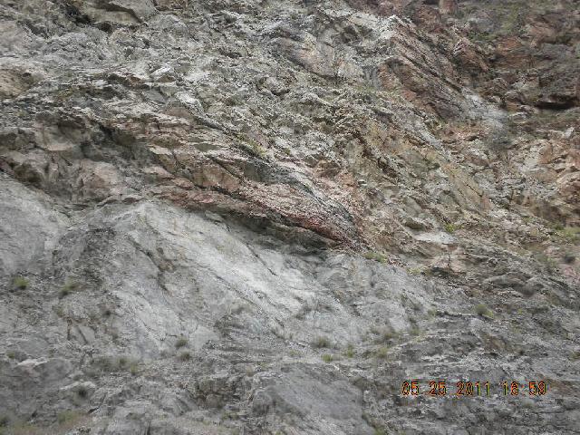
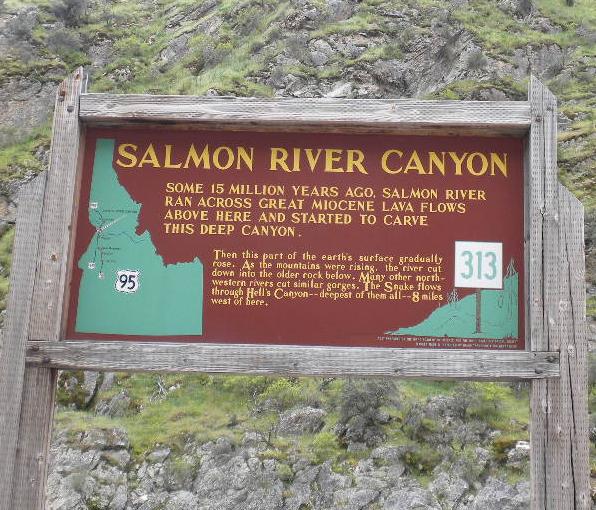
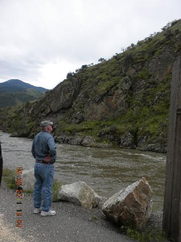
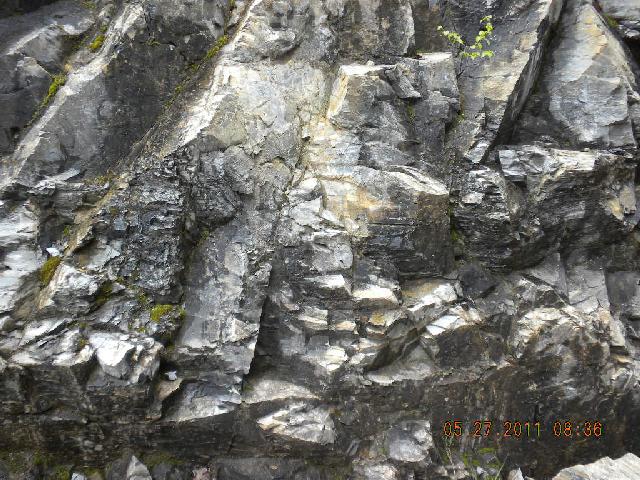
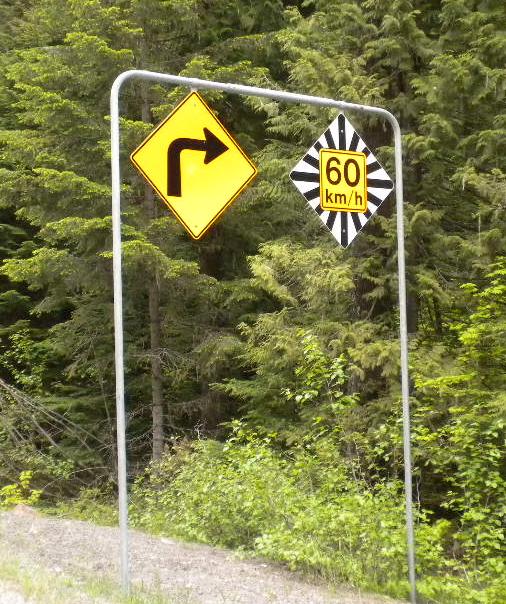
Anyway, we took lots of photos of the lovely green rolling hills and of the cool geology near there. John is a huge fan of geology and we saw lots more through the trip and so will you, if you keep reading. We vowed to stop and read road signs whenever we saw them, and so we did. This was great for the body circulation as well as reminding us that we were on vacation; we had no deadlines, we didn’t have to rush by, we could stop and read the signs, smell the flowers, and look at the scenery for as long as we wanted.
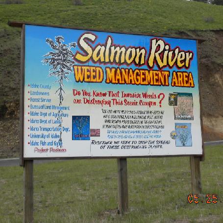
Idaho is big into weed management. We took this photo for our friends and weed sprayers Floyd and Elota.
We spent the night at our first RV park, the Bear Den. See how flat the site is? Means less leveling of the camper. It was here that I first learned how to log onto the web using RV wireless service. Sort of.
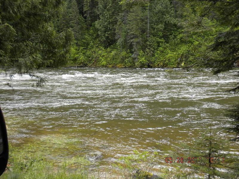
Day 2, Thursday, May 26: Grangeville to Hungry Horse, Montana
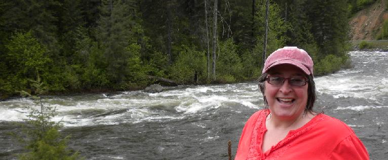
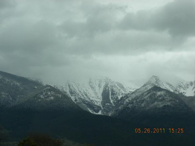
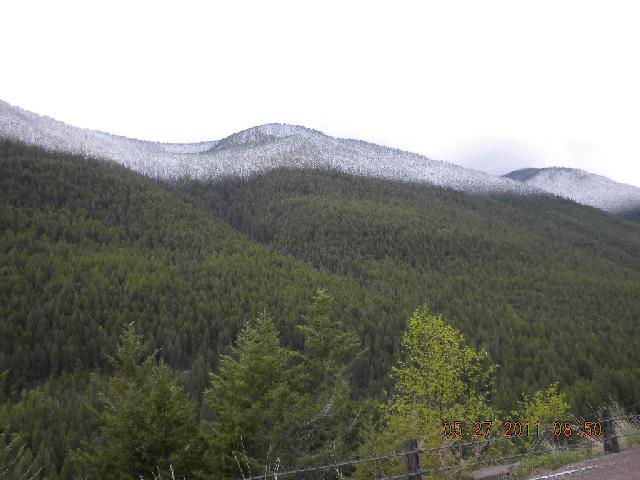
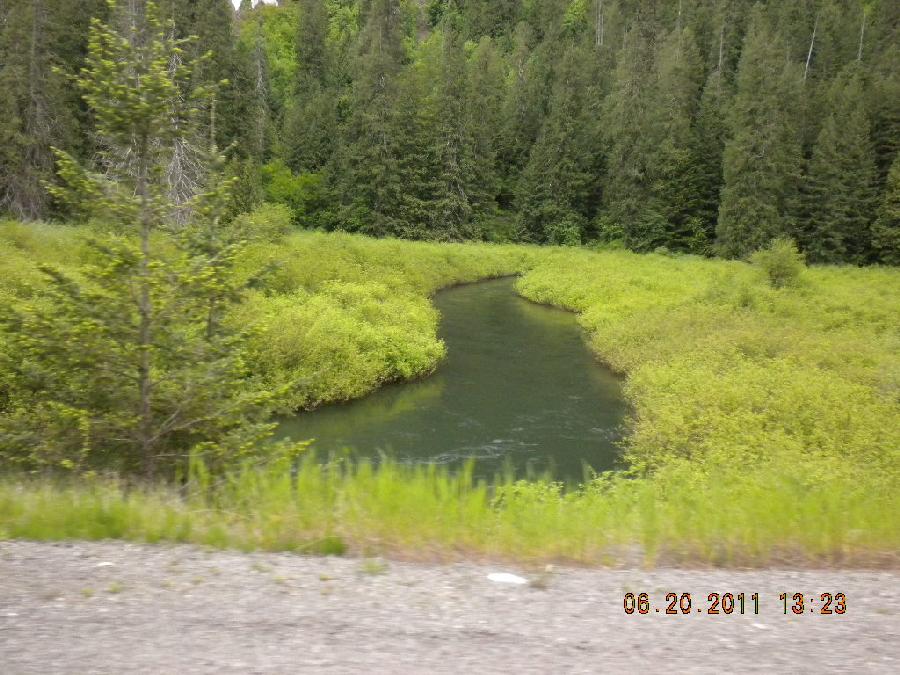
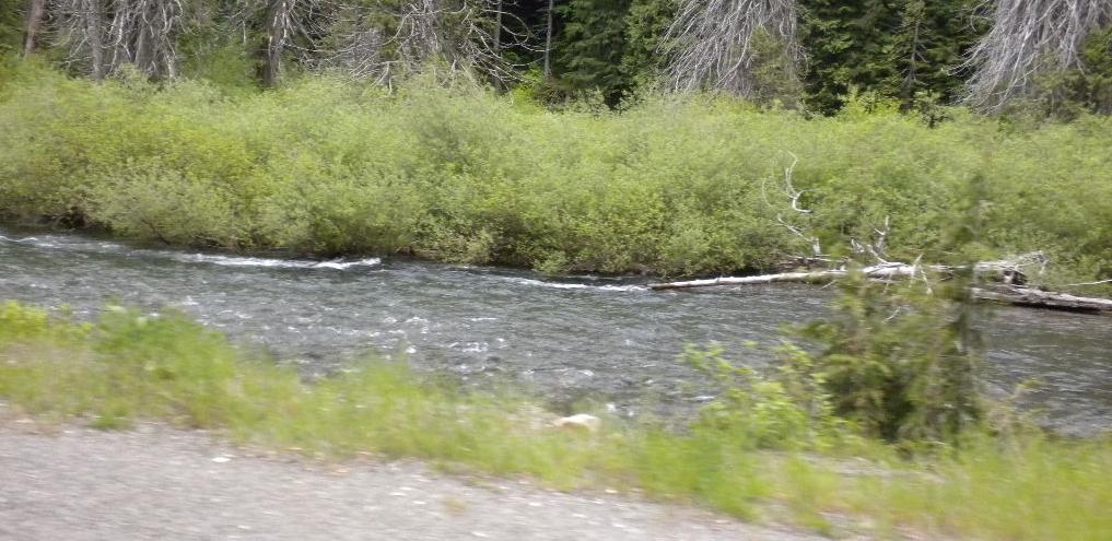
Pretty full rivers. Lots of chances to stop and admire nature. Lots of crystal-filled granite on the ground. Snow-covered mountains appeared. We began to get the sense that Idaho and Montana were having floods, caused by the snow melt from those mountains.
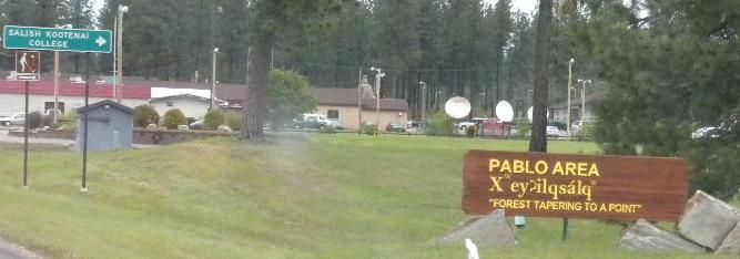
We entered Flathead Indian country; they own land in western Montana, and it was so cool to see signs written in the Salish language. Cool sights.
Stayed the night in an RV park in Hungry Horse.
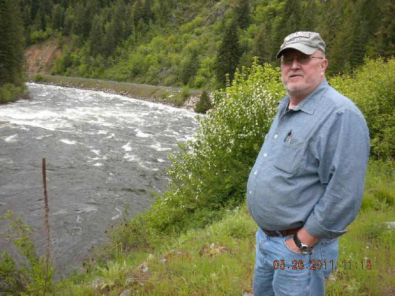
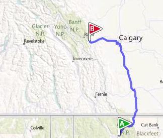
Day 3, Friday, May 27: Hungry Horse to Canmore, Alberta
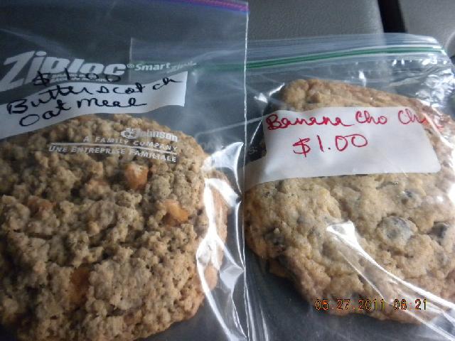
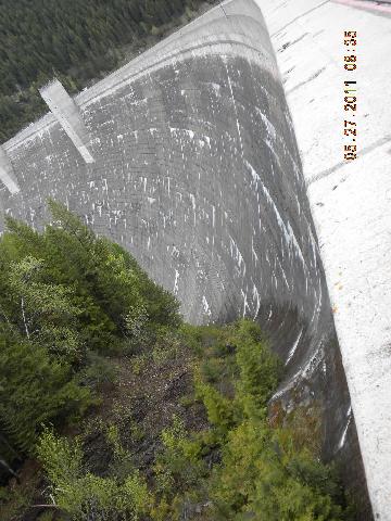
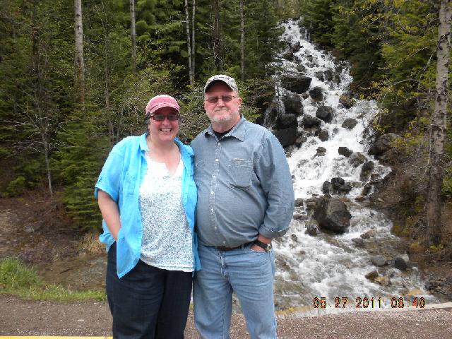
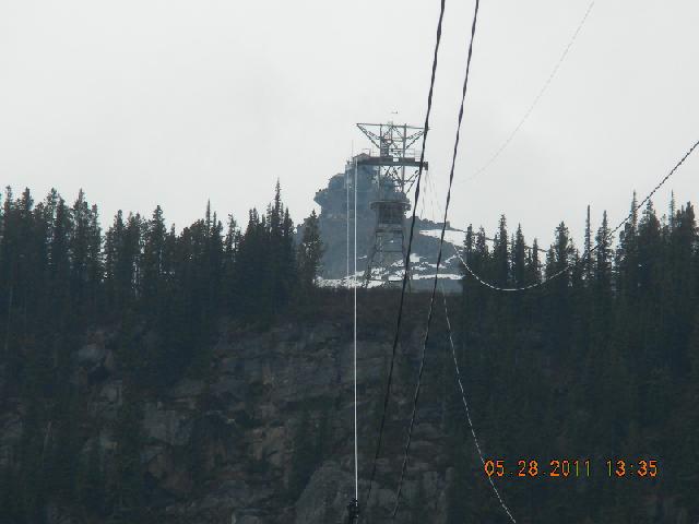
Found some wonderful home made cookies at a café the next morning. Went to Hungry Horse Dam to view the site where John set up microwave towers in his late twenties. This one was particularly cool to see since it was on the side of a dam and was rather dangerous to install. We also saw some more geology and rushing waterfalls. Oh: we met an older couple who had driven from Arkansas. They were on their way to Oregon or somewhere and wondered if there was pretty scenery there, since they “hadn’t seen much yet, but we’re looking”. Hope they find some.
That day we skirted the bottom of Glacier National Park; couldn’t go through it on the “Going to the Sun Road” since it was closed, but we saw lots and lots of flooded rivers and waterfalls. It was a cold and gray day, with lots of water everywhere. We knew that we were supposed to see moose along the way, so we called them faithfully, but nobody ever poked their heads out in answer.
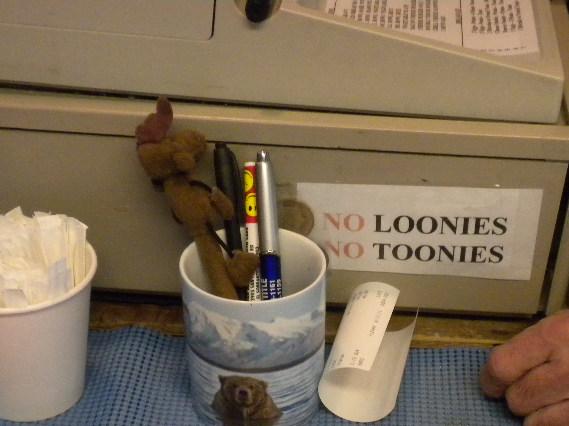
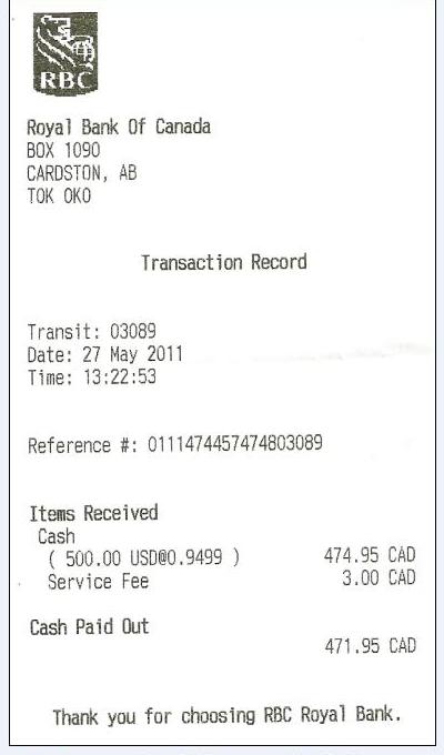
When US Hwy. 89 turned into Canada Highway 2 we crossed the border. It was pretty easy: we were asked where we were coming from, where we were going, whether we had guns, bear spray, alcohol, or more than $10,000. Lunch and money changing happened at Cardston. We learned this about Canadian money: their one dollar coin is called a Loonie (after the Loon, which is the Canadian national bird) and their two dollar coin is called a toonie. Loonies and Toonies.
Highway 2 to Calgary was a beautiful road, but, in John’s words, “brain dead to drive”. We celebrated each turn in the road as a break in monotony. The snowline got lower.
This is the day we went through one of only two unhappy parts of the trip. In Calgary Hwy. 2 intersects with Hwy. 1, and leads us to Canmore. Should be easy. Wasn’t. We sort of got off Hwy. 2 one exit early and found ourselves on MacLeod Street, which parallels Hwy. 2 and should intersect with Hwy 1. If it did, we didn’t see it, though we got pretty close. In frustration, we decided to use the Garmin Nuvii GPS. Oh, what a mistake. Jill took us through Calgary on 17th street, about 10 miles long, a road under deep construction which goes from the west end of Calgary all the way to downtown Calgary on the east end. We went two times on that road. We didn’t talk very much, and finally got smart enough to unplug Jill and use our own by now relatively well-developed senses of direction to find our way onto Hwy. 1 and out to freedom. We don’t like Calgary much, now, (sorry, June) and we dislike the Garmin Nuvii even more. No pictures. Wouldn’t have been prudent.
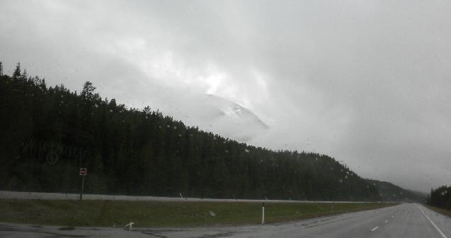
Stayed at an RV park in Canmore, Alberta, just outside Banff. It was there that we got a computer virus that apparently wiped out all our data and programs. Couldn’t log on to find the next night’s campground, couldn’t read email from family or work, couldn’t look up interesting facts… The RV camp was near train tracks upon which trains roared during the night and happily blew their horns. It was 35°, there was rain and snow and no visibility of beautiful mountains. Friday, May 27th, wasn’t the very best day of the adventure.
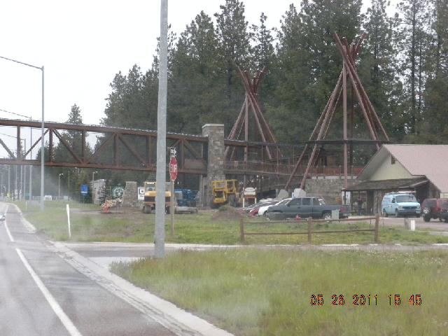
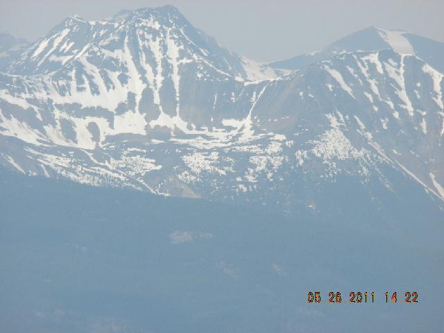
Day 4, Saturday, May 28: Canmore to Hinton, Alberta
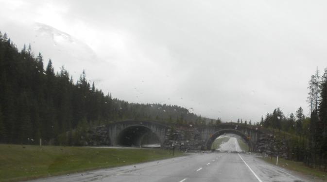
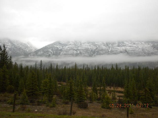
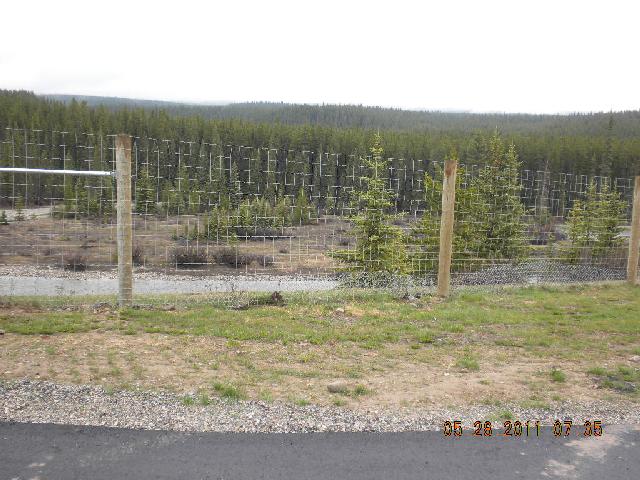
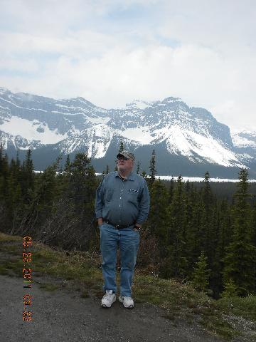
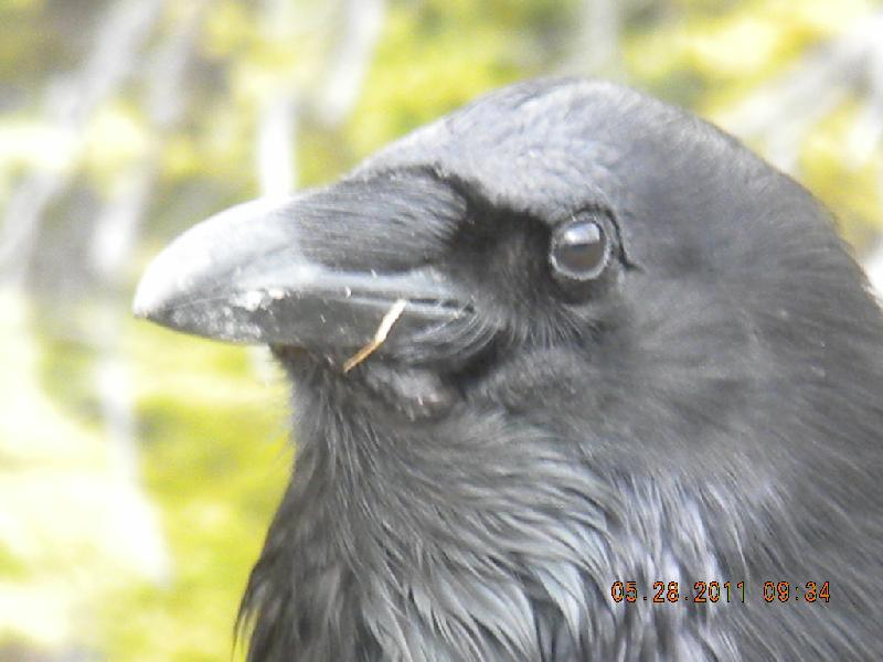
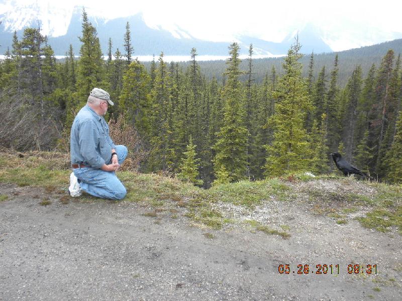
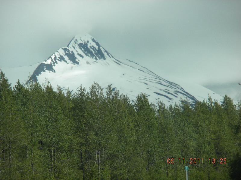
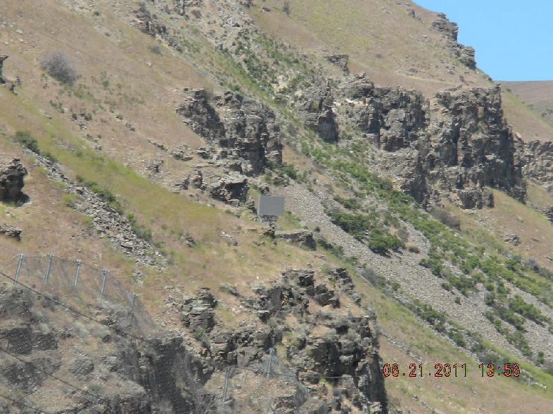
On this day we saw cool animal overpasses, the midriff of a mountain, our first bear-proof trashcan, and very tall fences that were meant to help animals stay out of harm’s way on the highway. The mountains came out of the fog and showed us their majesty. John and a raven got acquainted.
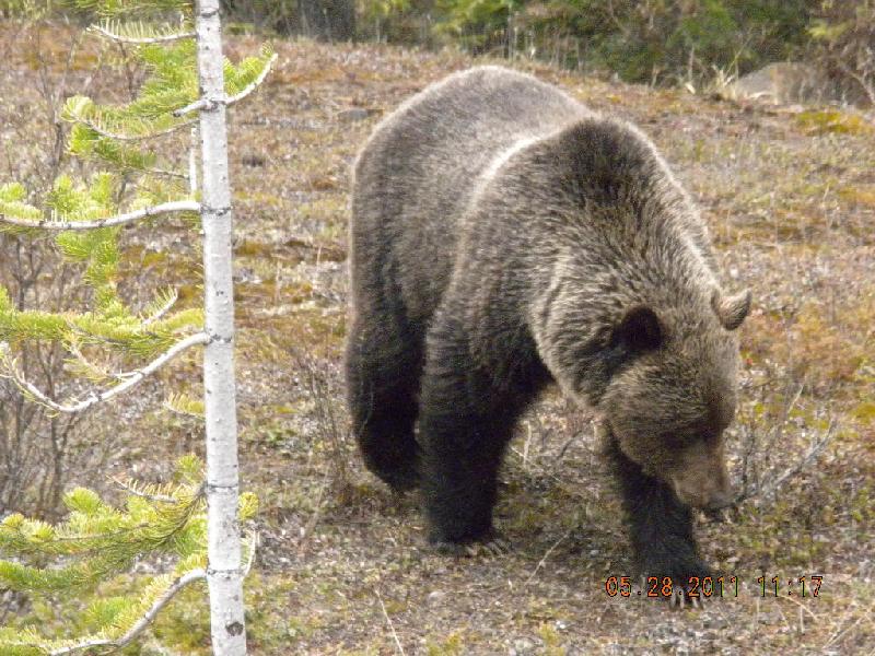
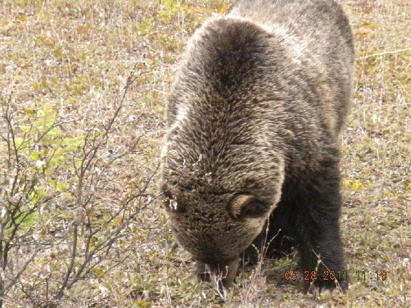
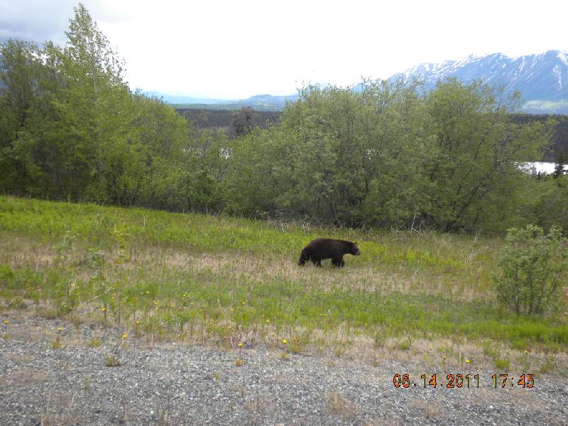
This was the day we saw our griz bear! There he was, just at the side of the road! Another car had stopped to take photos and we learned that when you see somebody stopped, taking pictures (rather than somebody stopped by the side of the road, squatting), it usually means there’s something photographic happening.. The folks in this mini-van were outside their vehicle, taking photos! This guy could have had them for a snack before they’d even get the sliding door closed, let alone get inside the van. Some folks don’t understand.
We also began seeing the first of many sets of bicyclists riding up the highways.
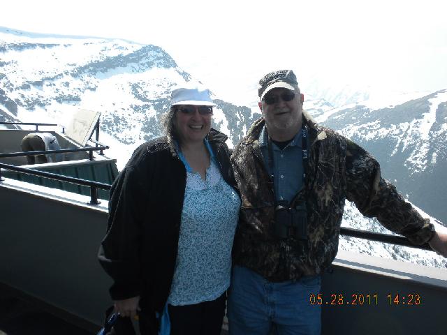
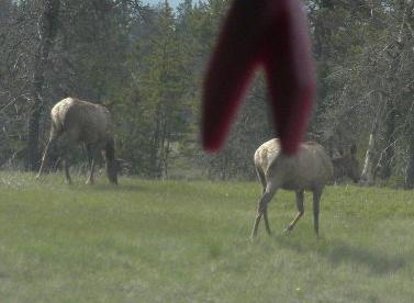
In Jasper park we took a tram up the 2,268 meters or 7,439 feet to the top of Whistler’s Mountain. Lots of exquisite views and very impressed tourists. There were lots of folks from many countries there: South Africa, Europe, and lots of Australians. The folks hired to run the trams and work the concessions were mostly young international folk, too. We have lots more photos of the gorgeous mountains – let us know if you want more, or better yet, find professional photos on the web. This site (http://www.jaspertramway.com/) says this about the tram: “Jasper Tramway is the longest and highest guided aerial tramway in Canada and the only guided aerial ropeway in the Canadian Rockies. Providing visitors with unprecedented views of six mountain ranges, glacial fed lakes, the Athabasca river (Alberta’s longest) and the scenic mountain.” We also saw our first elk of the trip that day.
We ended Day 4 at Hinton in the Edson RV Campground. John chatted with a traveling salesman who deals in nuts and bolts for the natural gas and oil industries. He was a nice feller; a golfer and hunter just like John. Oh: we bought a new computer for our trip that day; an emachine.
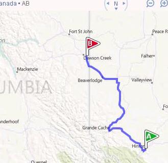
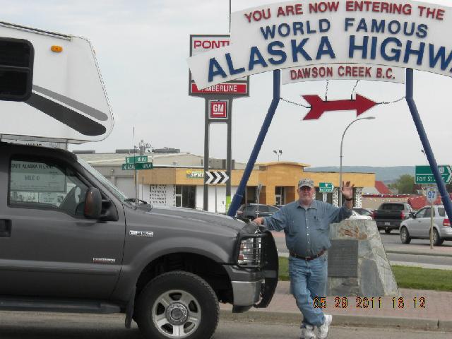
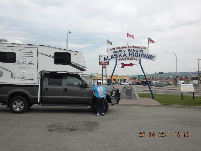
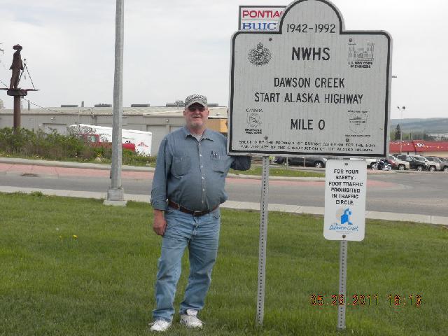
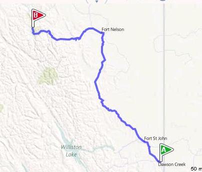
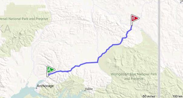
Day 5, Sunday, May 29: Hinton to Dawson Creek, Alberta
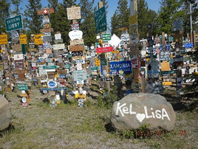
From Hinton to Dawson Creek we saw lots of natural gas and also oil refineries, condenser plants, and derricks. We were saddened by the lack of mileposts on this road, and the absence of elevation markers. I did see a sign that said “Hythe Motor Homes” and my brain translated it as “Honor thy Mother.” We had a good chortle over that; at least, I did. Slept that night in Dawson Creek which is the beginning of the Alaskan Highway. Here we are at the sign. And here’s the famous forest of signs.
Day 6, Monday, May 30: Dawson Creek to Muncho Lake, British Columbia
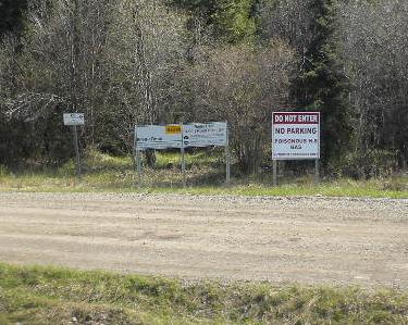
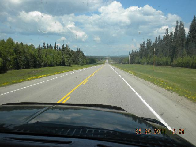
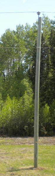
Natural gas is big up there! There are lots of side roads leading into gas mining areas with “No parking Poisonous gas” warnings. This part of the Alaska highway is long and straight and a little bit boring. The have green telephone poles which John says are painted with an arsenic paint.
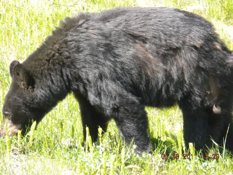
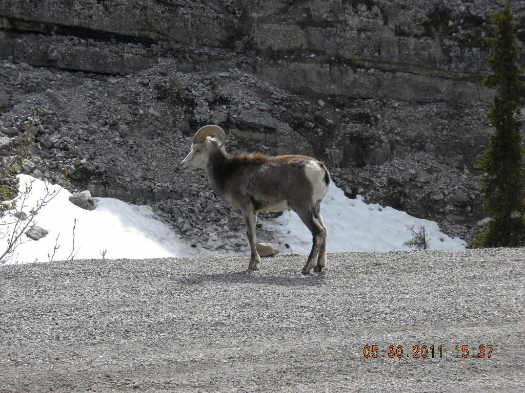
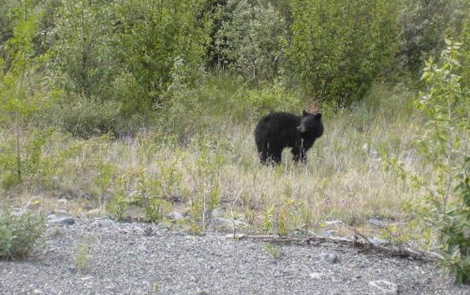
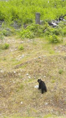
We saw our first black bear today! In fact, I think I was the one to spot it! At least, my notes say “saw Shirien’s bear”, and since there was no modifier on that, I figure it must mean I was the first to see one. We also saw stone sheep, right where the MilePost book said they’d be!
“Toad River, let ‘er buck!”. In Wyoming there’s a saying “Powder River, let ‘er buck!”. If you want to know where it came from you can find it online. Anyway, when I was a wee one and we crossed over the Powder River (my dad pronounced it “Pooder River”) he’d holler out “What’s the longest river in the world?” and we kidlets would squeal back “Powder River!”. He’d ask “How wide is it?” and we’d say “A mile wide!” and he’d ask back “How deep is it?” and we’d cry “An inch deep!” and then we’d all chorus at the top of our lungs, “Powder River, Let ‘er buck!!!”.
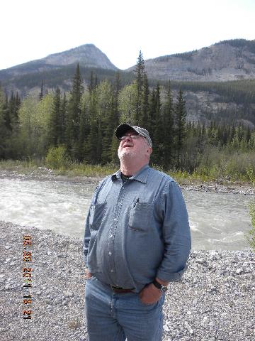
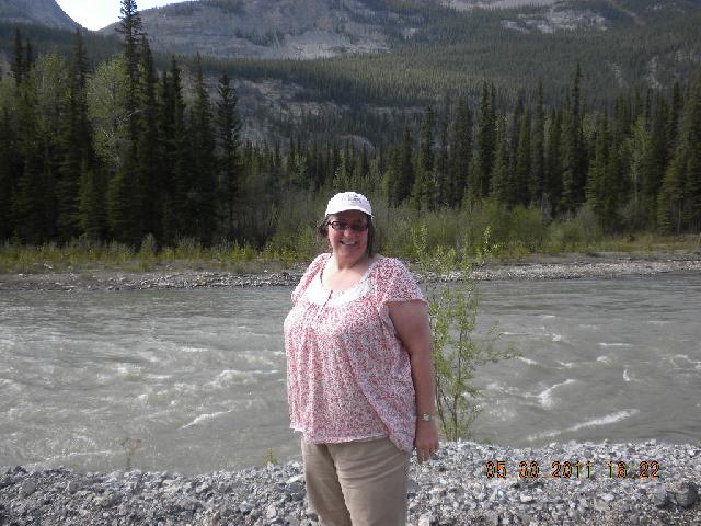
Well, as John and I passed over rivers, we’d let out the battle cry “Toad River, Let ‘er buck!” or “McLeod River, let ‘er buck!”. Ok, it was fun if you were there. Here’s a nice river and John and me.
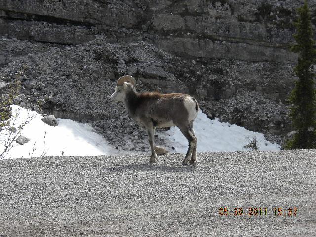
See this gorgeous sheep!
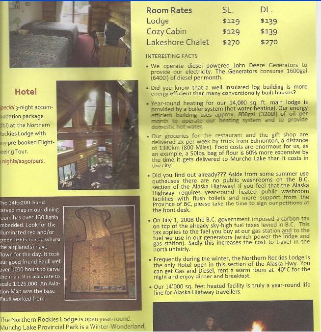
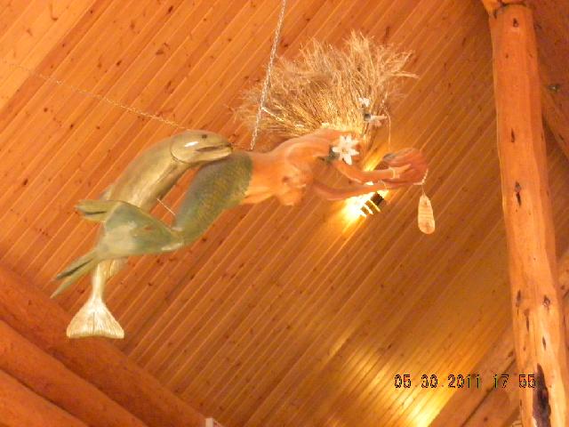
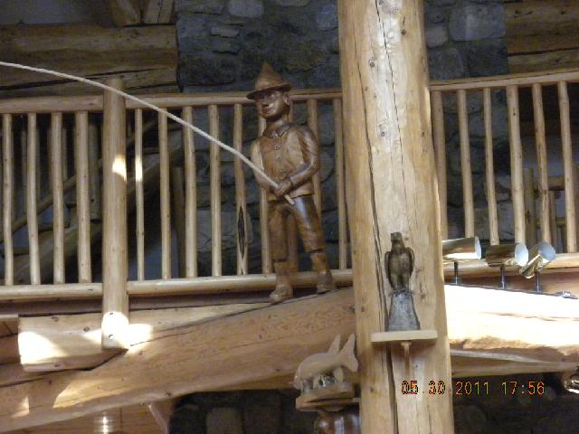
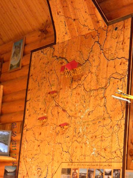
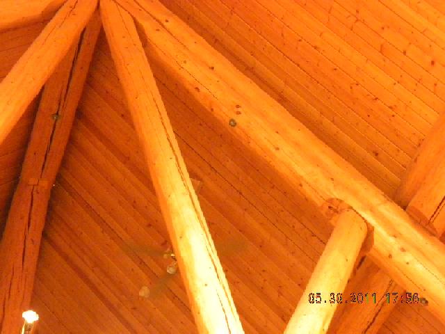
Stayed the night in an overpriced RV park in Muncho Lake. This was an interesting place: it seemed to be a little whiney to me. They posted signs about how the government was cutting back on how many flushes they could do at their resort and wanted tourists to write letters of protest. And they let us know how difficult it is to get supplies to this remote area. In retrospect, we were in even more remote areas and didn’t get the same sense of “poor us, and we have to charge you a whole lot more because of our desperate situation”. Dinner was $82.95, and it wasn’t all that fancy! The resort did have motel rooms and a lovely lodge. Here are some cool photos of the inside: ceiling sculpture, another wood carving, a relief map, and the support beams.
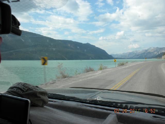
Muncho Lake itself was extraordinarily green.
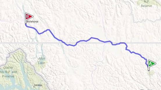
Day 7, Tuesday, May 31: Muncho Lake to Whitehorse, Yukon
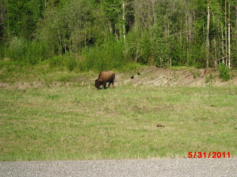
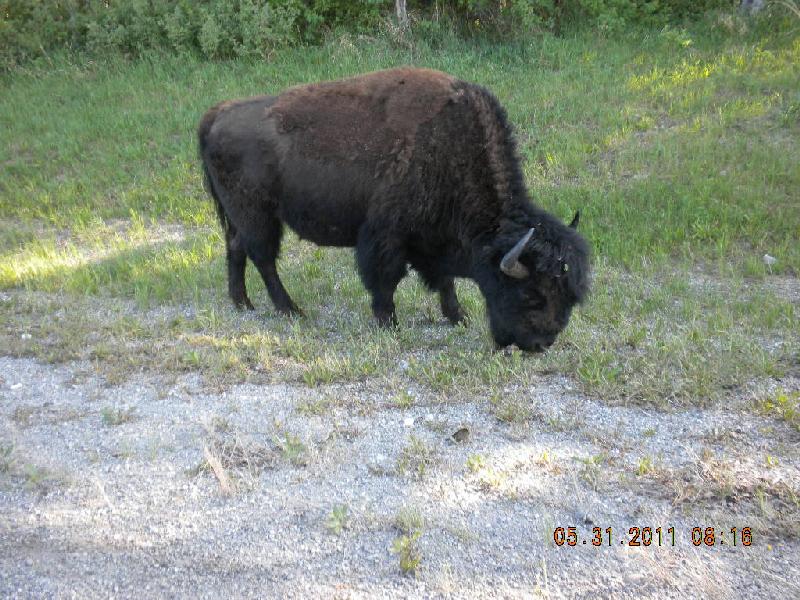
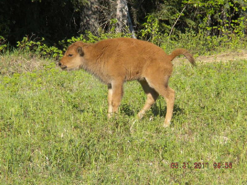
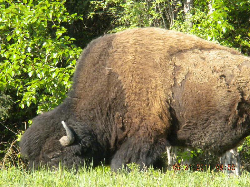
Buffalo and baby bears! We saw two baby black bears right at the side of the road. Rolly polly, frolicking, chasing each other up and down a small hill. Nearby stood a big buffalo, just watching them. Except it turns out it wasn’t the cute baby bears the buffalo was staring at – between him and the babies was a little depression and John saw the back and top of the head of momma bear. Our buffalo was wary of her, not watching the cubs romp! This day brought lots of buffalo. See this one right by the road! Had I wanted to I could have reached out and patted its head! Here’s a baby buffalo! And see this stunning huge guy!
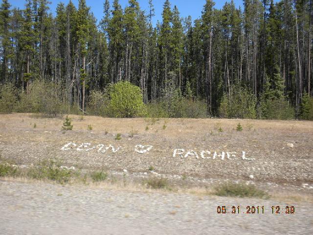
We also saw the first of a lot of examples of rock writing along the side of the highway. (Rachel, I thought about changing “Dean” to “Taelyn” but knew I shouldn’t mess with the magic of the original rockery…) This stuff turned up in a dozen different places in both Canada and Alaska.
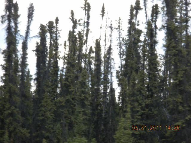
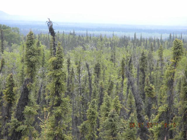
This was the first day we saw black spruce trees. I came to love them. They’re also called bottle washer trees because they’re tall and skinny. They grow in places where the ground doesn’t allow deep roots. This is a tundra tree since it can’t penetrate the perma-frost.
Slept the night in White Horse. We were really hungry and finally found a Greek pasta place downtown. I had a yummy pasta with cream sauce and quite enjoyed it until later than night when it came back up. I mention this as it is one of only two infirmities suffered on the trip.
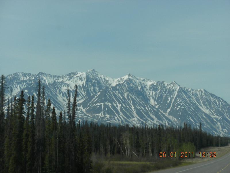
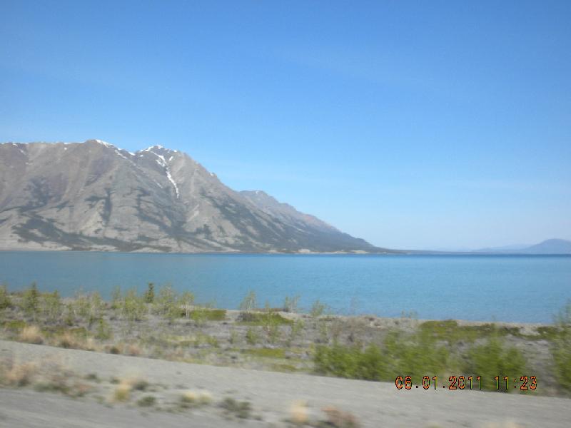
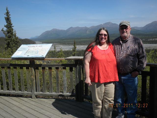
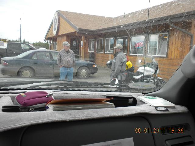
Day 8, Wednesday, June 1: Whitehorse to Tok, Alaska
Good sleep last night, clean showers, we’re both sweet-smelling and happy.
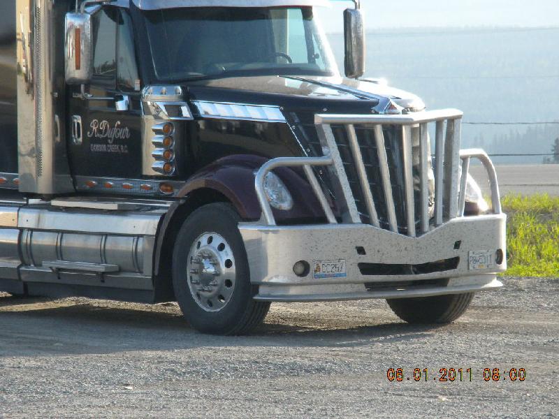
Look at the cool moose catcher on the front of this truck! Oh: today we learned that Verizon has very little coverage in Canada. We found that we could not make any outgoing calls but did receive an incoming call from Taelyn. Verizon says it has a Canada and US Plan, but we found dang few places where they have coverage. At least in western Canada where we were.
More pretty mountains and lovely lakes. Lakes and rivers have ice on them.
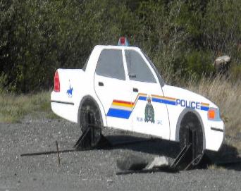
See this fake police car near Haines Junction – it’s just a cardboard cutout!
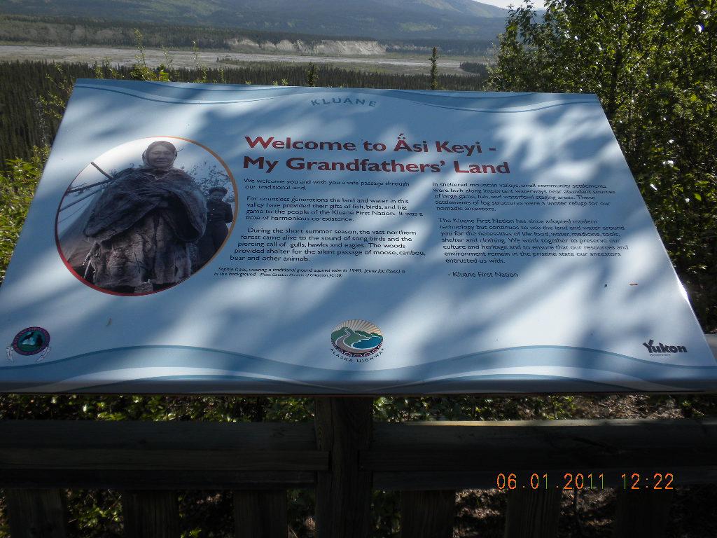
We stopped to read signs about the land belonging to the Kluane peoples. We see huge culverts and more wonderful black spruce trees. The mosquitoes are getting worse, and I hide in the truck from them as John and a biker socialize after dinner.
Roads and frost-heave: In Haines Junction, Canada, the gas attendant told us to beware of the frost-heave in the roads between Burwash Landing and the Alaskan border. “Thanks a lot!” we replied, but were stopped cold when he added, “Lots of people break axles on that road.” And it’s true: the road is a ribbon. Not a flat ribbon as in Woodie Guthrie’s song: “As I was walking a ribbon of highway I saw above me an endless skyway. I saw below me a golden valley This land was made for you and me”, but a folded and wrinkled and creased, crimped, twisted, bent, corrugated and every other word that I can think of. There’s no way to drive in your lane only; when you see one of these heaved hills in your lane you drive in the oncoming lane. And that’s no biggie; there’s plenty of space to see if anybody’s coming. Canada tries to put little red flags at the really bad heaves, and usually they do ok. Here’s what the Alaska Trekker http://alaskatrekker.com/alaska_highway.htm) says:
“In particular, some 100 miles of route between Burwash Landing and Koidern, Yukon, became virtually impassable in May and June of 1943, as the permafrost melted, no longer protected by a layer of delicate vegetation. A corduroy road was built to restore the route, and corduroy still underlays old sections of highway in the area. Modern construction methods do not allow the permafrost to melt, either by building a gravel berm on top or replacing the vegetation and soil immediately with gravel. However, the Burwash-Koidern section is still a problem, as the new highway built there in the late 1990s continues to experience frost heave.” Shirien’s note: “problem” is an understatement.
Sure enough, we soon saw a truck separated from its trailer, and the tongue of the hitch was with the truck, not the trailer. Scott, John’s son and a trucker (former ice road trucker and a transcontinental trucker, at that!) says that naive big rigs frequently lose their axles! Sometimes newbies get frustrated going 5mph and try to zoom right through. There go the axles. But we were cautious, running 5 -10 miles an hour and then speeding up to 30-35 mpg and rarely up to 50mph until we spied another of those little red flags. More on this special section of road on the return trip.
Oh yes: On that day I ate Rudolf, or maybe it was Prancer or Cupid, I’m not sure. I had a reindeer omlette. It wasn’t bad; tasted a bit like salty sausage of some sort. However, it didn’t agree with my intestines. That was the second and last infirmity of any inconvenience.
We spent the night in Tok.
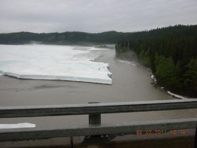
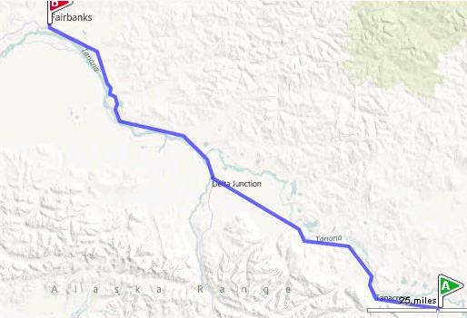
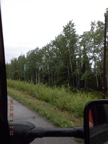
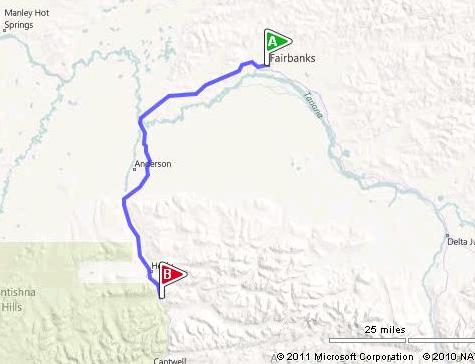
Day 9, Thursday, June 2: Tok to Fairbanks, Alaska
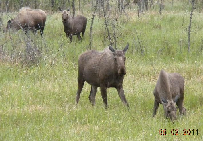
In Tok we got gas and ate at our first Fast Eddies. They were true to their name – we didn’t have to wait long for our food. We saw lots of firefighters eating there. We saw several deer and moose in camo; that is, they ducked into the forest just after we saw them and just before the camera clicked. I’m sure you can see them if you look hard enough. They’re laughing at us. Here are some that we caught, though.
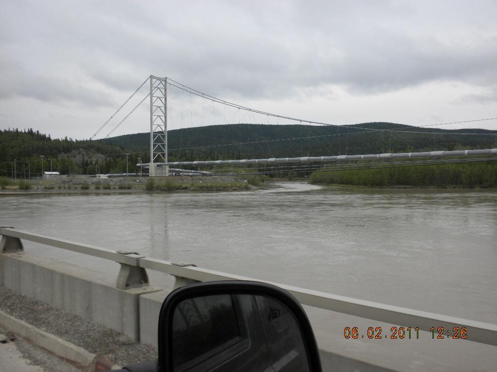
Oh: today we saw the Alaska pipeline!
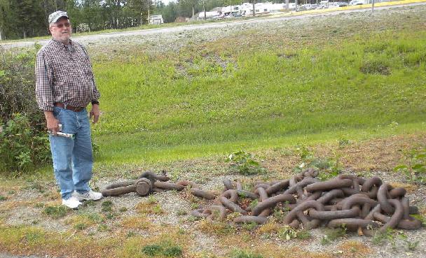
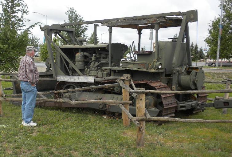
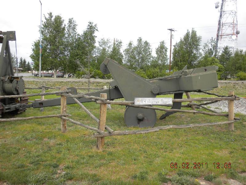
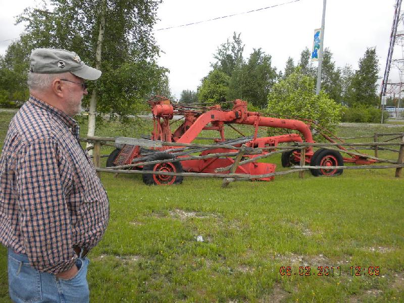
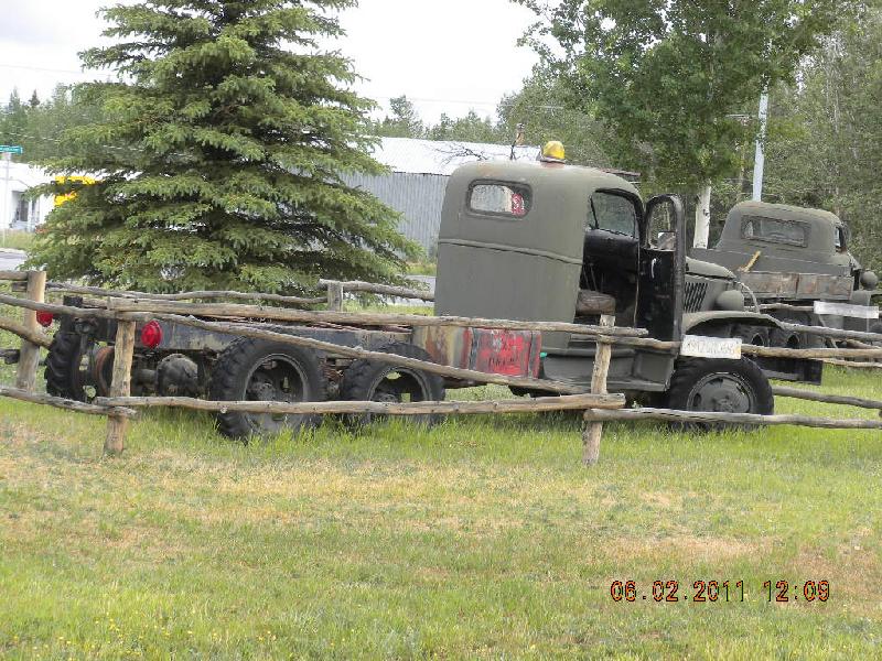
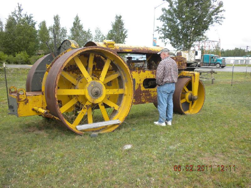
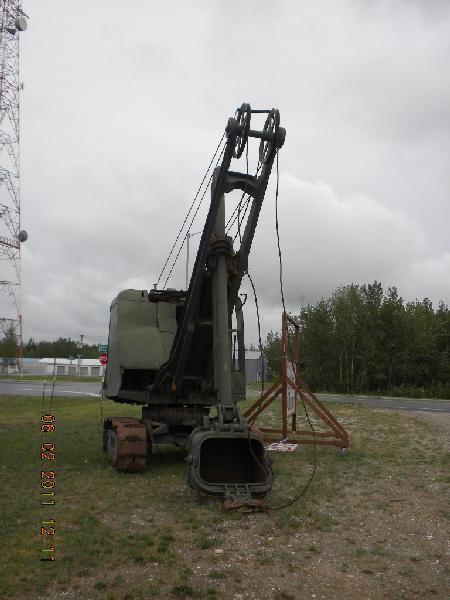
A bit about Delta Junction, Alaska: there’s wonderful mosquitoes there! They didn’t bother John too much, but they did get me. Across the street there were a lot of old equipment that tickled John’s fancy: some very big chains, an old cat, a ground chisel, a road grader, a very old studebaker truck, another big pavement compacter, and a shovel. He really enjoyed seeing equipment that is older than he is.
Up to Whitehorse the birches and Quaking Aspens were large, old. But here they’re smaller and possibly older; they’re affected by the short growing season and the cold. It’s hard to imagine this area being very cold when right now at 8:15 in the morning it’s 62º.
When Canadians work on the road they seem to have an ambulance always on site. We wondered whether the EMT who drives the ambulance doubles as a road worker or whether s/he just sits there all day waiting for an accident. We didn’t see anybody sitting inside it.
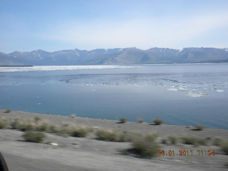
Look at Lake Kluane with all the ice on it! A couple weeks later when we went by there was no ice at all that we could see! The gas station lady in Burwash Landing said that all the ice submerged; it was still there, just not visible. Guess that makes sense.
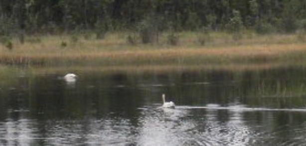
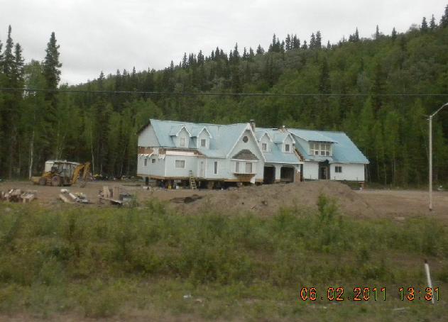
That day we saw swans, too. And here’s a house being moved.
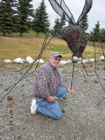
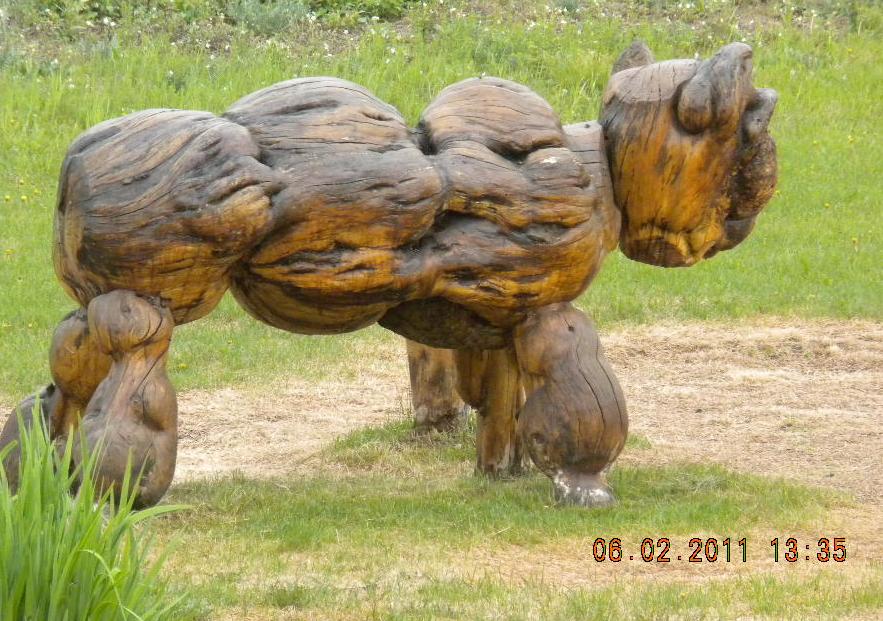
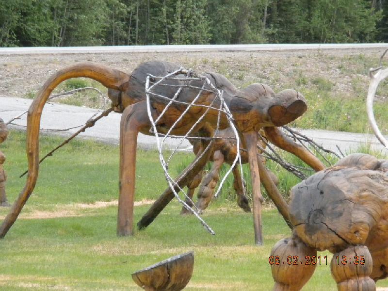
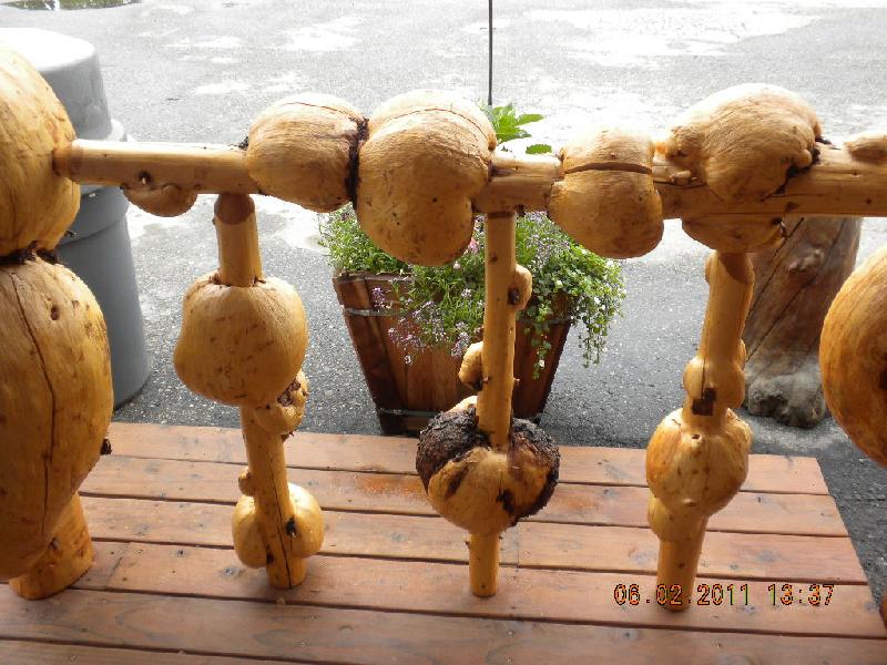
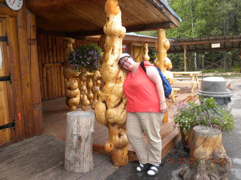
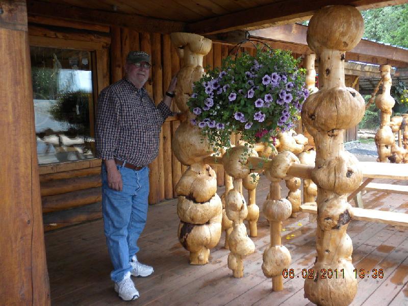
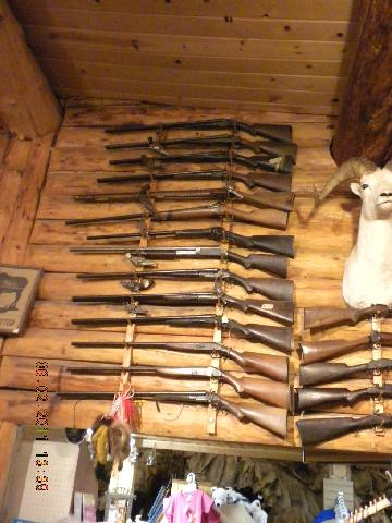
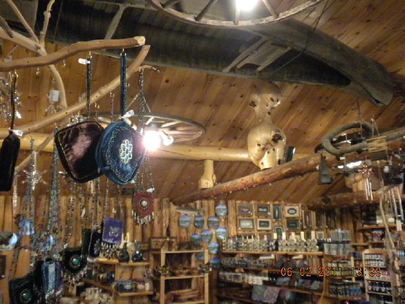
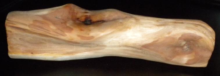
I have to say something about some very cool logs that have burls on them. We first saw them in a shop about 30 miles out of Fairbanks called the Knotty Shop. Burls are not good for trees: they’re growths on trees that look like protruding knobby balls. Sometimes people make these logs into sculptures like this one, or this mosquito, or they may use them as railings. We saw quite a few shops and homes that used them as porch support pillars. John would love to get a bunch of these for our front porch on our CV log home. Wouldn’t that be spectacular! They’re $10/linear foot, which doesn’t include shipping, though.
That store had all kinds of things to delight the soul. John enjoyed the old guns and I whiled my time looking at all the rest of the stuff.
Stayed in Fairbanks that night. Someone John knows asked him to look up his daughter in Fairbanks so we called the place where she worked, but no answer. Oh: the “check engine” light came on the Ford, too.
Day 10, Friday, June 3: Fairbanks to Denali Park
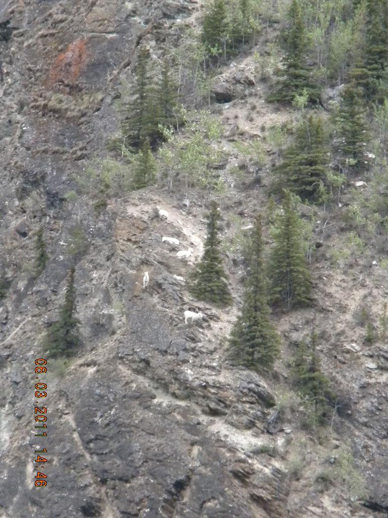
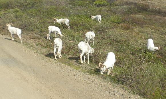
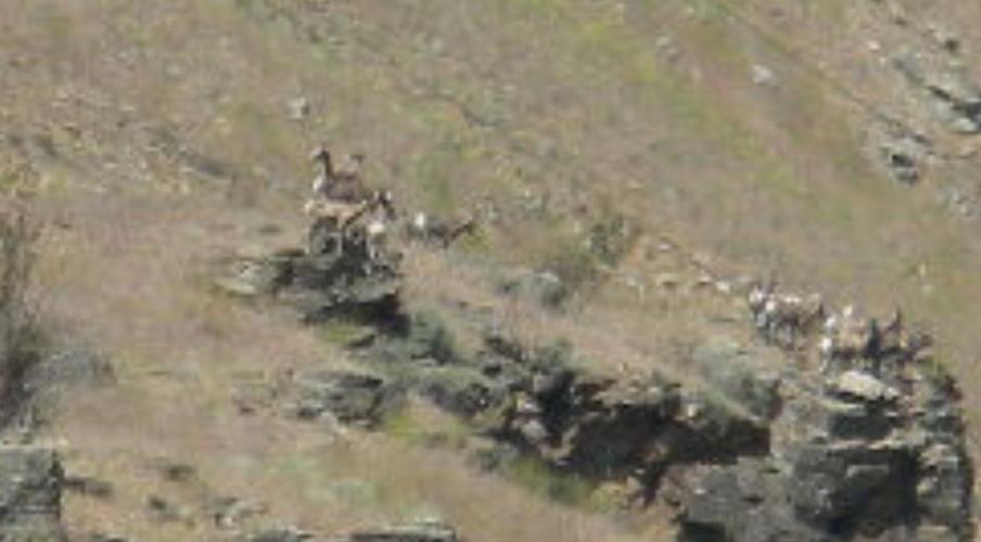
Short drive from Fairbanks to Denali Park. We saw a bunch dall sheep across the road on a mountain.
We parked the camper at Denali Grizzly Bear Resort. We stayed there two nights. During the afternoon on Friday we did laundry. We paid over $15 for two loads! We had to buy special tokens for their machines; we couldn’t use money, and we had to battle the mosquitoes while the clothes dried. Oh well; it felt really good to have no bags of dirty clothes hanging around.
Day 11, Saturday, June 4: in Denali Park
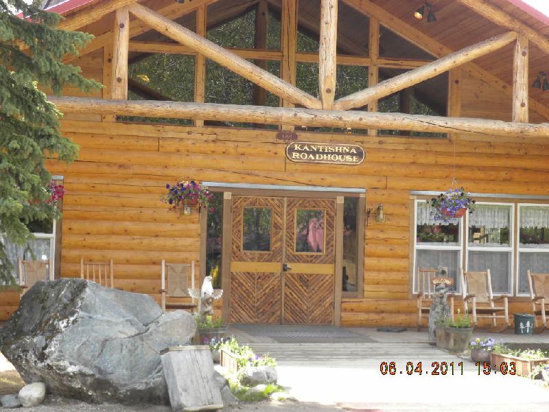
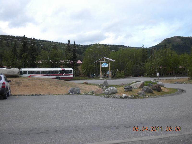
We had made reservations to take the bus trip into the farthest part of Denali Park that non-employees of the park are allowed to go: a little cabin resort called Kantishna. Tourists cannot drive their cars in the park; everybody takes busses. There are two kinds: the shuttles that you take whenever you want to (a bunch of busses make a loop throughout the day and you climb on and off as you wish), and then the tour busses that go for 12 hours on a round trip. We did the long one. The bus we took was maybe one step up from a school bus, and it was cram packed with tourists. The driver was the tour guide with a microphone, and ours was pretty good, pretty knowledgeable and pleasant.
But before we got started, here’s a little story. When I made the bus tour reservations the lady told me that the start of the tour was across the highway from our RV park; we could just walk there. She said we could have breakfast at 5:30 am before the tour began, and then lunch would be at Kantishna, and we’d be back by dinner. I didn’t worry too much about having too much food for John’s diabetes since it looked like most everything would be taken care of. At 5:00 the next morning we were sitting on the benches outside the locked doors of a really pretty resort. As it got closer to 5:30 I got more concerned that we would miss breakfast. I tried all the doors and finally found one open. Wandering around inside I found the restaurant and a bunch of chefs in preparing food. Long story short: they didn’t know anything about the tour or about breakfast or about anything that I had on my mind. They did, however, offer to make a little snack for John’s breakfast, and I gratefully accepted. I called the tour lady then and found out that the mistake was mine: there were two resorts across the highway and we’d walked right by the tour one. The chefs brought out a lovely platter with a dozen or so doughnuts, some Special K cereal, and a couple pieces of fruit, and they wouldn’t even let me pay them. “We’re in the hospitality industry and this is what it’s all about,” was the nice chef’s reply. I was embarrassed but very grateful, and we walked with our loot across the way to the correct resort. We donated all the sugary treats to others on the tour who were happily eating their breakfast furnished by the tour folks.
Oops. But what a great lesson about customer service.
The bus stopped at several other resorts picking up passengers and then began the tour through the park.
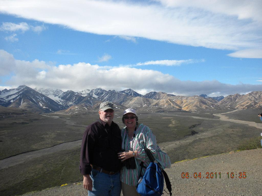
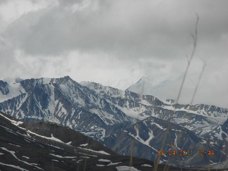
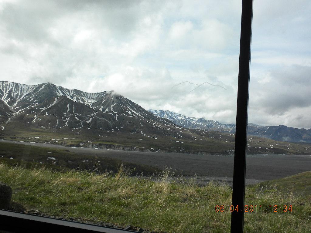
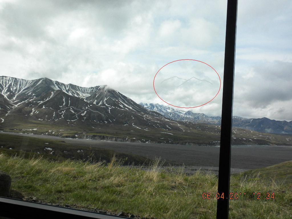
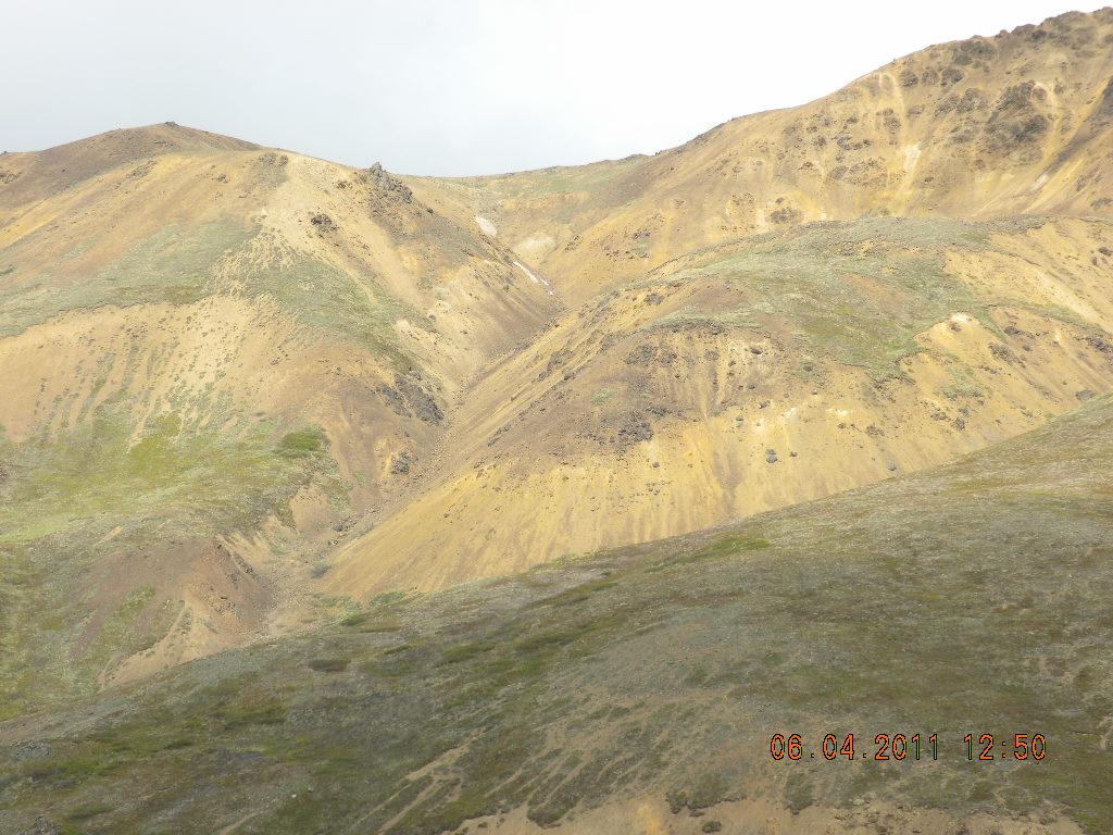
There were plenty of rest stops which had gorgeous mountains as backdrops. We saw lots of animals, but all except some sheep right on the road were either very far away (needed field glasses) or pretty far away. The mountains were awesome, however!!! Well, all of them except Mt. McKinley -- here’s its base (it’s the one to at the right of the photo that you cannot see). At the information center there was a window through which you could look at Mt. McKinley. Since there are only 17 days per year (on average) which people can see the mountain, they did this very funny thing. They put an “X” on the floor and said, “If you’re 6’ tall, stand here and look out the window.” Then on the window there was an etched outline of where Mt. McKinley would be if you could see it. Another “X” on the floor was for people 5.5’ tall, and they had a different etched outline to look at. Did you see the etched outline? If not, look again. Guess that’s the closest we got to seeing it. On the tour we did see the very top of the mountain for a few moments, and we did see the bottom for a longer period, but we never saw the whole thing. It was a real disappointment to miss this view. Other mountains were awe inspiring, however, and there were some really beautiful painted mountains to see.
We didn’t get back to the RV camp until about 8:30 or 9p, and we were really, really pooped.
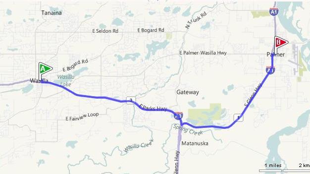
Day 12, Sunday, June 5: Denali to Wasilla
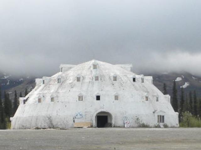
Denali to Wasilla wasn’t a terribly long day. We saw a cool igloo hotel that was probably built in the 50s and is no longer used. We drove to Palmer to spend some time with Char and Cebrina, John’s son’s Scott’s wife and daughter. Scott was out working on a road crew and since jobs are dear, we planned to drive to his job site on our way out.
We were getting pretty cabin-bound so we stayed at a hotel in Wasilla that night. Oh: Char and Cebrina and John and I had dinner at a yummy Italian restaurant.
Day 13, Monday, June 6: Wasilla and Palmer
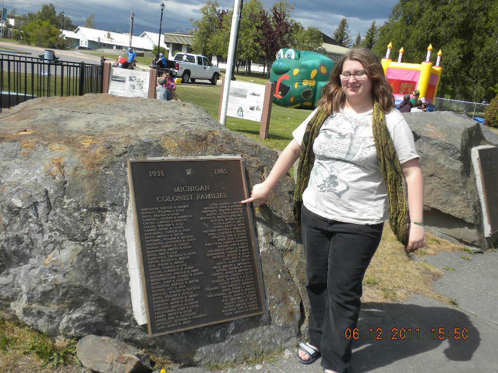
We spent the day with Char and Cebrina. Char has a very interesting heritage: her family was in the group of folks moved by the US government in the 1940s from the lower mainland into Palmer, Alaska, to participate in a grand experiment in socialism. Wikipedia gives a short history: ”Palmer was transformed in 1935, during the Great Depression when the Federal Emergency Relief Administration, one of President Franklin D. Roosevelt’s New Deal projects, established the Matanuska Colony. From Michigan, Wisconsin, and Minnesota, 203 families traveled by train and ship to reach the fledgling colony, arriving in the summer of 1935. Upon their arrival they were housed in a tent city during their first Alaskan summer. Each family drew lots for 40-acre (160,000 m2) tracts and their farming adventure began in earnest. The failure rate was high, but many of their descendants still live in the area and there are still many operating farms in the Palmer area, including Vanderwheele and Wolverine farms.” (http://en.wikipedia.org/wiki/Palmer,_Alaska). Here’s another website with more information: http://explorenorth.com/library/yafeatures/bl-matanuska.htm. It lists Char’s family: Loyer: Joseph, Naomi and 4 children (Harrisville, MI)
Char showed us a video documentary about the whole thing; it was really, really interesting. When we came back though Anchorage after our Homer fishing trip Char and Cebrina drove me around Palmer, pointing out uncles and cousins and aunts and everybody’s homes.
That evening we had a tasty pot roast by Char, accompanied by some very satisfying gravy by John. In all, it was a very enjoyable day, and I was glad for the chance to expand my relationship with those two women.
Day 14, Tuesday, June 7: Wasilla and Anchorage
Since the “check engine” light was on in the Ford we stopped by Kendall Ford in Wasilla. For over a thousand dollars they fixed the injection system. We were resigned about the cost and grateful that nothing terrible had happed when we were miles away from anything. The thing that really bugged us was that they had fixed the thing and taken it out for a test drive only 1 and a half hours after we got there, but then they kept us waiting for another hour, sitting in the waiting room and looking at our Ford right there in the parking lot, until we finally asked what was going on. Still don’t know what that was all about, but we did get out of there just about at the time they originally had predicted. Another interesting lesson in customer service.
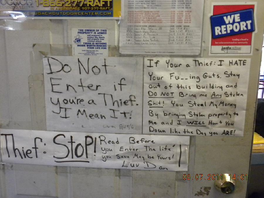
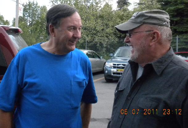
Tuesday afternoon we stopped by some friends of Eric and Chris’s; they’d given us contact information and suggested we look them up. Dan runs a pawn shop in Anchorage. He’s a very interesting fellow, and I enjoyed watching him interact with the customers who came in to sell and pawn their items. Here’s a sign on his front door. It turns out that while we were there a fellow came in to sell an iPod, and Dan bought it. Not more than half an hour after the fellow left Dan got a call from a woman who had her car broken into and her iPod stolen. There was some relatively high tension in the shop for a little while until the woman came in and said that the one Dan just bought wasn’t hers. We all decided to have dinner together the next night, and John and I left. Interesting afternoon. Nice folks, Dan and Darla.
We spent the evening with Phil and Molly Nelson. Phil was a good friend of John’s during high school. He had some great stories to tell about a moose racing him in his car. Molly made a really fine dinner, and we just had a great time. They have a lovely home and seem pretty content in their Alaska digs. We were lucky to connect with them; they spend part of their year in California. We lamented about the state of the culture, solved the world’s problems, and had a lot of laughs and enjoyment.
Day 15, Wednesday, June 8: Anchorage
We drove to Wasilla to spend some time with Johnny and Dale Reed. Johnny and my John went to high school together, also. They have the quintessential Alaska homestead: it sits on a lovely blue lake, there’re fruit trees on their rolling green property, their home is gorgeous – they have built for themselves quite a lovely life. They’re very happy with their puppies, as well. It was great seeing them. Oh: small world! Sharon Thomas’s (from CV) first husband was a pilot named Percy. Sharon knows Alaska pretty well because when her husband was alive they lived up here and he was a pilot. Johnny Reed had known of Percy!
That evening we had dinner with Dan and Darla, the pawn shop folks. They took us to a really tasty restaurant and I had some of the best halibut I’ve ever eaten. Afterwards we went on a little tour of Anchorage; we saw a bunch of folks fishing (this was 8 or 9pm when it was still light) in the only river in the US where it’s legal to fish in town. We saw the ulu factory where native folks make the knives; we saw most of the main drags in town and heard about how much they’d changed, grown… and then went back to their home and before we knew it, it was midnight and we were still laughing and talking. It didn’t help that it was still light out, of course.
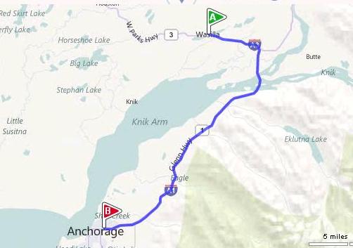
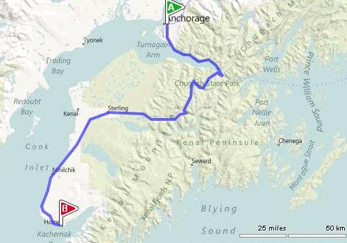
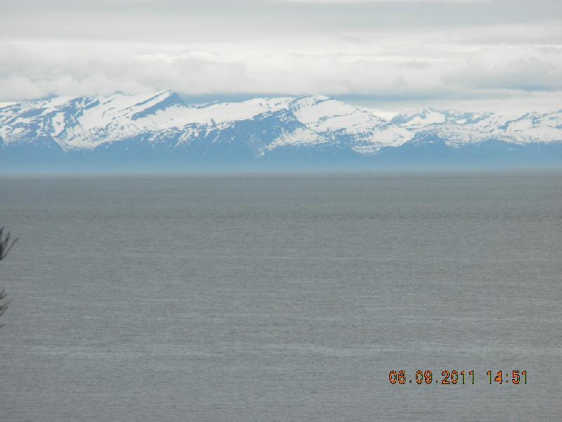
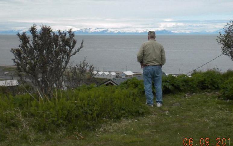
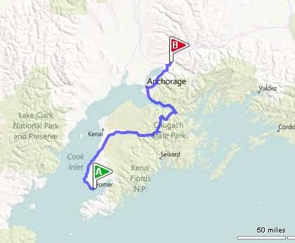
Day 16, Thursday, June 9: Anchorage to Homer
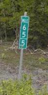
Time to head for the fishing grounds of Homer! It’s only about 220 miles, but it’s a curvy road and there was lots to see. The mountains weren’t amazingly high, but they had so many shades of green and they looked so soft and inviting. Oh! Here’s something very cool! I saw milepost signs that were incremented in half miles instead of every mile! This picture shows one, but it’s tough to see the decimal point. But it’s there!!
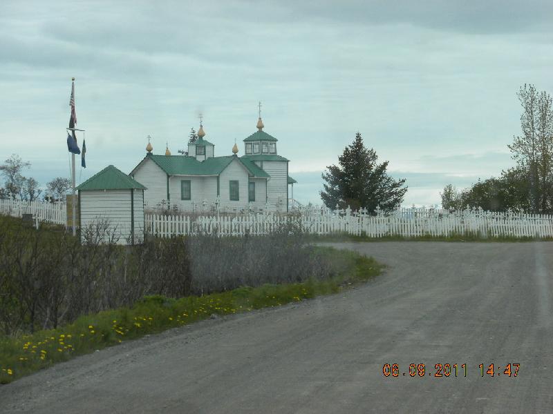
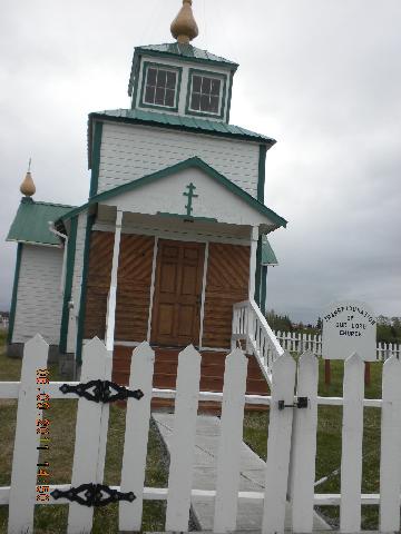
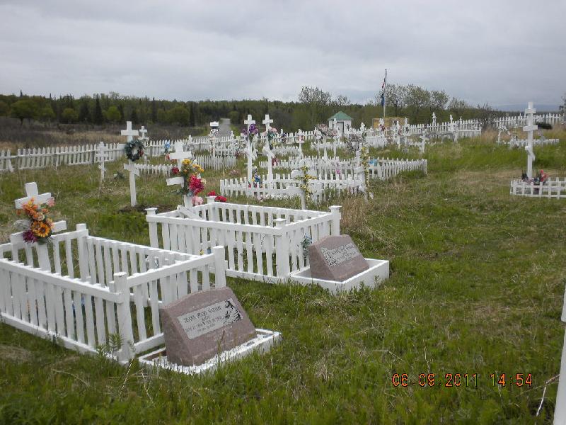
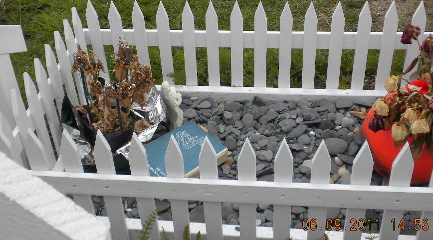
The MilePost told us about a little Russian Orthodox Church called the Holy Transfiguration of Our Lord Russian Orthodox Church so I wanted to get photos of it for my friend Janna. It had a pretty little cemetery and one of the graves even had a book left in it! And it wasn’t soggy or anything!
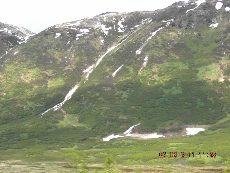
The mountains along this drive were starting to get taller and snowier. We got out of the truck to appreciate them pretty often.
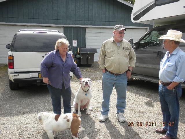
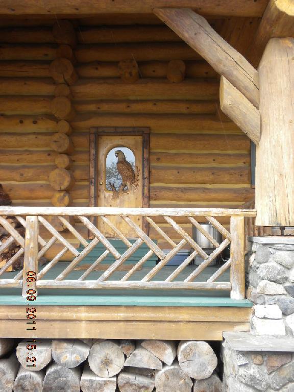
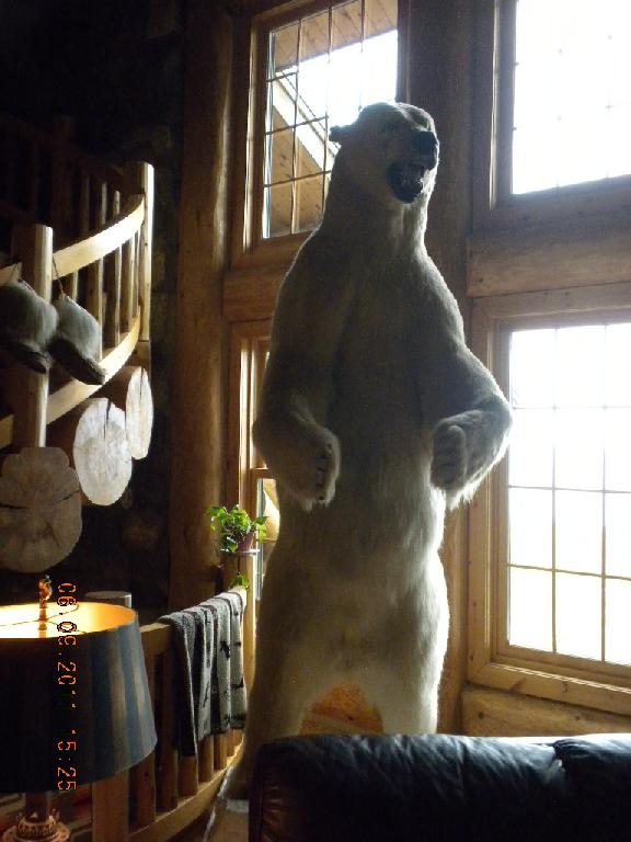
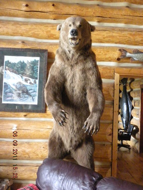
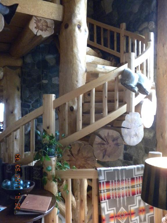
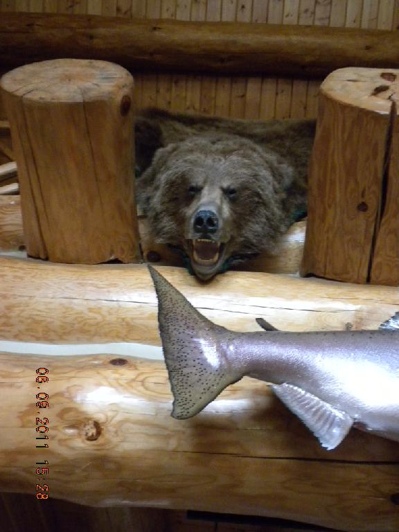
In Eugene John had an acquaintance who used to be in the fishing tour business. He’d gotten out of it quite a while ago but gave John the name of a person who used to be his partner, since John was interested in fishing for halibut in Homer. This partner was attached to the Deep Creek Fishing Club. Well, as we drove along the highway I saw a little sign for the Deep Creek Fishing Club so we followed the pretty bumpy road half a mile or so to the lodge. Turns out that this is a private fishing club in a league one or two steps above us. We believe it was a member-only or by invitation kind of establishment, and the lodges and grounds were very fancy, manicured, very expensive-looking. We drove our piglet truck and camper up to the main lodge front door, and I’m sure that driveway was far more used to stretch limousines than dirty trucks with campers. The lady who answered the door had never heard of John’s friend and her husband was out on a fishing tour, so there was nothing for us to do but gawk at the sumptuous surroundings and ask if we could take pictures and leave. Here’s the polar bear, the griz bear, the circular stairs, and another griz. The lady was gracious to us in an aristocratic, upper class kind of way that let us know we probably shouldn’t extend our stay much longer. But that’s ok: she and her husband were the working stiffs running the joint, and John and I were the people of leisure that day.
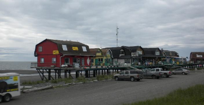
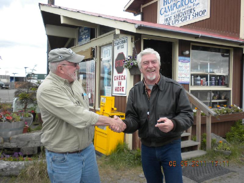
We got to Homer Spit and found a fishing tour for John; he signed up for a half-day. Full day tours go out further and find bigger halibut, and he was interested in the smaller, tastier ones. We asked about which RV park would be closest to the dock where John was to report the next morning and the tour lady told us about a perfectly located RV park and that the manager’s name was John Chapel. Well, we had to go there, didn’t we? This fellow spells his name wrong; he leaves out an “l” and a “p”, but we forgave him for those small flaws. In chatting we discovered that he, too, was a former marine, and that his birthday is in March, just as John’s is! There was lots of “my brother” and shoulder patting coming from him, and soon the two John’s were ostensibly best of buds. Here’s another funny thing: this John Chapel is the only son of another John Chapel, also in Homer, and is the father of an only son John Chapel, who just had a brand new baby only son, John Chapel. They didn’t do the numbering thing (Sr., Jr., 2nd, 3rd, etc.) like my John and h is son did. Anyway a lovely connection.
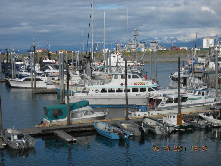
Homer Spit is a narrow arm of land poking out into Cook’s inlet. It has a large population of private, tour, and commercial fishing boats. They also had a visiting Navy ship while we were there. It’s also very tourist-oriented; lots of shops with souvenir shops, eateries, and places to spend money.
Day 17, Friday, June 10: Homer
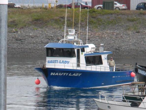
In the morning John walked to the correct pier and I tidied up the camper and did laundry. I talked with a very cute young couple while we did laundry; they were on their honeymoon! I met John at the pier around noon. The boat he went out on was called the Nauti Lady, which is funny, because back when I lived with Uncle Vern and Aunt Gwen as a baby they nicknamed me the “Naughty Lady of Shady Lane”. It’s an old fashioned song about a lady of allegedly questionable morals, but the line in that song “She just needs someone to change her and she’ll be as nice as can be” had more to do with my diapers than my character. Enough digression, back to Homer Spit.
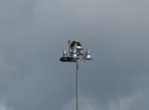
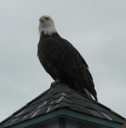
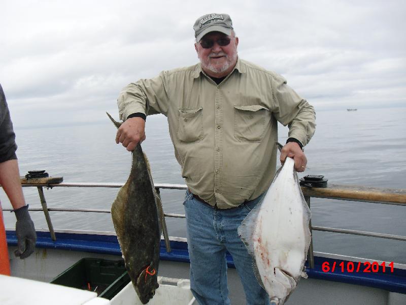
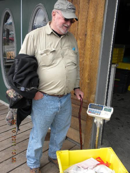
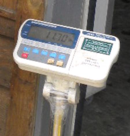
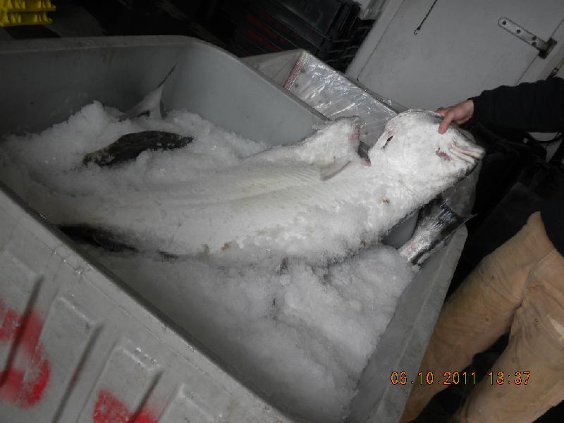
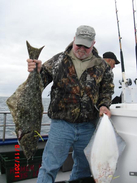
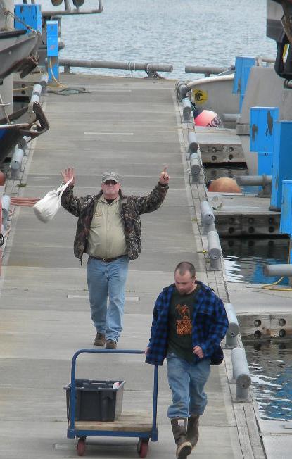
While waiting for John’s return from the sea I had plenty of company; bald and golden eagles abound and abound there. They even jostle each other for space on steeples and pier polls. John got off the boat after successfully catching his limit (two halibut) which were sent to the fish processors down the block for filleting and freezing. Since he had so much fun that morning he thought he might do it again Saturday morning. We took his fish to the processors, weighed it, asked that it be flash frozen, then admired the bigger fish that folks on other boats had caught.
John started running out of energy and needed food. The closest place was just across the highway at a fish and chips place. We ordered two halibut fish and chips lunches with two sody pops, and I sat down while John paid. Here’s a lesson we learned: if the chalkboard or menu says, “market price” ask what that price might be before ordering it. We could have had something else, something that had a price on it. Our halibut was stuck on a skewer, deep fried, and served with some french fries. Johnny laid out a $20 bill and the lady kept looking at him, expectantly. He laid out another $20, and that wasn’t good enough, so he retrieved the two $20 bills and handed her a $50. I think he got a couple one dollar bills back. Note that later the next day we had another halibut fish and chips meal on that very same Homer Spit, different café, for probably $20 or $25. I think the lady was enjoying her market price a bit too much.
Anyway, we walked around the spit for a while and eventually made it back to the RV park and our buddy John Chapel, and went happily to sleep.
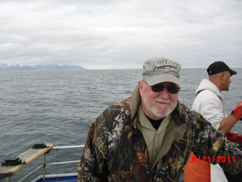
Day 18, Saturday, June 11: Homer to Palmer
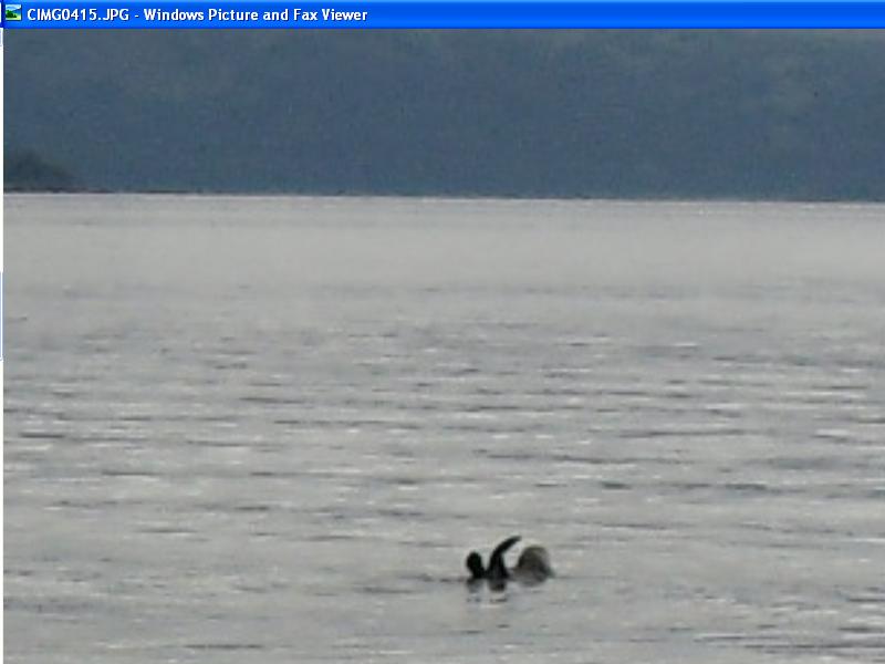
John did another day of fishing. He later said that he was surprised to see sea otters so far out to sea; he thought they were near-shore creatures. He had a good time this second day, caught his limit again, and I think he probably would have enjoyed a week or so of this.
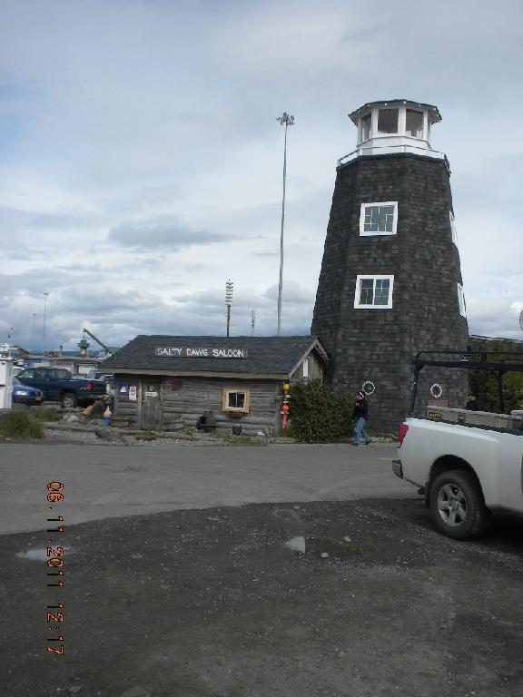
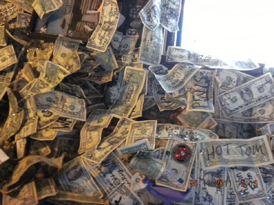
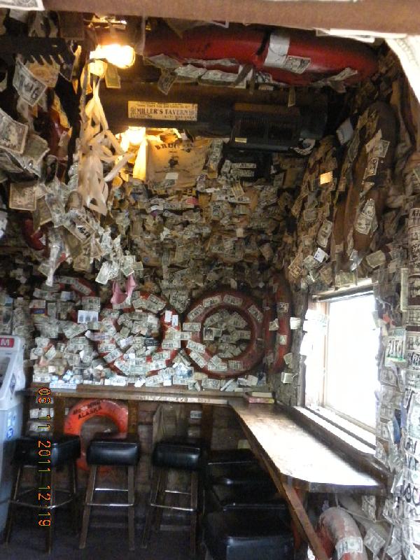
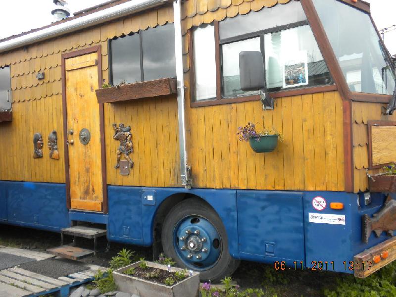
While he was fishing I wandered the spit. I went into the Salty Dawg, a famous saloon. This saloon is famous for…. I guess I don’t know what, but it is the place to see and be seen. Also, people staple dollar bills (sometimes with their names on them) all over the ceiling and walls. I saw another of those marvelous moose catchers on an 18-wheeler. Along the boardwalk there also was a cool bus which was reminiscent of Eugene.
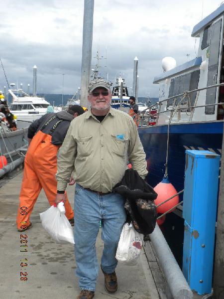
John caught his limit of two halibut again and was a happy camper. We took his two fish to the processors and they said they’d be ready in about an hour. Sure enough, they were, and we stuffed all the fish into our camper’s freezer and headed out of the Spit, into Homer and back to Anchorage.
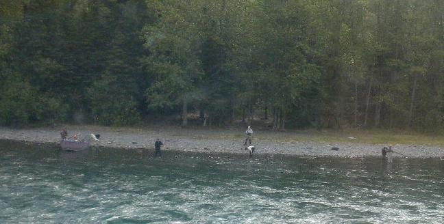
The Kenai River is an extremely popular fishing river. As we drove next to it we sometimes saw fisher folks lined up along the bank; at one spot there were so many that they were spaced about 15 feet apart! There were about 50 or 60 of them! It was a little strange: you’d see spaces along the road with lots of parked cars and at that bend of the river there would be lots and lots of people fishing; at the next turn of the river there wouldn’t be anybody. You really have to know which sections of which rivers are legally fishable and at what time of year.
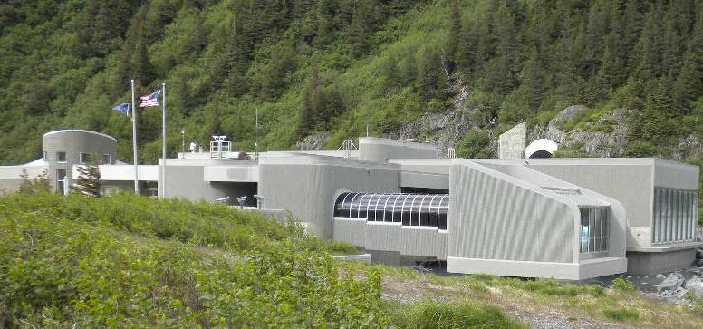
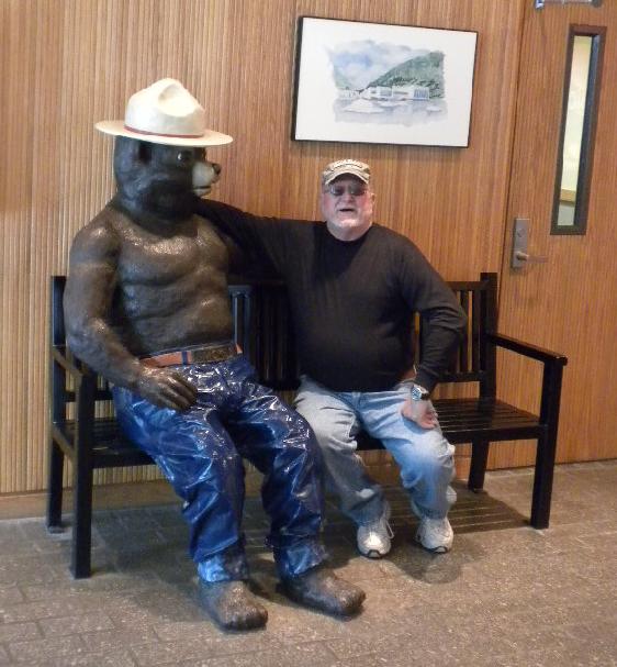
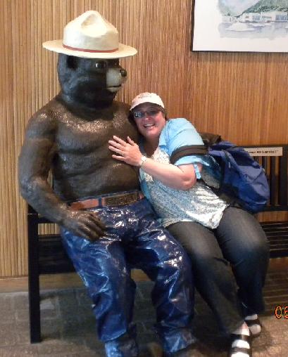
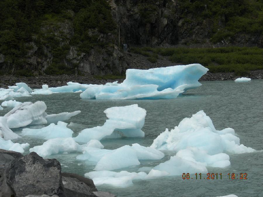
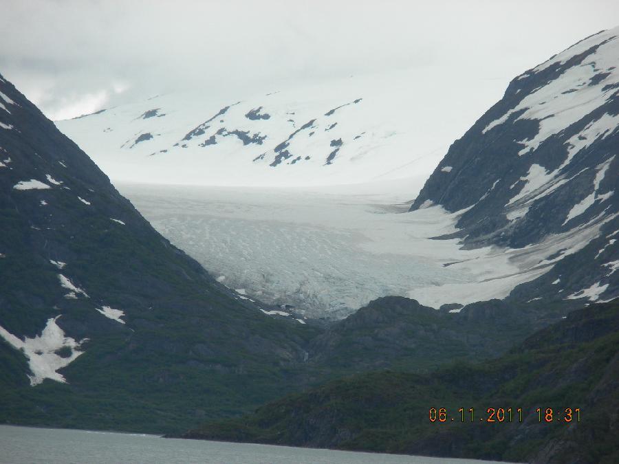
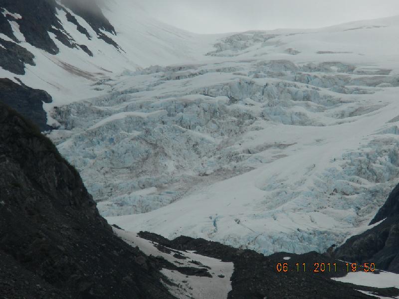
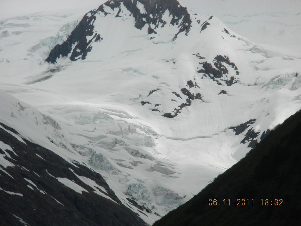
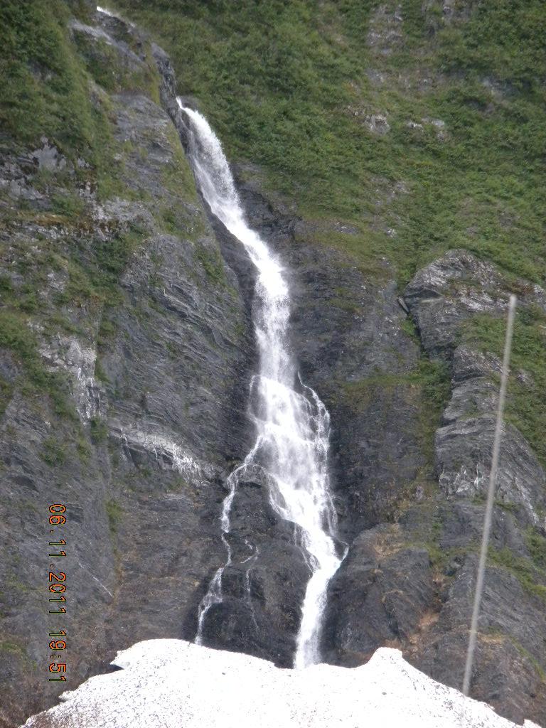
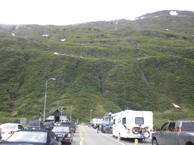
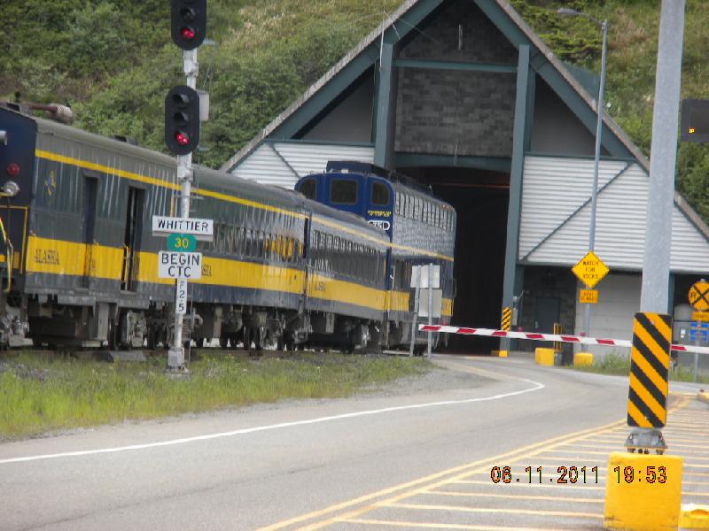
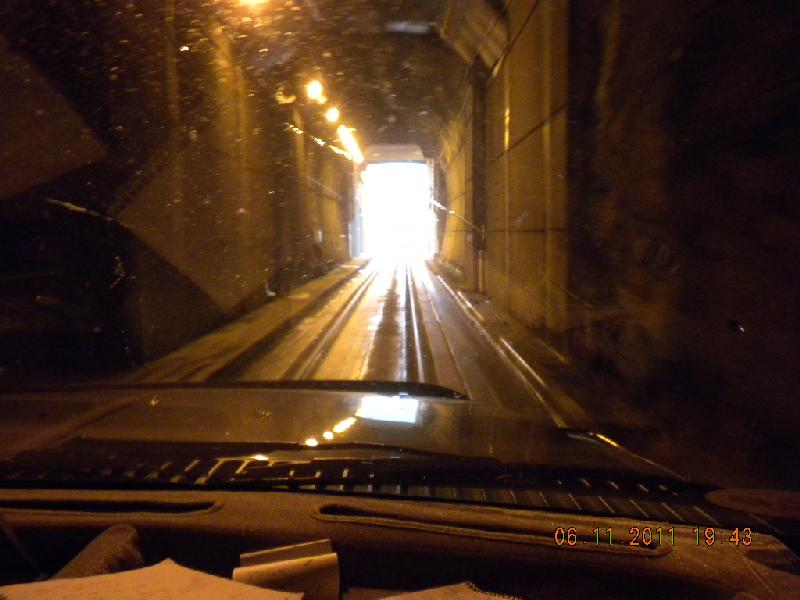
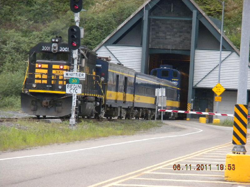
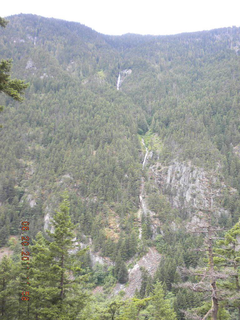
On the way to Anchorage we saw more pretty mountains. MilePost and some friend (can’t remember who – was it you, Sharon?) told us about a cool tunnel at Whittier, so we thought we’d take a short detour via the Whittier/Portage Glacier Access Road to see it. Glad we did! The tunnel was neat, but the glaciers at the Information Center were even better! Inside the Info Center John and I both made a good friend. Outside the Info Center were some floating ice bergs that were beautiful. Some glacier ice really is as blue as they say! Not all of them, and the photos don’t show at all how gorgeous and majestic and mysterious they are. The glaciers were big and thick and very impressive. There also were some wonderful waterfalls.
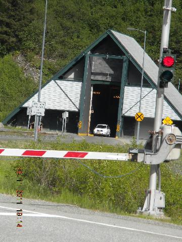
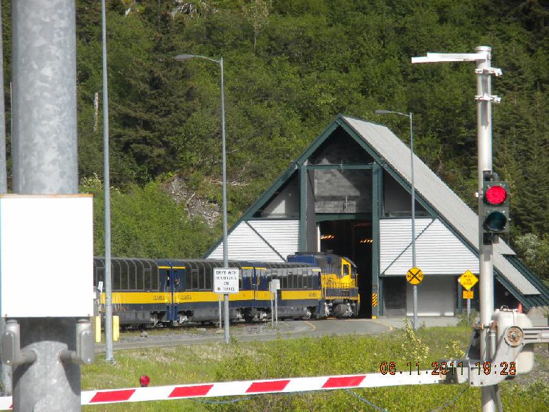
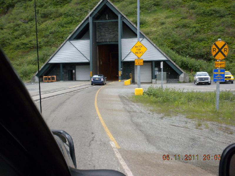
Here’s the tunnel: it is shared (one at a time, of course) by trains and cars. Everybody lines up on their end of the tunnel and eventually all the other-bound cars come through, then you wait for the train to go through, and then your side gets to go through. Pretty cool.
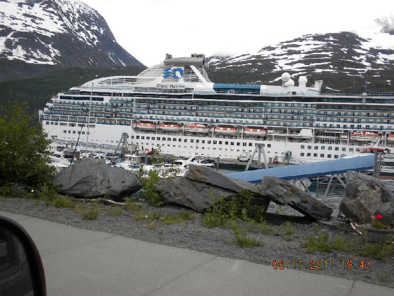
On the other side in Whittier we saw one of those big cruise ships docked. We didn’t visit Whittier; just looked at it as we turned around to get in line for our return trip through the tunnel. John’s comment: “And that’s what a colonoscopy looks like.”
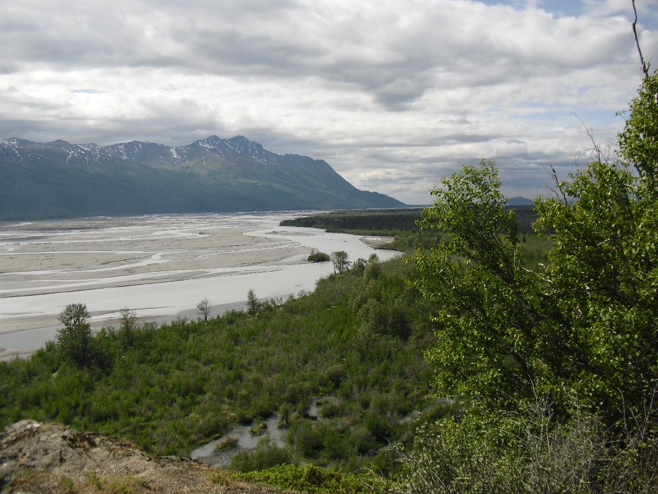
Alluvial fans, alluvial planes: We saw so many alluvial planes with tiny streams of water in them. These used to be huge rivers. Sediment washed down with glaciers create alluvial planes. When they’re in the shape of fans, at the bottom of a mountain, for example, they’re alluvial fans..
We arrived in Palmer that evening. Char graciously convinced us that we should hook up the camper in their driveway rather than go to an RV park. Scott hadn’t yet gotten home. We were so pooped that we fell asleep almost a second after the electricity was plugged in. We didn’t hear Scott come home.
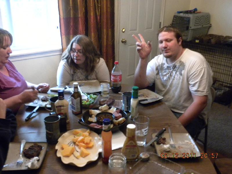
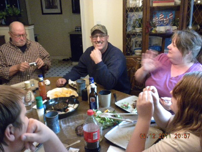
Day 19, Sunday, June 12: Palmer
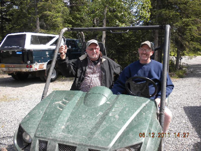
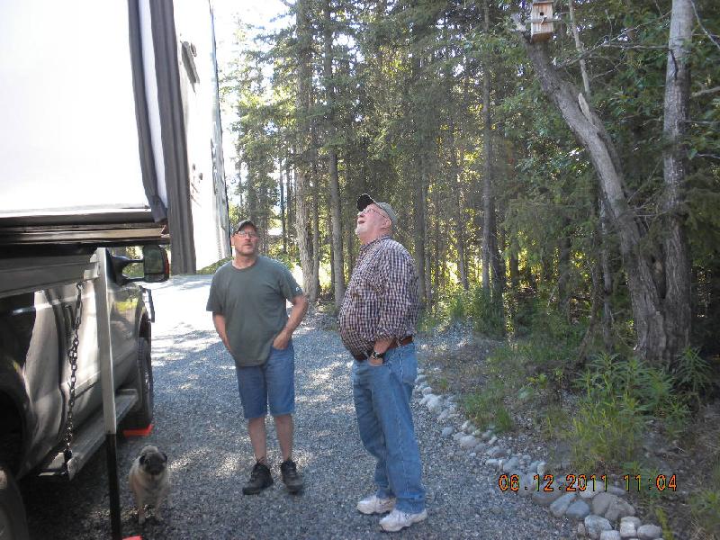
Another great day with Scott, Char, Kamen, and Cebrina! Scott took John on an adventure: they drove up some river in a side-by-side to Wolf Point. They went through the boondocks, seeing where the moose had scraped their horns, where bears pooped, where the salmon came through; they watched other folks in ATVs get stuck and unstuck. They crossed several water-ways where the water came over the floor board and they had to put their feet up on the dash to avoid getting wet. Scott couldn’t do that with one foot since he had to keep it on the gas pedal which was on the floor. All in all, they had good times together.
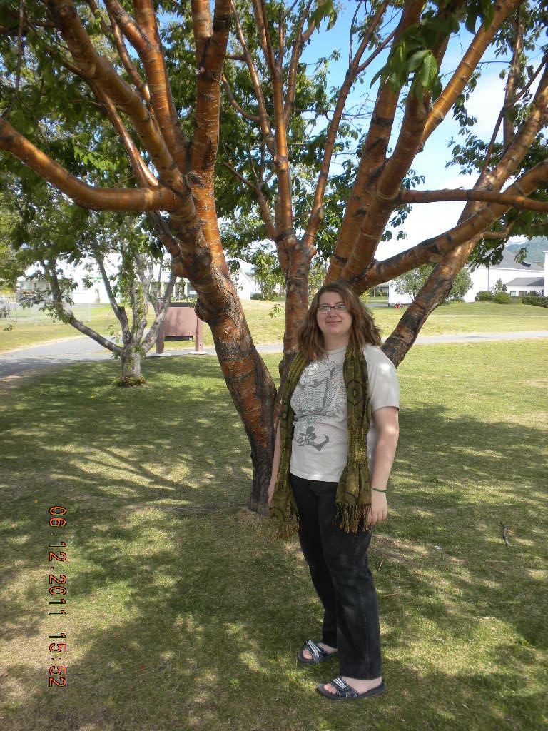
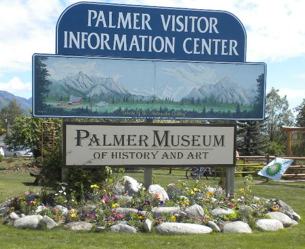
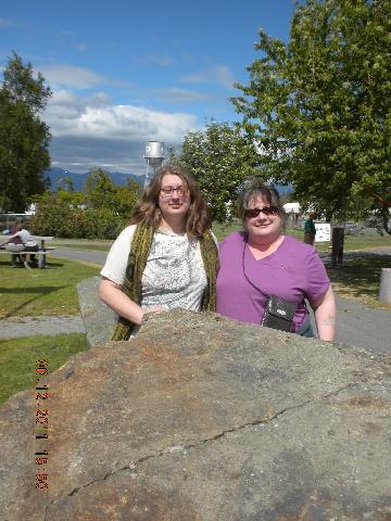
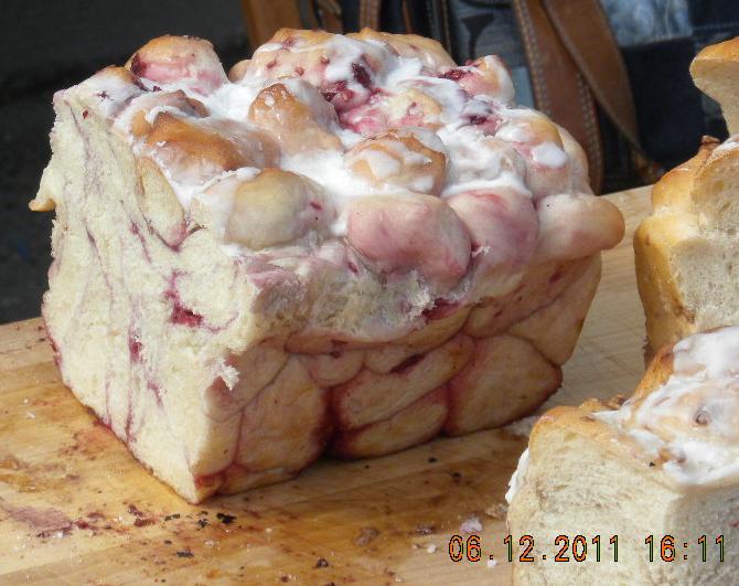
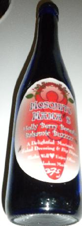
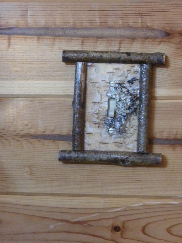
Meanwhile, Char and Cebrina took me to “Founder’s Day” celebration in downtown Palmer. Remember the story of the Matanuska Valley Colony? They celebrate that each year with street vendors in the downtown area. We visited those, and the museum, and saw the rock that had Char’s forebearers’ names on it (Loyer)… We ate yummy food and saw even more yummy food that we didn’t eat but wanted to, and visited another cool store called “NonEssentials”. That’s where Char bought a bottle of balsamic vinaigrette. I also bought a couple light fixture face plates for the CV home. Here’s one – I think it’s pretty. After the fair Char drove me around town, pointing out interesting things such as one of her aunt’s homes with plastic barnyard animals on the lawn, a skidoo on the roof, and a farm with some rescue moose and buffalo.
Well, another thing about Palmer: it’s famous for really big vegetables. It has to do with their growing season being so long (21 hours of sunlight in the summer, I bet). In 1993 Palmer got into the Guinness Book of World Records for a 35 pound broccoli.
Here’s something interesting: there are beautiful mountains around Palmer. One is called Pioneer Mountain. Char had mentioned that when she was a child growing up in Palmer she felt that the mountains surrounding the city were suffocating and restricting to her. Now that she’s older she feels they give her security. Interesting observation, in my opinion.
After everybody got home we had another great dinner at their home. Kamen joined us for dinner, too! He works at a service station in Palmer and came over to see Grandpop and me. Good food, good times making faces, laughing, bonding.
Thanks, Char, Scott, Cebrina, and Kamen for the good times, the gifts, (we love the cups, too!) the laughs. We love you.
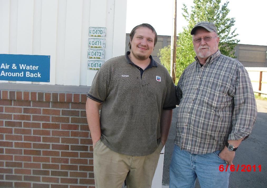
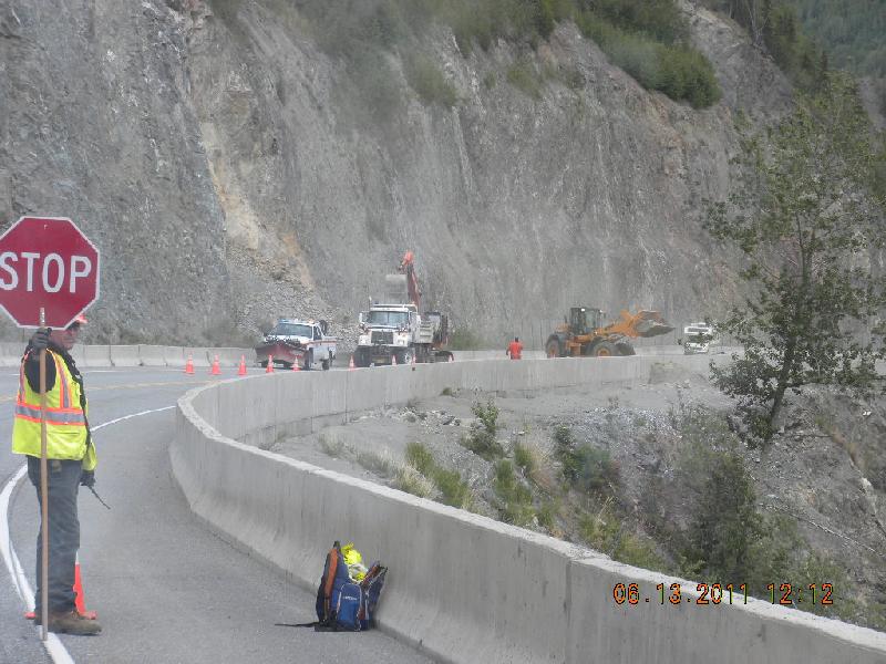
Day 20, Monday, June 13: Palmer to Tok
Since Scott’s job on the road crew was on the same road we were taking to Tok we arranged to meet him at the site for a short visit. He left earlier on Monday morning than we did, and he sent a call to our phone warning us of a severe road heave at milepost 15. He was so right! It was not marked (as they did in Canada) and we were rolling along at 50 and 55 mph. As we got closer to milepost 15 we experienced several shifts in the road, but it took us down only to about 20 mph. Oh, but then we saw the one Scott must have encountered! Thank you very much, Scott. We’d have very likely never found our way out of that one!
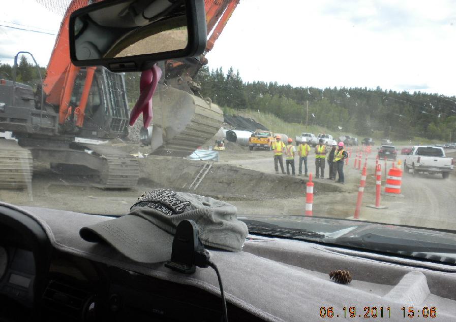
We found Scott and he took John on a turn. Scott hauls rocks for the road repair crew; he and John took about 1 hour and 20 minutes for the turn. I think he does about eight turns per day. He works hard for his money. Since he had such a tight schedule there wasn’t much time for goodbyes after he dropped John off and we all continued on.
This isn’t Scott’s site, but here’s a road crew scooping up rock and dumping it over the side of the road.
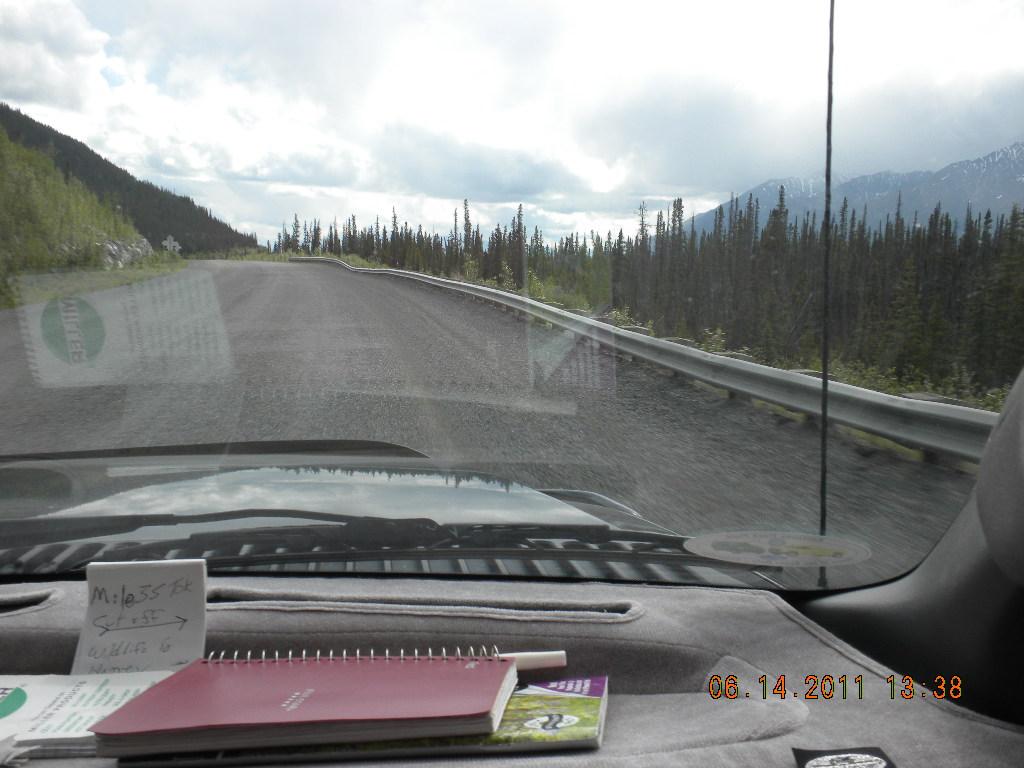
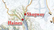
Day 21, Tuesday, June 14: Tok through Canada to Haines, Alaska
Border crossing back into Canada; easy and quick. Substituted our American money in our purses for Canadian coin.
This was the other less than happy day. Drove over the road from perdition, the nightmare road, the road of misery, suffering, torment, and wretchedness. Guess you can probably tell that this second pass over the frost-heaved road was less successful than the first time over it.
Short version: a particularly nasty set of very deep dips wasn’t red-flagged, and we saw them a few seconds too late. Slamming on the brakes didn’t help much. The impact of the drop tore the left front camper tie-down off. It also tore apart that corner of the camper. Kind of like peeling the lid partway off a can.
When I was telling Clayton the story he wondered if we’d taken photos of it for insurance purposes. I told him that a camera coming out at that moment probably wouldn’t have been the best of ideas.
John MacGyvered a temporary fix and we continued on. No photos to share. But later I tried to capture the nature of the road. Photos don’t show the dips at all well, but look at how close to the road the guard rail has sunk. This is one very very bad road.
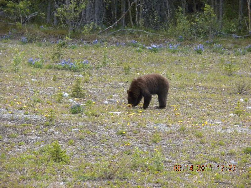
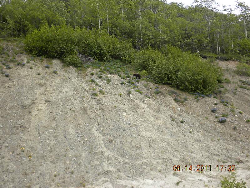
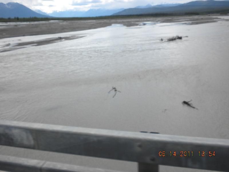
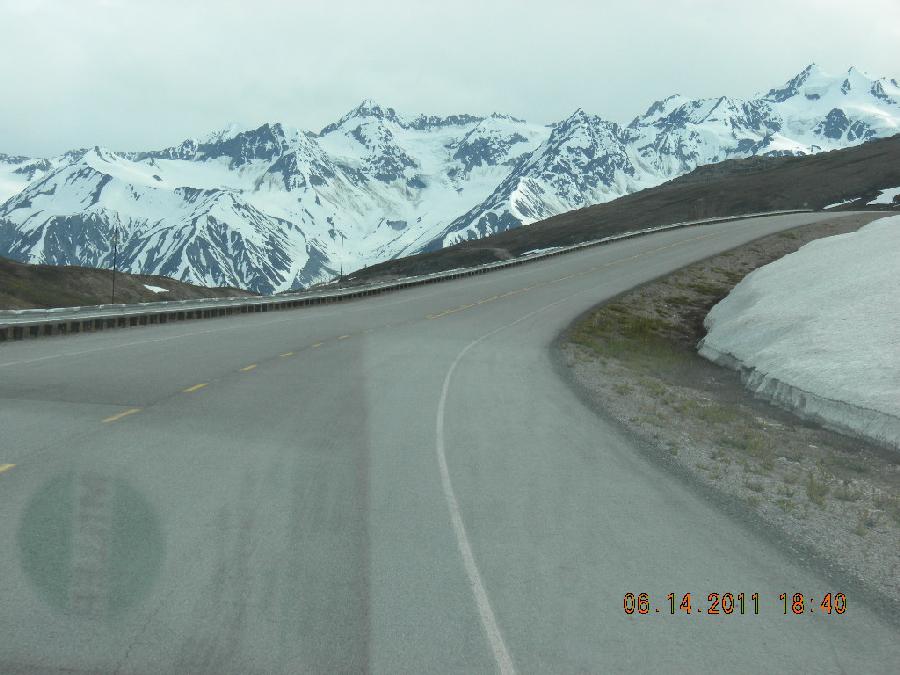
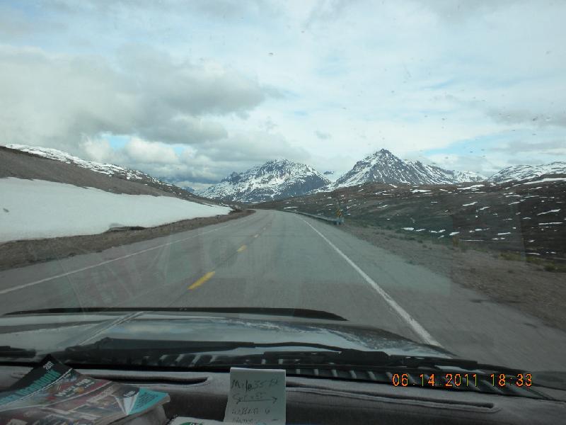
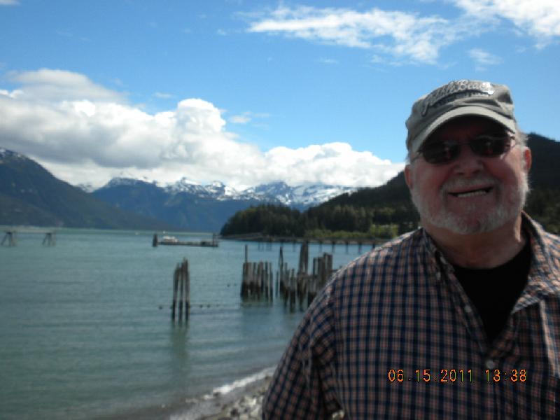
We did see some bears on this day. Four different sets of them! The rivers we passed over were muddy, mocha, and full of glacier-melt. Don’t think fish can live very well with all the sediment in them. The drive from Haines Junction to Haines goes over some very impressive mountains which are still glaciated. We took lots more photos of them, of course.
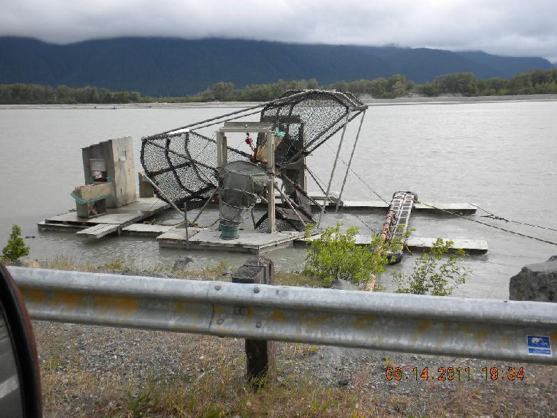
We also saw a fish wheel. It’s used for catching salmon. It belonged to Alaska Fish and Game, and they use it for catching salmon for their research, rather than rods and reels and nets. The wheel just keeps revolving and when the fish get inside, they’re dumped into a bucket.
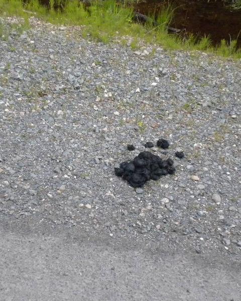
John kept telling me about the bear poop he kept seeing on the road. I didn’t see it until he finally stopped. After that I could see it lots! I don’t think bears poo in the woods; they all come to the road to do it. Maybe the road keeps their toes warm or something.
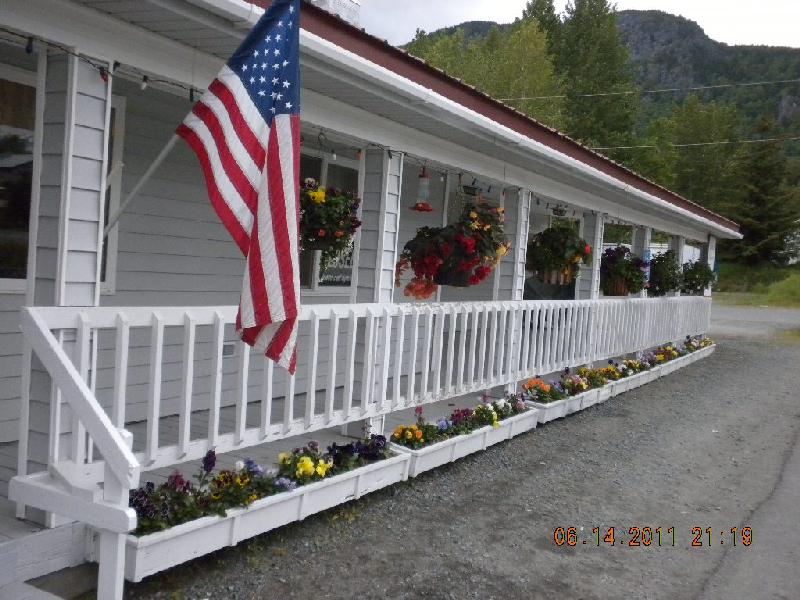
In Haines we found a little restaurant with a charming proprietress. I think her name was Mickey, but it could have been Nicky. Her restaurant had some beautiful hanging baskets and planters so John was doubly charmed. The food was pretty good, too.
We signed into our RV park for two nights, and fell asleep happily.
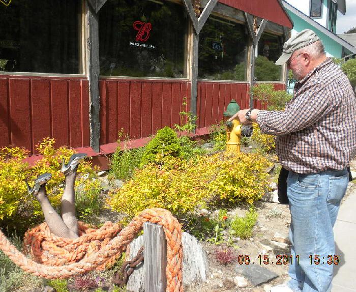
Day 22, Wednesday, June 15: In Haines, day ferry to Skagway and back to Haines
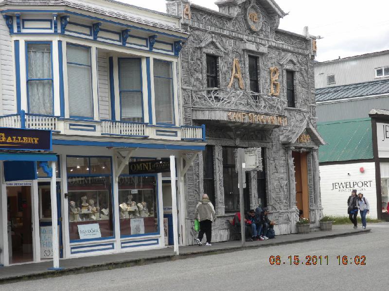
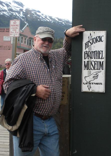
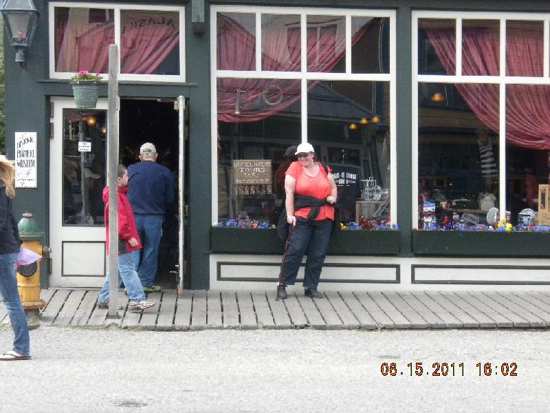
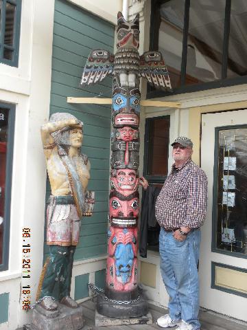
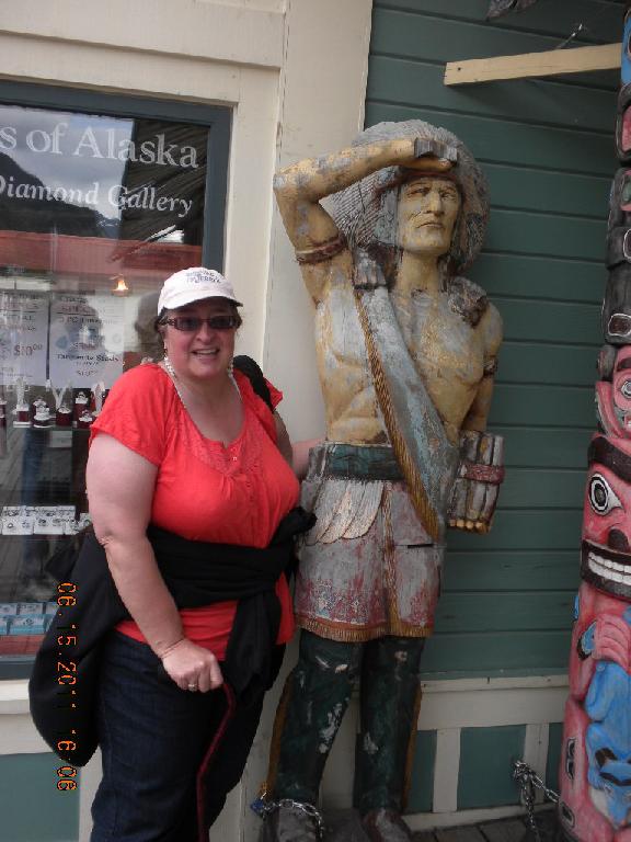
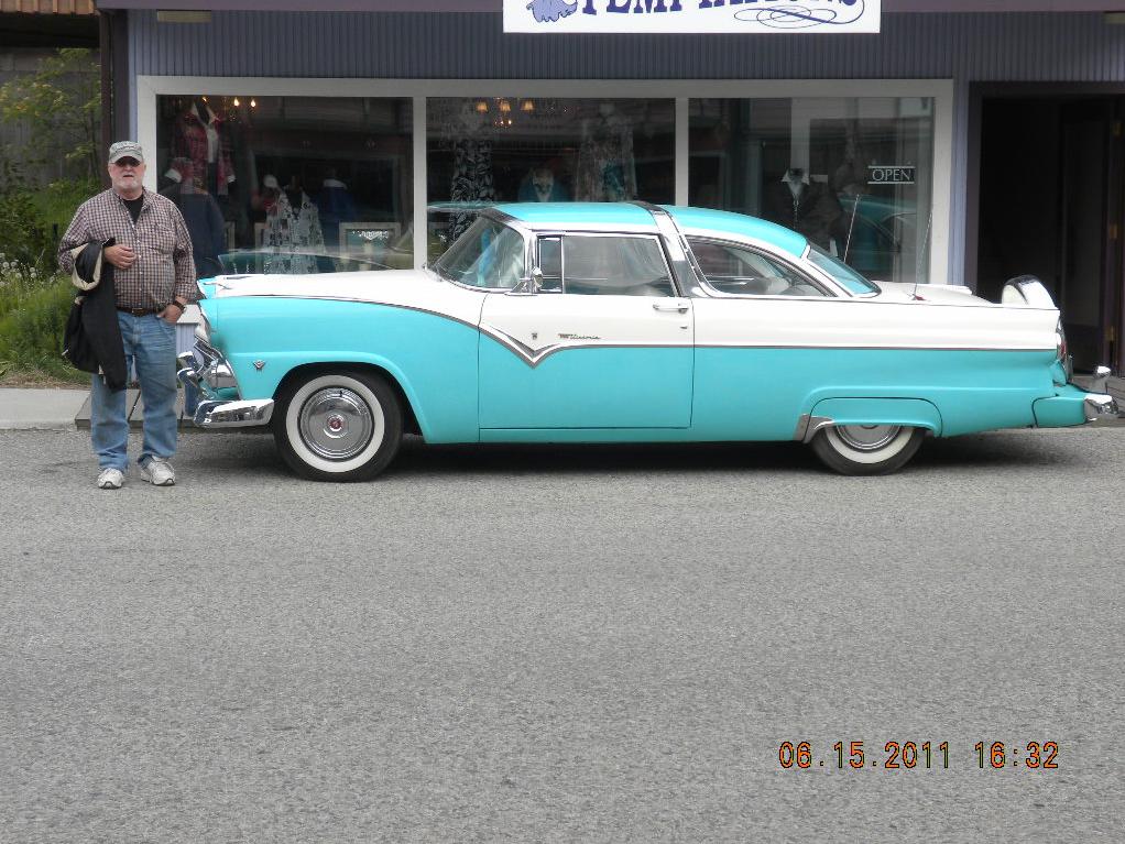
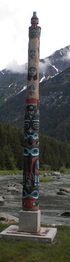
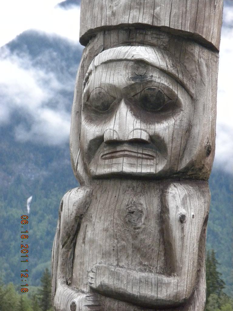
We had a day to kill in Haines so we decided to take a Fast Ferry to Skagway for a few hours. It was a 45 minute ride, I think. This was a little ferry; no cars, no berths, just a people ferry to Skagway. Skagway is quite the tourist town full of quirky things. When Lisa and Johnny went on a cruise ship up the inland passage they stopped at Skagway. Lots of the things we saw we recognized from the photos they shared with us. Here’s John and me in front of an old time brothel. Here’s John and a totem pole. And me with an old friend. And here’s a 1955 or 56 Ford Victoria with a continental kit (the spare tire on the back) which stole Johnny’s heart. I think there may be some romantic associations there. We kept finding rhubarb plants as decoratives! The return ferry dropped us back in Haines and after dinner (more halibut fish and chips) we slept pretty soundly in our play house camper.
Day 23, Thursday, June 16: Haines onto ferry
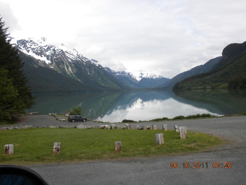
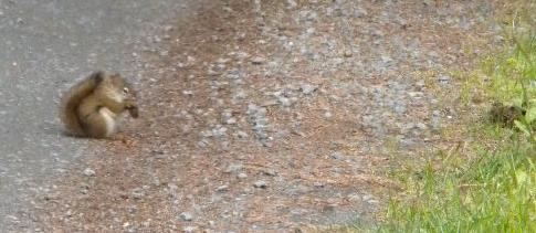
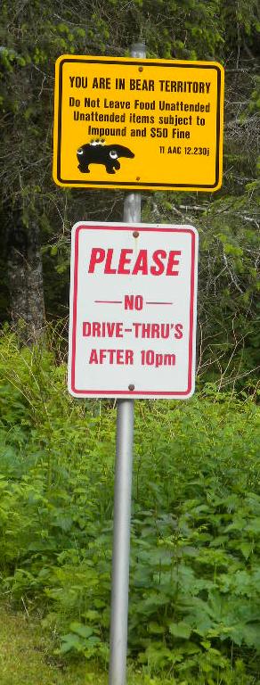
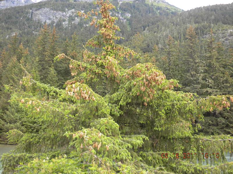
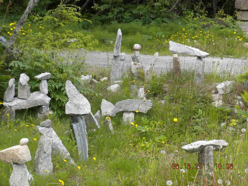
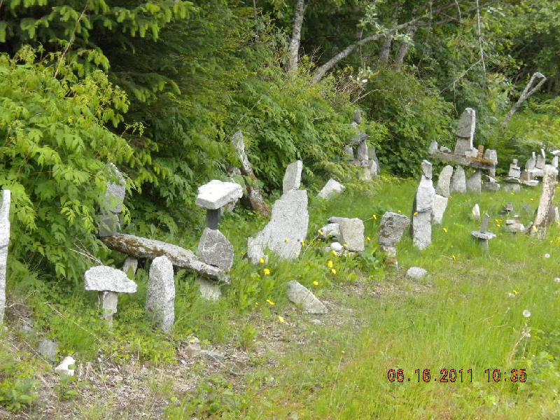
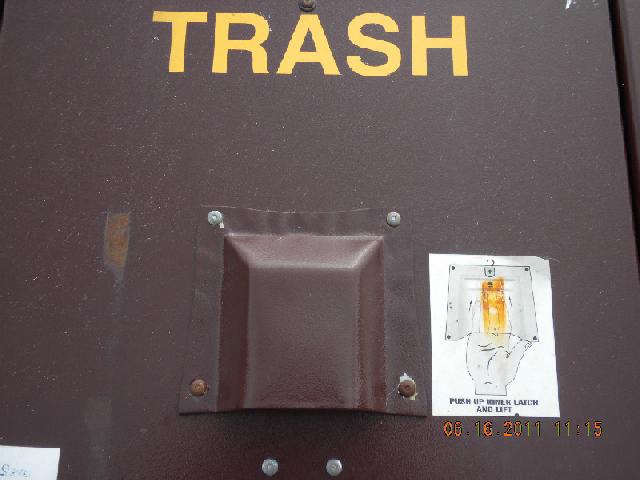
We were supposed to be at the ferry at 10am for a 1pm departure, but we learned that the ferry was delayed until 5pm or so. We spent the day driving through a pretty park that has Chilcoot Lake in it. We saw totem poles, squirrels, bear warnings, and trees loaded with pine cones. On the way out we saw some really interesting stacked rocks. There were lots of them! We also saw a trash can with a diagram about bear-proofing.
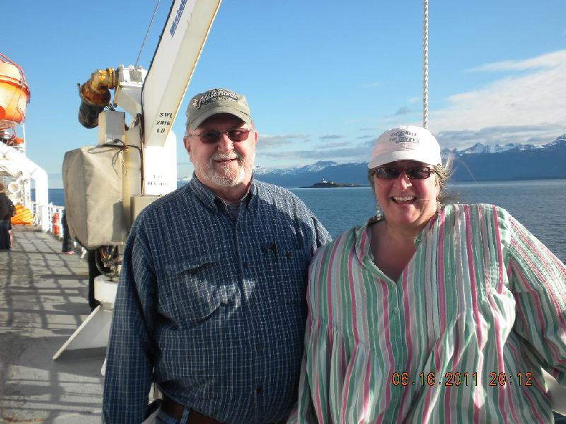
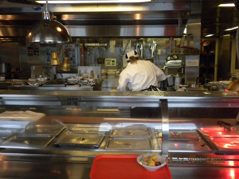
At about 6p or so we finally boarded the ferry. We were first in line that day, and about last to board. It was no biggie: we knew they weren’t going anywhere without us. Here we are on the deck. Our “stateroom” which measured about 8’ wide by 10’ long plus a small bathroom, reminded me of a submarine. (I’ve been on docked subs in Portland and Seattle and oh, they are small!). Everything was miniature, even the cute little tiny light switch. Here’s the galley (for Taelyn). And they don’t want Canadian money. This ferry system is run by the state of Alaska. John tried to tip one of the staff one time and he said they could not accept tips; against the law. I bet it’s because they’re state employees, and state employees in Alaska are probably like those in Oregon: can’t take money from customers or vendors, or anybody.
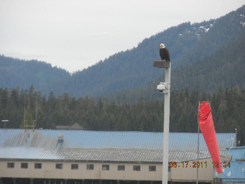
The first part of the trip was the best: it wasn’t raining and there were gorgeous mountains and lots of things to see. In St. Petersburg there were eagles.
Day 24, Friday, June 17: on the ferry
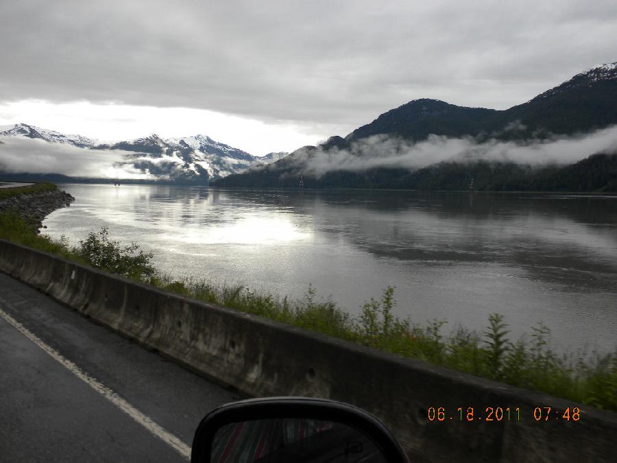
The next day was a little boring: it rained a lot and we couldn’t see mountains. The water was gray, the sky was gray…. The windows on the ferry were splattered and weren’t easy to see out of. But we did see whales slapping their tails and then spouting, we saw seals and porpoises. The ferry provided several 15 minute programs through the day in which we learned about glaciers, indigenous peoples, and a little geology. We weren’t too sorry to get off the boat, out of the sardine stateroom, away from all the people who were very chatty, and back into our private little world on wheels. I’m sure the ferry ride would have been better had the weather been clear and we could have seen more.
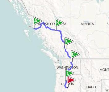
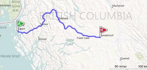
Day 25, Saturday, June 18: off ferry at Prince Rupert, BC, to Vanderhoof
John developed a head cold on the ferry and was in the process of sharing it with me, so our return trip didn’t include quite as many roadside stops. We were trying very hard to avoid that, though. Oh: about the border crossing: piece of cake. All they wanted was to see our passports and ask about guns and bear spray, again. We put our US money into plastic sacks and got out our Canadian money again and taped up the miles to km chart on the glove box. We were set.
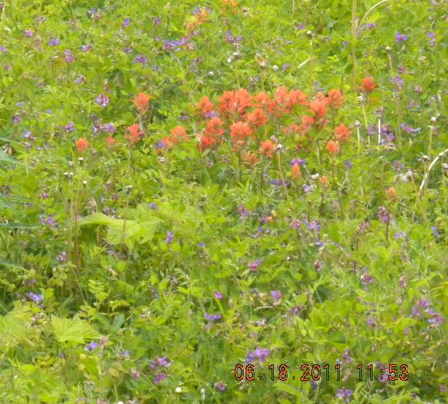
We did appreciate the pretty mountains. Here’s a rest stop with some stately trees. In Terrace we saw a sign that had the town song on it! Terrace also had a bear. And along the road there were other bears. Oh, and we also saw lots of Indian Paintbrush. My Wyoming relations will appreciate and love that. We saw a cool church steeple of St. Paul’s church.
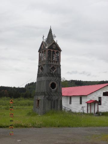
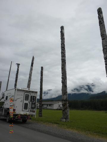
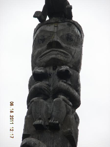
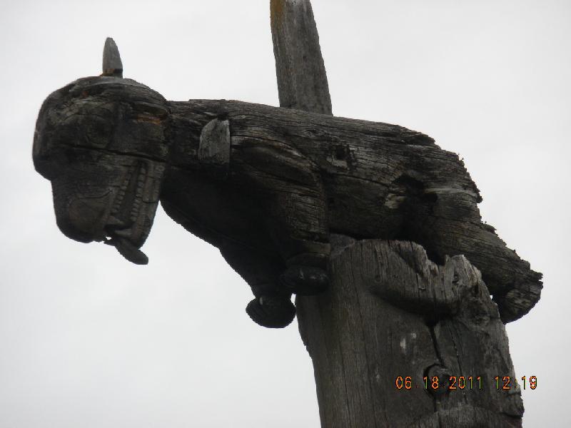
We saw some really awesome totem poles at Gitwangak. Gitwangak is a native people’s village, and the poles were authentic. They were outside a longhouse. Here are some photos: pole, another pole, another one (I think this is showing bear claw markings), another. There also were some unfinished poles lying down. I have lots more photos if you want to see them.
Logging is really big up here. We hoped that Canada is doing a better job than the US did in its logging, but we were disappointed to see a lot of clear cut (instead of picking and choosing individual logs). They do what is done here in America, though: they leave a swath of trees lining each side of the road and then clear cut behind that so the clear cutting is much less visible, except from the sky. We saw lots of sawmills which reminded John of Oregon in the old days. Of course, there were lots of “things that carries up the junk” sitings.
Like Americans, Canadians also have a sense of humor. Oh, and Susan, this one’s for you.
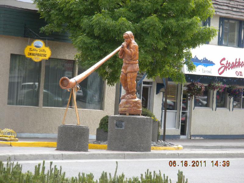
In Smithers they were having a parade so we didn’t go downtown too much. But we did see this wooden sculpture..
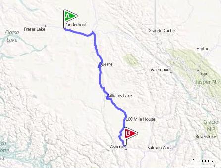
Day 26, Sunday, June 19: Vanderhoof to Cache Creek, BC
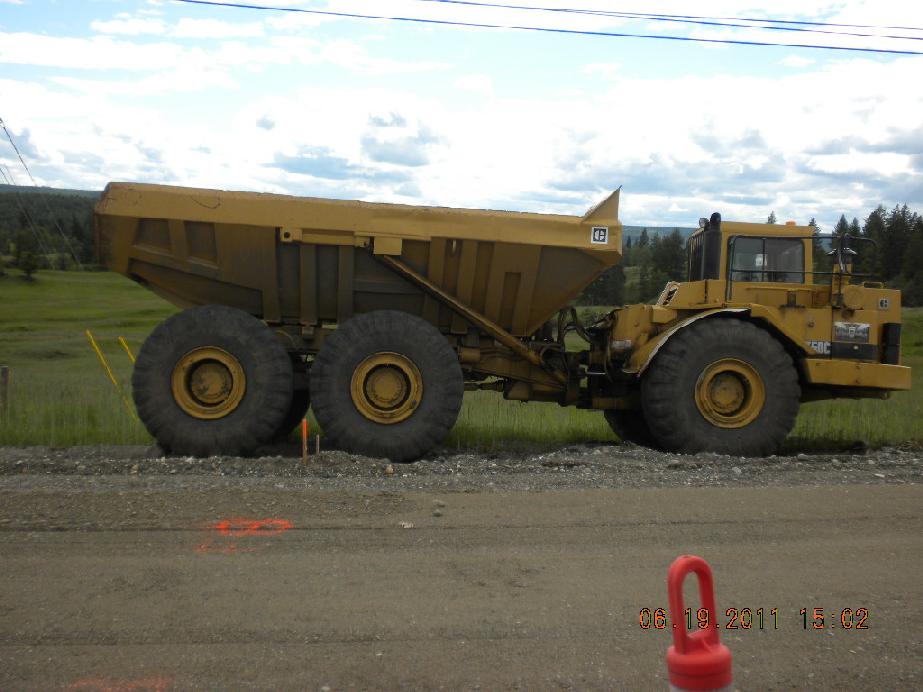
How many Canadians does it take to dig a hole? A: probably the same as Americans. Here’s a miniature truck that looks just like the great big ones in the huge Kennecott copper mine outside of Salt Lake City. By itself, it’s pretty big. In comparison, it’s kinda cute.
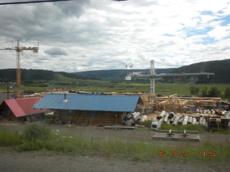
Saw quite a few log home assembly factories, too.
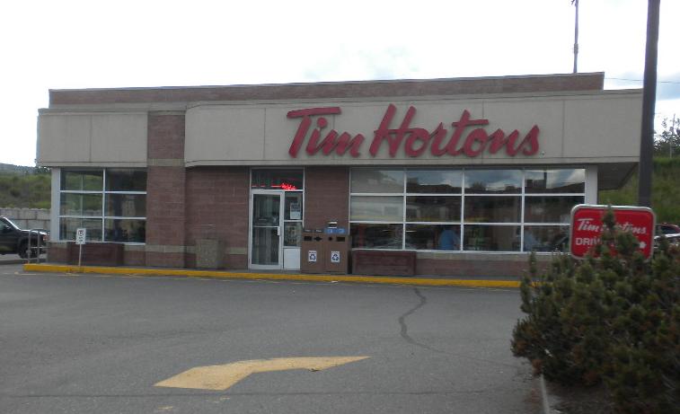
Tim Horton’s: this is a fairly big restaurant chain, at least in Western Canada. The first time we ate there John said it was the Canadian Denny’s. Sure enough, the second time (different city) we ate there we overheard some business men (a couple were American) say that Tim Horton’s is Canada’s Denny’s.
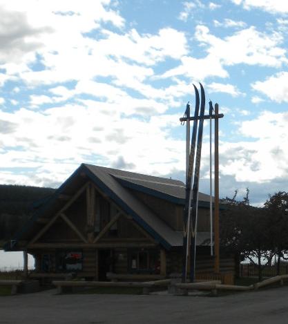
There are a series of towns on this road named after mileages. 150 Mile House, 100 Mile House, 70 Mile, etc. MilePost says “100 Mile House was established as a post house of the Cariboo Waggon Road to the gold fields.” Anyway, 100 Mile House, the town, seemed a little bigger than its 2,000 population would have suggested. The Visitor Centre sported a large pair of X-country skis. Not too much down the road we saw a huge water wheel, but no water, so we assume it was ornamental.
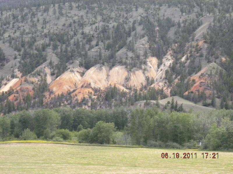
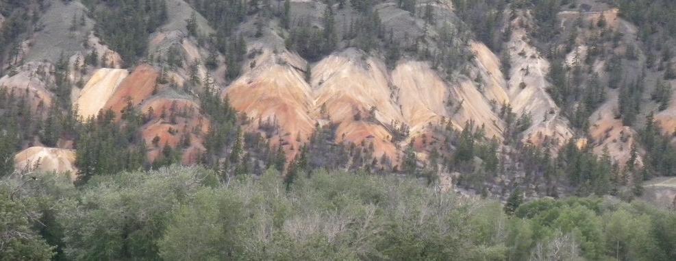
The scenery was beautiful here, too. This time the pretty mountains were copper colored and there were lots of other tans and golds swizzled in.
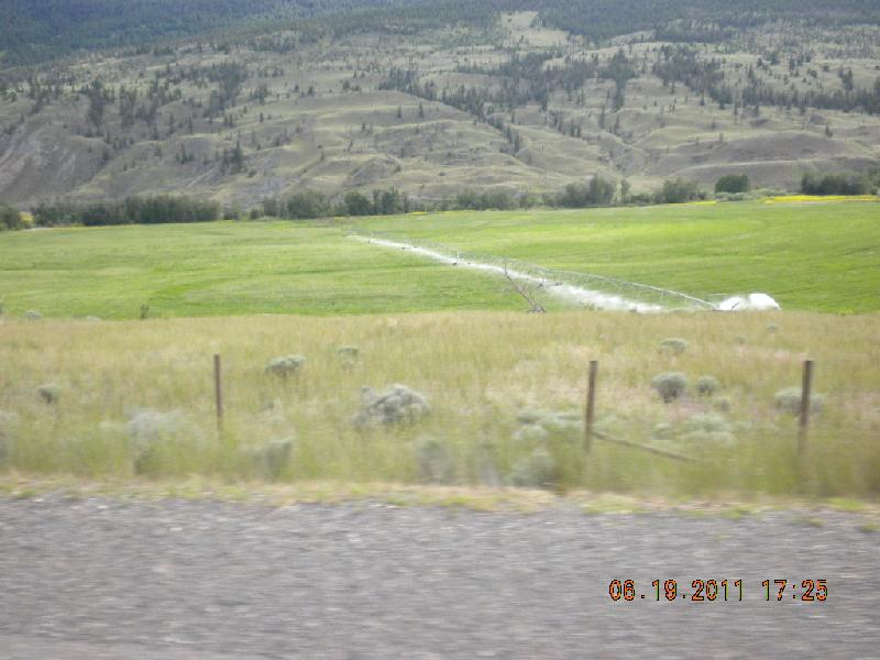
Here’s the first pivot with water running that we saw. We took this photo for Floyd and Elota, but then we remembered they sold their farm and don’t care about these things any more.
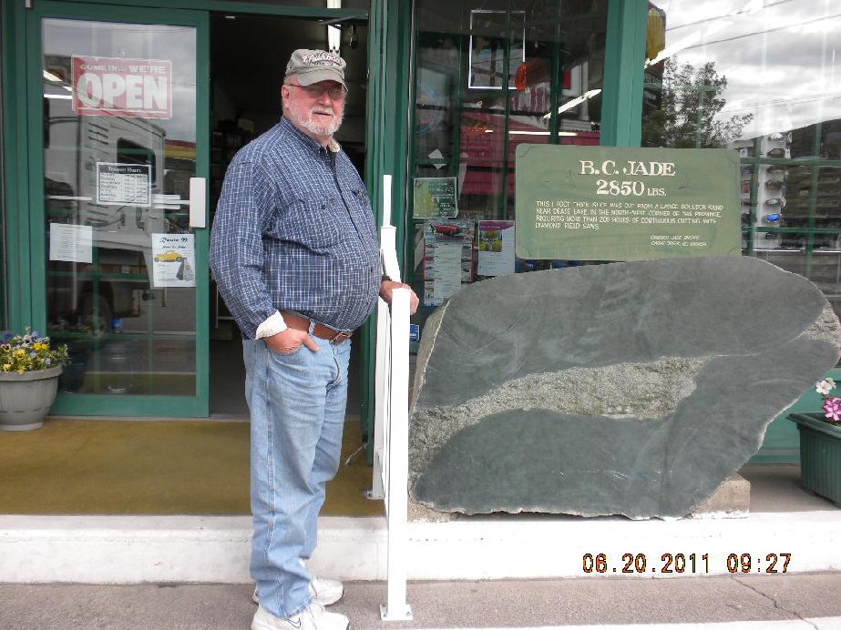
Day 27, Monday, June 20: Cache Creek to Omak, Washington
Jade is big in this area. Here are two very big hunks.
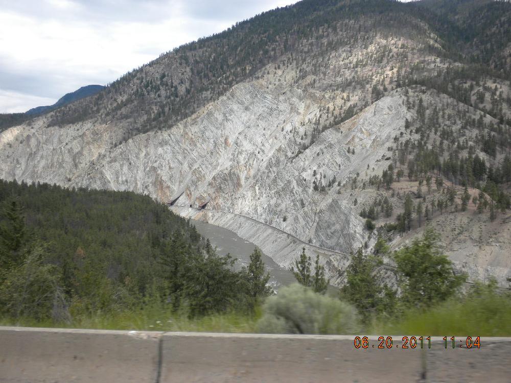
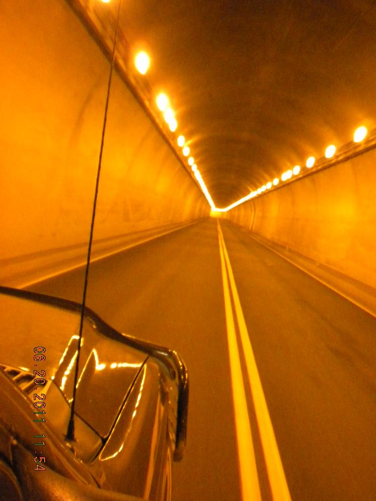
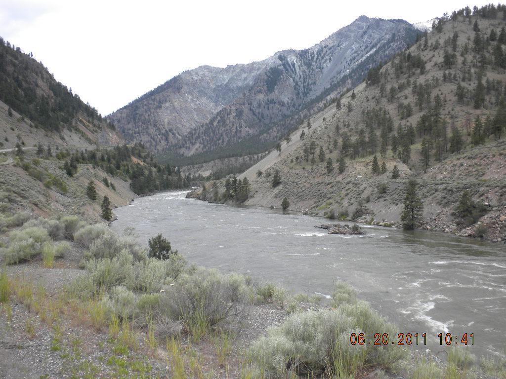
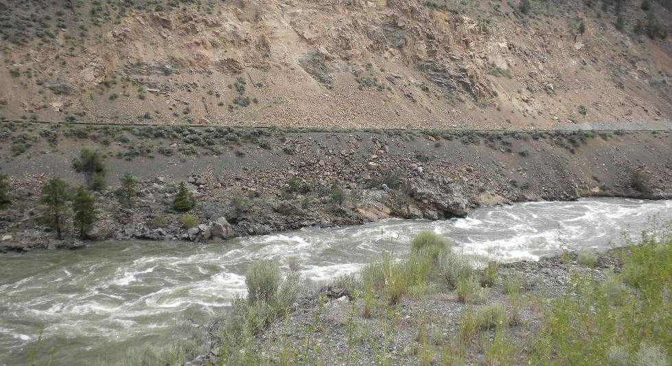
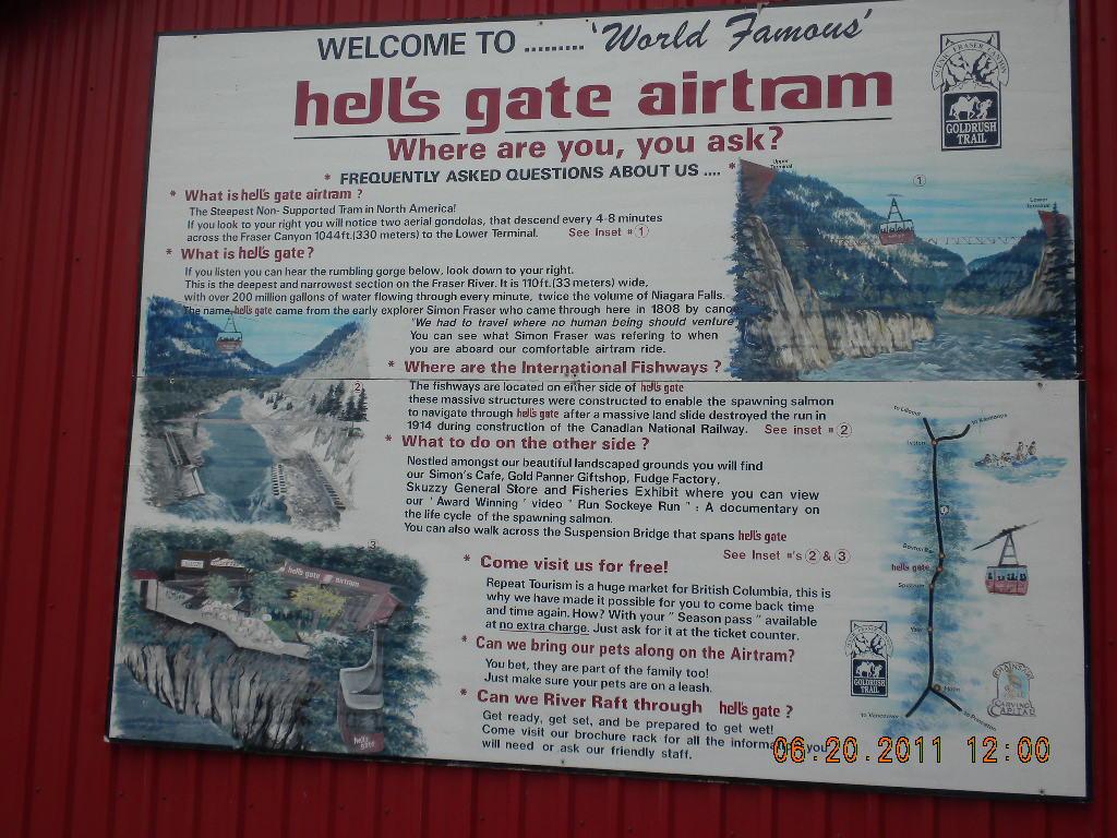
Here comes Frasier Canyon. MilePost: “The Frasier River and canyon were named for Simon Frasier, the first white man to descend the river in 1808. This is the dry forest region of BC, and it can be a hot drive in the summer. The scenic Frasier Canyon travelers drive through today was a formidable obstacle for railroad engineers in 1881.” This canyon has seven auto tunnels; some longer than others. The river was high in lots of places, a little narrower and roiling in others. We enjoyed some geology and we marveled at life’s tenacity. The canyon is pretty deep, and the river can get very agitated. There’s an air tram called Hell’s Gate Airtram that goes down to the bottom of the gorge. We didn’t take it; the head colds were nudging us homeward.
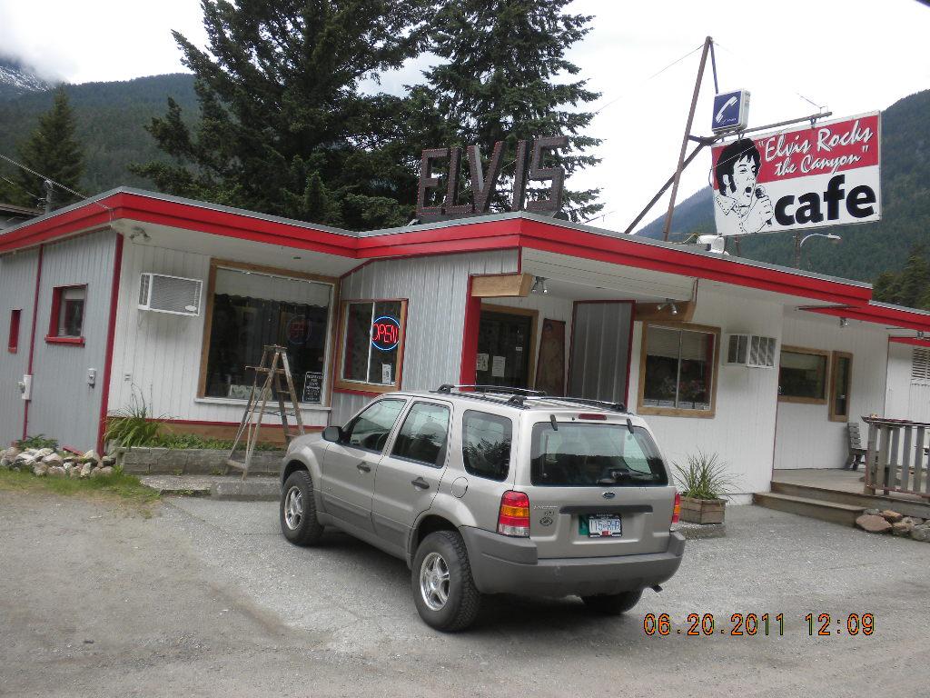
Shortly past the tram was a café I thought Taelyn would enjoy. It said it was open, but again, we didn’t stop. Sorry.
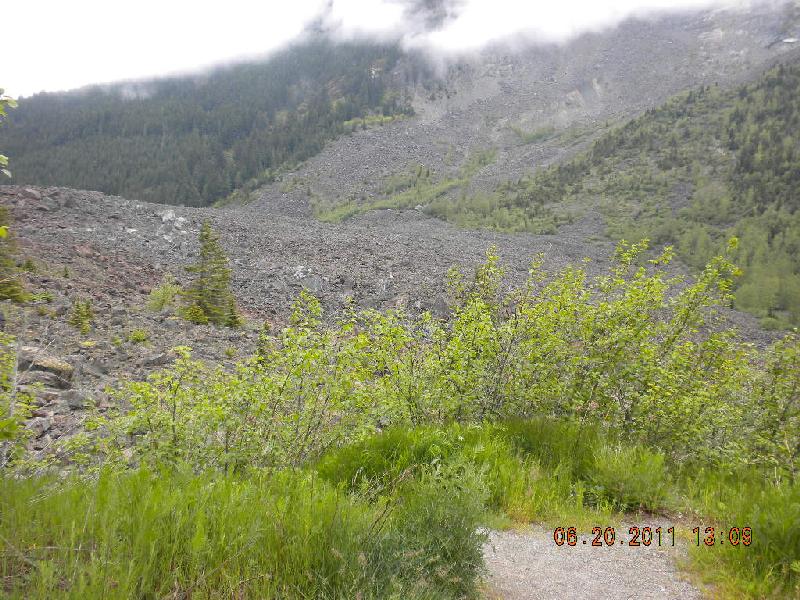
Hope: in January, 1965, there was the largest landslide in Canada’s history near the town of Hope. It dumped 47 million cubic meters. It was caused by two earthquakes happening at relatively the same time. This might not look very impressive, but it’s an infill in a pretty deep canyon. The debris is 280 feet deep and nearly two miles wide. The river it landed in splashed all the way up the mountain on the opposite side and scraped off all the trees and plants on that side, then splashed up the rock-slide side of the canyon, and finally settled into its current place. This was a pretty big event. Folks died.
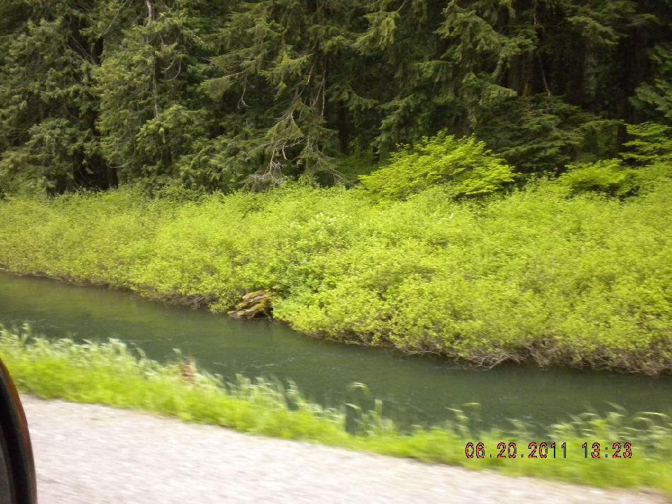
In contrast, we soon saw a little river/stream that John says is his ideal fishing stream. It meandered for miles and miles. But with no fishing license and not feeling that we had the time to go get one… we’ll have to come back.
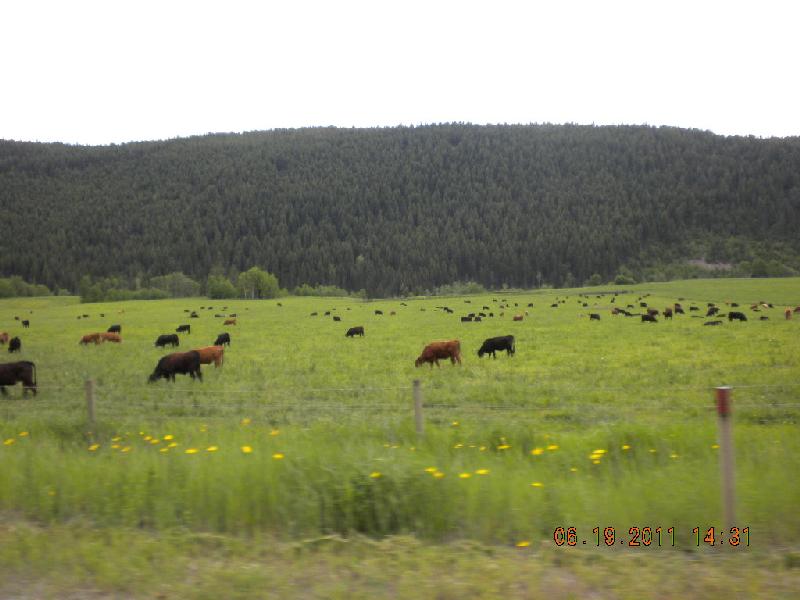
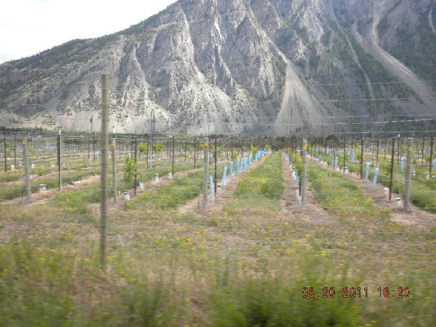
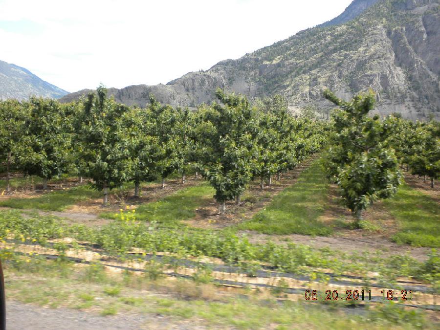
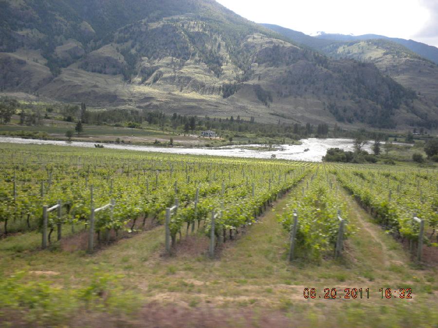
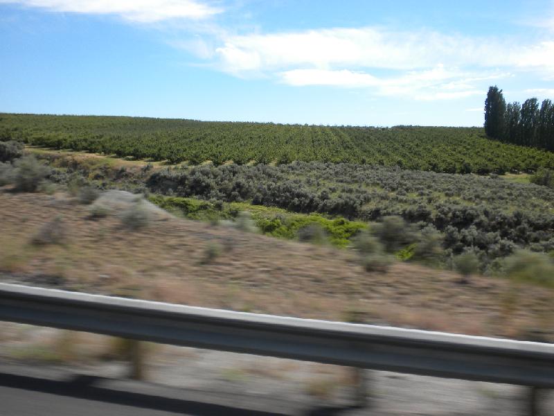
Near the Canadian / US border is lush farming land. They have lots of vineyards, apple, peach, apricot, and pear orchards, and more vineyards.
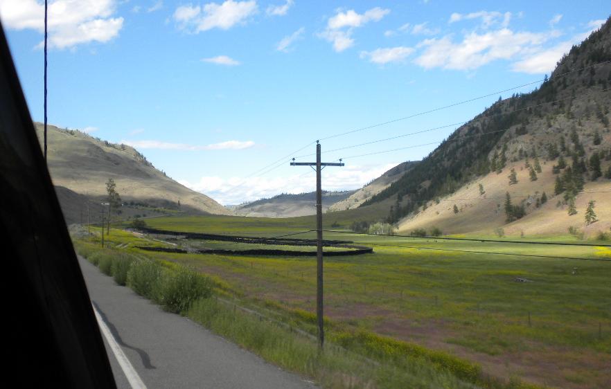
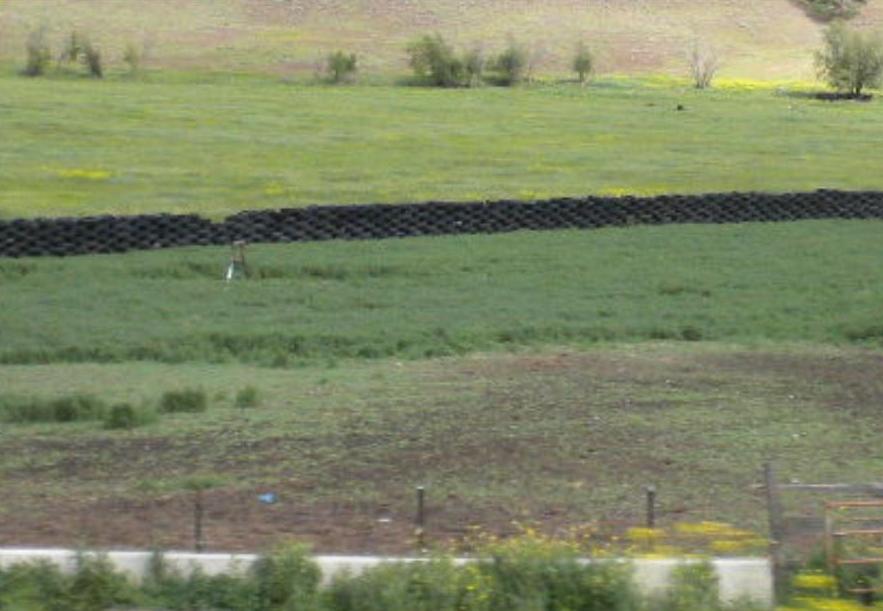
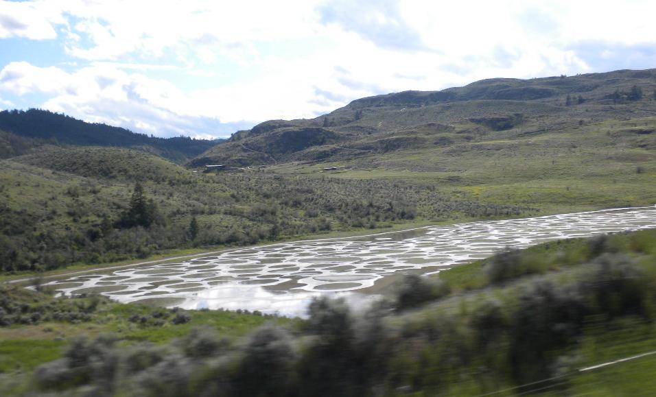
See this black fence? It’s made of tires! And I never could figure out what the strange rings of water were all about. Anybody?
Border crossing into the US was the only one in which they went into the camper. The border guy was looking for apples or fruit, and even though we denied their existance in our posession, he hopped into t he camper (didn’t even want the slide-out slid) and popped open the fridge and the bathroom door. No biggie; just a little strange. Maybe not, though: we’d just come from a rich fruit-bearing farmland, and across the border in the US was another just like it and they wouldn’t want any bugs destroying the crop. Spent the night in Omak, Washington.
Day 28, Tuesday, June 21: Omak to Madras, Oregon
I had about $30 of Canadian money left so we asked whether the Denny’s like restaurant in Omak took Canadian. They did. All of it plus a little. That pesky exchange fee and rate, I guess. When I first changed $500 into Canadian money at a Cardston, Alberta bank I got back $470. So I figured when I changed any Canadian money back into US currency I should get back more than I gave. Right? Wrong. Forgot about the exchange fee which can be hefty. But I was trying to dump the toonies and loonies anyway, so no complaints.
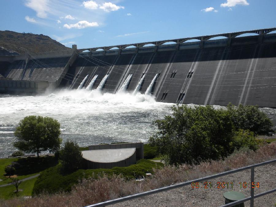
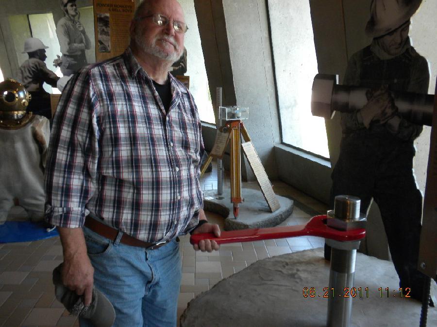
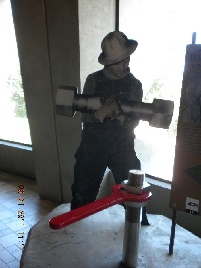
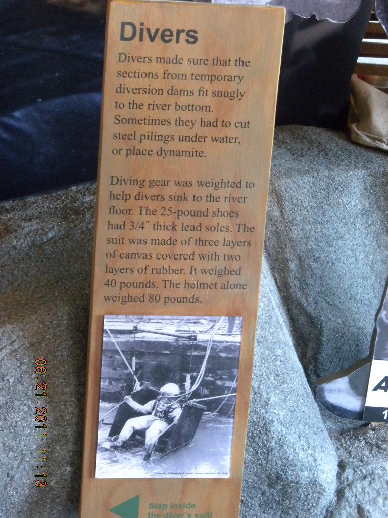
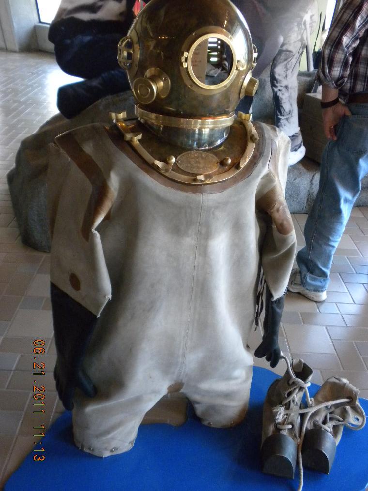
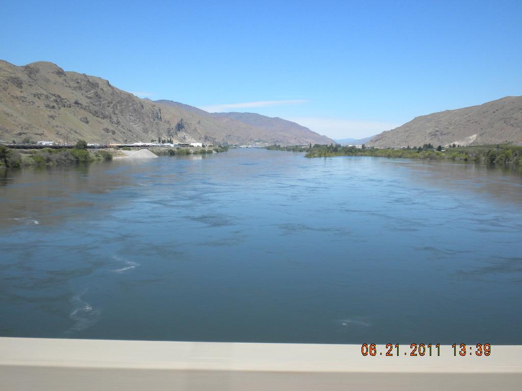
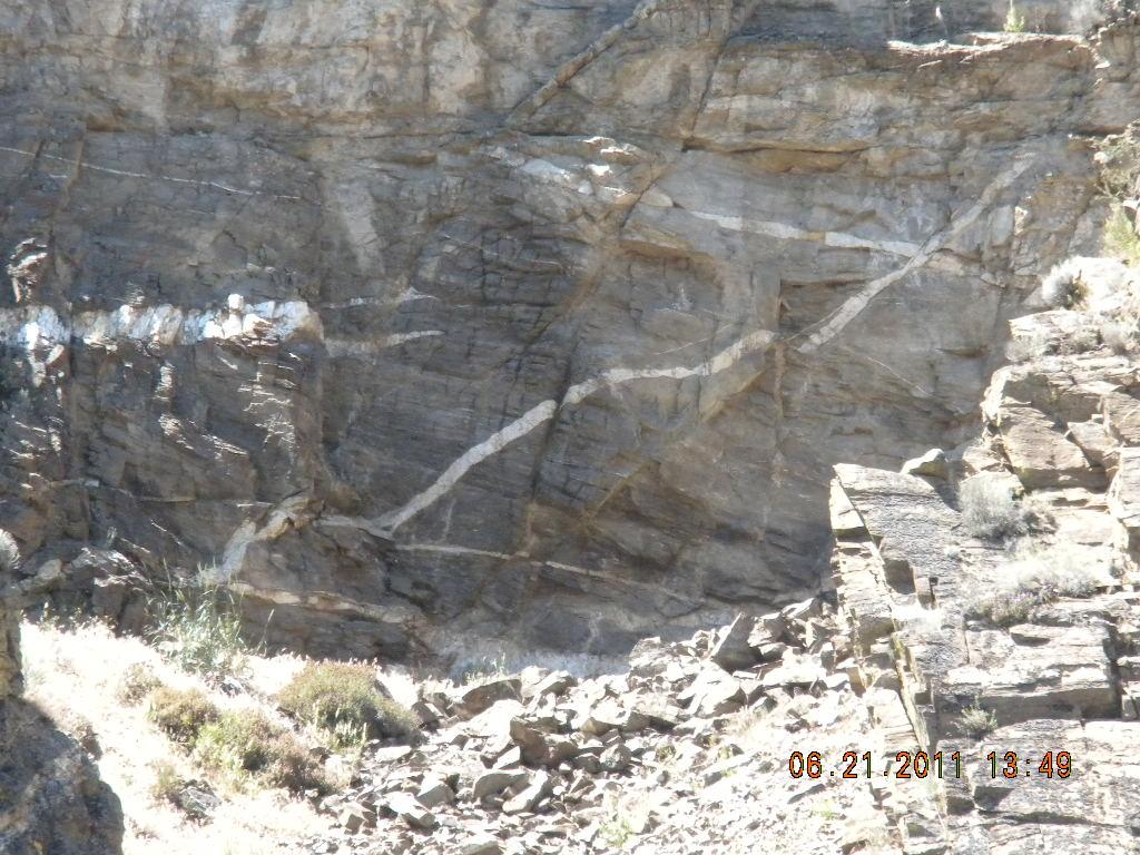
We visited the Grand Coolee Dam. I think the Stevens were here on our way to the 1962 Seattle World’s Fair, and it doesn’t look much different. We didn’t go on any dam tours, (oh, how fun that used to be to say in front of Mom and Dad when we were 8 years old!) but we did visit the Visitor’s Center. The folks who built this were big men with big bolts, Taelyn. They had divers whose job it was to secure temporary diversion dams. Look at their outfits! Very primitive and heavy by today’s technology. At the Center we watched films about the geology of it all. It was so interesting to watch how the huge boulders scattered in the fields were left there by glaciers. In Washington the farms are so huge you know that they can’t belong to individual families anymore, but to agribusiness. The Columbia is as huge and beautiful up there as it is down here in Oregon. The geology is just as interesting and prevalent.
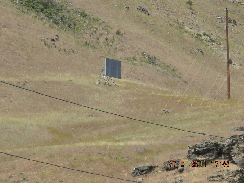
John had put up two microwave towers on some high cliffs in Wenatchee many years ago. I wanted to see them. We’d pulled into a parking lot at the public end of the Rocky Reach dam and were training our field glasses on the two microwave towers when a security officer came over to our car. We thought he’d be wondering if we were terrorists, scoping out the destruction of the ancient communication towers, so we were about to explain that John was showing Shirien the fruits of his labors 40 years ago, when the Trouper asked, “Did you see the dozen dall sheep up there today?” Sure enough, there they were.
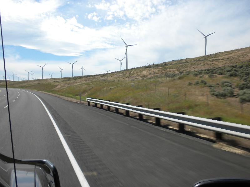
Apples are big up in Washington. Miles and miles of them. Windmills are, too. Maybe not miles and miles of them, but each one is miles and miles high. Ok, not that big, but they really are huge. I don’t know how huge, but the website for Sieman’s talks about blades that are 200 feet long!
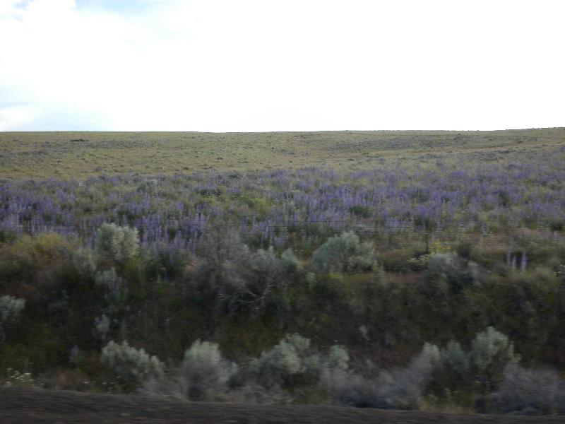
We also saw lots and lots and lots of wildflowers in bloom. There seemed to be acres of purple lupine. Also, we saw mounds covered with grass on the rolling hills, and we wondered what had made them. John geologically wondered, that is.
We stayed the night in a motel in Madras, Oregon. We thought of looking up Johnny and Virginia, but decided last minute pop-ins on people are probably not very good manners. We were tired, ready to stretch out some, and almost ready to be home.
Day 29, Wednesday, 22: Madras to Christmas Valley
This was the last leg of the trip. On the way from Madras we saw our own incredible Cascade mountains, all in a row: Mt. Hood, Squaw’s Tit, Mt. Jefferson, Three Fingered Jack, Mt. Washington, North Sister, Middle Sister, South Sister, Mount Bachelor, and Diamond Peak. Why I didn’t take photos of these pretty mountains, I do not know.
Madras is close to Bend is close to LaPine, and that’s close to CV. I guess we didn’t take any photos that day because we were tired. It’s too bad that we didn’t take any “after” shots of what we looked like when we arrived at our driveway. But we were home, head colds abating somewhat, rumpled, pooped, but happy for the adventure and the memories. It truly was a wonderful time.
I took 750 photos and John took 150 or so. If you want to see more of anything in particular, feel free to ask. Thanks for reading this.
Random Impressions and Thoughts:
• When ordering breakfast in Canada we were asked, “White or brown?” instead of “White or Wheat?” for our toast choices.
• Signs:
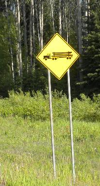
---Maybe it’s because Canada is more multi-lingual, but their road signs seem to be more graphic than text-oriented. Their signs cautioning drivers that there may be lots of trucks on the road vary according to the area. In foresting areas they have a log truck. In other areas they have a rounder, pudgier truck sign.
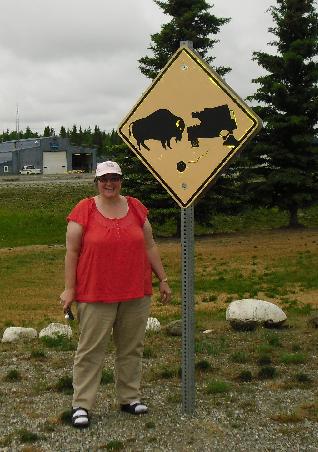
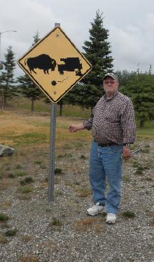
---See this sign about buffalo and traffic.
---And here’s what they do when they REALLY mean they want you to slow down.
---Oh: we didn’t get a photo of this one, but in a community along the Kenai River there was this sign: “Medical Clinic. Fish Hook Removal”.
---Here’s an advertising sign we saw along the road: “117% of men love cold beer, if our math is right.”
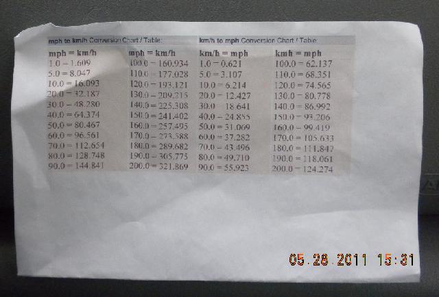
• An easy way to convert mph to kph: We printed a chart which I taped to the glove box. Whenever we saw a kph sign along the road it was my duty to say “90 is 55, honey”, and John responded with “check”. It worked. I didn’t feel like a nag, he didn’t have to keep asking what the conversion was, and all ended up happy.
• Animals that we saw: arctic turns, bear (black, brown, and griz, baby and mature), buffalo (mature and baby), caribou, coyote, deer; donkey, eagles (golden and bald, baby and mature) egret, elk, fox, halibut, moose (baby and mature), loons, pelicans, purple martins, porpoise, ruff grouse, sand hill cranes, sea lions, sea otters, sheep (big horn, dall, and stone), swans (white and black), whales (orca, minke, and humpback), wolf.
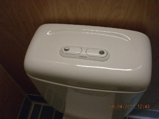
• Probably most of you folks have seen this, but I’ve never seen a push button toilet that had two buttons: one for #1 and one for #2. Ok, it doesn’t take much to entertain me….
• Several people have asked, “What was the best part of the trip?”. I heard John answer, “The time we got to spend together.” That got him a ton of brownie points, of course. But that is my answer, as well. A lot of concentrated time together – we found that we could do it really, really well. Other highlights in my mind: meeting or reacquainting myself with family and friends. Seeing the really pretty mountains. All the wonderful animals.
• Would we do it again? Oh yes. Would we drive it? Maybe oh no. While we did see most of our animals when we were driving ourselves (rather than on tours), having done it once in a camper is probably sufficient. It would be fun to fly to Anchorage and rent an RV there. We saw hundreds of rented RVs up there: “Cruise America”, “Cruise Canada”. It seems that lots of international folks do it that way.
• Alaska Permanent Fund money: If you are an Alaskan resident (and not a felon or a muliple misdemeanor criminal) you get free money every year from the Alaska Permanent Fund. It’s about $1,000 per year per person, but it varies quite a bit. In 2010 it was $1,281.
• Bicyclists: there were quite a few single or two bicyclists in Alaska, even in places that were hundreds of miles from nowhere.
• John tells folks that one of the things we underestimated was how big Alaska is, how long it takes to get anywhere. Even though we bing-mapped the route before we left and knew the number of miles, it takes longer to drive them, or the land magically stretches out longer than the miles account for, or something. We planned too many things things to do, places to go, and ran out of time. It takes longer to get places than we planned.
• Roads: in Canada the roads seemed so clean! We rarely saw trash along the roadsides. We regularly saw trash containers, though, and not just in rest areas. Lots of times there were just little pull-outs along the side of the road for them. But I believe that human nature is pretty much the same world-wide; there are slobby Canadians just as well as there are slobby Americans, so I’m not sure why the Canadian roads seemed cleaner to me.
• Somewhere we ran across a shop where an old fellow makes bowls out of wood with burls in them. He also has quite a collection of old chain saws. While we chatted about his beautiful work I was fondling a small diamond willow; it was so soft and satin smooth – and he just gave it to me!
• John said that he would not drive before dawn nor after dusk. He kept his word, and in Alaska, that was easy to do. Oh: Aurora borealis: we were really sad that we didn't get to see Northern Lights; wrong time of year. That really makes me want to go back again.
• If you’re going to use a pretty big camper, have a pretty big truck. Our Ford F350 is a one ton, and it was too small. John recommends duallies.
Total miles: 6,935
Total gallons (liters have been converted): 595.85
Miles/gallon: 11.6388
Fuel cost (US $): $2,837.02
Fuel cost / mile: $0.41
Ford F350 weight: 8,200 lbs.
Truck plus loaded camper: 13,150 lbs. (Vale weigh station, 2pm Wed, May 25th)
Truck plus unloaded camper: 12,400 lbs. (Hwy 58 weigh station, Fri, June 24th)
Max weight that we should have, according to the Ford’s door panel: 12,600
Overload amount: 550