

About This Print
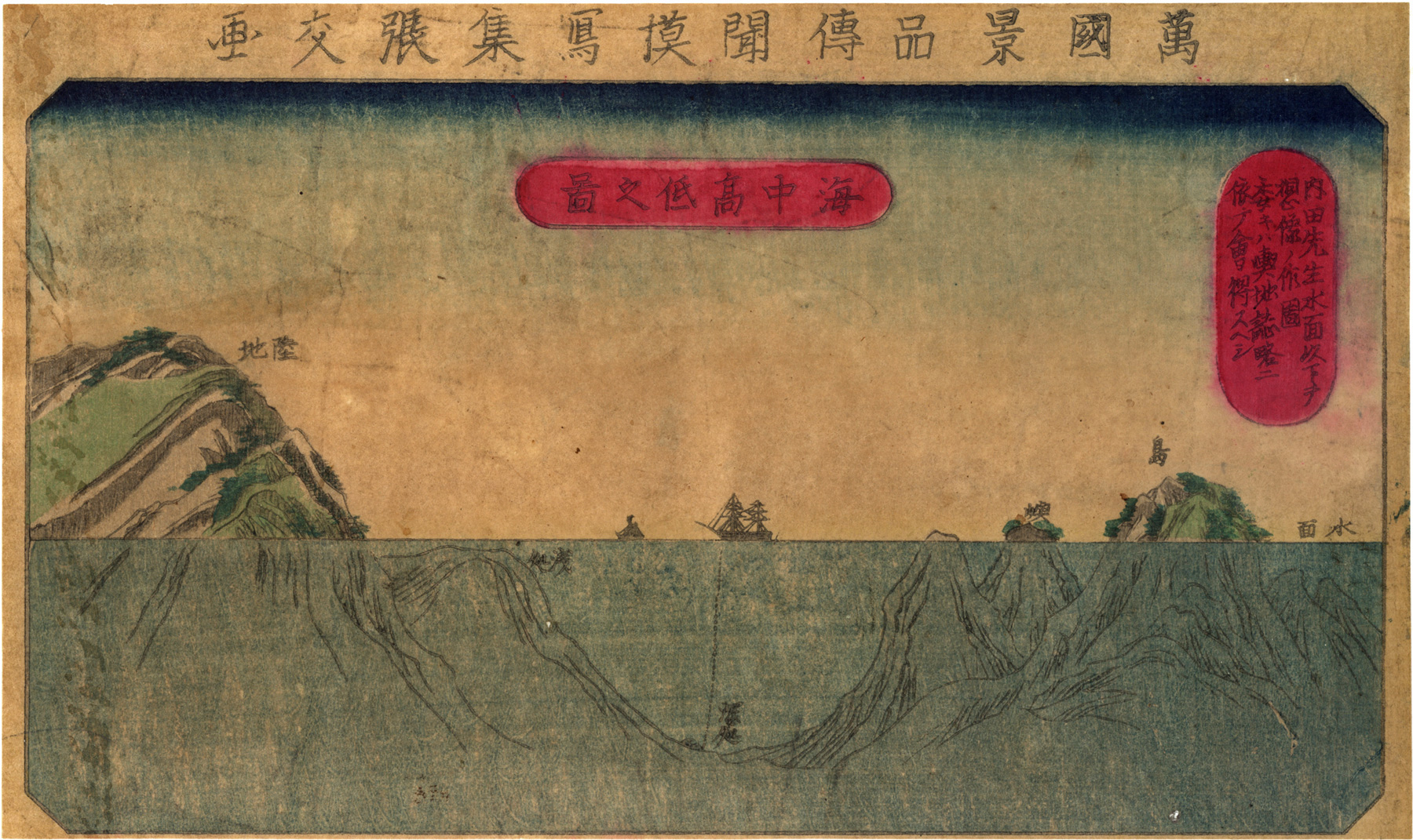
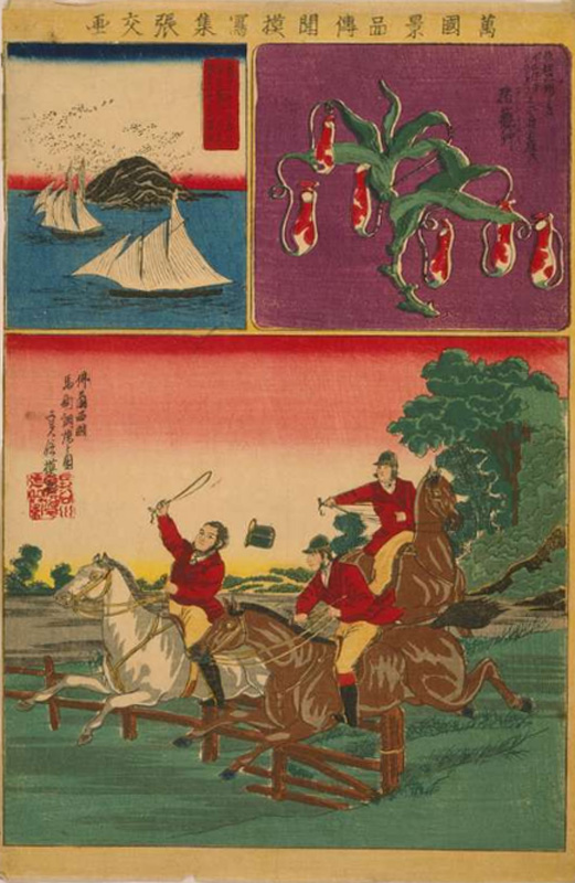
The top print in a three scene harimaze-e1 from a series of prints based on the 13 volume encyclopedia titled A Compilation of Geographical Knowledge (Yochi shiryaku 輿地誌略) by the multi-talented scholar of the West, Uchida Masao 内田正雄 (1839-1876), who traveled throughout the world to compile this encyclopedia.2 This top portion of the harimaze-e depicts a ship doing a sounding of the ocean bottom using a lead-line to determine depth. Various topographical formations are called out on the print and the red vertical cartouche on the right explains how ocean depth is measured as explained by "Uchida Sensei" (Uchida Masao) in Yochi shiryaku.
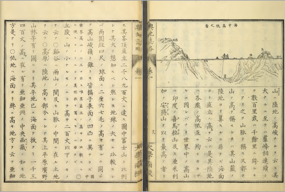
In the case of this collection's image, Sadanobu has largely copied the image from Volume 1, Asia of Uchida's encyclopedia, first published in 1870, as shown below.
click on image to enlarge
A Compilation of Geographical Knowledge, Volume 1, Asia
輿地誌略. 巻1亜細亜洲
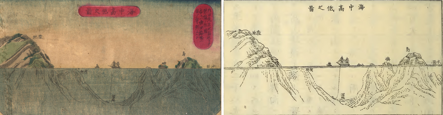
Comparison between Sadanobu print and original drawing appearing in Uchida's encyclopedia
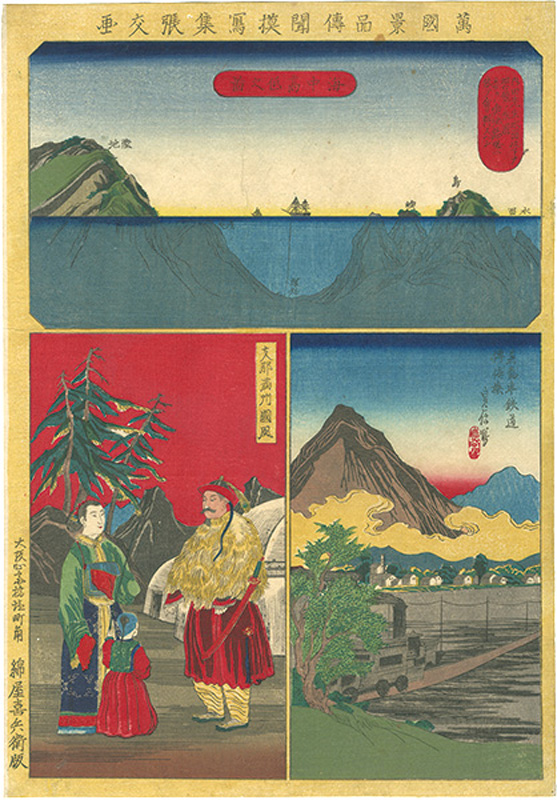
The complete print of this collection's partial print
top: 海中高低之図
(Illustration of Depth of the Sea)
bottom left: 支那満州国風
(Manchura, China Customs)
bottom right: 蒸気車鉄道伝信機
(Steam Locomotive Railway Transmission)
I have come across only two other prints from this series which are shown below. While these prints are sometimes credited to Hasegawa Sadanobu I (1809-1879), I believe this series was likely designed by Hasegawa Sadanobu II (1848-1890).
1 As this type of multi-scene print, a harimaze-e, was intended for cutting apart and using the individual scenes for various decorative purposes, perhaps it's appropriate that only the top part has found its way into my collection.
2 Uchida Masao (1838-1876), was a graduate of the Nagasaki naval school and one of the earliest Japanese travelers in America. He was dispatched to Europe by the Tokugawa shogunate, where learned Western culture and technology in Holland for five years beginning in 1862, visiting America on his way back from Europe. He returned to Japan with oil paintings, photographic albums, and hundreds of pictorial natural history images. Based upon the sources he collected on his travels. "Uchida began to compile the Yochi Shiryaku in 1870, a thirteen-volume of encyclopedia of world geography. Its success was primarily due to the huge number of illustrations that Uchida called "shashin (photography)," the images copied from the Western photographic albums and traveling magazines. [source: https://doyle.com/auctions/14bp04-rare-books-autographs-maps/catalogue/459-japan-uchida-masao-yochi-shiryaku-outlines]
Print Details
| IHL Catalog | #2268 |
| Title or Description | Illustration of Depth of the Sea 海中高低之図 |
| Series | Collection of Reported Objects and Views From Around the World 萬国景品伝聞模写集張交画 Bankoku keihin denbun mosha shu harimaze ga |
| Artist | Hasegawa Sadanobu II (1848-1940) |
| Signature | No signature on this top section of the complete print, but the entire print is credited to Sadanobu 貞信, whose seal appears on the bottom right print in the full uncut sheet. |
| Seal | no seal on this portion of the print |
| Publication Date | 1870/c. 1875 (the print is undated, but the drawing that this collection's print was copied from was first published in 1870) |
| Publisher | 綿屋喜兵衛 板 Wataya Kihei han [Marks: pub. ref. 579] |
| Impression | excellent |
| Carver | |
| Printer | |
| Colors | fair - darkened due to toning |
| Condition | poor - cut from 3 scene oban-size harimaze; dark toning and soiling |
| Genre | ukiyo-e; harimaze-e |
| Miscellaneous | |
| Format | |
| H x W Paper | 5 13/16 x 9 5/8 in. (14.8 x 24.4 cm) |
| H x W Image | |
| Literature | |
| Collections This Print |
4/5/2020