Crest Drive Community Mapping Project
Welcome to the Crest Drive Community Mapping Project site!
Blank

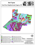
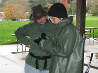
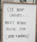
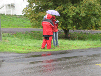
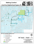
This project was a collaborative, participatory GIS project between citizens of the Crest Drive Neighborhood in Eugene, OR and students at the University of Oregon. Teams of students and residents walked the streets of the neighborhood collecting walkability data in the neighborhood using mobile GIS technology on PDAs. In the end, data of interest to the neighborhood was collected, students learned new skills in mobile and participatory GIS, and all had great fun working together on the project

Howdy

spacespace

This site is meant to be a resource for both the Crest Drive community and for other communities/students/educators who want to utilize GIS as a tool to foster community change. Feel free to explore using the main links above.

space

This project was made possible by a grant from the The Tom and Carol Williams Fund for Undergraduate Education ("The Williams Council") at the University of Oregon and through an initial seed grant from the Northwest Academic Computing Consortium.


This project was based on a collaborative effort between the citizens of the Crest Drive Neighborhood in Eugene, OR and students at the University of Oregon under the direction of Professor Marc Schlossberg.