Survey Area |
|
|
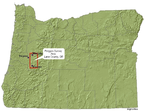
This year’s habitat surveys were conducted in the Marcola, Fall Creek, and Dorena areas of Lane County. Survey areas were located on Bureau of Land Management property within the general area indicated on the map to the right. |
| ____________________________________________________________________________________________________ |
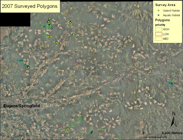
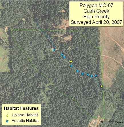
Survey Polygons
The team searched for habitat features (pools and upland habitats) within assigned survey polygons. Here is an example of a surveyed polygon with both upland and aquatic habitat features mapped from the GPS data collected in the field. This interactive map allows you to view photographs of each habitat feature type giving you a ground view of potential turtle habitat found within this survey polygon. |
|
| __________________________________________________________________________________________ |
Surveyed Habitat Features
|
|
Over the course of this term, the team collected GPS data for 134 aquatic features and 25 upland habitat features. Data was also collected for 22 aquatic and 1 upland feature that were not associated with a GPS coordinate. This is a significant increase from the amount of data collected in last year’s project. These features were surveyed in 17 polygons defined as high priority by the Bureau of Land Management. These maps display both the polygons surveyed and all of the habitat features that were mapped within the Marcola and Fall Creek areas. |