Traverse:
Shifted Waterways & Urban Life
Water quality is arguably the strongest indicator of landscape health and land use in a watershed. A topic most apt for city planning, water quality is also a great source of leverage in urban design. But including water quality in the urban design discourse is not without its challenges. The relationship of land use and water quality is not immediately perceptible, which can make this relationship vague if not totally unknown to the general public.
Because of its scale and invisible characteristics, water quality is difficult to represent visually, making it an abstract concept for planning purposes. This project tests representational methods that can help make the relationships between water and land vivid and clear.
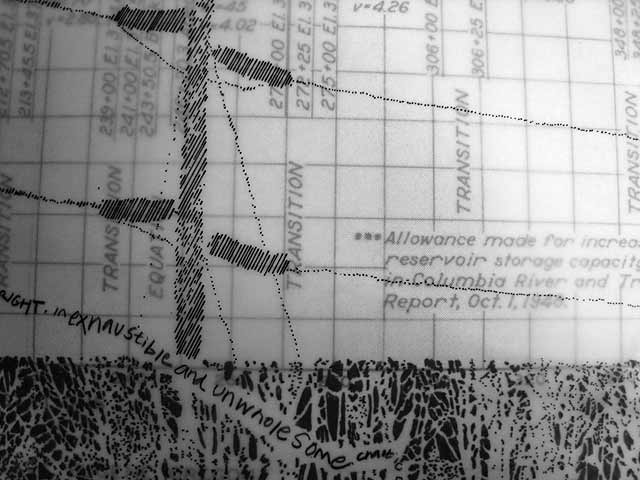
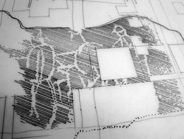
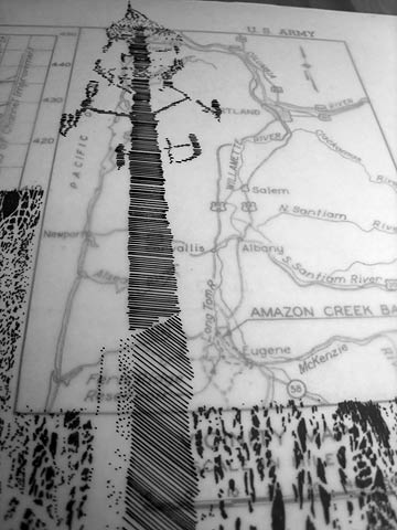
Mapping and walking are used methodically in TRAVERSE to examine and compare the contemporary engineered courses of Amazon Creek to the creek’s historical meanders. This creek, Eugene, Oregon’s second largest waterway (the Willamette River being the largest), was, until less-than 60-years ago, a winding shallow creek that, along with associated wetlands, flooded seasonally each year. As was the case in many North American cities during the post war development explosion, the stream was diverted into concrete channels, and became a major conduit for the city’s storm water runoff. As with many urbanized waterways, the future of Amazon Creek continues to be threatened by renewed development pressures within urban growth boundary.
My objective was to catalog the social and environmental context of this creek. I constructed an exhibit of map-based representations that shed light on the current and historical relationships between land use and water quality in this urban watershed. Kathryn Kuttis assisted me with the project.