|
The Regional Setting of the Galapagos Archipelago Regional Kinematics of the Galapagos Archipelago 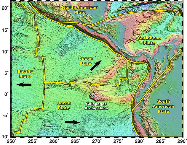 | | The direction of the migrating tectonic plates is annotated by the black arrows. Bathymetric and topographic data compiled by: Smith, W. H. F. and D. T. Sandwell, Global Seafloor Topography from Satellite Altimetry and Ship Depth Soundings, Science, v. 277, p. 1956-1962, 26 September, 1997. |
The Galapagos plume has a fixed location while the tectonic plates move above it. The Galapagos plume have not produced such as simple linear chain as the Hawaiian Islands or the Society Islands. Nevertheless, the islands do get older to the south-southeast (Espanola is the oldest Galapagos island). The Galapagos Islands are located on the Nazca Plate, which is moving east-southeast. It converges with the South American plate and subducts beneath it at a rate of seven inches a year. The Cocos plate migrates north, coverging and subducting under Central America. During the Neogene era (approximately five to twenty-four million years ago), the Galapagos Spreading Center was located directly over the Galapagos mantle plume which interacted to form two hotspot tracks, the Cocos and Carnegie Ridges. This chain of volcanos was produced on both the Cocos and Nazca plates. These ridges lie parallel to the movement of the underlying Cocos and Nazca plates. The Galapagos Spreading Center has since migrated to the north.
|